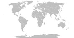
চিত্র:BlankMap-World.svg

এই SVG ফাইলের জন্য এই PNG প্রাকদর্শনের আকার: ৮০০ × ৪০৬ পিক্সেল। অন্যান্য আকারসমূহ: ৩২০ × ১৬২ পিক্সেল | ৬৪০ × ৩২৫ পিক্সেল | ১,০২৪ × ৫২০ পিক্সেল | ১,২৮০ × ৬৫০ পিক্সেল | ২,৫৬০ × ১,৩০০ পিক্সেল | ২,৭৫৪ × ১,৩৯৮ পিক্সেল।
মূল ফাইল (এসভিজি ফাইল, সাধারণত ২,৭৫৪ × ১,৩৯৮ পিক্সেল, ফাইলের আকার: ১.০৫ মেগাবাইট)


|
এই চিত্রটি সবসময় সবচেয়ে সাম্প্রতিক একটি হিসেবে প্রত্যাশিত। প্রয়োজন হলে এটি নির্দ্বিধায় হালনাগাদ করুন।
|

|
নতুন তথ্য প্রতিফলিত করতে এই ফাইলটি হালনাগাদ করা হতে পারে। আপনি যদি নতুন হালনাগাদ প্রতিফলিত করে না, ফাইলটির এমন একটি নির্দিষ্ট সংস্করণ ব্যবহার করতে চান তবে অনুগ্রহ করে একটি পৃথক ফাইল হিসাবে প্রয়োজনীয় সংস্করণটি আপলোড করুন। |
সারাংশ
| বিবরণ |
English: A detailed Robinson projection SVG map with grouping enabled to connect all non-contiguous parts of a country's territory for easy coloring. Smaller countries can also be represented by larger circles to show their data more clearly. A thorough description of use and other instructions relating to this can be found on the instructions page.
Русский: Современная политическая карта мира (бланк) в проекции Робинсона, сохранённая в векторном формате SVG, в котором территориально-разделённые части государств (острова, анклавы, заморские владения и другие) сгруппированы вместе — и таким образом легко окрашивать всю группу одним цветом. Малые страны, не отображающиеся или отображающиеся слишком мелко на карте мира в таком масштабе, на производных картах могут быть также отображены в виде кругов (на этой карте круги присутствуют в виде прозрачных невидимых элементов изображения). Более подробное описание и рекомендации по использованию смотрите в документации файла (англ.). |
||
| তারিখ | ১২ নভেম্বর ২০০৬ (মূল আপলোডের তারিখ) | ||
| উৎস | Adapted from File:"Political World" CIA World Factbook map 2005.svg which was originally based on CIA's 2005 political world map (a vector-based PDF file which can now be found in Perry–Castañeda Library Map Collection). | ||
| লেখক | Canuckguy (talk) and many others (see File history) | ||
| অনুমতি (এ ফাইলের পুনঃব্যবহার) |
|
||
| অন্যান্য সংস্করণ |
এই ফাইলের উপজাত কর্মসমূহ:
|
||
| SVG genesis | এই মানচিত্রটি ইনকস্কেইপ দিয়ে তৈরি করা হয়েছে, ও তারপর ম্যানুয়ালি সম্পাদিত হয়েছে । |


| Blank maps of the world for historical use | |
| pre-1800 | |
|
19th century | |
|
20th century | |
|
1902 · 1912 · 1914 · WWI · Aug 1918 · 1920 · 1921 · 1924 · 1926 · 1935 · 1937 · Mar 1938 · Oct 1938 · Mar 1939 · Oct 1939 · WWII · Nov 1942 · May 1945 · 1957 · 1959 · 1962 · 1968 · 1970 · 1985 · 1990 · 1993 | |
|
21st century | |
| (this template: · view · discuss ) | |
ফাইলের ইতিহাস
যেকোনো তারিখ/সময়ে ক্লিক করে দেখুন ফাইলটি তখন কী অবস্থায় ছিল।
| তারিখ/সময় | সংক্ষেপচিত্র | মাত্রা | ব্যবহারকারী | মন্তব্য | |
|---|---|---|---|---|---|
| বর্তমান | ০৯:২৫, ১৪ আগস্ট ২০২১ | ২,৭৫৪ × ১,৩৯৮ (১.০৫ মেগাবাইট) | Seryo93 | Reverted to version as of 23:50, 11 August 2021 (UTC) messed-up again | |
| ১৫:৫৭, ১২ আগস্ট ২০২১ | ২,৭৫৪ × ১,৩৯৮ (১.০৫ মেগাবাইট) | Flackseven | Reverted to version as of 14:41, 8 August 2021 (UTC) | ||
| ২৩:৫০, ১১ আগস্ট ২০২১ | ২,৭৫৪ × ১,৩৯৮ (১.০৫ মেগাবাইট) | Cherkash | using a 2-letter abbreviation (xr) for Kuril, just like the rest of them | ||
| ১৭:১৪, ৮ আগস্ট ২০২১ | ২,৭৫৪ × ১,৩৯৮ (১.০৫ মেগাবাইট) | Seryo93 | changed Southern Kurile caption to match File:World_map_configurable.svg | ||
| ১৭:০০, ৮ আগস্ট ২০২১ | ২,৭৫৪ × ১,৩৯৮ (১.০৫ মেগাবাইট) | Seryo93 | +xsq class for the w:Kuril Islands dispute, following general scheme (grouped into controlling Russia) | ||
| ১৬:২৭, ৮ আগস্ট ২০২১ | ২,৭৫৪ × ১,৩৯৮ (১.০৫ মেগাবাইট) | Seryo93 | Reverted to version as of 05:55, 8 August 2021 (UTC) see documentation and compare with Golans (internationally recognised as Syrian, yet grouped into Israel by default) | ||
| ১৪:৪১, ৮ আগস্ট ২০২১ | ২,৭৫৪ × ১,৩৯৮ (১.০৫ মেগাবাইট) | Flackseven | Reverted to version as of 18:04, 7 August 2021 (UTC). Crimea must be connected to Ukraine. It cannot be on same layer with Russia by default. | ||
| ০৫:৫৫, ৮ আগস্ট ২০২১ | ২,৭৫৪ × ১,৩৯৮ (১.০৫ মেগাবাইট) | Seryo93 | The map must be customisable | ||
| ১৮:০৪, ৭ আগস্ট ২০২১ | ২,৭৫৪ × ১,৩৯৮ (১.০৫ মেগাবাইট) | Flackseven | Reverted to version as of 22:47, 6 August 2021 (UTC). It is enough for pro-Russian users to edit the affiliation of Crimea. There should be no two classes, because Crimea must be inseparable with Ukraine, as it was before 2014. The map can be used by other people through search and can lead to a misconception about the affiliation of Crimea when they want to colorize and use it elsewhere.. | ||
| ০৬:৩৭, ৭ আগস্ট ২০২১ | ২,৭৫৪ × ১,৩৯৮ (১.০৫ মেগাবাইট) | Seryo93 | Reverted to version as of 16:36, 6 August 2021 (UTC) enough is enough, although Crimea is in a need for a solution. Maybe add it to both classes somehow? | ||
| ২২:৪৭, ৬ আগস্ট ২০২১ | ২,৭৫৪ × ১,৩৯৮ (১.০৫ মেগাবাইট) | Flackseven | Reverted to version as of 12:48, 5 August 2021 (UTC). | ||
| ১৬:৩৬, ৬ আগস্ট ২০২১ | ২,৭৫৪ × ১,৩৯৮ (১.০৫ মেগাবাইট) | Chipmunkdavis | Reverted to version as of 00:28, 23 May 2021 (UTC) Unproductive removal of various entities which are not shown by default anyway. New code also messes up the ids and class. | ||
| ১২:৪৮, ৫ আগস্ট ২০২১ | ২,৭৫৪ × ১,৩৯৮ (১.০৫ মেগাবাইট) | Flackseven | fixed tooltips | ||
| ১১:৫৪, ৫ আগস্ট ২০২১ | ২,৭৫৪ × ১,৩৯৮ (১.০৪ মেগাবাইট) | Flackseven | Crimea moved and connect from ru to ua. Crimea is not recognized as part of Russia. | ||
| ০০:৪৮, ৫ আগস্ট ২০২১ | ২,৭৫৪ × ১,৩৯৮ (১.০৫ মেগাবাইট) | Cherkash | Reverted to version as of 00:28, 23 May 2021 (UTC) unnecessary and counter-productive | ||
| ২৩:৫৮, ৪ আগস্ট ২০২১ | ৫১২ × ২৬০ (৮২৫ কিলোবাইট) | Vinikonov | Crimea moved from ru layer to ua. "lpr" and "dpr" cleared | ||
| ০০:২৮, ২৩ মে ২০২১ | ২,৭৫৪ × ১,৩৯৮ (১.০৫ মেগাবাইট) | Jamesy0627144 | remove comment as discussed on talk page | ||
| ২১:৩৪, ১৭ জানুয়ারি ২০২১ | ২,৭৫৪ × ১,৩৯৮ (১.০৫ মেগাবাইট) | L.tak | removing the EU-category from gibraltar (incl its circle) and Northern Ireland | ||
| ২০:১৬, ১৭ সেপ্টেম্বর ২০২০ | ২,৭৫৪ × ১,৩৯৮ (১.০৫ মেগাবাইট) | Χ | State of Palestine now shown by default without the use of a special rule // Editing SVG source code using c:User:Rillke/SVGedit.js | ||
| ২২:১২, ১৪ সেপ্টেম্বর ২০২০ | ২,৭৫৪ × ১,৩৯৮ (১.০৫ মেগাবাইট) | EnronEvolved | There was a typo in a comment. This cannot stand! | ||
| ১১:০৮, ১৯ আগস্ট ২০২০ | ২,৭৫৪ × ১,৩৯৮ (১.০৫ মেগাবাইট) | NuclearElevator | Added a special style rule so that Palestine will be shown by default, as it was in earlier versions of this file. | ||
| ১৩:২০, ১০ জুলাই ২০২০ | ২,৭৫৪ × ১,৩৯৮ (১.০৫ মেগাবাইট) | Chipmunkdavis | Adding some alternative names as hidden notes to facilitate searching. Naming a number of paths. | ||
| ০৬:৪৪, ১০ জুলাই ২০২০ | ২,৭৫৪ × ১,৩৯৮ (১.০৫ মেগাবাইট) | Heitordp | Corrected the positions of Niue, Cook Islands, Pitcairn Islands, and Nosy Be in Madagascar; moved the circle of French Polynesia to Tahiti; allocated Uelen/Naukan to Russia | ||
| ২৩:৫০, ১০ মে ২০২০ | ২,৭৫৪ × ১,৩৯৮ (১.০৫ মেগাবাইট) | Getsnoopy | Fixed some code formatting issues. | ||
| ২৩:০৮, ১২ এপ্রিল ২০২০ | ২,৭৫৪ × ১,৩৯৮ (১.০৬ মেগাবাইট) | John M Wolfson | Removed United Kingdom from "eu" class per Brexit. | ||
| ১৩:৩৩, ১৩ মার্চ ২০২০ | ২,৭৫৪ × ১,৩৯৮ (১.০৬ মেগাবাইট) | Χ | self revert because svg is invalid | ||
| ২০:১৯, ৭ মার্চ ২০২০ | ২,৭৫৪ × ১,৩৯৮ (১.০৫ মেগাবাইট) | Χ | Ungrouped Palestinian territories from Israel to internationally recognized borders // Editing SVG source code using c:User:Rillke/SVGedit.js | ||
| ১১:০৯, ১ মার্চ ২০২০ | ২,৭৫৪ × ১,৩৯৮ (১.০৬ মেগাবাইট) | Newfraferz87 | Adjust all coordinates to proper position & got rid of viewbox | ||
| ০০:০৫, ১০ জানুয়ারি ২০২০ | ২,৭৫৪ × ১,৩৯৮ (১.০৬ মেগাবাইট) | Cherkash | Reverted to version as of 00:47, 5 January 2020 (UTC) reverted an educational example (which was uploaded only to teach a user in response to a question at the Village Pump) which broke SVG validation | ||
| ২০:২৩, ৯ জানুয়ারি ২০২০ | ২,৭৫৪ × ১,৩৯৮ (১.০৬ মেগাবাইট) | Ian Furst | added a method to fill a country with horizontal lines. change and class="xxx" to fill="url(#diagonalHatch)" | ||
| ০০:৪৭, ৫ জানুয়ারি ২০২০ | ২,৭৫৪ × ১,৩৯৮ (১.০৬ মেগাবাইট) | Cherkash | Reverted to version as of 11:27, 1 January 2020 (UTC) restored a more comprehensive map: the entities help in having a more flexible map and are well-documented (both in the SVG code and on the Documentation page) | ||
| ১১:২২, ৩ জানুয়ারি ২০২০ | ২,৭৫৪ × ১,৩৯৮ (১.১ মেগাবাইট) | Kashmiri | Reverted to version as of 16:45, 26 December 2019 (UTC) | ||
| ১১:২৭, ১ জানুয়ারি ২০২০ | ২,৭৫৪ × ১,৩৯৮ (১.০৬ মেগাবাইট) | Akeosnhaoe | Reverted to version as of 19:40, 21 December 2019 (UTC) | ||
| ১৬:৪৫, ২৬ ডিসেম্বর ২০১৯ | ২,৭৫৪ × ১,৩৯৮ (১.১ মেগাবাইট) | Kashmiri | Same, but respecting the human-readable format | ||
| ১৬:২২, ২৬ ডিসেম্বর ২০১৯ | ২,৭৫৪ × ১,৩৯৮ (৮৯২ কিলোবাইট) | Kashmiri | Removed unrecognised political entities hidden in the code by a previous editor; compressed | ||
| ১৯:৪০, ২১ ডিসেম্বর ২০১৯ | ২,৭৫৪ × ১,৩৯৮ (১.০৬ মেগাবাইট) | Cherkash | Reverted to version as of 10:20, 3 September 2019 (UTC) with tabs introduced, too much blank space is shown in some editors - really, there's no need for it | ||
| ২১:৩৯, ১৮ নভেম্বর ২০১৯ | ২,৭৫৪ × ১,৩৯৮ (১.০৫ মেগাবাইট) | Getsnoopy | Minor code formatting changes. | ||
| ১০:২০, ৩ সেপ্টেম্বর ২০১৯ | ২,৭৫৪ × ১,৩৯৮ (১.০৬ মেগাবাইট) | Cherkash | Congo: full name | ||
| ২২:১৭, ৩০ আগস্ট ২০১৯ | ২,৭৫৪ × ১,৩৯৮ (১.০৬ মেগাবাইট) | Cherkash | Reverted to version as of 01:13, 12 August 2019 (UTC) See Talk - if you want to unentangle "disputed" territories from their "host" countries, it should ideally be done uniformly for all of them, and such changes better be discussed and agreed on in detail before being implemented | ||
| ০৮:১৪, ১৮ আগস্ট ২০১৯ | ২,৭৫৪ × ১,৩৯৮ (১.০৬ মেগাবাইট) | Ythlev | See talk | ||
| ০১:১৩, ১২ আগস্ট ২০১৯ | ২,৭৫৪ × ১,৩৯৮ (১.০৬ মেগাবাইট) | Cherkash | fixed Svalbard | ||
| ০০:০১, ১২ আগস্ট ২০১৯ | ২,৭৫৪ × ১,৩৯৮ (১.০৬ মেগাবাইট) | Cherkash | name: Curaçao | ||
| ২৩:০৫, ১০ আগস্ট ২০১৯ | ২,৭৫৪ × ১,৩৯৮ (১.০৬ মেগাবাইট) | Cherkash | removed UTF byte-order mark | ||
| ২৩:০২, ১০ আগস্ট ২০১৯ | ২,৭৫৪ × ১,৩৯৮ (১.০৬ মেগাবাইট) | Cherkash | updated country labels | ||
| ০০:৫৪, ৯ আগস্ট ২০১৯ | ২,৭৫৪ × ১,৩৯৮ (১.০৬ মেগাবাইট) | Cherkash | minor grammar fix in the code comments | ||
| ০১:০৭, ৪ আগস্ট ২০১৯ | ২,৭৫৪ × ১,৩৯৮ (১.০৬ মেগাবাইট) | Cherkash | removed couple spaces in the code | ||
| ২০:১৭, ২ আগস্ট ২০১৯ | ২,৭৫৪ × ১,৩৯৮ (১.০৬ মেগাবাইট) | Cherkash | Reverted to version as of 23:29, 27 June 2019 (UTC) rv gf update: Taiwan's status is on par with other similar territories – see Talk page and the documentation linked there | ||
| ১৫:৪১, ২৭ জুলাই ২০১৯ | ২,৭৫৪ × ১,৩৯৮ (১.০৬ মেগাবাইট) | Ythlev | Correction | ||
| ২৩:২৯, ২৭ জুন ২০১৯ | ২,৭৫৪ × ১,৩৯৮ (১.০৬ মেগাবাইট) | Cherkash | Reverted to version as of 00:58, 25 May 2019 (UTC) rv gf update | ||
| ১৪:৫৫, ১২ জুন ২০১৯ | ২,৭৫৪ × ১,৩৯৮ (১.০৬ মেগাবাইট) | Ythlev | Correction | ||
| ০০:৫৮, ২৫ মে ২০১৯ | ২,৭৫৪ × ১,৩৯৮ (১.০৬ মেগাবাইট) | Cherkash | reverted a bunch of incorrect name updates, kept two (Vietnam, Eswatini) | ||
| ০১:৩৮, ২৩ মে ২০১৯ | ২,৭৫৪ × ১,৩৯৮ (১.০৬ মেগাবাইট) | Viva Nicolás | Update names – Chagos Archipelago is part of Mauritius | ||
| ১২:৪৪, ২২ মে ২০১৯ | ২,৭৫৪ × ১,৩৯৮ (১.০৬ মেগাবাইট) | Viva Nicolás | Eswatini | ||
| ১২:৩৭, ২২ মে ২০১৯ | ২,৭৫৪ × ১,৩৯৮ (১.০৬ মেগাবাইট) | Viva Nicolás | Country names | ||
| ১৯:৫২, ১৯ এপ্রিল ২০১৯ | ২,৭৫৪ × ১,৩৯৮ (১.০৬ মেগাবাইট) | Cherkash | country name updated: North Macedonia | ||
| ২০:৪৩, ৩ এপ্রিল ২০১৯ | ২,৭৫৪ × ১,৩৯৮ (১.০৬ মেগাবাইট) | Cherkash | switched to 6-digit color code throughout for consistency's sake | ||
| ১৬:২১, ১ এপ্রিল ২০১৯ | ২,৭৫৪ × ১,৩৯৮ (১.০৬ মেগাবাইট) | Cherkash | minor SVG code clean-up | ||
| ১৫:৪৭, ১ এপ্রিল ২০১৯ | ২,৭৫৪ × ১,৩৯৮ (১.০৬ মেগাবাইট) | Cherkash | hide borders of disputed/unrecognized territories by default | ||
| ১৫:৪৫, ১ এপ্রিল ২০১৯ | ২,৭৫৪ × ১,৩৯৮ (১.০৬ মেগাবাইট) | Cherkash | Reverted to version as of 00:55, 28 February 2019 (UTC) rolled back to last stable version - so that the next update following this one is incremental | ||
| ২০:১৮, ২৮ মার্চ ২০১৯ | ২,৫৬০ × ১,৩১৪ (১.০৫ মেগাবাইট) | Giorgi Balakhadze | User Cherkash what you call "the long-standing depictions"? Before your edit on 21:50, 10 February 2019(!) this map for years was always without disputed territories! You are violating rules, you are making disruptive edits. | ||
| ১৯:৪৩, ২১ মার্চ ২০১৯ | ২,৭৫৪ × ১,৩৯৮ (১.০৬ মেগাবাইট) | Cherkash | Reverted to version as of 00:55, 28 February 2019 (UTC) This is the last consensus version (it's been already explained below why so). Let me repeat again: if you have any problem with the long-standing depictions this map takes, take it up on the Talk page. So far you are being disruptive while having not provided a single useful edit to this map. | ||
| ০৯:০৬, ২০ মার্চ ২০১৯ | ২,৫৬০ × ১,৩১৪ (১.০৫ মেগাবাইট) | Dim Grits | Every new controversial features only addicted with choosing parameters when using but not default. And where ISIS? Why real borders Pakistan but fairy UN for Palestine. | ||
| ১১:০১, ১৮ মার্চ ২০১৯ | ২,৭৫৪ × ১,৩৯৮ (১.০৬ মেগাবাইট) | Cherkash | Reverted to version as of 16:24, 12 March 2019 (UTC) You have to discuss this and get a consensus on the talk page first: it's already been explained below why your reverts are nonsensical | ||
| ২০:৩৯, ১৫ মার্চ ২০১৯ | ২,৫৬০ × ১,৩১৪ (১.০৫ মেগাবাইট) | Giorgi Balakhadze | It has been already explained. Read COM:OVERWRITE. You actions are against of the main rule. | ||
| ১৬:২৪, ১২ মার্চ ২০১৯ | ২,৭৫৪ × ১,৩৯৮ (১.০৬ মেগাবাইট) | Cherkash | Reverted to version as of 21:31, 8 March 2019 (UTC) This is the last consensus version: it had incremental improvements from the version "Dim Grits" arbitrarily perceived as the last consensus (17 Sep 2018), but nothing controversial. Any perceived controversy must lie then with even earlier editions – if the case, then this has to be discussed first on the Talk page. | ||
| ২৩:২৮, ৮ মার্চ ২০১৯ | ২,৫৬০ × ১,৩১৪ (১.০৫ মেগাবাইট) | Dim Grits | Reverted to consensus version. | ||
| ২১:৩১, ৮ মার্চ ২০১৯ | ২,৭৫৪ × ১,৩৯৮ (১.০৬ মেগাবাইট) | Cherkash | Reverted to version as of 00:55, 28 February 2019 (UTC) Stop overwriting it: make your case clear on the Talk page first and make sure there is a consensus for having less information rather than more. Thank you. | ||
| ১৬:৪৮, ৮ মার্চ ২০১৯ | ২,৫৬০ × ১,৩১৪ (১.০৬ মেগাবাইট) | Giorgi Balakhadze | User Cherkash you are adding disputed territories on a wide-used world map! Check original version, you are violating OVERWRITE rule! | ||
| ০০:৫৫, ২৮ ফেব্রুয়ারি ২০১৯ | ২,৭৫৪ × ১,৩৯৮ (১.০৬ মেগাবাইট) | Cherkash | PRC name updated to be in line with other republics | ||
| ০৬:১৪, ২৬ ফেব্রুয়ারি ২০১৯ | ২,৭৫৪ × ১,৩৯৮ (১.০৬ মেগাবাইট) | Cherkash | explicitly specified width/height | ||
| ০৫:৫৫, ২৬ ফেব্রুয়ারি ২০১৯ | ৫১২ × ২৬০ (১.০৬ মেগাবাইট) | Cherkash | updated ViewBox to match actual borders of the map closely and not to use convoluted re-scaling/stretching | ||
| ০১:৫৯, ২৫ ফেব্রুয়ারি ২০১৯ | ২,৫৬০ × ১,৩১৪ (১.০৬ মেগাবাইট) | Cherkash | Reverted to version as of 08:58, 11 February 2019 (UTC) reverted a few changes that have nothing to do with the edit summary presented | ||
| ২১:৫৬, ১৭ ফেব্রুয়ারি ২০১৯ | ২,৫৬০ × ১,৩১৪ (১.০৬ মেগাবাইট) | Giorgi Balakhadze | For years this map was without occupied or disputed territories like DNR, Karabakh or Kosovo. This is not a minor change. | ||
| ০৮:৫৮, ১১ ফেব্রুয়ারি ২০১৯ | ২,৫৬০ × ১,৩১৪ (১.০৬ মেগাবাইট) | Cherkash | put .eu and .eaeu classes first - the priority from L to R is from less detailed layers to more (should help with hierarchical coloring) | ||
| ২৩:৫৪, ১০ ফেব্রুয়ারি ২০১৯ | ২,৫৬০ × ১,৩১৪ (১.০৬ মেগাবাইট) | Cherkash | ocean outline updated, other minor tweaks (mostly with numbers precision) | ||
| ২১:৫০, ১০ ফেব্রুয়ারি ২০১৯ | ২,৫৬০ × ১,৩১৪ (১.০৬ মেগাবাইট) | Cherkash | slightly darker default color; a few other minor tweaks | ||
| ২৩:১৭, ৮ ফেব্রুয়ারি ২০১৯ | ২,৫৬০ × ১,৩১৪ (১.০৬ মেগাবাইট) | Cherkash | treat all optional layers via "opacity" now; made all "limitxx" class elements into overlay layers; fixed several border outlines | ||
| ১৮:১৫, ৭ ফেব্রুয়ারি ২০১৯ | ২,৫৬০ × ১,৩১৪ (১.০৬ মেগাবাইট) | Jamesy0627144 | additional fix to antxx class (see talk page) | ||
| ০৯:৫১, ৭ ফেব্রুয়ারি ২০১৯ | ২,৫৬০ × ১,৩১৪ (১.০৬ মেগাবাইট) | Cherkash | fixed "antxx" class coloring | ||
| ১৩:১২, ২ ফেব্রুয়ারি ২০১৯ | ২,৫৬০ × ১,৩১৪ (১.০৬ মেগাবাইট) | Cherkash | * Belarus is part of EAEU * Saint Barthelemy is not part of EU * corrected classes and groupings (landxx/coastxx/etc.) * fixed locations of some islands (Maldives) * added a few islands (Australian islands, BIOT, Easter Island, Cocos Island, etc.) * corrected Luhansk region * re-ordered Cypres layers * consistency in layers ordering (landxx/coastxx, etc.) * fixed Holland (it has a bay, not a lake; the southernmost piece bordering Belgium is not an island) * corrected some location names * sma... | ||
| ০৭:২০, ১৭ সেপ্টেম্বর ২০১৮ | ২,৫৬০ × ১,৩১৪ (১.০৫ মেগাবাইট) | Carnby | More readable CSS | ||
| ১৭:২৭, ২৪ আগস্ট ২০১৮ | ২,৫৬০ × ১,৩১৪ (১.০৫ মেগাবাইট) | Χ | frxx, cnxx and nlxx as classes for dependent territories' circles // Editing SVG source code using User:Rillke/SVGedit.js; upload handled by User:Rillke/MwJSBot.js | ||
| ১৫:৫৯, ২২ আগস্ট ২০১৮ | ২,৫৬০ × ১,৩১৪ (১.০৫ মেগাবাইট) | Χ | Nagorno-Karabakh was renamed to Artsakh // Editing SVG source code using User:Rillke/SVGedit.js; upload handled by User:Rillke/MwJSBot.js | ||
| ১৪:৫৬, ২২ আগস্ট ২০১৮ | ২,৫৬০ × ১,৩১৪ (১.০৫ মেগাবাইট) | Χ | small mistake | ||
| ১৪:২৯, ২২ আগস্ট ২০১৮ | ২,৫৬০ × ১,৩১৪ (১.০৫ মেগাবাইট) | Χ | limitxx remain invisible by default, subxx ungrouped but hierarchy kept through existing classes instead, territories with circles moved down the file to make sure circles are not covered by landmass | ||
| ১৪:০৮, ১৪ আগস্ট ২০১৮ | ২,৫৬০ × ১,৩১৪ (১.০৫ মেগাবাইট) | Χ | subxx and unxx circles no longer show up unless explicitly stated // Editing SVG source code using User:Rillke/SVGedit.js; upload handled by User:Rillke/MwJSBot.js | ||
| ১৭:৩৯, ৮ আগস্ট ২০১৮ | ২,৫৬০ × ১,৩১৪ (১.০৫ মেগাবাইট) | Χ | made eu and eaeu lower priority than nations // Editing SVG source code using User:Rillke/SVGedit.js; upload handled by User:Rillke/MwJSBot.js | ||
| ০২:০৬, ১৭ জুলাই ২০১৮ | ২,৫৬০ × ১,৩১৪ (১.০৫ মেগাবাইট) | Stefán Örvar Sigmundsson | Markup cleanup. | ||
| ২৩:২৩, ১৭ জুন ২০১৮ | ২,৫৬০ × ১,৩১৪ (১.০৫ মেগাবাইট) | Χ | ungrouped palestine from israel, added the small islands of svalbard within the svalbard group | ||
| ১৭:২৯, ১২ মার্চ ২০১৮ | ২,৫৬০ × ১,৩১৪ (১.০৬ মেগাবাইট) | Aetherophon | Reverted to version as of 04:55, 19 April 2017 (UTC) | ||
| ১২:৪৮, ২৮ সেপ্টেম্বর ২০১৭ | ২,৫৬০ × ১,৩১৪ (১.০৬ মেগাবাইট) | Seryo93 | Changed Crimea class to "coastxx ru ua qr", which allow ua to have influence on it. Precedence is regulated by order of defining in style tag (which class defined later, which color Crimea will have) | ||
| ০৪:৫৫, ১৯ এপ্রিল ২০১৭ | ২,৫৬০ × ১,৩১৪ (১.০৬ মেগাবাইট) | TriadicRelation98 | No need to mark micro states, we have a separate map for that here: File:BlankMap-World-Microstates.svg | ||
| ১২:২৮, ৮ এপ্রিল ২০১৭ | ২,৫৬০ × ১,৩১৪ (১.০৬ মেগাবাইট) | Alexander Roumega | properties errors corrections | ||
| ১১:১২, ৮ এপ্রিল ২০১৭ | ২,৫৬০ × ১,৩১৪ (১.০৬ মেগাবাইট) | Alexander Roumega | antxx class | ||
| ১০:৪৭, ৮ এপ্রিল ২০১৭ | ২,৫৬০ × ১,৩১৪ (১.০৬ মেগাবাইট) | Alexander Roumega | Christmas Island, Heard Island and McDonald Islands, Macquarie Island, Cocos (Keeling) Islands. | ||
| ১৪:০৭, ২৮ মার্চ ২০১৭ | ২,৫৬০ × ১,৩১৪ (১.০৬ মেগাবাইট) | Alexander Roumega | Added Azad Kashmir, grouping, working with id and class. CSS class eaue for members of Euroasian Economical Union. | ||
| ০৬:১২, ২৭ মার্চ ২০১৭ | ২,৫৬০ × ১,৩১৪ (১.০৬ মেগাবাইট) | Alexander Roumega | Svalbard has been grouped. | ||
| ০৪:২৮, ২৭ মার্চ ২০১৭ | ২,৫৬০ × ১,৩১৪ (১.০৬ মেগাবাইট) | Alexander Roumega | Sahrawi Arab Democratic Republic has been added. | ||
| ২০:৩২, ২৬ মার্চ ২০১৭ | ২,৫৬০ × ১,৩১৪ (১.০৫ মেগাবাইট) | Alexander Roumega | Republic of Crimea, Donetsk People's Republic and Luhansk People's Republic have been added. | ||
| ০০:৫৬, ৮ ফেব্রুয়ারি ২০১৭ | ২,৫৬০ × ১,৩১৪ (১.০৫ মেগাবাইট) | Χ | updated aral sea | ||
| ১৫:১১, ১ ফেব্রুয়ারি ২০১৭ | ২,৫৬০ × ১,৩১৪ (১.০৫ মেগাবাইট) | Χ | let's keep the code clean please | ||
| ০২:৫৩, ৫ জানুয়ারি ২০১৭ | ২,৫৬০ × ১,৩১৪ (১.২৮ মেগাবাইট) | TriadicRelation98 | Updated borders of the Aral Sea | ||
| ০১:২৫, ২ ডিসেম্বর ২০১৬ | ২,৫৬০ × ১,৩১৪ (১.১ মেগাবাইট) | TriadicRelation98 | Changed file to plain SVG, rather than Inkscape | ||
| ০৫:০৯, ১ ডিসেম্বর ২০১৬ | ২,৫৬০ × ১,৩১৪ (১.০৫ মেগাবাইট) | Χ | please do not upload files saved directly from inkscape | ||
| ০৩:২১, ১ ডিসেম্বর ২০১৬ | ২,৫৬০ × ১,৩১৪ (১.১ মেগাবাইট) | TriadicRelation98 | Added Kosovo with a broken border since it is partially recognized, changed the border of Egypt/Sudan since Egypt administers the Hala'ib Triangle | ||
| ২২:৪৫, ১৪ অক্টোবর ২০১৬ | ২,৫৬০ × ১,৩১৪ (১.০৫ মেগাবাইট) | Χ | croatia in the eu | ||
| ১৬:৪১, ১৪ অক্টোবর ২০১৬ | ২,৫৬০ × ১,৩১৪ (১.০৫ মেগাবাইট) | Χ | flattened transforms, switched to relative paths, code reduction | ||
| ০৯:২৮, ৪ আগস্ট ২০১৬ | ২,৫৬০ × ১,৩১৪ (১.৫৫ মেগাবাইট) | Iago4096 | Moved the island of Gökçeada/Imbros from Greece to Turkey. | ||
| ০০:২০, ২৮ মার্চ ২০১৬ | ২,৫৬০ × ১,৩১৪ (১.৫৫ মেগাবাইট) | Kingofthedead | increase resolution | ||
| ১৮:৫০, ২৮ এপ্রিল ২০১৫ | ৮৬৩ × ৪৪৩ (১.৫৫ মেগাবাইট) | Carnby | Please ask for modification in the discussion page | ||
| ০৬:০০, ১১ এপ্রিল ২০১৫ | ৮৬৩ × ৪৪৩ (১.৫৭ মেগাবাইট) | AHC300 | Updated with some minor islands added and highlighted and other stuff | ||
| ১৭:০১, ৪ ফেব্রুয়ারি ২০১৫ | ৮৬৩ × ৪৪৩ (১.৫৫ মেগাবাইট) | Anastan | per User talk:Leftcry | ||
| ১৪:৫৭, ৩০ জানুয়ারি ২০১৫ | ৮৬৩ × ৪৪৩ (১.৫৯ মেগাবাইট) | Mapclean | not agreed | ||
| ১৩:১১, ৩০ জানুয়ারি ২০১৫ | ৮৬৩ × ৪৪৩ (১.৫৫ মেগাবাইট) | Anastan | It wasn't agreed per User talk:Leftcry | ||
| ২১:৩৬, ২৭ জানুয়ারি ২০১৫ | ৮৬৩ × ৪৪৩ (১.৫৯ মেগাবাইট) | Bobrayner | Updated borders, per COM:OVERWRITE, as agreed on talkpage. | ||
| ১১:৫৫, ২২ জানুয়ারি ২০১৫ | ৮৬৩ × ৪৪৩ (১.৫৫ মেগাবাইট) | Anastan | Either show all breakaway regions or don't show any | ||
| ২২:৩৮, ২১ জানুয়ারি ২০১৫ | ৮৬৩ × ৪৪৩ (১.৫৯ মেগাবাইট) | Bobrayner | Updated borders, per COM:OVERWRITE. Can't we discuss this on the talkpage? | ||
| ০৬:৫৩, ২১ জানুয়ারি ২০১৫ | ৮৬৩ × ৪৪৩ (১.৫৫ মেগাবাইট) | Leftcry | Reverted to version as of 03:22, 2 November 2014 Either show all breakaway regions or don't show any | ||
| ২৩:২৫, ১৯ জানুয়ারি ২০১৫ | ৮৬৩ × ৪৪৩ (১.৫৯ মেগাবাইট) | Bobrayner | Updated borders, per COM:OVERWRITE | ||
| ০৩:২২, ২ নভেম্বর ২০১৪ | ৮৬৩ × ৪৪৩ (১.৫৫ মেগাবাইট) | Leftcry | Reverted to version as of 14:19, 16 April 2014 Kosovo is a disputed region, either show all breakaway regions or none | ||
| ২২:১৭, ২৩ অক্টোবর ২০১৪ | ৮৬৩ × ৪৪৩ (১.৫৯ মেগাবাইট) | Denniss | Reverted to version as of 06:59, 22 October 2014 | ||
| ২২:১১, ২৩ অক্টোবর ২০১৪ | ৮৬৩ × ৪৪৩ (১.৫৫ মেগাবাইট) | Anastan | Reverted to version as of 14:19, 16 April 2014 | ||
| ০৬:৫৯, ২২ অক্টোবর ২০১৪ | ৮৬৩ × ৪৪৩ (১.৫৯ মেগাবাইট) | AceDouble | added Kosovo | ||
| ১৪:১৯, ১৬ এপ্রিল ২০১৪ | ৮৬৩ × ৪৪৩ (১.৫৫ মেগাবাইট) | Canuckguy | Reverted to version as of 05:13, 26 December 2013: see comments to reasons why. | ||
| ২২:৫১, ৫ এপ্রিল ২০১৪ | ৮৬৩ × ৪৪৩ (১.৫৮ মেগাবাইট) | Spesh531 | just figured out what "broken code" meant for Australia. Could have said misposition | ||
| ০১:২৪, ৪ এপ্রিল ২০১৪ | ৮৬৩ × ৪৪৩ (১.৫৮ মেগাবাইট) | Spesh531 | Again, updating with what I said previously. I don't see a broken code anywhere anything to do with Australia, there are a few updates in this one image, do not revert it for only Australia, and if you spot the broken code, fix it, like I said, I have... | ||
| ২১:৩৮, ১ এপ্রিল ২০১৪ | ৮৬৩ × ৪৪৩ (১.৫৭ মেগাবাইট) | Michaelwuzthere | Crimea | ||
| ২৩:২৯, ১ মার্চ ২০১৪ | ৮৬৩ × ৪৪৩ (১.৫৫ মেগাবাইট) | Underlying lk | Reverted to version as of 17:32, 6 February 2014: Australia is broken in the last revision | ||
| ২১:০৮, ৬ ফেব্রুয়ারি ২০১৪ | ৮৬৩ × ৪৪৩ (১.৫৮ মেগাবাইট) | Spesh531 | fixed coding in australia with additional islands, fixed kazakhstan and uzbekistan with fixed coding, separated kosovo from serbia, fixed dutch coast, w/o messing up the coding | ||
| ১৭:৩২, ৬ ফেব্রুয়ারি ২০১৪ | ৮৬৩ × ৪৪৩ (১.৫৫ মেগাবাইট) | L.tak | Reverted to version as of 05:13, 26 December 2013: edit broke nl and nix coding so they could nt be made visible again…. | ||
| ১৮:৫৮, ৪ জানুয়ারি ২০১৪ | ৮৬৩ × ৪৪৩ (১.৫৯ মেগাবাইট) | Spesh531 | made Kosovo solid because it is recognized by about 52% of countries, making that the majority. Fixing the Dutch coastline and the Aral Sea, and adding islands off the coast of Australia | ||
| ০৫:১৩, ২৬ ডিসেম্বর ২০১৩ | ৮৬৩ × ৪৪৩ (১.৫৫ মেগাবাইট) | Canuckguy | fix a small error with Mayotte code | ||
| ১৯:১৫, ৬ আগস্ট ২০১৩ | ৮৬৩ × ৪৪৩ (১.৫৫ মেগাবাইট) | Fractal | Reverted to version as of 12:42, 19 May 2013 (the new version breaks css coloring) | ||
| ১৮:৪৭, ৫ জুন ২০১৩ | ৮৬৩ × ৪৪৩ (১.৫৪ মেগাবাইট) | U003F | Consolidated class definitions | ||
| ১২:৪২, ১৯ মে ২০১৩ | ৮৬৩ × ৪৪৩ (১.৫৫ মেগাবাইট) | U003F | As below. The map seems not to have been replaced with the new version. | ||
| ২০:২৫, ১৮ মে ২০১৩ | ৮৬৩ × ৪৪৩ (১.৫৫ মেগাবাইট) | U003F | Take 2. Added a <title> element to name country, with the official name derived using existing 2-character ISO 3166-1 alpha-2 code. These country names will be displayed (in most browsers) when hovered over. | ||
| ২০:২১, ১৮ মে ২০১৩ | ৮৬৩ × ৪৪৩ (১.৫৫ মেগাবাইট) | U003F | Added a <title> element to name country, with the official name derived using existing 2-character [w:ISO 3166-1 alpha-2|ISO 3166-1 alpha-2]] code. These country names will be displayed (in most browsers) when hovered over. | ||
| ১০:০৯, ১১ ডিসেম্বর ২০১২ | ৮৬৩ × ৪৪৩ (১.৫৮ মেগাবাইট) | Konstantin Burov | Cleansed Inkscape tags so the file now passes W3G SVG validation, converted all relative coordinates into absolute so the file is parsable by the nugsl-worldmap script again. Fixed version of the script is available at [https://bitbucket.org/aectann/wo... | ||
| ১৬:৪৯, ৩০ নভেম্বর ২০১২ | ৮৬৩ × ৪৪৩ (১.৫৮ মেগাবাইট) | Yug | user:Konstantin_Burov's fixes. I help her/him for this upload. | ||
| ০০:২৭, ৩০ অক্টোবর ২০১২ | ৮৬৩ × ৪৪৩ (১.৫৩ মেগাবাইট) | Chipmunkdavis | Reverted to version as of 13:37, 14 February 2012 POV pushing, neither Moroccos recognised borders, nor its de facto ones | ||
| ২০:১৪, ২৮ অক্টোবর ২০১২ | ৮৬৩ × ৪৪৩ (১.৫৭ মেগাবাইট) | Apolikamixitos | Fixing Morocco borders | ||
| ১৩:৩৭, ১৪ ফেব্রুয়ারি ২০১২ | ৮৬৩ × ৪৪৩ (১.৫৩ মেগাবাইট) | Tentotwo | Removed hardcoded styles from sd, ss, and cf | ||
| ০৩:২২, ৬ জানুয়ারি ২০১২ | ৮৬৩ × ৪৪৩ (১.৫৭ মেগাবাইট) | Spesh531 | Fixing South Sudan's border | ||
| ০০:০৪, ১৯ ডিসেম্বর ২০১১ | ৮৬৩ × ৪৪৩ (১.৫৪ মেগাবাইট) | Chipmunkdavis | Reverted to version as of 00:51, 27 August 2011 | ||
| ১৫:১৪, ১৮ ডিসেম্বর ২০১১ | ১,৯২০ × ১,০৮০ (৩১৩ কিলোবাইট) | Anshulkumardhiman | fixed background | ||
| ১৫:০৬, ১৮ ডিসেম্বর ২০১১ | ১,৯২০ × ১,০৮০ (৩১৬ কিলোবাইট) | Anshulkumardhiman | fixed color texture | ||
| ০০:৫১, ২৭ আগস্ট ২০১১ | ৮৬৩ × ৪৪৩ (১.৫৪ মেগাবাইট) | Anomie | South Sudan has been assigned code SS, so use that code. | ||
| ১৮:০৪, ৩০ জুলাই ২০১১ | ৮৬৩ × ৪৪৩ (১.৫৪ মেগাবাইট) | Lokal Profil | Minor circle related changes and remove the legacy pentagram | ||
| ২৩:২৬, ৮ জুলাই ২০১১ | ৮৬৩ × ৪৪৩ (১.৫৪ মেগাবাইট) | NuclearVacuum | South Sudan is free!! Hooray | ||
| ২০:৪১, ৪ জুলাই ২০১১ | ৮৬৩ × ৪৪৩ (১.৫৪ মেগাবাইট) | NuclearVacuum | Restored to previous version, as SS isn't independent yet. But the code is now ready and waiting | ||
| ২০:৪০, ৪ জুলাই ২০১১ | ৮৬৩ × ৪৪৩ (১.৫৪ মেগাবাইট) | NuclearVacuum | Separated South Sudan from (North) Sudan in preparation for SS independence on July 9, 2011. | ||
| ১৫:১৫, ২৭ জুন ২০১১ | ৮৬৩ × ৪৪৩ (১.৫৪ মেগাবাইট) | Canuckguy | restored PR, set id labels for West Bank and Gaza | ||
| ১৪:০৯, ১ এপ্রিল ২০১১ | ৮৬৩ × ৪৪৩ (১.৫৪ মেগাবাইট) | NuclearVacuum | Mayotte is now a department of France | ||
| ১৪:৩১, ১৭ ফেব্রুয়ারি ২০১১ | ৮৬৩ × ৪৪৩ (১.৫৪ মেগাবাইট) | NuclearVacuum | minor fixes | ||
| ০১:৪৩, ১৩ ফেব্রুয়ারি ২০১১ | ৮৬৩ × ৪৪৩ (১.৫৬ মেগাবাইট) | Canuckguy | minor fix | ||
| ২০:১৬, ২২ জানুয়ারি ২০১১ | ৮৬৩ × ৪৪৩ (১.৫৪ মেগাবাইট) | NuclearVacuum | added lakes | ||
| ২০:১২, ২২ জানুয়ারি ২০১১ | ৮৬৩ × ৪৪৩ (১.৫৬ মেগাবাইট) | NuclearVacuum | ... | ||
| ২০:০৮, ২২ জানুয়ারি ২০১১ | ৮৬৩ × ৪৪৩ (১.৫৬ মেগাবাইট) | NuclearVacuum | Reverted to version as of 18:31, 17 January 2011 | ||
| ২০:০৭, ২২ জানুয়ারি ২০১১ | ১,১৭৩ × ৯৩৭ (৩২৬ কিলোবাইট) | NuclearVacuum | just testing something | ||
| ১৮:৩১, ১৭ জানুয়ারি ২০১১ | ৮৬৩ × ৪৪৩ (১.৫৬ মেগাবাইট) | NuclearVacuum | minor fix of Sudan | ||
| ১৮:২৬, ১৭ জানুয়ারি ২০১১ | ৮৬৩ × ৪৪৩ (১.৫৬ মেগাবাইট) | NuclearVacuum | minor fix | ||
| ১৮:১৭, ১৭ জানুয়ারি ২০১১ | ৮৬৩ × ৪৪৩ (১.৫৬ মেগাবাইট) | NuclearVacuum | clean code | ||
| ১৮:১২, ১৭ জানুয়ারি ২০১১ | ৮৬৩ × ৪৪৩ (১.৫৬ মেগাবাইট) | NuclearVacuum | added new class of circles, added Southern Sudan as a region within Sudan. | ||
| ০০:০৬, ১৫ জানুয়ারি ২০১১ | ৮৬৩ × ৪৪৩ (১.৫৬ মেগাবাইট) | NuclearVacuum | minor fix | ||
| ২৩:৫১, ১৪ জানুয়ারি ২০১১ | ৮৬৩ × ৪৪৩ (১.৫৬ মেগাবাইট) | NuclearVacuum | added missing regions of the European Union | ||
| ১৪:২৬, ১৩ জানুয়ারি ২০১১ | ৮৬৩ × ৪৪৩ (১.৫৬ মেগাবাইট) | NuclearVacuum | minor fix | ||
| ১৪:১৭, ১৩ জানুয়ারি ২০১১ | ৮৬৩ × ৪৪৩ (১.৫৬ মেগাবাইট) | NuclearVacuum | added the BES Islands to the Netherladns | ||
| ২১:০২, ৭ জানুয়ারি ২০১১ | ৮৬৩ × ৪৪৩ (১.৫৬ মেগাবাইট) | NuclearVacuum | minor fix | ||
| ২০:৫৫, ৭ জানুয়ারি ২০১১ | ৮৬৩ × ৪৪৩ (১.৫৬ মেগাবাইট) | NuclearVacuum | corrected code for the circles | ||
| ১৬:৪৪, ৬ জানুয়ারি ২০১১ | ৮৬৩ × ৪৪৩ (১.১৫ মেগাবাইট) | NuclearVacuum | removed all but 5px of whitespace, see talk page | ||
| ১৪:০৩, ৩ জানুয়ারি ২০১১ | ৮৫৪ × ৪৩৩ (১.১৫ মেগাবাইট) | NuclearVacuum | Curaçao and Sint Maarten have been given codes | ||
| ০৩:২১, ২ জানুয়ারি ২০১১ | ৮৫৪ × ৪৩৩ (১.১৫ মেগাবাইট) | Tomchen1989 | compromised for the bug | ||
| ০১:৫৮, ২৮ ডিসেম্বর ২০১০ | ৮৫৩ × ৪৩৩ (১.১৫ মেগাবাইট) | Kintetsubuffalo | what are you talking about? nothing is cut off or squished | ||
| ০০:২৮, ২৮ ডিসেম্বর ২০১০ | ৯৪০ × ৪৭৭ (১.৫৬ মেগাবাইট) | NuclearVacuum | Reverted to version as of 16:43, 27 October 2010 | ||
| ২০:১০, ১৯ ডিসেম্বর ২০১০ | ৮৫৩ × ৪৩৩ (১.১৫ মেগাবাইট) | Tomchen1989 | stroke-width of coast | ||
| ০৮:৫১, ১৯ ডিসেম্বর ২০১০ | ৮৫৩ × ৪৩৩ (১.১৫ মেগাবাইট) | Tomchen1989 | minor change | ||
| ১৬:১৪, ১৬ ডিসেম্বর ২০১০ | ৮৫৩ × ৪৩৩ (১.১৫ মেগাবাইট) | Tomchen1989 | radius of the circles changed | ||
| ২২:৫৭, ১৪ ডিসেম্বর ২০১০ | ৮৫৩ × ৪৩৩ (১.১৫ মেগাবাইট) | Tomchen1989 | small fixed | ||
| ২২:৩৬, ১৪ ডিসেম্বর ২০১০ | ৮৫৩ × ৪৩৩ (১.১৫ মেগাবাইট) | Tomchen1989 | had outside whitespace removed; cleaned the code; used tab indent | ||
| ১৬:৪৩, ২৭ অক্টোবর ২০১০ | ৯৪০ × ৪৭৭ (১.৫৬ মেগাবাইট) | NuclearVacuum | fixed as part of discussion | ||
| ০৩:৫৪, ২৪ অক্টোবর ২০১০ | ৯৪০ × ৪৭৭ (১.৫৬ মেগাবাইট) | NuclearVacuum | I fixed the code so it is valid | ||
| ২২:০৬, ১০ অক্টোবর ২০১০ | ৯৪০ × ৪৭৭ (১.৫৬ মেগাবাইট) | Canuckguy | Reverted to version as of 02:01, 18 September 2010 (Neth. Antilles removed, Sint Maarten and Curacao added, Bonaire part of "nl") | ||
| ০২:০১, ১৮ সেপ্টেম্বর ২০১০ | ৯৪০ × ৪৭৭ (১.৫৬ মেগাবাইট) | Canuckguy | Reverted to version as of 01:03, 9 July 2010. New version to be used October 10, 2010 | ||
| ০২:০১, ১৮ সেপ্টেম্বর ২০১০ | ৯৪০ × ৪৭৭ (১.৫৬ মেগাবাইট) | Canuckguy | version with Sint Maarten and Curacao added, Bonaire as part of Netherlands, and Netherlands Antilles removed. To be used starting October 10, 2010 | ||
| ০১:০৩, ৯ জুলাই ২০১০ | ৯৪০ × ৪৭৭ (১.৫৬ মেগাবাইট) | NuclearVacuum | after thinking about it, I think "aa" is better for the ocean than "zz" | ||
| ২১:৪৯, ৭ জুলাই ২০১০ | ৯৪০ × ৪৭৭ (১.৫৬ মেগাবাইট) | NuclearVacuum | Reverted to version as of 20:25, 7 July 2010 | ||
| ২১:৪৯, ৭ জুলাই ২০১০ | ৯৪০ × ৪৭৭ (১.৫৫ মেগাবাইট) | NuclearVacuum | Reverted to version as of 16:45, 25 June 2010 | ||
| ২১:৪৮, ৭ জুলাই ২০১০ | ৯৪০ × ৪৭৭ (১.৫৬ মেগাবাইট) | NuclearVacuum | Reverted to version as of 16:51, 29 June 2010 checking | ||
| ২১:৪৭, ৭ জুলাই ২০১০ | ৯৪০ × ৪৭৭ (১.৫৫ মেগাবাইট) | NuclearVacuum | Reverted to version as of 14:49, 1 July 2010 checking something | ||
| ২০:২৫, ৭ জুলাই ২০১০ | ৯৪০ × ৪৭৭ (১.৫৬ মেগাবাইট) | NuclearVacuum | added marker for Swaziland | ||
| ১৯:৪৩, ৭ জুলাই ২০১০ | ৯৪০ × ৪৭৭ (১.৫৬ মেগাবাইট) | NuclearVacuum | added the European Union | ||
| ১৪:৪৯, ১ জুলাই ২০১০ | ৯৪০ × ৪৭৭ (১.৫৫ মেগাবাইট) | NuclearVacuum | minor mistake | ||
| ১৪:৪৭, ১ জুলাই ২০১০ | ৯৪০ × ৪৭৭ (১.৫৫ মেগাবাইট) | NuclearVacuum | Created code for the French Southern and Antarctic Lands. | ||
| ১৬:৫১, ২৯ জুন ২০১০ | ৯৪০ × ৪৭৭ (১.৫৬ মেগাবাইট) | NuclearVacuum | minor code cleanup | ||
| ২২:২৮, ২৮ জুন ২০১০ | ৯৪০ × ৪৭৭ (১.৫৬ মেগাবাইট) | NuclearVacuum | new version taking into account the unrecognized nations and using user-assigned code. | ||
| ২০:১৬, ২৮ জুন ২০১০ | ৯৪০ × ৪৭৭ (১.৫৬ মেগাবাইট) | NuclearVacuum | added separate class for unrecognized nations, minor cleanup | ||
| ২০:০০, ২৮ জুন ২০১০ | ৯৪০ × ৪৭৭ (১.৫৫ মেগাবাইট) | NuclearVacuum | checking again | ||
| ১৯:৪৭, ২৮ জুন ২০১০ | ৯৪০ × ৪৭৭ (১.৫৫ মেগাবাইট) | NuclearVacuum | checking something | ||
| ১৮:৫৭, ২৮ জুন ২০১০ | ৯৪০ × ৪৭৭ (১.৫৫ মেগাবাইট) | NuclearVacuum | Minor corrections involving lakes. Made a gap within South Africa where Lesotho should go. | ||
| ০৪:৪৫, ২৭ জুন ২০১০ | ৯৪০ × ৪৭৭ (১.৫৬ মেগাবাইট) | NuclearVacuum | removed different coloring for Antarctica, as there is no real reason it should be in a different color, plus with the coloring changes recently made, the color used for Antarctica has no real difference. | ||
| ১৬:৪৫, ২৫ জুন ২০১০ | ৯৪০ × ৪৭৭ (১.৫৫ মেগাবাইট) | Lokal Profil | Reverting to version from 17:47, April 18, 2010 but with Yug's colour change redone so as not to double the filesize (encoding seems to have changed) | ||
| ০১:০৯, ২৪ জুন ২০১০ | ৯৪০ × ৪৭৭ (৩.১১ মেগাবাইট) | NuclearVacuum | minor correction | ||
| ১৬:৫৫, ২৩ জুন ২০১০ | ৯৪০ × ৪৭৭ (৩.১১ মেগাবাইট) | NuclearVacuum | minor | ||
| ১৬:৪৭, ২৩ জুন ২০১০ | ৯৪০ × ৪৭৭ (৩.১১ মেগাবাইট) | NuclearVacuum | removed separate color for Antarctica, made space in South Africa where Lesotho goes. | ||
| ০৯:৩৯, ২৪ মে ২০১০ | ৯৪০ × ৪৭৭ (৩.১১ মেগাবাইট) | Yug | Grey move : B9B9B9 to E0E0E0 according to wikipedia convention. | ||
| ১৬:৪৭, ১৮ এপ্রিল ২০১০ | ৯৪০ × ৪৭৭ (১.৫৬ মেগাবাইট) | NuclearVacuum | minor | ||
| ১৮:৫০, ১৭ এপ্রিল ২০১০ | ৯৪০ × ৪৭৭ (১.৫৬ মেগাবাইট) | NuclearVacuum | fixed lakes of Alaska | ||
| ১৬:৩৭, ১১ এপ্রিল ২০১০ | ৯৪০ × ৪৭৭ (১.৫৬ মেগাবাইট) | NuclearVacuum | added the Nagorno-Karabakh Republic | ||
| ১৯:৩৬, ১০ এপ্রিল ২০১০ | ৯৪০ × ৪৭৭ (১.৫৬ মেগাবাইট) | NuclearVacuum | touched up Abkhazia and South Ossetia, added Pridnestrovie and Somaliland. | ||
| ২০:৩৮, ২ জানুয়ারি ২০১০ | ৯৪০ × ৪৭৭ (১.৫৬ মেগাবাইট) | NuclearVacuum | Separated the South Georgia and South Sandwich Islands from the Falkland Islands (because they are two different entities). Also moved the Elephant Islands into Antarctica. | ||
| ১৯:৪৭, ২৭ নভেম্বর ২০০৯ | ৯৪০ × ৪৭৭ (১.৫৫ মেগাবাইট) | Lokal Profil | Minuscule fix to make northern Cyprus be coloured when Cyprus is coloured and Northern Cyprus isn't explicitly so. | ||
| ১৮:০৪, ২৭ নভেম্বর ২০০৯ | ৯৪০ × ৪৭৭ (১.৫৫ মেগাবাইট) | NuclearVacuum | minor fix | ||
| ১৭:৫১, ২৭ নভেম্বর ২০০৯ | ৯৪০ × ৪৭৭ (১.৫৬ মেগাবাইট) | NuclearVacuum | Added Northern Cyprus to the map using the method that Lokal Profil suggested. | ||
| ১৫:৪১, ২৭ নভেম্বর ২০০৯ | ৯৪০ × ৪৭৭ (১.৫৫ মেগাবাইট) | NuclearVacuum | Fixed those ISO problems | ||
| ১৫:১৩, ২৭ নভেম্বর ২০০৯ | ৯৪০ × ৪৭৭ (১.৫৫ মেগাবাইট) | Lokal Profil | Corrected ISO codes for areas included in fr and cn (leaving mainland fr as frx though) | ||
| ১৪:৪৭, ২৬ নভেম্বর ২০০৯ | ৯৪০ × ৪৭৭ (১.৫৫ মেগাবাইট) | NuclearVacuum | Minor mistake from previous version. I still used a word processor. | ||
| ১৪:৪৫, ২৬ নভেম্বর ২০০৯ | ৯৪০ × ৪৭৭ (১.৫৫ মেগাবাইট) | NuclearVacuum | Fixed some of the country codes using a word processor. This should be acceptable. | ||
| ১০:৪৪, ২৬ নভেম্বর ২০০৯ | ৯৪০ × ৪৭৭ (১.৫৫ মেগাবাইট) | Lokal Profil | Reverted to version as of 00:38, 26 November 2009, newest upload reintoroduced some of the Inkscape junk code and broke the CSS classes in the US. | ||
| ০২:২৩, ২৬ নভেম্বর ২০০৯ | ৯৪০ × ৪৭৭ (১.৬ মেগাবাইট) | NuclearVacuum | fixed some code mistakes from reuploading, nothing major | ||
| ০০:৩৮, ২৬ নভেম্বর ২০০৯ | ৯৪০ × ৪৭৭ (১.৫৫ মেগাবাইট) | Lokal Profil | Going back to revision from 21:17, October 15, 2009. Then removed lakes and added Norfolk Island and Tokelau. This should correct the misstakes in the class tags in the most recent uploads and remove the inkscape junk code. | ||
| ২২:৫৫, ২৫ নভেম্বর ২০০৯ | ৯৪০ × ৪৭৭ (১.৭২ মেগাবাইট) | NuclearVacuum | minor fixes | ||
| ২৩:০১, ২১ নভেম্বর ২০০৯ | ৯৪০ × ৪৭৭ (১.৭৩ মেগাবাইট) | NuclearVacuum | border fixing | ||
| ২০:৫১, ২১ নভেম্বর ২০০৯ | ৯৪০ × ৪৭৭ (১.৬৮ মেগাবাইট) | NuclearVacuum | minor again | ||
| ২০:২৫, ২১ নভেম্বর ২০০৯ | ৯৪০ × ৪৭৭ (১.৬৮ মেগাবাইট) | NuclearVacuum | minor change | ||
| ১৮:২১, ২১ নভেম্বর ২০০৯ | ৯৪০ × ৪৭৭ (১.৬৮ মেগাবাইট) | NuclearVacuum | Cleanup. The lakes are a good idea, but you erased the country code while doing it (re-added them). Also added the Norfolk Island and Tokelau to the map. | ||
| ১৮:৪৮, ১৩ নভেম্বর ২০০৯ | ৯৪০ × ৪৭৭ (১.৬৭ মেগাবাইট) | Ninjatacoshell | Recombined Alaska, Hawaii, and Mainland USA. Also, I converted the lakes to holes in their respective countries. See File Talk for more details. | ||
| ২১:১৫, ২৭ অক্টোবর ২০০৯ | ৯৪০ × ৪৭৭ (১.৫৯ মেগাবাইট) | NuclearVacuum | Separated Alaska and Hawaii from mainland USA. | ||
| ২০:১৭, ১৫ অক্টোবর ২০০৯ | ৯৪০ × ৪৭৭ (১.৫৩ মেগাবাইট) | Fibonacci | Copied path data from Kosovo, Abkhazia and South Ossetia onto the previous map. | ||
| ১৪:২১, ১৪ অক্টোবর ২০০৯ | ৯৪০ × ৪৭৭ (১.৫৭ মেগাবাইট) | NuclearVacuum | minor fix | ||
| ০১:১৯, ১৪ অক্টোবর ২০০৯ | ৯৪০ × ৪৭৭ (১.৫৭ মেগাবাইট) | NuclearVacuum | fixed up the borders of Kosovo, Abkhazia, and South Ossetia. | ||
| ০৫:৪৩, ১২ অক্টোবর ২০০৯ | ৯৪০ × ৪৭৭ (১.৫৩ মেগাবাইট) | Fibonacci | Simplified code, fixed Georgia, changed circles into actual circles. | ||
| ১৪:২৭, ১০ সেপ্টেম্বর ২০০৯ | ৯৪০ × ৪৭৭ (১.৫৮ মেগাবাইট) | NuclearVacuum | minor | ||
| ১৩:৫৯, ১০ সেপ্টেম্বর ২০০৯ | ৯৪০ × ৪৭৭ (১.৫৮ মেগাবাইট) | NuclearVacuum | fixed Abkhazia and South Ossetia | ||
| ১৮:২৮, ২ সেপ্টেম্বর ২০০৯ | ৯৪০ × ৪৭৭ (১.৫৮ মেগাবাইট) | NuclearVacuum | re-added Abkhazia and South Ossetia. | ||
| ১৭:৪৯, ২ সেপ্টেম্বর ২০০৯ | ৯৪০ × ৪৭৭ (১.৫৩ মেগাবাইট) | Holly Cheng | SVG files must be in valid XML; please address issues before reuploading | ||
| ১৩:৫২, ২ সেপ্টেম্বর ২০০৯ | ৯৪০ × ৪৭৭ (১.৬২ মেগাবাইট) | NuclearVacuum | Reverted to version as of 17:23, 1 September 2009 there is nothing wrong with this one | ||
| ০১:২৪, ২ সেপ্টেম্বর ২০০৯ | ৯৪০ × ৪৭৭ (১.৫৩ মেগাবাইট) | AzaToth | Reverted to version as of 13:58, 13 May 2009 - reecent editds broke xml validity, please check first. | ||
| ১৭:২৩, ১ সেপ্টেম্বর ২০০৯ | ৯৪০ × ৪৭৭ (১.৬২ মেগাবাইট) | NuclearVacuum | fixed lakes | ||
| ২২:৫০, ২৮ জুন ২০০৯ | ৯৪০ × ৪৭৭ (১.৬২ মেগাবাইট) | NuclearVacuum | Removed Transnistria, since it is currently not recognized | ||
| ০০:৫৭, ২৮ জুন ২০০৯ | ৯৪০ × ৪৭৭ (১.৬২ মেগাবাইট) | NuclearVacuum | I forgot to readd the ISO-code for Moldova. | ||
| ০০:৫১, ২৮ জুন ২০০৯ | ৯৪০ × ৪৭৭ (১.৬২ মেগাবাইট) | NuclearVacuum | Fixed the borders of Abkhazia, South Ossetia, and Transnistria. | ||
| ১৬:৫৯, ১৩ জুন ২০০৯ | ৯৪০ × ৪৭৭ (১.৫৯ মেগাবাইট) | NuclearVacuum | fixed the global outline on my upload | ||
| ১৬:৫৫, ১৩ জুন ২০০৯ | ৯৪০ × ৪৭৭ (১.৫৯ মেগাবাইট) | NuclearVacuum | Similar to how Serbia and Kosovo are separated, I made the outline for Abkhazia, South Ossetia, and Transnistria | ||
| ১৩:৫৮, ১৩ মে ২০০৯ | ৯৪০ × ৪৭৭ (১.৫৩ মেগাবাইট) | Artem Karimov | fixed | ||
| ০৩:২৪, ১৩ মে ২০০৯ | ৯৪০ × ৪৭৭ (১.৫৩ মেগাবাইট) | Unionhawk | Reverted to version as of 01:00, 20 March 2009 | ||
| ১৫:৩৯, ১২ মে ২০০৯ | ৯৪০ × ৪৭৭ (১.৫৩ মেগাবাইট) | Artem Karimov | oops | ||
| ১৫:৩৮, ১২ মে ২০০৯ | ৪৭৭ × ৯৪০ (১.৫৩ মেগাবাইট) | Artem Karimov | code cleanup | ||
| ০১:০০, ২০ মার্চ ২০০৯ | ৯৪০ × ৪৭৭ (১.৫৩ মেগাবাইট) | AzaToth | Fix errorious duplicate end tag of id='ma'/> Specified style, dc:format, and dc:title tag to be CDATA | ||
| ২৩:৫৭, ১৯ মার্চ ২০০৯ | ৯৪০ × ৪৭৭ (১.৫৩ মেগাবাইট) | AzaToth | Fix duplicate ID (was two "mf", changed second to "mf-") | ||
| ১৩:৩৬, ২৩ জানুয়ারি ২০০৯ | ৯৪০ × ৪৭৭ (১.৫৩ মেগাবাইট) | Yug | The English colours are controversial: ink consuming, not print friendly [black&white], CIA based. | ||
| ১৮:৩৭, ১৯ জানুয়ারি ২০০৯ | ৯৪০ × ৪৭৭ (১.৫৩ মেগাবাইট) | Emilfaro | CSS edited to bring in accordance with en:Wikipedia:WikiProject Maps Standard convention on the Map colors. | ||
| ০২:১৩, ২ নভেম্বর ২০০৮ | ৯৪০ × ৪৭৭ (১.৫৩ মেগাবাইট) | Lokal Profil | Reverted to version as of 00:30, 29 March 2008. This version includes metadata about title and license of image. The SVG validator is broken with regards to metadata (and other thing) see Template talk:ValidSVG for more info | ||
| ০১:৩২, ২ নভেম্বর ২০০৮ | ৯৪০ × ৪৭৭ (১.৫৩ মেগাবাইট) | Victormoz | |||
| ০১:২৮, ২ নভেম্বর ২০০৮ | ৯৪০ × ৪৭৭ (১.৫৩ মেগাবাইট) | Victormoz | |||
| ০১:১৪, ২ নভেম্বর ২০০৮ | ৯৪০ × ৪৭৭ (১.৫৩ মেগাবাইট) | Victormoz | |||
| ০০:৩০, ২৯ মার্চ ২০০৮ | ৯৪০ × ৪৭৭ (১.৫৩ মেগাবাইট) | Canuckguy | fixed error found: Sao Tome (code "st") was messing with the coast tag ("coast" ends in "st") on some maps. Changed "land", "coast", "circle" and "sub" tags to "landxx", "coastxx", "circlexx" and "subxx" to prevent further errors. | ||
| ০৩:৫৫, ২৮ ফেব্রুয়ারি ২০০৮ | ৯৪০ × ৪৭৭ (১.৫৩ মেগাবাইট) | Canuckguy | re-added missing Honduras | ||
| ২১:২০, ২৭ ফেব্রুয়ারি ২০০৮ | ৯৪০ × ৪৭৭ (১.৫৩ মেগাবাইট) | Canuckguy | make borders touch, add circles for French DOMs and Chinese SARs, undo rounding of numbers, delete some extraneous nodes. | ||
| ১৮:৩৮, ২ ফেব্রুয়ারি ২০০৮ | ৯৪০ × ৪৭৭ (৮৬১ কিলোবাইট) | AzaToth | rounding the values to near whole numbers. I don't think the decimals will do any visible difference at all. | ||
| ০২:৫৭, ১৪ ডিসেম্বর ২০০৭ | ৯৪০ × ৪৭৭ (১.৫৪ মেগাবাইট) | Lokal Profil | a class fix to France. Moved the france group further down to not cover andorra circle etc. Got rid of som translate tags by recalculating the paths. | ||
| ২০:২৭, ৯ ডিসেম্বর ২০০৭ | ৯৪০ × ৪৭৭ (১.৫৪ মেগাবাইট) | Canuckguy | thinner line for borders | ||
| ০৩:৫৮, ৯ ডিসেম্বর ২০০৭ | ৯৪০ × ৪৭৭ (১.৫৪ মেগাবাইট) | Canuckguy | changes to France (see description and discussion pages), added a class for islands without an international border that makes the coastline thinner | ||
| ২২:২০, ৮ নভেম্বর ২০০৭ | ৯৪০ × ৪৭৭ (১.৫৪ মেগাবাইট) | Ketiltrout | Move Disko Island and the Bahamas back to their rightful places | ||
| ২০:২৯, ৬ অক্টোবর ২০০৭ | ৯৪০ × ৪৭৭ (১.৫৪ মেগাবাইট) | Canuckguy | removed unneeded classes | ||
| ০২:৫২, ২৫ সেপ্টেম্বর ২০০৭ | ৯৪০ × ৪৭৭ (১.৫৬ মেগাবাইট) | Canuckguy | Moved css classes around and added a few additional instructions in the css for colouring the map. Fixed a few errors that were reverted. | ||
| ২২:০৬, ১৭ সেপ্টেম্বর ২০০৭ | ৯৪০ × ৪৭৭ (১.৫৬ মেগাবাইট) | Lokal Profil | aq_land (and arctic) to aq, removed two formating cludges which didn't make any visual difference, Replaced swaziland by formating cludge around swaziland and renamed, removed duplicat "ki" entry (probably left by me last time) | ||
| ১৮:৫২, ১৩ সেপ্টেম্বর ২০০৭ | ৯৪০ × ৪৭৭ (১.৫৬ মেগাবাইট) | Lokal Profil | Basically same edits as Canuckguy but in a text editor so as to eliminate Inksacape junk code and preserve the style structure. Also made sure all circles are above the surrounding countries. | ||
| ০৫:৫৪, ১০ সেপ্টেম্বর ২০০৭ | ৯৪০ × ৪৭৭ (১.৮৩ মেগাবাইট) | Canuckguy | Simplified circles - now in same layer as countries (making the whole file one layer), simplified a few other things as detailed on the changes in the descrption on the talk page. | ||
| ০৩:০৩, ৯ সেপ্টেম্বর ২০০৭ | ৯৪০ × ৪৭৭ (১.৫৬ মেগাবাইট) | Lokal Profil | Added ISO-id to Mongolia, Bhutan and Andorra circle, Corrected id of Malawi, made "Swaziland border path" transparent so that colour of underlying path becomes visible. Also removed Inkscape objects, cleaned out a lot of blank lines and unnested the circl | ||
| ২১:১৪, ২৯ আগস্ট ২০০৭ | ৯৪০ × ৪৭৭ (১.৫৫ মেগাবাইট) | H2g2bob | Remove class="..." from elements if parent has same or similar class, allowing for inheritance of style rules. | ||
| ২২:১৫, ২৫ আগস্ট ২০০৭ | ৯৪০ × ৪৭৭ (১.৬১ মেগাবাইট) | H2g2bob | Update to map to include styles in CSS stylesheet using <svg:style> tags. This allows changing the style of the entire map in one go. This edit was done in a text editor. | ||
| ০০:২৭, ২২ আগস্ট ২০০৭ | ৯৪০ × ৪৭৭ (১.৯৩ মেগাবাইট) | Canuckguy | fixed a few problems with previous version (restored small countries circles, fixed problem with Germany and Serbia) | ||
| ২১:০০, ৮ জুলাই ২০০৭ | ৯৪০ × ৪৭৭ (১.৯৩ মেগাবাইট) | Andrew pmk~commonswiki | Remove lots of small islands which are not visible or barely visible at normal zoom levels; clean up borders so that boundaries are included in the main country groups, rather than being separate objects; make background all one object | ||
| ০০:০৪, ৪ জুলাই ২০০৭ | ৯৪০ × ৪৭৭ (২.১৬ মেগাবাইট) | AzaToth | Minor optimizations using perl SVG::Parser and SVG modules (reparsing the tree) | ||
| ০৩:৩৮, ৯ জানুয়ারি ২০০৭ | ৯৪০ × ৪৭৭ (২.২৬ মেগাবাইট) | Roke~commonswiki | Reverted to earlier revision | ||
| ০৩:৩৭, ৯ জানুয়ারি ২০০৭ | ৯৪০ × ৪৭৭ (২.৪৩ মেগাবাইট) | Roke~commonswiki | hidden layers: separate non-sovereign & sovereign circles, text | ||
| ০৪:০২, ২৯ ডিসেম্বর ২০০৬ | ৯৪০ × ৪৭৭ (২.২৬ মেগাবাইট) | Canuckguy | |||
| ১০:৩৪, ১০ ডিসেম্বর ২০০৬ | ৯৪০ × ৪৭৭ (২.১১ মেগাবাইট) | Brianski | re-optimized with optisvg.pl | ||
| ০৬:৫৪, ২৬ নভেম্বর ২০০৬ | ৯৪০ × ৪৭৭ (২.২৬ মেগাবাইট) | Canuckguy | deleted Aksai Chin, awarded territory to China (nation of control, as India is pictured as the nation of control over Arunchal Pradesh). Revised from previous version by me, so may need optimizing by Brianski's tool again (sorry :( )) | ||
| ১১:২৭, ২৩ নভেম্বর ২০০৬ | ৯৪০ × ৪৭৭ (২.১৭ মেগাবাইট) | Brianski | optimized using Brian Szymanski's optisvg.pl | ||
| ২৩:০৯, ২১ নভেম্বর ২০০৬ | ৯৪০ × ৪৭৭ (২.৩৩ মেগাবাইট) | Canuckguy | a few more minor tweaks | ||
| ০৪:১৩, ১২ নভেম্বর ২০০৬ | ৯৪০ × ৪৭৭ (২.২৬ মেগাবাইট) | Happenstance | Canuckguy's fixed some errors | ||
| ০২:০২, ১২ নভেম্বর ২০০৬ | ৯৪০ × ৭৬৫ (২.২১ মেগাবাইট) | Happenstance | Detailed SVG map with grouping enabled to connect all non-contiguous parts of a country's territory for easy colouring. |
ফাইলের ব্যবহার
নিম্নলিখিত 6টি পাতা এই ফাইল ব্যবহার করে:
ফাইলের বৈশ্বিক ব্যবহার
নিচের অন্যান্য উইকিগুলো এই ফাইলটি ব্যবহার করে:
- ar.wikipedia.org-এ ব্যবহার
- ast.wikipedia.org-এ ব্যবহার
- be-tarask.wikipedia.org-এ ব্যবহার
- be.wikipedia.org-এ ব্যবহার
- Катэгорыя:Геаграфія паводле кантынентаў
- Катэгорыя:Астравы паводле акіянаў
- Шаблон:Спасылкі паводле кантынентаў
- Катэгорыя:Флора паводле кантынентаў
- Катэгорыя:Рыбы паводле рэгіёнаў
- Катэгорыя:Фаўна паводле кантынентаў
- Катэгорыя:Адміністрацыйны падзел краін паводле кантынентаў
- Катэгорыя:Эндэмікі Еўразіі
- Катэгорыя:Эндэмікі паводле кантынентаў
- Катэгорыя:Эндэмікі Паўночнай Амерыкі
- Катэгорыя:Эндэмікі Паўднёвай Амерыкі
- bg.wikipedia.org-এ ব্যবহার
- bn.wikipedia.org-এ ব্যবহার
- bpy.wikipedia.org-এ ব্যবহার
এই ফাইলের অন্যান্য বৈশ্বিক ব্যবহার দেখুন।