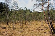
Category:Bogs in Bavaria
Federal states of Germany:
Wikimedia category | |||||
| Upload media | |||||
| Instance of | |||||
|---|---|---|---|---|---|
| Category combines topics | |||||
| Bavaria | |||||
federated state in the south of Germany | |||||
| Pronunciation audio | |||||
| Instance of |
| ||||
| Part of |
| ||||
| Named after | |||||
| Patron saint | |||||
| Location |
| ||||
| Capital | |||||
| Basic form of government |
| ||||
| Legislative body | |||||
| Executive body | |||||
| Highest judicial authority | |||||
| Official language |
| ||||
| Anthem | |||||
| Head of government |
| ||||
| Inception |
| ||||
| Highest point | |||||
| Population |
| ||||
| Area |
| ||||
| Elevation above sea level |
| ||||
| Follows | |||||
| Budget |
| ||||
| Top-level Internet domain |
| ||||
| Different from | |||||
| official website | |||||
 | |||||
Subcategories
This category has the following 47 subcategories, out of 47 total.
A
- Aachgraben (Riegsee) (3 F)
B
- Brucker Moos (Alxing) (3 F)
D
- Deininger Moos (38 F)
F
- FFH-Gebiet Bärnseemoor (4 F)
H
- Heiligenstädter Moos (9 F)
K
- Kematsriedmoos (47 F)
- Kendlmühlfilzn (42 F)
- Klosterfilz/Großer Filz (25 F)
- Kronfilz (3 F)
L
M
- Moorseen in der Seacht'n (15 F)
N
- Naturschutzgebiet Ampermoos (18 F)
- Naturschutzgebiet Brandmoos (14 F)
- Naturschutzgebiet Pulvermoos (19 F)
- Naturschutzgebiet Zengermoos (38 F)
O
- Ottmaringer Moor (2 F)
S
W
- Wiesfilz (8 F)
Z
- Zwieselter Filz (12 F)
Media in category "Bogs in Bavaria"
The following 34 files are in this category, out of 34 total.
-
Bad aibling moorabbau.png 1,493 × 1,002; 3.19 MB
-
Bad aibling schuhbraeufilze.png 1,493 × 1,024; 3.69 MB
-
Die Todtenau.JPG 3,232 × 2,410; 1.4 MB
-
Eberfing -Gewässer im Herbst.JPG 3,648 × 2,736; 2.34 MB
-
Feuerbachmoor.jpg 4,000 × 3,000; 4.46 MB
-
Grassau von der Zeppelinhöhe 2.jpg 4,928 × 3,264; 5.77 MB
-
Grundloser See 1.jpg 4,000 × 3,000; 3.31 MB
-
Grundloser See 4.jpg 4,000 × 3,000; 4.31 MB
-
Grundloser See Panorama.jpg 3,840 × 720; 2.86 MB
-
Grundloser See.jpg 3,263 × 2,039; 7.79 MB
-
Günzburg - Schwäbisches Donaumoos 02.JPG 1,920 × 1,080; 440 KB
-
Hochmoor östlich Harpfetsham Amtsblatt.jpg 1,700 × 2,338; 1.27 MB
-
Hochmoor östlich Harpfetsham.jpg 4,895 × 1,727; 11.17 MB
-
Kienbach Maimoos.jpg 800 × 600; 115 KB
-
Leipheim - Schwäbisches Donaumoos, Bohlenweg 02.JPG 1,920 × 1,080; 662 KB
-
Leipheim - Schwäbisches Donaumoos, Bohlenweg 03.JPG 1,920 × 1,080; 863 KB
-
Leipheim - Schwäbisches Donaumoos, Bohlenweg 04.JPG 1,920 × 1,080; 556 KB
-
Leipheim - Schwäbisches Donaumoos, Bohlenweg 05.JPG 2,835 × 3,852; 2.4 MB
-
Leipheim - Schwäbisches Donaumoos, Bohlenweg 06.JPG 1,920 × 1,080; 575 KB
-
Leipheim - Schwäbisches Donaumoos, Bohlenweg 07.JPG 1,920 × 1,080; 459 KB
-
Leipheim - Schwäbisches Donaumoos, Bohlenweg 08.JPG 1,920 × 1,080; 810 KB
-
LSG-By-OA-Grüntengebiet-Kematsriedmoos bei Oberjoch 01.08.2010-NL3.jpg 4,288 × 2,848; 13.02 MB
-
LSG-By-OA-Grüntengebiet-Kematsriedmoos bei Oberjoch 09.07.2013-NL1.jpg 6,304 × 2,637; 19.42 MB
-
LSG-By-OA-Grüntengebiet-Kematsriedmoos bei Oberjoch 09.07.2013-NL2.jpg 5,382 × 2,477; 14.53 MB
-
Moor Kupferbach.jpg 2,736 × 3,648; 7.93 MB
-
Moorallianz Allgäu.JPG 4,320 × 3,240; 5.64 MB
-
Moorwiese im Kupferbachtal.jpg 3,648 × 2,736; 6.59 MB
-
ND-00117.jpg 3,264 × 2,448; 3.45 MB
-
Oberammergau Altaulüsse 2015.jpg 4,288 × 2,848; 5.38 MB
-
Pfaffelmoos ND-01313.jpg 4,747 × 3,165; 23.45 MB
-
Rosmarienheide.JPG 4,320 × 3,240; 5.77 MB
-
Schlossweiher Moorgebiet.jpg 1,024 × 768; 103 KB
-
Sumpfgebiet im NWR Seelaub 14.jpg 9,241 × 4,799; 11.98 MB
-
Taferlmoos im LSG Schliersee.jpg 4,080 × 3,060; 7.7 MB


