Godawari, Lalitpur: Difference between revisions
Content deleted Content added
m →top: minor fixes, mostly disambig links using AWB |
Rescuing 3 sources and tagging 0 as dead. #IABot (v1.2.7.1) |
||
| Line 69: | Line 69: | ||
|footnotes = |
|footnotes = |
||
}} |
}} |
||
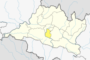
'''Godawari''' is a [[municipality]] in [[Lalitpur District, Nepal|Lalitpur District]] in the [[Bagmati Zone]] of central [[Nepal]]. In Dec 2014, [[Nepal]] government created Godawari [[Municipality]] by combining five [[Village Development Committees]]; [[Godawari, Bagmati|Godawari]], [[Badikhel]], [[Bisankhunarayan]], [[Godamchaur]] and [[Thaiba]].<ref>{{cite web|title=GIS Map Center|url=http://www.lgcdp.gov.np/home/map_newmunicipality.php|website=lgcdp.gov.np|accessdate=1 March 2016}}</ref> Per 2011 National Population and Housing Census,<ref>National Population and Housing Census 2011; http://cbs.gov.np/wp-content/uploads/2012/11/VDC_Municipality.pdf</ref> the population of five [[Village development committee|VDCs]] will make the total population of 28,793 for Godawari [[Municipality]]. The municipal office is located in Taukhel, [[Thaiba]]. |
'''Godawari''' is a [[municipality]] in [[Lalitpur District, Nepal|Lalitpur District]] in the [[Bagmati Zone]] of central [[Nepal]]. In Dec 2014, [[Nepal]] government created Godawari [[Municipality]] by combining five [[Village Development Committees]]; [[Godawari, Bagmati|Godawari]], [[Badikhel]], [[Bisankhunarayan]], [[Godamchaur]] and [[Thaiba]].<ref>{{cite web|title=GIS Map Center |url=http://www.lgcdp.gov.np/home/map_newmunicipality.php |website=lgcdp.gov.np |accessdate=1 March 2016 |deadurl=yes |archiveurl=https://web.archive.org/web/20160111164502/http://www.lgcdp.gov.np:80/home/map_newmunicipality.php |archivedate=11 January 2016 |df= }}</ref> Per 2011 National Population and Housing Census,<ref>National Population and Housing Census 2011; {{cite web|url=http://cbs.gov.np/wp-content/uploads/2012/11/VDC_Municipality.pdf |title=Archived copy |accessdate=2012-11-01 |deadurl=yes |archiveurl=https://web.archive.org/web/20130731124937/http://cbs.gov.np/wp-content/uploads/2012/11/VDC_Municipality.pdf |archivedate=2013-07-31 |df= }}</ref> the population of five [[Village development committee|VDCs]] will make the total population of 28,793 for Godawari [[Municipality]]. The municipal office is located in Taukhel, [[Thaiba]]. |
||
==References== |
==References== |
||
| Line 75: | Line 75: | ||
==External links== |
==External links== |
||
*[http://www.lgcdp.gov.np/home/map_newmunicipality.php] |
*[https://web.archive.org/web/20160111164502/http://www.lgcdp.gov.np:80/home/map_newmunicipality.php] |
||
*[http://www.nepalmountainnews.com/cms/2014/12/03/78579/] |
*[http://www.nepalmountainnews.com/cms/2014/12/03/78579/] |
||
*[http://kvda.gov.np/Kathmandu-Valley.aspx] |
*[http://kvda.gov.np/Kathmandu-Valley.aspx] |
||
Revision as of 16:51, 13 January 2017
Godawari
गोदावरी | |
|---|---|
| Godawari Municipality | |
| Country | |
| Zone | Bagmati Zone |
| District | Lalitpur District |
| Population (2011) | |
| • Total | 28,793 |
| Time zone | UTC+5:45 (Nepal Time) |
| Postal code | 00977 |
| Area code | 01 |
Godawari is a municipality in Lalitpur District in the Bagmati Zone of central Nepal. In Dec 2014, Nepal government created Godawari Municipality by combining five Village Development Committees; Godawari, Badikhel, Bisankhunarayan, Godamchaur and Thaiba.[1] Per 2011 National Population and Housing Census,[2] the population of five VDCs will make the total population of 28,793 for Godawari Municipality. The municipal office is located in Taukhel, Thaiba.
References
- ^ "GIS Map Center". lgcdp.gov.np. Archived from the original on 11 January 2016. Retrieved 1 March 2016.
{{cite web}}: Unknown parameter|deadurl=ignored (|url-status=suggested) (help) - ^ National Population and Housing Census 2011; "Archived copy" (PDF). Archived from the original (PDF) on 2013-07-31. Retrieved 2012-11-01.
{{cite web}}: Unknown parameter|deadurl=ignored (|url-status=suggested) (help)CS1 maint: archived copy as title (link)
External links
This article about a location in Bagmati Province of Nepal is a stub. You can help Wikipedia by expanding it. |