Black Point, South Australia: Difference between revisions
m convert param fix |
Rescuing 2 sources and tagging 0 as dead. #IABot (v1.4.2) |
||
| Line 11: | Line 11: | ||
| pop_year = {{censusAU|2011}} |
| pop_year = {{censusAU|2011}} |
||
| pop_footnotes = <ref name= Census2011>{{Census 2011 AUS|id= SSC40050 |name= Black Point |accessdate=10 May 2016|quick=on}}</ref> |
| pop_footnotes = <ref name= Census2011>{{Census 2011 AUS|id= SSC40050 |name= Black Point |accessdate=10 May 2016|quick=on}}</ref> |
||
| est = 1999<ref name=PLB>{{cite web|title=Search result for "Black Point(Locality Bounded)" (Record no SA0006972) with the following layers being selected - "Suburbs and Localities" and "Place names (gazetteer)" and "Road Labels" |
| est = 1999<ref name=PLB>{{cite web|title=Search result for "Black Point(Locality Bounded)" (Record no SA0006972) with the following layers being selected - "Suburbs and Localities" and "Place names (gazetteer)" and "Road Labels"|url=http://maps.sa.gov.au/plb/#|publisher=Government of South Australia|date=|accessdate=9 May 2016|deadurl=yes|archiveurl=https://web.archive.org/web/20161012010923/http://maps.sa.gov.au/plb/|archivedate=12 October 2016|df=dmy-all}}</ref> |
||
| postcode = 5571<ref name=postcode>{{cite web|title=Postcode for Black Point, South Australia |url= http://www.postcodes-australia.com/areas/sa/adelaide/black+point |publisher= postcodes-australia.com |accessdate=9 May 2016}}</ref> |
| postcode = 5571<ref name=postcode>{{cite web|title=Postcode for Black Point, South Australia |url= http://www.postcodes-australia.com/areas/sa/adelaide/black+point |publisher= postcodes-australia.com |accessdate=9 May 2016}}</ref> |
||
| elevation = |
| elevation = |
||
| Line 48: | Line 48: | ||
Its boundaries were created in May 1999 for the “long established name” and includes the Black Point Shack Site.<ref name=PLB/> The name was derived from the headland on the coastline which was named by a Stephen Goldsworthy on 10 October 1854.<ref name=PLB/><ref>{{cite web|title= Black Point; Nomenclature |url=http://www.slsa.sa.gov.au/manning/pn/b/b16.htm#blackp|publisher= State Library of South Australia |accessdate=9 May 2016}}</ref> |
Its boundaries were created in May 1999 for the “long established name” and includes the Black Point Shack Site.<ref name=PLB/> The name was derived from the headland on the coastline which was named by a Stephen Goldsworthy on 10 October 1854.<ref name=PLB/><ref>{{cite web|title= Black Point; Nomenclature |url=http://www.slsa.sa.gov.au/manning/pn/b/b16.htm#blackp|publisher= State Library of South Australia |accessdate=9 May 2016}}</ref> |
||
Black Point consists of an area of land bounded to the west by the [[St Vincent Highway]] and to the east by [[Gulf St Vincent]] where the coastline forms a bay gazetted as '''Port Alfred''' which faces to the north-east and concludes in the headland gazetted both as Black Point and the [[Narungga]] word, Gudliwardi.<ref name=PLB/><ref>{{cite web|title=Search result for "Black Point(Point)" (Record no SA0006967) with the following layers being selected - "Suburbs and Localities" and "Place names (gazetteer)" |
Black Point consists of an area of land bounded to the west by the [[St Vincent Highway]] and to the east by [[Gulf St Vincent]] where the coastline forms a bay gazetted as '''Port Alfred''' which faces to the north-east and concludes in the headland gazetted both as Black Point and the [[Narungga]] word, Gudliwardi.<ref name=PLB/><ref>{{cite web|title=Search result for "Black Point(Point)" (Record no SA0006967) with the following layers being selected - "Suburbs and Localities" and "Place names (gazetteer)"|url=http://maps.sa.gov.au/plb/#|publisher=Government of South Australia|date=|accessdate=9 May 2016|deadurl=yes|archiveurl=https://web.archive.org/web/20161012010923/http://maps.sa.gov.au/plb/|archivedate=12 October 2016|df=dmy-all}}</ref> |
||
As of 2015, the majority land use within the locality is [[agriculture]]. A secondary land use is [[conservation (ethic)|conservation]] which concerns the strip of land immediately adjoining the coastline. Tertiary uses include the use of land along the Port Alfred coastline for both [[residential area|residential use]] and short-term tourist accommodation with the latter being provided in the form of a [[caravan park]].<ref name=Yorke>{{cite web|title= Development Plan - Yorke Peninsula Council - Consolidated – 26 November 2015 |url=http://www.dpti.sa.gov.au/__data/assets/pdf_file/0015/250026/Yorke_Peninsula_Council_Development_Plan.pdf |publisher=Government of South Australia |accessdate=25 February 2016|pages=321–323 and 433–440}}</ref> |
As of 2015, the majority land use within the locality is [[agriculture]]. A secondary land use is [[conservation (ethic)|conservation]] which concerns the strip of land immediately adjoining the coastline. Tertiary uses include the use of land along the Port Alfred coastline for both [[residential area|residential use]] and short-term tourist accommodation with the latter being provided in the form of a [[caravan park]].<ref name=Yorke>{{cite web|title= Development Plan - Yorke Peninsula Council - Consolidated – 26 November 2015 |url=http://www.dpti.sa.gov.au/__data/assets/pdf_file/0015/250026/Yorke_Peninsula_Council_Development_Plan.pdf |publisher=Government of South Australia |accessdate=25 February 2016|pages=321–323 and 433–440}}</ref> |
||
Revision as of 10:54, 21 July 2017
| Black Point South Australia | |||||||||||||||
|---|---|---|---|---|---|---|---|---|---|---|---|---|---|---|---|
 Black Point | |||||||||||||||
| Coordinates | 34°36′44″S 137°53′29″E / 34.6121°S 137.891460°E | ||||||||||||||
| Population | 194 (shared with other localities within the “State Suburb of Black Point”) (2011 census)[2] | ||||||||||||||
| Established | 1999[1] | ||||||||||||||
| Postcode(s) | 5571[3] | ||||||||||||||
| Time zone | ACST (UTC+9:30) | ||||||||||||||
| • Summer (DST) | ACST (UTC+10:30) | ||||||||||||||
| Location | 72 km (45 mi) northwest of Adelaide | ||||||||||||||
| LGA(s) | Yorke Peninsula Council[1] | ||||||||||||||
| Region | Yorke and Mid North[4] | ||||||||||||||
| County | Fergusson[1] | ||||||||||||||
| State electorate(s) | Goyder[5] | ||||||||||||||
| Federal division(s) | Grey[6] | ||||||||||||||
| |||||||||||||||
| |||||||||||||||
| Footnotes | Location[3] Coordinates[1] Climate[7] Adjoining localities[1] | ||||||||||||||
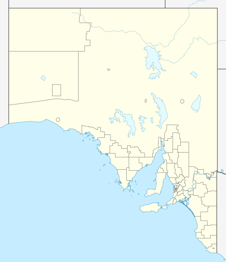
Black Point is a locality in the Australian state of South Australia located on the east coast of Yorke Peninsula about 72 kilometres (45 miles) northwest of the state capital of Adelaide.[3][1]
Its boundaries were created in May 1999 for the “long established name” and includes the Black Point Shack Site.[1] The name was derived from the headland on the coastline which was named by a Stephen Goldsworthy on 10 October 1854.[1][8]
Black Point consists of an area of land bounded to the west by the St Vincent Highway and to the east by Gulf St Vincent where the coastline forms a bay gazetted as Port Alfred which faces to the north-east and concludes in the headland gazetted both as Black Point and the Narungga word, Gudliwardi.[1][9]
As of 2015, the majority land use within the locality is agriculture. A secondary land use is conservation which concerns the strip of land immediately adjoining the coastline. Tertiary uses include the use of land along the Port Alfred coastline for both residential use and short-term tourist accommodation with the latter being provided in the form of a caravan park.[10]
Black Point is located within the federal division of Grey, the state electoral district of Goyder and the local government area of the Yorke Peninsula Council.[6][5][1]
See also
References
- ^ a b c d e f g h i j "Search result for "Black Point(Locality Bounded)" (Record no SA0006972) with the following layers being selected - "Suburbs and Localities" and "Place names (gazetteer)" and "Road Labels"". Government of South Australia. Archived from the original on 12 October 2016. Retrieved 9 May 2016.
{{cite web}}: Unknown parameter|deadurl=ignored (|url-status=suggested) (help) - ^ Australian Bureau of Statistics (31 October 2012). "Black Point". 2011 Census QuickStats. Retrieved 10 May 2016.
- ^ a b c "Postcode for Black Point, South Australia". postcodes-australia.com. Retrieved 9 May 2016.
- ^ "Yorke and Mid North SA Government region" (PDF). The Government of South Australia. Retrieved 17 April 2017.
- ^ a b "Federal electoral division of Grey" (PDF). Australian Electoral Commission. Retrieved 24 July 2015.
- ^ a b "Goyder electorate boundaries as of 2014". Electoral Commission SA. Retrieved 23 July 2015.
- ^ "Monthly climate statistics: Summary statistics Maitland (nearest station)". Commonwealth of Australia , Bureau of Meteorology. Retrieved 9 May 2016.
- ^ "Black Point; Nomenclature". State Library of South Australia. Retrieved 9 May 2016.
- ^ "Search result for "Black Point(Point)" (Record no SA0006967) with the following layers being selected - "Suburbs and Localities" and "Place names (gazetteer)"". Government of South Australia. Archived from the original on 12 October 2016. Retrieved 9 May 2016.
{{cite web}}: Unknown parameter|deadurl=ignored (|url-status=suggested) (help) - ^ "Development Plan - Yorke Peninsula Council - Consolidated – 26 November 2015" (PDF). Government of South Australia. pp. 321–323 and 433–440. Retrieved 25 February 2016.
This South Australia geography article is a stub. You can help Wikipedia by expanding it. |