Uxbridge, Massachusetts: Difference between revisions
→Economy: NECTA labor data |
|||
| Line 237: | Line 237: | ||
==Economy== |
==Economy== |
||
High tech, services, distribution, life sciences, hospitality, local government, education and tourism offer local jobs. A 618,000 square feet (57,400 m2) distribution center serves [[BJ's Wholesale Club]]'s, northern division. |
High tech, services, distribution, life sciences, hospitality, local government, education and tourism offer local jobs. A 618,000 square feet (57,400 m2) distribution center serves [[BJ's Wholesale Club]]'s, northern division. August 2011 unemployment was 7.4% <ref>[http://lmi2.detma.org/lmi/lmi_area.asp?areatype=05&area=000294 NECTA, Labor data, Uxbridge]</ref> |
||
==Education== |
==Education== |
||
Revision as of 00:45, 25 September 2011
Uxbridge | |
|---|---|
 Taft Brothers Block, Downtown Uxbridge | |
 Flag | |
| Nickname: "Home of America's First Woman Voter" | |
 Location in Worcester County in Massachusetts | |
| Country | United States |
| State | Massachusetts |
| County | Worcester |
| Settled | 1662 |
| Incorporated | 1727 |
| Government | |
| • Type | Representative town meeting |
| • Chair, Board of Selectmen | Bruce Desilets |
| • Vice Chair, Board of Selectmen | Beth Pittman |
| • Clerk, Board of Selectmen | Peter Petrillo |
| • Selectmen | Carrie Kay Robertson, Jay Cahill |
| • Town Manager | Michael A Szlosek |
| Area | |
| • Total | 30.4 sq mi (78.7 km2) |
| • Land | 29.5 sq mi (76.5 km2) |
| • Water | 0.8 sq mi (2.1 km2) |
| Elevation | 270 ft (82 m) |
| Population (2010) | |
| • Total | 13,457 |
| • Density | 442.66/sq mi (170.77/km2) |
| Time zone | UTC-5 (Eastern) |
| • Summer (DST) | UTC-4 (Eastern) |
| ZIP code | 01569, 01538, 01525 |
| Area code | 508 / 774 |
| FIPS code | 25-71620 |
| GNIS feature ID | 0618387 |
| Website | http://www.uxbridge-ma.gov/ |
Uxbridge is a town in Worcester County, Massachusetts, in the United States. It was first settled in 1662, incorporated in 1727, and named for the Earl of Uxbridge. Uxbridge is 16 miles (26 km) south-southeast of Worcester, 20 miles (32 km) north-northwest of Providence, and 34 miles (55 km) southwest of Boston. It is part of the Greater Boston[1] and Worcester metro areas. The 2010 census showed 13,457 people. Uxbridge includes the villages of North Uxbridge, Linwood (in part), Wheelockville, and Ironstone (South Uxbridge).
Uxbridge, a "mini tapestry of early America",[2] marks the center of the Blackstone Valley Heritage Corridor, a key region of America's earliest industrialization. There are more than 375 state or national historic sites. Uxbridge was known for woolens, since Cashmere woolens, and military uniforms were made here for 140 years. The first woolen mill in the Blackstone Valley was built here in 1809. The Bachman Uxbridge Worsted Company's proposed 1954 buyout of the American Woolen Company would have created America's largest woolen conglomerate.[3] The first Air Force Dress Uniform, "Uxbridge Blue", was made here. Uxbridge played roles in women's rights with first woman voter, Lydia Taft,[4] American Revolution soldier, Deborah Sampson, 3) abolitionist Abby Kelley, and Massachusetts's first women jurors. Seth Reed fought at Bunker Hill, and was "instrumental" in adding E Pluribus Unum, ('From Many, One'), to U.S. Coins.[5]
History
Colonial era, Quakers, Revolution
John Eliot started Praying Indian villages (Wacentug) among the Nipmuc.[6][7][8] Natives sold land to settlers in 1662,[9] "for 24 pound Ster".[9][9][10] Mendon burned in King Phillips War. West Mendon became Uxbridge in 1727, and Farnum House held the first town meeting.[11] The 1728 Town Meeting, funded 15 gallons of 'ye good rum for ye raising of ye meeting house'. Nathan Webb's church, was the first new Congregational church in the Great Awakening.[12] Lydia Taft, voted in the 1756 Town meeting, a first for women.[4] Smithfield, RI Quakers came here and built mills, railroads, houses, tools and Conestoga wagon wheels.[13][14][15] Southwick's store housed the "Social and Instructive Library". Friends Meetinghouse, built of local bricks on Farnum's farm, had abolitionist" Abby Kelley as a member.[16][17][18][19] Seth & Joseph Read and Simeon Wheelock joined Committees of Correspondence.[20] Baxter Hall, was a Revolutionary War drummer.[21] Seth Read fought at Bunker Hill, and the Canadian campaign. Washington stopped at Reed's tavern, en-route to command the Continental Army.[22][23] Samuel Spring, was a Revolutionary war chaplain.[24] Deborah Sampson, a woman posing as a man, enlisted in the Continental Army as "Robert Shurtlieff of Uxbridge".[25] Shays' Rebellion's, opening salvos led Gov. Hancock to suppress town riots.[26][27] Lt. Simeon Wheelock, died at Springfield, protecting the armory.[13] Seth Reed petitioned the state legislature, to mint "coppers", and was instrumental adding E pluribus unum to coins.[5][20][28] President Washington, slept here on his Inaugural tour.[29][30]
Early transportation, education and public health
The Tafts built the Middle Post Road's Blackstone River bridge.[31] "Teamsters" drove horse "team" freight wagons, on the Worcester-Providence stage route, giving Uxbridge the nickname of "a crossroads village". Construction of the Blackstone Canal brought horsedrawn barges which made Uxbridge their overnight stop.[9][32][33] Completion of the P&W Railroad in 1848 ended canal traffic. A 1788 grammar school was followed by 13 one room schools, built for just $2000. Uxbridge Academy, which began in 1818, became a prestigious New England Prep School. Uxbridge voted against smallpox vaccine in 1775,[4] recorded high infant mortality ,[22] Benedict Arnold's widow's death, and "Quincy", smallpox, "dysentary", and tuberculosis deaths.[13][22] Dr. Leonard White, filed an 1896 malaria public health report that led to a plan for[34] his son to collect mosquitoes for study, and citizens to add window screens and drain standing water, firsts in malaria preventive medicine.[34]
Industrial era: 19th century to mid-20th century
Large industries began by 1775.[35] Richard Mowry, built and marketed equipment to manufacture woolen, linen or cotton cloth.[2][36] Gristmills, sawmills, forges, bog iron, distilleries, and 20 mills developed.[6][13] Daniel Day built the Valley's first woolen mill in 1809.[4][9] In 1855, 560 local workers made 2.5 million yards of cloth,(14,204 miles).[6][13][35] Entrepreneur's firsts included woolen power looms, satinets, vertical textile integration to clothes, wool-nylon serge, wool synthetic blends, "poodle cloth", 'wash and wear' fabric, new yarn spinning techniques, and latch hook kits. Villages developed with mills, shops, housing, farms, (aka The Rhode Island System), and baseball leagues. Wm.Arnold's 1814 Ironstone cotton mill, made Blue Jeans.[13] Seth Read's gristmill became Bay State Arms. John Capron's 1820 mill made the first American satinets.[6][9][35][37] Hecla and Wheelockville had American Woolen, Waucantuck Mill Complex, and Hilena Lowell's shoe factory. Wheelock&Taft's Calumet (Central Woolen) ran 24/7 making Civil War cloth[13] completing a vertical integration business model.[38] North Uxbridge had Clapp's 1810 Cotton Mill, Sayles Rivulet Mill, Blanchard's granite quarry, and Rogerson's village. Crown and Eagle Mill, was 'a masterpiece of early industrial architecture'. Bachman Uxbridge Worsted 's, 13 plants, topped women's fashions.,[39] and proposed a buyout to be the top US woolen company.[40] It made Civil War, World War I, World War II Army, nurse corps, and the first Air Force 'dress uniforms' "Uxbridge Blue".[13][41]
Mid-20th century to present


State and national parks developed around the mills and rivers were restored.[42] The Great Gatsby (1974) and Oliver's Story (1978) were filmed locally including Stanley Woolen Mill. The National Heritage Corridor[43] contains the 1,000-acre (4.0 km2)Blackstone Canal Heritage State Park,[44] 9 miles (14 km) of the Blackstone River Bikeway,[45] the Southern New England Trunkline Trail, and West Hill Dam and wildlife refuge.[46] 60 Federalist homes[13] add to 54 National, and 375 state-listed historic sites, including Georgian Elmshade.[13] A 2007 fire destroyed the Bernat Mill but Capron's mill was preserved,.[47] Stanley mill is being restored while Waucantuck mill, was razed. See National historic sites. The area offers scenic golf courses, B & B, and hospitality venues.
Notable families and people
Robert Taft I, (1680) was patriarch of an American dynasty. Taft's grandson's widow, Lydia (Chapin), was "America's first woman voter".[4] Samuel Taft hosted George Washington's inaugural tour.[4] Ezra Taft(T.) Benson was an LDS Church Apostle, Hawaii missionary, and Utah legislator. Great grandson, Ezra Taft Benson, was U.S. Secretary of Agriculture and LDS President. Luke Taft built 2 water powered mills, and son, Moses built Stanley Woolen Mill. Peter Rawson Taft I's son, Secretary of War Alphonso Taft delivered a speech on Taft family history at an Elmshade reunion.[48] Alfonso's son, William Howard Taft, visited Samuel Taft House in 1910 with Gov. Eben Draper.[49] Arthur MacArthur, Sr. became Governor, Lt. Governor and Supreme Court Justice in Wisconsin and Washington, D.C. and his grandson, was Gen. Douglas MacArthur. Seth Read[50] founded Erie, PA and Geneva, NY, and his descendents were Congressmen and Great Lakes ship captains.[5][20][28] Paul C. Whitin, founded the Whitin Machine Works. Phineas Bruce and Benjamin Adams were U.S. Congressmen. Joshua Macomber and William Augustus Mowry were educators. Edward Sullivan (US Marine), won a Medal of Honor in the Spanish-American War. Alice Bridges won an Olympic bronze in the backstroke in 1936's Berlin Olympics.[51] Tim Fortugno pitched for the California Angels, Chicago White Sox and Cincinnati Reds, (1990's). Senator Richard Moore was FEMA executive (1994–1996), a key co-author of the 2006 landmark Massachusetts healthcare access law, and President of the National Conference of State Legislatures, (2010–2011).[52][53] Brian Skerry is a "legendary" photojournalist with National Geographic. Arthur K. Wheelock, Jr. is a curator of Baroque Art at the National Gallery.[54] Jacqueline Liebergott,was the first woman president of Emerson College. Jeannine Oppewall, film art producer, has 30+ films, and 4 Academy Awards nominations for best art direction of LA Confidential, Pleasantville, "Seabiscuit" and The Good Shepherd. Her film art is recognized in more films including The Big Easy, The Bridges of Madison County and Catch Me If You Can. (see also list of notable residents)
Government
| State government | |
|---|---|
| State Representative(s): | Ryan Fattman (R) Kevin J. Kuros (R) |
| State Senator(s): | Richard T. Moore (D) |
| Governor's Councilor(s): | Jen Caissie (R) |
| Federal government | |
| U.S. Representative(s): | Richard E. Neal (D-2nd Dist.) |
| U.S. Senators: | Elizabeth Warren (D), Ed Markey (D) |
Uxbridge has a Board of Selectmen and representative town meeting with officials listed in the top infobox:[55] Local government 1) granted the first woman in America the right to vote,[4] 2) voted down smallpox vaccine in 1775,[4] and 3) defied the Secretary of State's office, approving women jurors.[56] The 2009 Board of Health, made Uxbridge the 3rd community in the US, to ban tobacco sales in pharmacies. County Government in Massachusetts is weak or has vestiges of the former system. Worcester County has had no official county government since 1998, though regional officials of state government hold county elected offices (see info box). The Worcester County, Massachusetts Sherriff, Lewis Evangelidis provides corrections at West Boylston, and Worcester District Courts is the judicial jurisdiction for regional courts. There is is an Uxbridge district court which serves surrounding towns.
Geography
The town occupies 30.4 square miles (79 km2), of which 0.8 square miles (2.1 km2), or 2.73%, is water. It is situated 35 miles (56 km) southwest of Boston, 16 miles (26 km) southeast of Worcester, and 20 miles (32 km) northwest of Providence, Rhode Island. Elevations range from 200 feet (61 m) to 577 feet (176 m) above sea level, and the town borders Douglas, Mendon, Millville, Northbridge, and Sutton, Massachusetts, plus the Rhode Island towns of Burrillville and North Smithfield.
Places adjacent to Uxbridge, Massachusetts | |
|---|---|
Climate
A USDA hardiness zone 5 continental climate prevails with snowfall etremes from October(rare), to May. The highest temp was 104 F, in July 1975, and the lowest, -25 F in January 1957.[57]
| Climate data for Uxbridge, Massachusetts | |||||||||||||
|---|---|---|---|---|---|---|---|---|---|---|---|---|---|
| Month | Jan | Feb | Mar | Apr | May | Jun | Jul | Aug | Sep | Oct | Nov | Dec | Year |
| Mean daily maximum °F (°C) | 37 (3) |
40 (4) |
49 (11) |
59 (15) |
70 (21) |
79 (27) |
84 (29) |
82 (28) |
75 (23) |
64 (18) |
53 (13) |
42 (5) |
60 (15) |
| Mean daily minimum °F (°C) | 13 (−9) |
16 (−8) |
27 (−2) |
37 (3) |
47 (8) |
55 (13) |
60 (16) |
59 (15) |
49 (9) |
37 (4) |
30 (−1) |
20 (−6) |
40 (4) |
| Average precipitation inches (cm) | 3.6 (9) |
3.3 (8) |
4.1 (10) |
3.9 (9) |
4.3 (10) |
3.6 (9) |
3.7 (9) |
4.1 (10) |
4.1 (10) |
4.1 (10) |
4.5 (11) |
4.0 (10) |
47.3 (120) |
| Source: Weather.com[57] | |||||||||||||
Demographics
| Year | Pop. | ±% |
|---|---|---|
| 1850 | 2,457 | — |
| 1860 | 3,133 | +27.5% |
| 1870 | 3,058 | −2.4% |
| 1880 | 3,111 | +1.7% |
| 1890 | 3,408 | +9.5% |
| 1900 | 3,599 | +5.6% |
| 1910 | 4,671 | +29.8% |
| 1920 | 5,384 | +15.3% |
| 1930 | 6,285 | +16.7% |
| 1940 | 6,417 | +2.1% |
| 1950 | 7,007 | +9.2% |
| 1960 | 7,789 | +11.2% |
| 1970 | 8,253 | +6.0% |
| 1980 | 8,374 | +1.5% |
| 1990 | 10,415 | +24.4% |
| 2000 | 11,156 | +7.1% |
| 2001* | 11,636 | +4.3% |
| 2002* | 11,851 | +1.8% |
| 2003* | 12,121 | +2.3% |
| 2004* | 12,308 | +1.5% |
| 2005* | 12,458 | +1.2% |
| 2006* | 12,704 | +2.0% |
| 2007* | 12,860 | +1.2% |
| 2008* | 12,768 | −0.7% |
| 2009* | 12,873 | +0.8% |
| 2010 | 13,457 | +4.5% |
| * = population estimate. Source: United States census records and Population Estimates Program data.[58][59][60][61][62][63][64][65][66][67] | ||
The 2010 United States CensusTemplate:GR was 13,457, a growth rate of 20.6%, with 4,708 households. 95.35% were White, 2.07% Asian, 1.0% Hispanic, 0.18% African American,and 1.4% other. Population density was 442.66 people/ mile2 (170.77/km²). Per capita income was $24,540, and 4.7% fell below the poverty line.
Economy
High tech, services, distribution, life sciences, hospitality, local government, education and tourism offer local jobs. A 618,000 square feet (57,400 m2) distribution center serves BJ's Wholesale Club's, northern division. August 2011 unemployment was 7.4% [68]
Education
Local schools include: Blanchard Pre-K, Taft Elementary, Whitin Middle, Uxbridge High and Our Lady of the Valley Regional. Valley Tech(Upton) houses Quinsigamond, C.C. The NYT called reforms, a "little revolution" to meet family needs.[69]
Healthcare
Tri-River Family Health, (UMass Medical) offers primary care. Milford Regional, Landmark M/C, hospices and long term care are nearby.
Transportation
Rail
Commuter rails include: Franklin Line, at Forge Park & I-495 12.77 mi. east and Worcester's Line, 14.04 mi north. The P&W carries freight.
Highways
Route 146[70] connects Worcester, I-290, I-90, I-295 and I-95 at Providence. Route 16 connects to Connecticut via I-395, and Boston, by I-495. Route 122 connects Northbridge, and Woonsocket. Route 146A, connects to North Smithfield. Route 98 connects to Burrillville.
Airports
TF Green Warwick, Boston Logan, and Worcester airport, have commercial flights. Hopedale airport,7.2 miles (11.6 km), has general aviation.
Points of interest
- National historic sites
- John C. Farnum House, Uxbridge Historical Society Museum, circa 1710
- Lt. Simeon Wheelock House, Uxbridge common district, 1768
- Friends meetinghouse, circa 1770
- Taft House, 1789 Inaugural tour visit of George Washington and 1910 visit of Uxbridge grandson, William Howard Taft
- Crown and Eagle Cotton Mill, circa 1826
- Elmshade, Site of historic Taft family reunion of 1874
- Bernat Mill, formerly Capron Mill, circa 1820, and Uxbridge Worsted Company
- Stanley Woolen Mill, also once known as Central Woolen, Calumet, and Moses Taft Mill
- Stanley Woolen Mill
- Blackstone River Valley National Heritage Corridor
- National Park Service, valley sites: Millville & Uxbridge
- Blackstone Canal at River Bend Farm
- Blackstone River and Canal Heritage State Park Massachusetts Department of Conservation and Recreation park website
- River Bend Farm and Canal, National Park Service brochure
- West Hill Dam and recreation area
- Walking tour of Uxbridge, National Park Service brochure
Photos
-
-
Nipmuck dancers today in the Blackstone Valley
-
Puritan Missionary, John Eliot, started 14 Praying Indian Villages such as those at RIce City and Wacentug and was a witness for the original deed with native Americans of what became the original town (Mendon).
-
Coronet John Farnum, Jr., House, 1710, houses Uxbridge Historical Society
-
Nathan Webb's Church (1731), first new Congregational Church in Massachusetts, First Great Awakening Period
-
Friends Meeting House (1770), Quaker Highway at Route 98, Uxbridge, MA. AbolitionistQuakers with ties to Moses Brown first resettled here from Rhode Island.
-
-
Uxbridge Academy & Masonic Lodge. Uxbridge Academy was a sought after New England Prep School from 1818
-
Lt. Simeon Wheelock House (1768), Deborah Wheelock Chapter, D.A.R. Lt. Wheelock died in Shays' rebellion while on duty protecting theSpringfield Armory. Shays' Rebellion had opening salvos in Uxbridge.
-
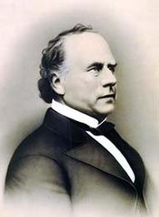
Lt. Colonel Seth Read, fought at Bunker Hill, added E Pluribus Unum to coins, and founded Erie, PA, and early settlement at Geneva, New York
-
Captain Baxter Hall was a drummer in the first musters of the Revolutionary War. He responded to the Lexington Alarm at age 18 and drummed the first drum beats of American freedom. The uniforms of the period resembled this photo.
-
Mill worker housing, Ironstone Cotton Manufacturing Company, built 1814
-
Crown & Eagle Mill, built in 1824 by Robert Rogerson, who like Samuel Slater, immigrated from England with industrial plans, is considered a masterpiece of early American Industrial architecture
-
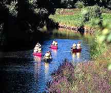
Canoes on the Blackstone Canal. The Blackstone Canal was built starting in 1824 and provided early freight transport by horse pulled barges from Providence to Worcester.
-
Stanley Woolen Mill, built by Moses Taft, with view of the Blackstone Canal, was the scene for two movies, The Great Gatsby, 1974, and Oliver's Story, 1978. In 1989, it had been the longest continuously operating family-owned mill in the US. This mill ran 24/7 making Civil War blue woolen cloth for military uniforms.
-
Historic North Uxbridge School, former Virginia Blanchard pre-K Center
-
Mumford River's Capron Falls. Water powered early Uxbridge mills
-
The Capron mill, built by John Capron Sr. and his sons Effingham, and John, circa 1820 manufactured the first satinets, used the first power looms for woolens in America, and made US military uniforms for over 140 years, including the first US Air Force dress uniform, "Uxbridge 1683", aka Uxbridge Blue.
-
Current US Air Force Service Dress uniforms similar to Uxbridge Blue, made here in 1947: Officer on the left, enlisted on the right. Taken from AFI 36-2903
-
Unitarian Church at Uxbridge where Judge Henry Chapin delivered a historical address in 1864, and was an amateur historian of this community. Henry Chapin was a prominent Unitarian Church leader in Massachusetts. The Unitarian Church was prominent in the Industrial period of this community.
-
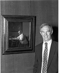
Arthur Wheelock, Jr., National Gallery Curator Northern Baroque Art
-
Jeannine Oppewall, film art and four time academy award nominee
-
-
Arthur MacArthur, Sr., Wisconsin Lt. Governor, Chief Justice, Grandfather of Douglas McArthur


See also
- List of notable Uxbridge people by century
- Jerry Wheelock
- Richard Mowry
- Taft Family
- John Capron
- North Uxbridge
- Linwood, Massachusetts
- Wheelockville
- Ironstone, Massachusetts
- Rogerson's Village Historic District
- Uxbridge Free Public Library
- Wrona, B., Uxbridge-Images of America (2000), Arcadia, ISBN 0738504610
References
- ^ "Greater Boston Map". wikipedia.org. Retrieved 2008-12-17.
{{cite web}}: Text "Boston-Worcester-Manchester Combined Statistical Area" ignored (help) - ^ a b [National Park Service brochure, reference for tapestry analogy and US minihistory "Uxbridge Walking Tour, NPS brochure"]. NPS.gov. Retrieved 2011-01-01.
{{cite web}}: Check|url=value (help) - ^ http://www.time.com/time/magazine/article/0,9171,819703,00.htmlBusiness: Time Clock, Time Magazine, March 29, 1954
- ^ a b c d e f g h Chapin, Judge Henry (1881). Address Delivered at the Unitarian Church in Uxbridge, 1864. Worcester, MA: Charles Hamilton Press (Harvard Library; from Google Books). p. 172.
{{cite book}}: Cite has empty unknown parameter:|coauthors=(help) - ^ a b c "e pluribus unum FAQ #7". www.treas.gov. Retrieved 2007-09-29.
- ^ a b c d "MHC Reconnaissance Survey Town Report: Uxbridge; Report Date: 1984 Associated Regional Report: Central Massachusetts;" (PDF). Massachusetts Historical Commission;. 1984. Archived from the original (PDF) on 2007-12-02. Retrieved 2007-11-20.
{{cite web}}: CS1 maint: extra punctuation (link) - ^ "Nipmuc History". Lee Sultzman. Retrieved 2007-09-28.
- ^ "Nipmuc place names of New England". native tech.org. Retrieved 2008-04-12.
- ^ a b c d e f Marvin, Rev. Abijah Perkins (1879). History of Worcester County, Massachusetts, Embracing a Comprehensive History of the County from its earliest beginnings to the present time; Vol. II. Boston, MA: CF Jewitt and Company. pp. 421–436.
{{cite book}}: Cite has empty unknown parameter:|coauthors=(help) - ^ Connole, Dennis A. (2001). The Indians of the Nipmuck Country in Southern New England, 1630-1750: A Historical Geography. McFarland and Company (Accessed by Google Books). p. 146. ISBN 9780786407996.
{{cite book}}: Cite has empty unknown parameter:|coauthors=(help) - ^ "John Farnum, Jr". Doug Sinclair's Archives. Retrieved 2007-10-04.
- ^ Clarke, D.D., Joseph S. (1858). A Historical Sketch of the Congregational Churches in Massachusetts, from 1620 to 1858. Boston (Digitized by Google books): Congregational Board of Publication. p. 148.
{{cite book}}: Cite has empty unknown parameter:|coauthors=(help) - ^ a b c d e f g h i j "walking tours-Uxbridge". Blackstone Daily. Archived from the original on 2007-09-28. Retrieved 2007-09-23. Cite error: The named reference "walking" was defined multiple times with different content (see the help page).
- ^ "Uxbridge, Worcester County". Department of Housing and Community Development. Retrieved 2008-05-24.
- ^ "The Conestoga Wagon". The Conestoga Area Historical Society. Retrieved 2007-09-23.
- ^ "Uxbridge, Friends Meetinghouse". NPS. Retrieved 2007-09-29.
- ^ "The Historical Archeology of Mortuary Behavior: Coffin Hardware from Uxbridge, Massachusetts; Abstract: Edward Bell" (PDF). University of Florida. 1992. Retrieved 2007-11-01.
- ^ Buffum, Lucille (1914). Elizabeth Buffme Chase- Her Life and Its Environment. Google books.
- ^ "The Uxbridge Meeting House". Blackstone Daily. Retrieved 2007-09-23. [dead link]
- ^ a b c Buford, Mary Hunter (1895). Seth Read, Lieut.-Col.Continental Army; Pioneer at Geneva, New York, 1787, and at Erie, Penn., June, 1795. His Ancestors and Descendants. Boston, Mass. pp. 167 pages on CD in PDF Format.
{{cite book}}: Cite has empty unknown parameter:|coauthor=(help)CS1 maint: location missing publisher (link) Cite error: The named reference "Seth" was defined multiple times with different content (see the help page). - ^ "Martial Musick in Uxbridge Massachusetts 1727-Present". www.angelfire.com. Retrieved 2007-09-23.
- ^ a b c Baldwin, Thomas Williams (1916). Vital Records of Uxbridge, Massachusetts to the Year 1850. Boston: Wright and Potter Printing. pp. 2–450. Retrieved 2007-11-02.
- ^ Collections of the Worcester Society of Antiquity. Volume XIV. Worcester, Massachusetts: googlebooks. 1897. p. 34. Retrieved 2007-09-07.
- ^ "Samuel Spring of Uxbridge, Revolutionary War Chaplain, by Michael Potaski" (PDF). Blackstone Valley Tribune. p. 5. Retrieved 2008-12-12.
- ^ "DEBORAH SAMPSON.; How She Served as a Soldier in the Revolution – Her Sex Unknown to the Army.*" (PDF). New York Times. 1898-10-08. Retrieved 2007-10-31.
- ^ "Quelling the opening salvos of Shay's rebellion". alexautographs.com. Archived from the original on 2007-08-12. Retrieved 2007-11-10.
- ^ Supplement to the Acts and resolves of Massachusetts:Vo1.1, p. 148. google books. 1896. Retrieved 2009-08-26.
- ^ a b Preble, George (1879). Origin and History of the American Flag and of the Naval and Yacht Club Signals, Seals and Arms, and of the Principal National Songs of the United States; Volume II. Philadelphia: Brown. pp. 695–696.
{{cite book}}: Cite has empty unknown parameter:|coauthors=(help); Unknown parameter|middle=ignored (help) Cite error: The named reference "Origin" was defined multiple times with different content (see the help page). - ^ "Stanton River Tour". oldhalifax.com. Retrieved 2008-05-01.
- ^ Holbrook, Stewart H (1962). The Old Post Road: The Story of the Boston Post Road. New York: McGraw Hill.
{{cite book}}: Cite has empty unknown parameter:|coauthors=(help) - ^ "History of the Canal, The Blackstone Canal: A Brief Overview of Its Historical Significance". Worcester Historical Museum. Retrieved 2007-09-23.
- ^ "Stone Arch Bridge across Blackstone Canal in Blackstone River and Canal Heritage State Park. Uxbridge, Massachusetts, October 10, 2004". Asgreev Photos. Retrieved 2007-09-25.
- ^ a b "A History of Mosquitoes in Massachusetts, by Curtis R. Best". Northeast Mosquito Control Association. Retrieved 2008-03-31.
- ^ a b c "Uxbridge, MA-Description of Uxbridge". mass.info. Retrieved 2007-11-20.
- ^ "Blackstone River Valley, New England's Historic National Park area; Navigator/Uxbridge". Blackstonerivervalley.com. Retrieved 2007-12-06.
- ^ "Blackstone River Watershed". Executive Office of Environmental Affairs, Mass. Gov. Retrieved 2007-09-23.
- ^ "Stanely Woolen Mill, The Story". Deaneredevelopment.com. Retrieved 2009-01-13.
- ^ Textiles, The Pride of Uxbridge, Time Magazine, Aug. 24, 1953
- ^ [1]"Time Clock- American Woolen will ask stockholders to approve buy-out by Bachman-Uxbrige",Time Magazine, March, 29 1954)
- ^ "Getting the Blues, by Tech. Sgt. Pat McKenna". Air Force Link. Retrieved 2007-09-24. [dead link]
- ^ "Cleaning up the Blackstone". National Park Service. Retrieved 2007-11-16.
- ^ "John H. Chaffee Blackstone Valley National Heritage Corridor; Massachusetts/Rhode Island; Birthplace of the Industrial Revolution". National Park Service; US Department of the Interior. Retrieved 2007-09-23.
- ^ "Blackstone River and Canal Heritage State Park". Mass.gov; Department of Conservation and Recreation. Retrieved 2007-09-23.
- ^ "About the Bikeway". Blackstone Valley Chamber of Commerce. Retrieved 2007-09-23.
- ^ "West Hill Dam, Uxbridge Massachusetts". US Army Corps of Engineers. Retrieved 2007-09-23.
- ^ "Fire ravages old Uxbridge mill, by John Guilfoil (July 22, 2007)". The Boston Globe. 2007-07-22. Retrieved 2007-09-24.
- ^ Leonard, Lewis recounted Alexander. The Life of Alphonso Taft. Google Books.Leonard, Lewis Alexander. The Life of Alphonso Taft. Google Books.Life of Alphonso Taft. Google Books. 1920. Retrieved 2007-11-25.
- ^ "Taft Visits Home of His Ancestors" (PDF). New York Times. 1910-08-20. Retrieved 2007-11-27.
- ^ "Faces of Erie County, Seth and Hannah Reed". rootsweb.com. Retrieved 2008-12-23.
- ^ "Town Honors 1936 Olympian". The Worcester Telegram and Gazette. Retrieved 2008-10-12.
- ^ Krasner, Jeffrey (2006-12-05). "The rock stars of universal coverage, by J. Kaisser (December 5, 2006)". The Boston Globe. Retrieved 2007-09-23.
- ^ "Sen. Richard Moore, Massachusetts, President-elect, National Conference of State Legislatures". ncsl.org. Retrieved 2009-08-11.
- ^ "Biographical overview: Arthur K. Wheelock, Jr". National Gallery of Art. Retrieved 2008-12-25.
- ^ Uxbridge Massachusetts Website - Board of Selectmen (1.00.00).
- ^ "Selectman affirm right of Women to Serve on Juries" (PDF). New York Times. 1922-07-02.
- ^ a b "Weather Averages, Uxbridge, MA: United States of America". Weather.com. 2009. Retrieved 2009-03-07.
- ^ "Total Population (P1), 2010 Census Summary File 1". American FactFinder, All County Subdivisions within Massachusetts. United States Census Bureau. 2010.
- ^ "Massachusetts by Place and County Subdivision - GCT-T1. Population Estimates". United States Census Bureau. Retrieved July 12, 2011.
- ^ "1990 Census of Population, General Population Characteristics: Massachusetts" (PDF). US Census Bureau. December 1990. Table 76: General Characteristics of Persons, Households, and Families: 1990. 1990 CP-1-23. Retrieved July 12, 2011.
- ^ "1980 Census of the Population, Number of Inhabitants: Massachusetts" (PDF). US Census Bureau. December 1981. Table 4. Populations of County Subdivisions: 1960 to 1980. PC80-1-A23. Retrieved July 12, 2011.
- ^ "1950 Census of Population" (PDF). Bureau of the Census. 1952. Section 6, Pages 21-10 and 21-11, Massachusetts Table 6. Population of Counties by Minor Civil Divisions: 1930 to 1950. Retrieved July 12, 2011.
- ^ "1920 Census of Population" (PDF). Bureau of the Census. Number of Inhabitants, by Counties and Minor Civil Divisions. Pages 21-5 through 21-7. Massachusetts Table 2. Population of Counties by Minor Civil Divisions: 1920, 1910, and 1920. Retrieved July 12, 2011.
- ^ "1890 Census of the Population" (PDF). Department of the Interior, Census Office. Pages 179 through 182. Massachusetts Table 5. Population of States and Territories by Minor Civil Divisions: 1880 and 1890. Retrieved July 12, 2011.
- ^ "1870 Census of the Population" (PDF). Department of the Interior, Census Office. 1872. Pages 217 through 220. Table IX. Population of Minor Civil Divisions, &c. Massachusetts. Retrieved July 12, 2011.
- ^ "1860 Census" (PDF). Department of the Interior, Census Office. 1864. Pages 220 through 226. State of Massachusetts Table No. 3. Populations of Cities, Towns, &c. Retrieved July 12, 2011.
- ^ "1850 Census" (PDF). Department of the Interior, Census Office. 1854. Pages 338 through 393. Populations of Cities, Towns, &c. Retrieved July 12, 2011.
- ^ NECTA, Labor data, Uxbridge
- ^ Lewin, Tamar (1996-01-13). "The ramparts of a little revolution in education". New York Times. Retrieved 2008-04-04.
- ^ http://www.gribblenation.net/nepics/ma/146/ma146a-on146s.jpg
External links
- Town of Uxbridge website
- Uxbridge Community TV streaming; Public, educational, and government access (PEG) cable tv channel
- Nipmucknation.org Uxbridge is a "Nipmuck Nation lands" community
- Town Description,School history, Preserve America Community
- Uxbridge on "New England Byways", 1998 WBZ TV plus Christmas eve video of Uxbridge on youtube.com
- Fantastic Planet, Uxbridge aerial view with music
- Grafton Nipmuck re-created Nipmuc village, CT
- Lt. Col. Seth Read Home c. 1769-1790 {between p. 72 and p. 73. of book}, Seth & Hannah Reed
- Abby Kelley Foster, Worcester women's history project
