Sunderland: Difference between revisions
No edit summary |
|||
| Line 20: | Line 20: | ||
|london_distance= 240 mi (387 km) [[Boxing the compass|SSE]] |
|london_distance= 240 mi (387 km) [[Boxing the compass|SSE]] |
||
}} |
}} |
||
'''Sunderland''' ({{IPAc-en|audio=en-uk-Sunderland.ogg|ˈ|s|ʌ|n|d|ɚ|l|ə|n|d}} or {{IPA-en|ˈsʊnᵈlən|local}}) lies at the heart of the [[City of Sunderland]], a [[metropolitan borough]] of [[Tyne and Wear]], in [[North East England]]. It is situated at the mouth of the [[River Wear]]. |
|||
| ⚫ | |||
The name "Sunderland" is reputed to come from Soender-land (soender/sunder being the [[Old English language|Anglo-Saxon]] [[infinitive]], meaning "to part", (cf. "(a)sunder"), likely to be reference to the valley carved by the [[River Wear]] on whose south bank the original settlement of Sunderland was founded. |
|||
[[Historic counties of England|Historically]] a part of [[County Durham]], there were three original settlements on the site of modern-day Sunderland. On the north side of the river, [[Monkwearmouth]] was settled in 674 when [[Benedict Biscop]] founded the [[Wearmouth-Jarrow]] monastery. Opposite the monastery on the south bank, [[Bishopwearmouth]] was founded in 930. A small fishing village called Sunderland, located toward the mouth of the river (modern day East End) was granted a charter in 1179. |
|||
Over the centuries, Sunderland grew as a port, trading [[coal]] and [[salt]]. Ships began to be built on the river in the 14th century. By the 19th century, the port of Sunderland had grown to absorb Bishopwearmouth and Monkwearmouth. |
|||
A person who is born or lives around the Sunderland area is sometimes colloquially known as a ''[[Mackem]]''.<ref>{{cite web |url=http://www.bbc.co.uk/wear/content/articles/2005/06/21/wordhunt_feature.shtml|title=The Mackem Wordhunt|accessdate=2008-04-03 |author=BBC|year=2005}}</ref><ref>{{cite web |url=http://www.phrases.org.uk/bulletin_board/18/messages/814.html Mackems|title=The word Mackem origins|accessdate=2008-04-03 |author=Phrases.org website|year=2005}}</ref> |
|||
==History== |
|||
[[File:st peters sunderland.jpg|thumb|left|250px|[[St Peter's Church, Monkwearmouth|St Peter's Church in Monkwearmouth]]. Only the porch and part of the west wall are what remain of the original monastery built in 674.]] |
|||
===Early history=== |
|||
{{Main|Monkwearmouth-Jarrow Abbey}} |
|||
The earliest inhabitants of the Sunderland area were [[Stone Age]] [[hunter-gatherer]]s and artifacts from this era have been discovered, including [[microliths]] found during excavations at [[St Peter's Church, Monkwearmouth]].<ref>{{cite book |title=A History of Sunderland |edition=2nd |year=2001 |isbn=0952512262 |author=Glen Lyndon Dodds |page=5}}</ref> During the final phase of the Stone Age, the [[Neolithic period]] (c.4,000-c.2,000 BC), [[Hastings Hill]], on the western outskirts of Sunderland, was evidently a focal point of local activity and a place of burial and ritual significance. Evidence for this includes the former presence of a cursus monument.<ref>{{cite book |title=A History of Sunderland |edition=2nd |year=2001 |isbn=0952512262 |author=Glen Lyndon Dodds |page=6}}</ref> Although it is believed [[Brigantes]] inhabited the area around the [[River Wear]] in the pre- and post-[[Roman Empire|Roman]] era. There has also been a long-standing local legend that there was a small Roman settlement standing on the south bank of the [[River Wear]] on what is currently the site of the former Vaux Brewery, although no archaeological work has yet taken place to explore this.<ref>{{cite web|url=http://news.bbc.co.uk/1/hi/england/wear/3200659.stm|title=Brewery may hold Roman answers|accessdate=2009-07-22 |publisher=BBC News|date=2003-09-02}}</ref> |
|||
Recorded settlements on the mouth of the Wear date back to 674, when an [[Anglo-Saxon]] nobleman named Benedict Biscop, granted land by King [[Ecgfrith of Northumbria]], founded the Wearmouth-Jarrow (''St. Peter's'') [[monastery]] on the north bank of the river Wear – an area that became known as Monkwearmouth. Biscop's monastery was the first built of stone in [[Northumbria]]. He employed glaziers from [[France]] and in doing so he re-established [[glass making]] in Britain.<ref>{{cite web|url=http://www.sunderlandecho.com/CustomPages/CustomPage.aspx?PageID=31748|title=Museum and Winter Gardens – Look At Glass|accessdate=2008-04-03 |author=Sunderland Echo|year=2005 |archiveurl = http://web.archive.org/web/20080513072206/http://www.sunderlandecho.com/CustomPages/CustomPage.aspx?PageID=31748 <!-- Bot retrieved archive --> |archivedate = 2008-05-13}}</ref> |
|||
In 686 the community was taken over by [[Ceolfrid]], and Wearmouth-Jarrow became a major centre of learning and knowledge in [[Anglo-Saxon England]] with a library of around 300 volumes.<ref>{{cite web|url=http://www.weardaleway.wanadoo.co.uk/history1.html|title=Sunderland History|accessdate=2008-04-03 |author=Weardaleway website|year=2005}}</ref> |
|||
The [[Codex Amiatinus]], described by some{{Who|date=August 2008}} as the 'finest book in the world',<ref>{{cite web |url=http://www.newadvent.org/cathen/09227b.htm |title=Libraries |work=Catholic Encyclopedia |accessdate=2007-01-23}}</ref> was created at the monastery and was likely worked on by [[Bede]], who was born at Wearmouth in 673.<ref>{{cite web|url=http://www.bedesworld.co.uk/academic-bede.php|title=Academic – The Venerable Bede|accessdate=2008-04-03 |author=Bede's World museum|year=2008}}</ref> While at the monastery, Bede completed the ''[[Historia ecclesiastica gentis Anglorum]]'' ''(The Ecclesiastical History of the English People)'' in 731, a feat which earned him the title: ''The father of English history.''<ref>{{cite web|url=http://special.lib.gla.ac.uk/exhibns/month/jan2001.html|title=Book of the Month, Bede Wrings on the Calendar|accessdate=2008-04-03 |author=University of Glasgow|year=2001}}</ref> |
|||
In the late 8th century, the [[Vikings]] began to raid the coast, and by the middle of the 9th century, the monastery had been abandoned. Lands on the south side of the river were granted to the [[Bishop of Durham]] by [[Athelstan|Athelstan of England]] in 930; these became known as Bishopwearmouth and included settlements such as [[Ryhope]] which fall within the modern day boundary of Sunderland.<ref>{{cite web |url=http://www.sunderland.gov.uk/public/editable/themes/environment/implementation/conservation/conservationwalks/bishopwearmouth/bishop.origins.asp |title=Origins of Bishopwearmouth |accessdate=2007-01-23 |archiveurl = http://web.archive.org/web/20070927201702/http://www.sunderland.gov.uk/public/editable/themes/environment/implementation/conservation/conservationwalks/bishopwearmouth/bishop.origins.asp <!-- Bot retrieved archive --> |archivedate = 2007-09-27}}</ref><ref>{{cite web|url=http://www.wearsideonline.com/ryhope_village.html|title=Ryhope Village|accessdate=2008-04-03 |author=Wearsideonline website|year=2008}}</ref> |
|||
As early as 1100, Bishopwearmouth parish included a small [[fishing]] village at the southern mouth of the river (modern day [[Hendon, Sunderland|Hendon]]) known as 'Soender-land' (which evolved into 'Sunderland').<ref>{{cite news|title=What's in a name? |url=http://www.sunderlandtoday.co.uk/ViewArticle2.aspx?SectionID=1512&ArticleID=1962253 |work=Sunderland Echo|accessdate=2007-01-17 |archiveurl = http://web.archive.org/web/20070927032005/http://www.sunderlandtoday.co.uk/ViewArticle2.aspx?SectionID=1512&ArticleID=1962253 <!-- Bot retrieved archive --> |archivedate = 2007-09-27}}</ref> This settlement was granted a [[charter]] in 1179 by [[Hugh Pudsey]], then the [[Bishop of Durham]].<ref>{{cite web|url=http://www.northeastengland.talktalk.net/page42.htm|title=The North East England History Pages|accessdate=2008-04-03 |author=David Simpson|work=The Millennium History of North East England|year=1991}}</ref> |
|||
From as early as 1346 [[shipbuilding|ships were being built]] at Wearmouth, by a merchant named Thomas Menville.<ref>{{cite web|url=http://www.thisissunderland.com/history/a_shipbuilding_tradition.asp|title=Sunderland Ship Building|accessdate=2008-04-03 |author=This is Sunderland website|year=2008}} {{Dead link|date=September 2010|bot=H3llBot}}</ref> In 1589, salt began to be made in Sunderland.<ref>{{cite web|url=http://www.localhistories.org/sunderland.html|title=A Brief History of Sunderland|accessdate=2008-04-03 |author=Tim Lambert|year=2008}}</ref> Large vats of [[seawater]], were heated using coal. As the water evaporated the salt sediment remained. This process is known as [[Salt pan (evaporation)|salt panning]], which gave its name to [[Bishopwearmouth Panns]]; the modern-day name of the area the pans occupied is Pann's Bank, located on the river bank between the city centre and Hendon. As coal was required to heat the [[Salt evaporation pond|salt pan]]s, a [[coal mining]] community began to emerge in the area. Only poor quality coal was used in salt panning; quality coal was traded via the port, which subsequently began to grow.<ref>{{cite web|url=http://www.northeasthistory.co.uk/the_north_east/history/coal/1100_1500/index.html|title=North East History, Early Coal Mining|accessdate=2008-04-03 |author=The Northern Echo newspaper|year=2003}} {{Dead link|date=September 2010|bot=H3llBot}}</ref> |
|||
===17th and 18th centuries=== |
|||
[[File:HolyTrinitySunderland-apse.jpg|thumb|right|Holy Trinity church, built in 1719]] |
|||
Prior to the [[English Civil War]] in 1642, [[Charles I of England|King Charles I]] bestowed the rights to the [[East of England]] coal trade upon Newcastle.<ref>{{cite news|url=http://football.guardian.co.uk/News_Story/0,,1598572,00.html|title=A rivalry with roots in kings and coal |
|||
|accessdate=2008-04-03 |author=Richard Stonehouse| work=The Guardian | location=London | date=2005-10-23}}</ref> This had a big impact on Sunderland, which had begun to rapidly grow as a coal-trading town. This created resentment toward Newcastle and toward the monarchy. In March 1644, a Scottish army allied to the king's enemies was stationed at Sunderland and clashes occurred in the vicinity with Royalist troops under the [[William Cavendish, 1st Duke of Newcastle-upon-Tyne|Marquess of Newcastle]] who moved against them. The most significant encounter occurred in the Hylton and Boldon areas.<ref>{{cite news |title=''A History of Sunderland'' (second edition, 2001), Glen Lyndon Dodds, pp. 46–48}}</ref> During the Civil War Parliament blockaded the [[River Tyne]], crippling the Newcastle coal trade and allowing the Sunderland coal trade to flourish. Because of the difficulty for colliers in trying to navigate the shallow waters of the River Wear, the coal had to be loaded onto keels (large boats) and taken downriver to the waiting colliers. The keels were manned by a close-knit group of workers known as '[[keelmen]]'.<ref>{{cite web|url=http://www.northeasthistory.co.uk/the_north_east/history/didyouknow/12.html|title=Did you know?|accessdate=2008-04-03 |author=North East History website|year=2003}} {{Dead link|date=September 2010|bot=H3llBot}}</ref> |
|||
In 1719, the separate parish of Sunderland was carved from the densely populated east end of Bishopwearmouth by the establishment of [[Holy Trinity Church, Sunderland]] parish church (today also known as Sunderland Old Parish Church). The three original settlements of Wearmouth (Bishopwearmouth, Monkwearmouth and Sunderland) had begun to combine, driven by the success of the port of Sunderland as well as the salt panning and the shipbuilding along the banks of the Wear. Around this time, Sunderland was also known as 'Sunderland-near-the-Sea'.<ref>{{cite web |last=Shegog |first=Eric |url=http://www2.citysun.ac.uk/minster/history.htm |title=Sunderland Minster |publisher=City of Sunderland College |accessdate=2006-12-09}}</ref> |
|||
===19th century=== |
|||
[[Local government]] was divided between the three churches (Holy Trinity Church, Sunderland, [[Sunderland Minster|St. Michael's, Bishopwearmouth]], and [[St Peter's Church, Monkwearmouth|St. Peter's, Monkwearmouth]]) and when [[cholera]] broke out in 1831, the "select vestrymen", as the church councilmen were called, showed themselves unable to understand and cope with the [[epidemic]].<ref>{{cite web|url=http://www.bbc.co.uk/radio4/history/longview/longview_20030415.shtml|title=BBC Diary of an Epidemic|accessdate=2008-04-03 |author=BBC website|year=2003}}</ref> Sunderland, a main trading port at the time, was the first British town to be struck with the 'Indian cholera' epidemic.<ref>''Diary of an Epidemic (Cholera)'', [[BBC Radio 4]], [http://www.bbc.co.uk/radio4/history/longview/longview_20030415.shtml]</ref> The first victim, William Sproat, died on 23 October 1831. Sunderland was put under quarantine, and the port was blockaded, but in December of that year the disease spread to [[Gateshead]] and from there, it rapidly made its way across the country, killing an estimated 32,000 people. Among those to die was Sunderland's Naval hero [[Jack Crawford (sailor)|Jack Crawford]]. The novel ''The Dress Lodger'' by American author [[Sheri Holman]] is set in Sunderland during the epidemic.<ref>{{cite web|url=http://www.sunderland.gov.uk/libraries/Leaflets/Jack%20Crawford.pdf|title=Who was Jack Crawford?|accessdate=2008-04-03 |author=Sunderland Council website|year=2005|format=PDF |archiveurl = http://web.archive.org/web/20071011202836/http://www.sunderland.gov.uk/libraries/Leaflets/Jack+Crawford.pdf <!-- Bot retrieved archive --> |archivedate = 2007-10-11}}</ref> |
|||
Demands for [[democracy]] and organised town government saw the Borough of Sunderland created in 1835.<ref>{{cite web|url=http://archive.thenorthernecho.co.uk/2003/3/10/100809.html|title=Burning Questions|accessdate=2008-04-03 |author=The Northern Echo|year=2003}}</ref> Sunderland developed on plateaux high above the river, and so never suffered from the problem of allowing people to cross the river without interrupting the passage of high masted vessels. The [[Wearmouth Bridge]] was built in 1796, at the instigation of [[Rowland Burdon (died 1838)|Rowland Burdon]], the [[Member of Parliament]] for [[County Durham (UK Parliament constituency)|County Durham]], and is described by [[Nikolaus Pevsner]] as being of superb elegance.{{Citation needed|date=August 2008}} It was the second iron bridge built after the famous span at [[Ironbridge]] itself, but over twice as long and only three-quarters the weight. Indeed, at the time of building, it was the biggest single span bridge in the world.<ref>{{cite web |work=Wearside Onliine |title=Sunderland Wearmouth Bridge |url=http://www.wearsideonline.com/Sunderland_Wearmouth_Bridge.html |accessdate=2006-09-24}}</ref> Further up the river, the [[Queen Alexandra Bridge]] was built in 1909, linking the areas of [[Deptford, Sunderland|Deptford]] and [[Southwick, Sunderland|Southwick]].<ref>{{cite web |title=SINE Project: Structure details for Queen Alexandra Bridge |work=University of Newcastle upon Tyne |url=http://sine.ncl.ac.uk/view_structure_information.asp?struct_id=1242 |accessdate=2006-10-12}}</ref> |
|||
In 1897, Monkwearmouth officially became a part of Sunderland. Bishopwearmouth had long since been absorbed.<ref>{{cite web |title=Sunderland: The Sundered Land |work=Sunderland and East Durham History |url=http://www.northeastengland.talktalk.net/Sunderland%20and%20East%20Durham.htm |accessdate=2007-01-23}}</ref> |
|||
===Victoria Hall Disaster=== |
|||
{{Main|Victoria Hall disaster}} |
|||
| ⚫ | The Victoria Hall was a large [[concert hall]] on Toward Road facing onto [[Mowbray Park]]. The Hall was the scene of a [[Tragedy (event)|tragedy]] on 16 June 1883 when 183 children died.<ref name="vic">{{cite web |title=Sunderland's Victoria Hall Stampede |url=http://www.north-country.co.uk/victoria.htm |work=North Country Web |accessdate=2007-01-27}}</ref> During a [[variety show]], children rushed towards a staircase for treats.<ref>{{cite web |title=Victims of the Victoria Hall Calamity |url=http://www.genuki.org.uk/big/eng/DUR/Sunderland/VictoriaHall.html |work=Genuki |accessdate=2007-01-27}}</ref> At the bottom of the staircase, the door had been opened inward and bolted in such a way as to leave only a gap wide enough for one child to pass at a time.<ref name="vic2">{{cite web|title=The Victoria Hall Disaster 1883 |url=http://www.sunderland.gov.uk/libraries/Leaflets/Victorian%20Hall%20Disaster.pdf |work=City of Sunderland Library |accessdate=2007-01-27|format=PDF |archiveurl = http://web.archive.org/web/20070711002529/http://www.sunderland.gov.uk/libraries/Leaflets/Victorian+Hall+Disaster.pdf <!-- Bot retrieved archive --> |archivedate = 2007-07-11}}</ref> The children surged down the stairs toward the door. Those at the front became trapped, and were crushed by the weight of the crowd behind them.<ref>{{cite web|url=http://www.sunderlandecho.com/news/GIVE-THEM-A-FITTING-MEMORIAL.589296.jp|title=Give them a fitting memorial|accessdate=2008-04-03 |author=Carol Roberton|year=2000}}</ref> |
||
With the [[asphyxiation]] of 183 children aged between three and 14, the disaster is the worst of its kind in British history.<ref name="vic2">{{cite web |title=The Victoria Hall Disaster of 1883 |url=http://www.bbc.co.uk/dna/h2g2/A882173 |work=BBC h2g2 |accessdate=2007-05-26}}</ref> The memorial, of a grieving mother holding a dead child, is currently located in Mowbray Park with a protective canopy.<ref>{{cite news |title=Toy Tragedy Children Honoured|url=http://news.bbc.co.uk/1/hi/england/1925815.stm|work=BBC News|date=2002-05-12 |accessdate=2007-01-27}}</ref> Newspaper reports at the time triggered a mood of national outrage and the resulting inquiry recommended that public venues be fitted with a minimum number of outward opening [[emergency exit]]s, which led to the invention of 'push bar' emergency doors. This law still remains in full force to this day. The Victoria Hall remained in use until 1941 when it was destroyed by a [[Nazi Germany|German]] bomb.<ref>{{cite book|first=Bryan |last=Talbot |authorlink=Bryan Talbot |title=Alice in Sunderland: An Entertainment |year=2007 |publisher=Jonathon Cape |location=London|isbn=0-224-08076-8|pages=58–60}}</ref> |
With the [[asphyxiation]] of 183 children aged between three and 14, the disaster is the worst of its kind in British history.<ref name="vic2">{{cite web |title=The Victoria Hall Disaster of 1883 |url=http://www.bbc.co.uk/dna/h2g2/A882173 |work=BBC h2g2 |accessdate=2007-05-26}}</ref> The memorial, of a grieving mother holding a dead child, is currently located in Mowbray Park with a protective canopy.<ref>{{cite news |title=Toy Tragedy Children Honoured|url=http://news.bbc.co.uk/1/hi/england/1925815.stm|work=BBC News|date=2002-05-12 |accessdate=2007-01-27}}</ref> Newspaper reports at the time triggered a mood of national outrage and the resulting inquiry recommended that public venues be fitted with a minimum number of outward opening [[emergency exit]]s, which led to the invention of 'push bar' emergency doors. This law still remains in full force to this day. The Victoria Hall remained in use until 1941 when it was destroyed by a [[Nazi Germany|German]] bomb.<ref>{{cite book|first=Bryan |last=Talbot |authorlink=Bryan Talbot |title=Alice in Sunderland: An Entertainment |year=2007 |publisher=Jonathon Cape |location=London|isbn=0-224-08076-8|pages=58–60}}</ref> |
||
Revision as of 17:38, 10 October 2011
| Sunderland | |
|---|---|
 | |
| Population | 177,739 (2001 Census) |
| OS grid reference | NZ395575 |
| • London | 240 mi (387 km) SSE |
| Metropolitan borough | |
| Metropolitan county | |
| Region | |
| Country | England |
| Sovereign state | United Kingdom |
| Post town | SUNDERLAND |
| Postcode district | SR1, SR2, SR3, SR4, SR5, SR6, SR9 |
| Dialling code | 0191 |
| Police | Northumbria |
| Fire | Tyne and Wear |
| Ambulance | North East |
| UK Parliament | |
Sunderland (/ˈsʌndərlənd/ or locally /ˈsʊnᵈlən/) lies at the heart of the City of Sunderland, a metropolitan borough of Tyne and Wear, in North East England. It is situated at the mouth of the River Wear.
The name "Sunderland" is reputed to come from Soender-land (soender/sunder being the Anglo-Saxon infinitive, meaning "to part", (cf. "(a)sunder"), likely to be reference to the valley carved by the River Wear on whose south bank the original settlement of Sunderland was founded.
Historically a part of County Durham, there were three original settlements on the site of modern-day Sunderland. On the north side of the river, Monkwearmouth was settled in 674 when Benedict Biscop founded the Wearmouth-Jarrow monastery. Opposite the monastery on the south bank, Bishopwearmouth was founded in 930. A small fishing village called Sunderland, located toward the mouth of the river (modern day East End) was granted a charter in 1179.
Over the centuries, Sunderland grew as a port, trading coal and salt. Ships began to be built on the river in the 14th century. By the 19th century, the port of Sunderland had grown to absorb Bishopwearmouth and Monkwearmouth.
A person who is born or lives around the Sunderland area is sometimes colloquially known as a Mackem.[1][2]
History

Early history
The earliest inhabitants of the Sunderland area were Stone Age hunter-gatherers and artifacts from this era have been discovered, including microliths found during excavations at St Peter's Church, Monkwearmouth.[3] During the final phase of the Stone Age, the Neolithic period (c.4,000-c.2,000 BC), Hastings Hill, on the western outskirts of Sunderland, was evidently a focal point of local activity and a place of burial and ritual significance. Evidence for this includes the former presence of a cursus monument.[4] Although it is believed Brigantes inhabited the area around the River Wear in the pre- and post-Roman era. There has also been a long-standing local legend that there was a small Roman settlement standing on the south bank of the River Wear on what is currently the site of the former Vaux Brewery, although no archaeological work has yet taken place to explore this.[5] Recorded settlements on the mouth of the Wear date back to 674, when an Anglo-Saxon nobleman named Benedict Biscop, granted land by King Ecgfrith of Northumbria, founded the Wearmouth-Jarrow (St. Peter's) monastery on the north bank of the river Wear – an area that became known as Monkwearmouth. Biscop's monastery was the first built of stone in Northumbria. He employed glaziers from France and in doing so he re-established glass making in Britain.[6] In 686 the community was taken over by Ceolfrid, and Wearmouth-Jarrow became a major centre of learning and knowledge in Anglo-Saxon England with a library of around 300 volumes.[7]
The Codex Amiatinus, described by some[who?] as the 'finest book in the world',[8] was created at the monastery and was likely worked on by Bede, who was born at Wearmouth in 673.[9] While at the monastery, Bede completed the Historia ecclesiastica gentis Anglorum (The Ecclesiastical History of the English People) in 731, a feat which earned him the title: The father of English history.[10]
In the late 8th century, the Vikings began to raid the coast, and by the middle of the 9th century, the monastery had been abandoned. Lands on the south side of the river were granted to the Bishop of Durham by Athelstan of England in 930; these became known as Bishopwearmouth and included settlements such as Ryhope which fall within the modern day boundary of Sunderland.[11][12]
As early as 1100, Bishopwearmouth parish included a small fishing village at the southern mouth of the river (modern day Hendon) known as 'Soender-land' (which evolved into 'Sunderland').[13] This settlement was granted a charter in 1179 by Hugh Pudsey, then the Bishop of Durham.[14]
From as early as 1346 ships were being built at Wearmouth, by a merchant named Thomas Menville.[15] In 1589, salt began to be made in Sunderland.[16] Large vats of seawater, were heated using coal. As the water evaporated the salt sediment remained. This process is known as salt panning, which gave its name to Bishopwearmouth Panns; the modern-day name of the area the pans occupied is Pann's Bank, located on the river bank between the city centre and Hendon. As coal was required to heat the salt pans, a coal mining community began to emerge in the area. Only poor quality coal was used in salt panning; quality coal was traded via the port, which subsequently began to grow.[17]
17th and 18th centuries

Prior to the English Civil War in 1642, King Charles I bestowed the rights to the East of England coal trade upon Newcastle.[18] This had a big impact on Sunderland, which had begun to rapidly grow as a coal-trading town. This created resentment toward Newcastle and toward the monarchy. In March 1644, a Scottish army allied to the king's enemies was stationed at Sunderland and clashes occurred in the vicinity with Royalist troops under the Marquess of Newcastle who moved against them. The most significant encounter occurred in the Hylton and Boldon areas.[19] During the Civil War Parliament blockaded the River Tyne, crippling the Newcastle coal trade and allowing the Sunderland coal trade to flourish. Because of the difficulty for colliers in trying to navigate the shallow waters of the River Wear, the coal had to be loaded onto keels (large boats) and taken downriver to the waiting colliers. The keels were manned by a close-knit group of workers known as 'keelmen'.[20]
In 1719, the separate parish of Sunderland was carved from the densely populated east end of Bishopwearmouth by the establishment of Holy Trinity Church, Sunderland parish church (today also known as Sunderland Old Parish Church). The three original settlements of Wearmouth (Bishopwearmouth, Monkwearmouth and Sunderland) had begun to combine, driven by the success of the port of Sunderland as well as the salt panning and the shipbuilding along the banks of the Wear. Around this time, Sunderland was also known as 'Sunderland-near-the-Sea'.[21]
19th century
Local government was divided between the three churches (Holy Trinity Church, Sunderland, St. Michael's, Bishopwearmouth, and St. Peter's, Monkwearmouth) and when cholera broke out in 1831, the "select vestrymen", as the church councilmen were called, showed themselves unable to understand and cope with the epidemic.[22] Sunderland, a main trading port at the time, was the first British town to be struck with the 'Indian cholera' epidemic.[23] The first victim, William Sproat, died on 23 October 1831. Sunderland was put under quarantine, and the port was blockaded, but in December of that year the disease spread to Gateshead and from there, it rapidly made its way across the country, killing an estimated 32,000 people. Among those to die was Sunderland's Naval hero Jack Crawford. The novel The Dress Lodger by American author Sheri Holman is set in Sunderland during the epidemic.[24]
Demands for democracy and organised town government saw the Borough of Sunderland created in 1835.[25] Sunderland developed on plateaux high above the river, and so never suffered from the problem of allowing people to cross the river without interrupting the passage of high masted vessels. The Wearmouth Bridge was built in 1796, at the instigation of Rowland Burdon, the Member of Parliament for County Durham, and is described by Nikolaus Pevsner as being of superb elegance.[citation needed] It was the second iron bridge built after the famous span at Ironbridge itself, but over twice as long and only three-quarters the weight. Indeed, at the time of building, it was the biggest single span bridge in the world.[26] Further up the river, the Queen Alexandra Bridge was built in 1909, linking the areas of Deptford and Southwick.[27]
In 1897, Monkwearmouth officially became a part of Sunderland. Bishopwearmouth had long since been absorbed.[28]
Victoria Hall Disaster
The Victoria Hall was a large concert hall on Toward Road facing onto Mowbray Park. The Hall was the scene of a tragedy on 16 June 1883 when 183 children died.[29] During a variety show, children rushed towards a staircase for treats.[30] At the bottom of the staircase, the door had been opened inward and bolted in such a way as to leave only a gap wide enough for one child to pass at a time.[31] The children surged down the stairs toward the door. Those at the front became trapped, and were crushed by the weight of the crowd behind them.[32]
With the asphyxiation of 183 children aged between three and 14, the disaster is the worst of its kind in British history.[31] The memorial, of a grieving mother holding a dead child, is currently located in Mowbray Park with a protective canopy.[33] Newspaper reports at the time triggered a mood of national outrage and the resulting inquiry recommended that public venues be fitted with a minimum number of outward opening emergency exits, which led to the invention of 'push bar' emergency doors. This law still remains in full force to this day. The Victoria Hall remained in use until 1941 when it was destroyed by a German bomb.[34]
20th century to present
As the former heavy industries have declined, so electronic, chemical, paper and motor manufactures have replaced them, including the city's Nissan car plant.[35]
At the beginning of the 20th century some 146,000 people were living in Sunderland. The public transport network was enhanced in 1900 with an electric tram system. The trams were gradually replaced by buses during the 1940s before being completely axed in 1954.
Education in Sunderland was improved in 1901 with the opening of the town's Technical College. A big improvement to healthcare came in 1929 when the town's General Hospital opened.
Several public parks were opened in Sunderland during the first four decades of the 20th century, including Barnes Park in 1909, Backhouse Park in 1923 and Thompson Park in 1933.
Housing conditions in the town began to improve in the 1920s and 1930s when new council estates were developed in the suburbs, with new houses being built to rehouse families from town centre slums. New homes for private sale were built as well.
With the outbreak of World War II in 1939, Sunderland found itself as a key target of the German Luftwaffe, who claimed the lives of 267 people in the town as well as causing damage or destruction to some 4,000 homes, not to mention the devastation to the local industry. After the war was over, more new housing was developed. The town's boundaries were expanded in 1967 when neighbouring Ryhope, Silksworth, Herrington, South Hylton and Castletown[disambiguation needed] were all incorporated into Sunderland.
The 1970s saw the completion of a new town hall, civic centre, police station and General Hospital. With more and more of the old Sunderland disappearing, attempts were made to preserve some of the town's historic past, with Monkwearmouth Station Museum opening in 1973 and the North East Aircraft Museum opening a year later.
Sunderland had suffered badly from unemployment during the Great Depression of the early 1930s, but then improved over the subsequent decades as new industries sprung up. Jobs were readily available in skilled trades and this played a role in the continuing rebuilding of the town. During the second half of the 20th century shipbuilding and coalmining both declined; shipbuilding ended in 1988 and coalmining in 1993. Some new industries were also developing in the area at this time, and the service sector expanded during the 1980s and 1990s.
In July 1986, Sunderland became home to a car factory owned by Japanese carmaker Nissan – the first European factory to be built by a Japanese carmaker.

From 1990, the banks of the Wear experienced a massive physical regeneration with the creation of housing, retail parks and business centres on former shipbuilding sites. Alongside the creation of the National Glass Centre the University of Sunderland has also built a new campus on the St. Peter's site. The clearance of the Vaux Breweries site on the north west fringe of the city centre has created a further opportunity for new development in the city centre.[36][37][38]
Sunderland finally received city status in 1992.[39]
The 20th century saw Sunderland A.F.C. firmly established as the area's greatest claim to sporting fame. Football League founder members in 1888, they had been champions on five occasions by 1936. They won their first FA Cup in 1937, but their only post World War II major honour came in 1973 when they won a second FA Cup. They have consistently been in the top flight of English football.[40] After 99 years at their historic Roker Park stadium,[41] they moved into the new 42,000-seat Stadium of Light on the banks of the River Wear in 1997. At the time, it was the largest new stadium built by an English football club since the 1920s, and has since been expanded to hold nearly 50,000 seated spectators.[42]
Like many cities, Sunderland comprises a number of areas with their own distinct histories, for example Fulwell, Monkwearmouth, Roker, and Southwick on the northern side of the Wear, and Bishopwearmouth and Hendon to the south.
Many fine old buildings remain despite the heavy bombing that occurred during World War II.[43] Religious buildings include Holy Trinity Church, built in 1719 for an independent Sunderland, St. Michael's Church, built as Bishopwearmouth Parish Church and now known as Sunderland Minster and St. Peter's Church, Monkwearmouth, part of which dates from AD 674, and was the original monastery. St. Andrew's Roker, known as the "Cathedral of the Arts and Crafts Movement", contains work by William Morris, Ernest Gimson and Eric Gill.[44]
On 24 March 2004, the city adopted St. Benedict Biscop as its patron saint. A patron had never been adopted before.[45]
Governance

Civic history

Sunderland was created a municipal borough of County Durham in 1835. Under the Local Government Act 1888, it was given further status as a county borough with independence from county council control. In 1974, under the Local Government Act 1972, the county borough was abolished and its area combined with that of other districts to form the Metropolitan Borough of Sunderland in Tyne and Wear. The metropolitan borough was granted city status after winning a competition in 1992 to celebrate the Queen's 40th year on the throne.
Motto
Sunderland has the motto of Nil Desperandum Auspice Deo loosely translated it means Never Despair, Trust In God.[46]
Geography


Much of the city is located on a low range of hills running parallel to the coast. On average, it is around 80 metres above sea level. Sunderland is divided by the River Wear which passes through the middle of the city in a deeply incised valley, part of which is known as the Hylton gorge. The only two road bridges connecting the north and south halves of the city are the Queen Alexandra Bridge at Pallion and the Wearmouth Bridge just to the north of the city centre. A third bridge carries the A19 dual-carriageway over the Wear to the west of the city (see map below).
Most of the suburbs of Sunderland are situated towards the west of the city centre with 70% of its population living on the south side of the river and 30% on the north side. The city extends to the seafront at Hendon and Ryhope (on the south) and Seaburn (on the north).
The area is part of the Anglican Diocese of Durham. It has been in the Roman Catholic Diocese of Hexham since the Catholic hierarchy was restored in 1850.
Alphabetical street naming of suburbs
Some, mainly local authority-built, Sunderland suburbs have most streets beginning with the same letter:
- A: Farringdon
- B: Town End Farm
- C: Hylton Castle
- D: Dykelands Road area of Seaburn
- E: Carley Hill
- F: Ford Estate
- G: Grindon
- H: Hylton Lane / Havelock[disambiguation needed]
- K: Downhill
- M: Moorside
- P: Pennywell and Plains Farm
- R: Red House
- S: Springwell
- T: Thorney Close
- W: Witherwack
In Marley Pots, the steets are all associated with trees, e.g. Maplewood, Elmwood etc.
Demography
| Population of Sunderland urban area by ward[47] | |
| Ward | Population |
| Castle | 11,292 |
| Fulwell | 12,906 |
| Redhill | 11,867 |
| St Peter's | 11,760 |
| Southwick | 11,634 |
| Northside total: | 59,459 |
| Barnes | 12,030 |
| Doxford | 11,318 |
| Hendon | 11,551 |
| Millfield | 10,277 |
| Pallion | 10,385 |
| Ryhope | 11,217 |
| St Anne's | 11,409 |
| St Chad's | 10,922 |
| St Michael's | 11,626 |
| Sandhill | 11,319 |
| Silksworth | 11,245 |
| Southside total: | 123,299 |
| City total: | 182,758 |
Sunderland is the 26th largest city in England. At 3,874 hectares, Sunderland is the 45th largest urban area in England by measure of area, with a population density of 45.88 people per hectare.
According to statistics[48] based on the 2001 census, 60% of homes in the Sunderland metropolitan area are owner occupied, with an average household size of 2.4 people. Three percent of the homes have no permanent residents.
66% (men) and 54.7% (women) of the population within working age are economically active. 6.7% of men and 3% of women are unemployed. 12.2% of men and 8.6% women are permanently sick or disabled.
Immigration into Sunderland is 2.4%, emigration is 2.2%.
Ethnicity
At the 2001 census, 98.1% of the population were white, with 1% Asian and 0.4% mixed-race.
The most ethnically diverse ward of the city was the (now defunct) Thornholme area. This ward, which included Eden Vale, Thornhill, as well as parts of Hendon, Ashbrooke and the city centre, has long been the focus of Wearside's Bangladeshi community. In Thornholme, 89.4% are white, 7.8% are Asian and 1.3% are mixed-race. The 2001 census also recorded a substantial concentration of Greek nationals, living mainly in Central and Thornholme wards. The least ethnically diverse wards are in the north of the city. The area of Castletown is made up of 99.3% white, 0.4% Asian and 0.2% mixed-race.
With recent inward migration of refugees, workers and students, it is expected that the 2011 census will record a significant change in the ethnic composition of the city, with substantial African, Chinese and Eastern European communities centred on the areas of Chester Road, Millfield, Hendon, Thornhill, Ashbrooke and Roker Avenue.
Religion
According to census statistics, 81.5% of Sunderland residents class themselves as Christian, 9.6% are irreligious, 0.7% are Muslim and 7.6% did not wish to give their religion.[citation needed]
114 people of Jewish faith were recorded as living in Sunderland, a vanishingly small percentage. There was no Jewish community before 1750, though subsequently a number of Jewish merchants from across the UK and Europe settled in Sunderland, A Rabbi from Holland was established in the city in 1790. The once thriving Jewish community has been in slow decline since the mid 20th century. Many Sunderland Jews left for stronger Jewish communities in Britain or to Israel.[49] The Jewish primary school, the Menorah School, closed in July 1983. The synagogue on Ryhope Road, opened in 1928, closed at the end of March 2006. (See also Jews and Judaism in North East England)
Hinduism arrived from the early 1900s and adherents now number around 1000.[citation needed]
Economy
| Employment in Sunderland by sector – 2004[50] | |
| Sector | % Employed |
| Public Administration, Education and Health |
29.7 |
| Distribution, Hotels and Restaurants |
22.7 |
| Manufacturing | 16.8 |
| Finance, IT and other business activities |
16.3 |
| Construction | 4.4 |
| Other services | 4.3 |
| Transport and Communications | 4.2 |
| Agriculture, Energy & Water | 1.6 |
Sunderland has some of the most deprived areas in England with 11 of the 24 wards featuring in the list of the 2000 most deprived wards in England and in the 1980s it was one of the most deprived cities in England.[citation needed] The most deprived areas are Southwick and Marley Potts to the north of the river and Hendon and Farringdon to the south – both with chronic levels of unemployment, high murder rates and car crimes, although the city is performing better than the North East as a whole.[citation needed]
Ship building and coal mining
Once famously hailed as the "Largest Shipbuilding Town in the World",[51] ships were built on the Wear from at least 1346 onwards and by the mid-eighteenth century Sunderland was one of the chief shipbuilding towns in the country. The Port of Sunderland was significantly expanded in the 1850s with the construction of Hudson Dock to designs by River Wear Commissioner's Engineer John Murray, with consultancy by Robert Stephenson.[52] One famous vessel was the Torrens, the clipper in which Joseph Conrad sailed, and on which he began his first novel. As Basil Lubbock states, Torrens was one of the most successful ships ever built, besides being one of the fastest, and for many years was the favourite passenger ship to Adelaide.[citation needed] She was one of the most famous ships of her time and can claim to be the finest ship ever launched from a Sunderland yard. She was built in ten months by James Laing at his Deptford yard on the Wear in 1875.
Between 1939 and 1945 the Wear yards launched 245 merchant ships totalling 1.5 million tons, a quarter of the merchant tonnage produced in the UK at this period. Competition from overseas caused a downturn in demand for Sunderland built ships toward the end of the twentieth century. The last shipyard in Sunderland closed in 1988.[citation needed]
Sunderland, part of the Durham coalfield, has a coal-mining heritage that dates back centuries. At the peak in 1923, 170,000 miners were employed in County Durham alone,[53] as labourers from all over Britain, including many from Scotland and Ireland, entered the region. As demand for coal slipped following World War II, mines began to close across the region, causing mass unemployment. The last coal mine closed in 1994. The site of the last coal mine, Wearmouth Colliery, is now occupied by the Stadium of Light, and a miner's Davy lamp monument stands outside of the ground to honour the heritage of the site. Documentation relating to the region's coalmining heritage are stored at the North East England Mining Archive and Resource Centre (NEEMARC).
Other industry

Glass has been made in Sunderland for around 1,500 years.[citation needed] As with the coal-mining and shipbuilding, overseas competition has forced the closure of all of Sunderland's glass-making factories. Corning Glass Works, in Sunderland for 120 years, closed on March 31, 2007[54] and in January 2007, the Pyrex manufacturing site also closed,[55] bringing to an end commercial glass-making in the city. However there has been a modest rejuvenation with the opening of the National Glass Centre which, amongst other things, provides international glass makers with working facilities and a shop to showcase their work, predominantly in the artistic rather than functional field.
Vaux Breweries was established in the town centre in the 1880s and for 110 years was a major employer. Following a series of consolidations in the British Brewing industry, however, the brewery was finally closed in July 1999. Vaux in Sunderland and Wards in Sheffield had been part of the Vaux Group, but with the closure of both breweries it was re-branded The Swallow Group, concentrating on the hotel side of the business. This was subject to a successful take-over by Whitbread PLC in the autumn of 2000. It is now a brownfield site and this is a derelict site in an urban area that could be targeted for redevelopment[citation needed]
Regeneration
Since the mid 1980s Sunderland has undergone massive regeneration, particularly around the central business district and the river corridor.
1985 to 2009

In the mid 1980s, Sunderland's economic situation began to improve following the collapse of shipbuilding in the town. In addition to the giant Nissan car factory opened in 1986, new service industries moved in to sites such as the Doxford International Business Park in the south west of the city, attracting a host of national and international companies. Sunderland was named in the shortlist of the top seven "intelligent cities" in the world for the use of Information Technology, in both 2004 and 2005.[56]
The former shipyard areas along the Wear were transformed with a mixture of residential, commercial and leisure facilities including St. Peter's Campus of the University of Sunderland, University accommodation along the Fish Quay on the South side of the river, the North Haven housing and marina development, the National Glass Centre, the Stadium of Light and Hylton Riverside Retail Park. Also in 2007, the Echo 24 luxury apartments opened on Pann's Bank overlooking the river. In 2008 the Sunderland Aquatic Centre opened adjacent to the Stadium of Light, containing the only Olympic-size swimming pool between Leeds and Edinburgh.
In 2000, The Bridges shopping centre was extended towards Crowtree Road and the former Central Bus Station, attracting national chain stores including Debenhams, H&M, Schuh, Disney Store, Pandora (jewelry), La Senza, TopShop and Starbucks. This was followed by adjacent redevelopments on Park Lane.
Sunderland Corporation's massive post-war housing estate developments, such as Farringdon, Pennywell and Grindon have all passed into the ownership of Gentoo (previously 'Sunderland Housing Group'), a private company and a Registered Social Landlord. Since the housing stock transfer in 2000 there have been considerable improvements to the quality of social housing in the city.
In 2004, redevelopment work began on the Sunniside area of the east-end of the city centre, including a multiplex cinema, a multi-storey car park, restaurants, a casino and tenpin bowling. Originally called the River Quarter, the site was renamed Limelight in 2005, and then was renamed again in 2008, when it became Sunniside Leisure. Aside from the leisure site, Sunniside Gardens were landscaped, and a number of new cafes, bars and restaurants were opened. Up-market residential apartments were developed, including the Echo 24 building.[57]
2010 and Beyond
Sunderland City Council's Unitary Development Plan (UDP) outlines ambitious regeneration plans for a number of sites around the city.[58] The plans are supported by Sunderland Arc, an urban regeneration company funded by the City council, One NorthEast and the Homes and Communities Agency.
The Holmeside Triangle
The Holmeside Triangle is an area adjacent to the Park Lane transport interchange, enclosed on three sides by Park Lane, Holmeside and railway tracks. Sunderland arc own 75% of the land,[59] currently occupied by a mixture of retail and commercial units including Park Lane Market. £147 million plans for the site include the creation of extensive retail space, public meeting spaces, cafes, bars and restaurants, and a 33 storey Skyscraper called the Spirit of Sunderland, which would be the tallest building in North East England.[60]
Vaux and Farringdon Row
Since the closure of the Vaux brewery in 1999, a 26-acre (110,000 m2) brownfield site has lain dormant in the centre of Sunderland. The land is subject to dispute between supermarket chain Tesco, who bought the site in 2001, and Sunderland arc, who submitted plans for its redevelopment in 2002.[61] During formal negotiations, Tesco stated they would be willing to sell the land to arc, if an alternative city centre site could be found. Possibilities include Holmeside Triangle, and the Sunderland Retail Park in Roker. Arc hope to begin development in 2010.[61] Arc's plans for the site were approved by the Secretary of State in 2007, and include extensive office space, hotels, leisure and retail units, residential apartments and a new £50 m Crown and Magistrates court. The central public arcade will be located under an expansive glass canopy. It is hoped an evening economy can be encouraged which will complement the city's nightlife.[62]
Stadium Village
Redevelopment of the Monkwearmouth Colliery site, which sits of the north bank of the river Wear opposite the Vaux site, began in the mid 1990s with the creation of the Stadium of Light. In 2008, it was joined by the Sunderland aquatic centre. The Sheepfolds industrial estate occupies a large area of land between the Stadium and the Wearmouth Bridge. Sunderland arc are in the process of purchasing land in the Sheepfolds, with a view to relocate the businesses and redvelop the site. The emphasis of development plans include further sporting facilities, in order to create a Sports Village. Other plans include a hotel, residential accommodation, and a footbridge linking the site with the Vaux development.[63]
Grove and Transport Corridor
The Sunderland Strategic Transport Corridor (SSTC) is a proposed transport link from the A19, through the city centre, to the port. A major phase of the plan is the creation of a new bridge, which will link the A1231 Wessington Way on the north of the river with the Grove site in Pallion, on the south of the river. In 2008, Sunderland City Council offered the residents of Sunderland the opportunity to vote on the design of the bridge. The choices were a 180 m iconic cable-stayed bridge, which would result in a temporary increase in council tax, or a simple box structure which would be within the council's budget.[64] The results of the consulatation were inconclusive, with residents keen to have an iconic bridge, but reluctant to have a subsequent increase in tax to fund it.[65] Regardless of the ultimate design of the new bridge, the landing point will be the former Grove Cranes site in Pallion. Plans for this site focus around the creation of a new residential area, with homes, community buildings, commercial and retail space.[66]
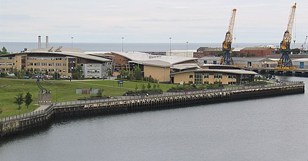
The Port
The Port of Sunderland is owned by the city council, and has been earmarked for medium-term redevelopment with a focus on mixed-use industry.[67]
Transport
Rail

Sunderland station was opened in 1879 but was completely redesigned to facilitate football teams and officials from countries who were drawn to play at Roker Park during England's hosting of the 1966 World Cup. The station as it currently stands was opened on 4 November 1965 and since then little has changed in terms of the general appearance of the station.[citation needed] Situated on an underground level, the station is generally considered an eyesore [who?] and is currently undergoing renovation, backed by the artistic team which designed the stations along the Wearside extension of the Tyne and Wear Metro in 2002.[68][69] It is situated on the Durham Coast Line served by direct Northern Rail services to Newcastle upon Tyne, Hartlepool, Stockton and Middlesbrough, as well as further afield to Hexham, Carlisle and the Gateshead MetroCentre. These services run hourly in each direction, cut from half-hourly on 12 December 2005.
From 1998 to 2004, Northern Spirit and subsequently Arriva Trains Northern ran bihourly direct trains from Sunderland to Liverpool Lime Street via Durham, Darlington, York, Leeds and Manchester. The services were withdrawn due to a change of franchise which saw the Transpennine Express route gain a franchise in its own right, distinct from the Regional Railways network which Arriva had inherited. Services now terminate at Newcastle, and a separate service also travels to Middlesbrough, but both only stretch as far as Manchester Airport.
In 2006, Grand Central Railway announced plans to operate a direct service between Sunderland and London King's Cross via York, a service which had been stripped from Wearside twenty years earlier. A scaled-down service of one train each day began in December 2007, twelve months after the initial launch date, due to delays caused by restoring rolling stock and a protracted court case against the now defunct GNER franchise (which Grand Central won). The service increased to three departures daily each way on 1 March 2008, connecting a line which can run from Edinburgh to London. The service has proved so popular that a fourth direct train is now in operation.
Metro

In May 2002 the Tyne and Wear Metro was extended to Sunderland in an official ceremony attended by The Queen, twenty-two years after it originally opened in Newcastle upon Tyne. The line now stretches deeper into South Tyneside and into Sunderland, incorporating Seaburn, Millfield, Pallion, as well as Sunderland's mainline railway station and stations at the Park Lane Transport Interchange and both campuses of the University of Sunderland before terminating at South Hylton. At first, six trains per hour ran along the route, but much lower patronage than expected between central Sunderland and South Hylton, as well as scheduling issues, meant that service was cut to five trains per hour to Park Lane, with three or four trains terminating in South Hylton.[citation needed] Upon the opening of the Metro extension, the mainline rail service frequency to Newcastle upon Tyne was halved to one per hour.[citation needed] In many quarters, the Metro extension has not been viewed as a huge success due to this cut in the frequency of services. Moreover, fare-dodging is an issue, with the lack of service checks and ticket barriers at stations leading to perceptions of a lack of demand.[citation needed]
Road

There are no motorways that run through the Sunderland urban area. The largest and busiest road is the A19, which runs north-to-south along the western edge of the urban area, crossing the River Wear at Hylton. The A19 originally ran through the city centre until the bypass was built in the 1970s, the route is now the A1018. There are four main roads which support the city centre. The A690 Durham Road terminates in the city centre, and runs all the way to Crook, County Durham via the city of Durham. This is the main road supporting the south-west of the city.[citation needed]
The A1231 starts in the city centre, crosses the Queen Alexandra Bridge and runs through Washington to the A1. Most of this road is national speed limit dual carriageway.[citation needed]
The A1018 and A183 roads both start in the centre of South Shields and enter Sunderland from the north, before merging to cross the Wearmouth Bridge. The A1018 follows a direct route from Shields to Sunderland, the A183 follows the coast. After crossing the bridge, the A1018 follows a relatively straight path to the south of Sunderland where it merges with the A19. The A183 becomes Chester Road and heads west out of the city to the A1 at Chester-le-Street.[citation needed]
In Autumn 2007 the Southern Radial Route was opened. This is a bypass of the A1018 through Grangetown and Ryhope – a stretch that commonly suffered from congestion, especially during rush hour. The bypass starts just south of Ryhope, and runs parallel to the cliff tops into Hendon, largely avoiding residential areas.[citation needed]
Bus
A multi-million pound transport interchange at Park Lane was opened on 2 May 1999 by the then Brookside actor Michael Starke. With 750,000 passengers per year it is the busiest bus and coach station in Britain after Victoria Coach Station in Central London, and has won several awards for innovative design.[70] The majority of bus services in Sunderland are provided by Arriva North East, Go North East and Stagecoach in Sunderland and a new Metro station was built underneath the bus concourse to provide a direct interchange as part of the extension to South Hylton in 2002.
Cycle
There are a number of cycle routes that run through and around Sunderland. The National Cycle Network National Route 1 runs from Ryhope in the south, through the centre of the city, and then along the coast towards South Shields. Britain's most popular long-distance cycle route – The 'C2C' Sea to Sea Cycle Route – traditionally starts (or ends) when the cyclist dips their wheel in the sea on Roker beach. The 'W2W' 'Wear-to-Walney' route, and the 'Two-Rivers' (Tyne and Wear) route also terminate in Sunderland.
Culture and attractions
Literature and art
Lewis Carroll was a frequent visitor to the area. He wrote most of Jabberwocky at Whitburn[disambiguation needed] as well as "The Walrus and the Carpenter".[71] Some parts of the area are also widely believed to be the inspiration for his Alice in Wonderland stories, such as Hylton Castle and Backhouse Park.[72] There is a statue to Carroll in Whitburn library. Lewis Carroll was also a visitor to the Rectory of Holy Trinity Church, Southwick; then a township independent of Sunderland. Carroll's connection with Sunderland, and the area's history, is documented in Bryan Talbot's 2007 graphic novel Alice in Sunderland.[73] More recently, Sunderland-born Terry Deary, writer of the series of Horrible Histories books, has achieved fame and success, and many others such as thriller writer Sheila Quigley, are following his lead.[74]
The Salford-born painter, L. S. Lowry, was a frequent visitor, staying in the Seaburn Hotel in Sunderland.[75] Many of his paintings of seascapes and shipbuilding are based on Wearside scenes. The Northern Gallery for Contemporary Art on Fawcett Street and Sunderland Museum and Winter Gardens showcase exhibitions and installations from up-and-coming and established artists alike, with the latter holding an extensive collection of LS Lowry. The National Glass Centre on Liberty Way also exhibits a number of glass sculptures.
Music
Sunderland musicians that have gone on to reach international fame include Dave Stewart of the Eurythmics and all four members of Kenickie and whose vocalist Lauren Laverne later became known as a TV presenter. In recent years, the underground music scene in Sunderland has helped promote the likes of The Futureheads, The Golden Virgins and Field Music. The Black Metal band Wodensthrone is from Sunderland.
Other Mackem musicians include punk rockers The Toy Dolls ("Nellie the Elephant", December 1984), punk band Leatherface, the lead singer of dance outfit Olive, Ruth Ann Boyle ("You're Not Alone", May 1997) and A Tribe of Toffs ("John Kettley is a Weatherman", December 1988). Alex Kapranos of the band Franz Ferdinand also grew up in Sunderland and South Shields.[citation needed]
In May 2005, Sunderland played host to BBC Radio 1's Big Weekend concert at Herrington Country Park, attended by 30,000 visitors and which featured Foo Fighters, Kasabian, KT Tunstall, Chemical Brothers and The Black Eyed Peas.[76][77]
The Sunderland Stadium of Light, home to Sunderland AFC, is recognised as a major stadium concert venue, having hosted world tours by Take That, Oasis, P!nk and Kings of Leon since 2009. Since opening in 1997, it has also played host to Billy Ocean, Go West, Toyah, Tasmin Archer, Republica, Shola Ama, Sweet Female Attitude, Liberty X, Damage, Precious, Jessica Garlick, Status Quo and Sunderland Symphony Orchestra, founded in 2000.[citation needed]
The Empire Theatre sometimes plays host to music acts. Since its refurbishment in 2004, it has hosted acts as diverse as Morrissey, Deacon Blue, McFly, Journey South, Jane McDonald and The Drifters and in its distinguished history it has also welcomed world-renowned bands such as The Beatles and The Kinks.[citation needed] In 2011 it hosted Alexandra Burke and Paolo Nutini among others.
Independent, a city centre nightclub/music venue, satisfies underground music lovers, having previously played host to Keane, Franz Ferdinand, Kasabian, Kaiser Chiefs, Maxïmo Park and Snow Patrol when they were largely unknown and had not yet achieved commercial success.[citation needed] In the past year, the club has hosted gigs from established bands such as The Zutons, The Maccabees, The Young Knives, Robots In Disguise, Saxon, The Mystery Jets, Klaxons and The Futureheads. In 2009 it hosted Finley Quaye, General Fiasco, Attack! Attack!, Hot Club de Paris and The Automatic as well as a DJ set from Andrew Weatherall.
The Manor Quay, the students' union nightclub on St. Peter's Riverside at the University of Sunderland, has also hosted the Arctic Monkeys, Maxïmo Park, 911, the Levellers and Girls Aloud. In 2009, the club was taken into private ownership under the name Campus and hosted N-Dubz, Ocean Colour Scene, Little Boots, Gary Numan and Showaddywaddy but has since been returned to the university.[citation needed] The former students' union Wearmouth Hall hosted Voice of the Beehive and Manic Street Preachers before closing in 1992.
Since 2009, Sunderland: Live in the City has played host to a series of free and ticketed live music events throughout venues in the city centre. Sunderland also hosts the yearly Split Music Festival at Ashbrooke Cricket Club which was first celebrated in October 2009 and will return in 2010 with Maxïmo Park and The Futureheads headlining.
Theatre

The Sunderland Empire Theatre opened in 1907 on High Street West in the city centre. It is the largest theatre in the North East, and completed a comprehensive refurbishment in 2004. Operated by international entertainment group Live Nation, the Empire is the only theatre between Glasgow and Leeds with sufficient capacity to accommodate large West End productions.[78] It is infamous for playing host to the final performance of British comic actor Sid James who died of a heart attack whilst on stage in 1976.[79]
The Royalty Theatre on Chester Road is the home to the amateur Royalty Theatre Group who also put on a number of low-budget productions throughout the year. Renowned film producer David Parfitt belonged to this company before achieving worldwide fame and is now a patron of the theatre.[80]
The Sunniside area plays host to a number of smaller theatrical workshops and production houses, as well as the Theatre Restaurant, which combines a dining experience with a rolling programme of musical theatre.
Media, film and television
Sunderland has two local newspapers: the daily evening tabloid The Sunderland Echo, founded in 1873, and the Sunderland Star – a free newspaper.[81] It also has its own local radio station Sun FM,a community radio station Spark FM and a hospital radio station – Radio Sunderland for Hospitals, and can receive other north-eastern independent radio stations Metro Radio, Magic 1152, Galaxy North East and Century Radio. The current regional BBC radio station is BBC Radio Newcastle University of Sunderland student radio station Utopia FM has recently won awards for innovation and broadcasts for part of the year.[citation needed] In September 2007, Ofcom, the media regulator, awarded a 5 year full-time community radio licence to Utopia FM to start broadcasting in 2008. The regional DAB multiplex for the Sunderland area is operated by Bauer DIGITAL RADIO LTD. – owned by Bauer Digital Radio plc.[citation needed] The city is covered by BBC North East and Cumbria and ITV's Tyne Tees franchise, which has a regional office in the University's Media Centre.[82] Sunderland and its surrounding area is also referenced in The Catherine Tate Show numerous times.[citation needed]
Sunderland's first film company was established in 2008; and is known as "Tanner Films Ltd" and is based in the Sunniside area of the city. The companies first film, "King of the North" starring Angus MacFadyen and set in the Hetton-le-Hole area of the city; is currently under production.[83]
Events
Each year on the last weekend in July, the city hosts the Sunderland International Airshow. It takes place primarily along the sea front at Roker and Seaburn, and is attended by over 1.2 million people annually.[citation needed] It is the largest free airshow in Europe.[citation needed]
Sunderland also hosts the free International Festival of Kites, Music and Dance, which attracts kite-makers from around the world to Northumbria Playing Fields, Washington.
Every year the city hosts a large Remembrance Day memorial service, the largest in the UK outside of London in 2006.[84]
At a special meeting of the Council on 19 December 1973, the Honorary Freedom of the then County Borough of Sunderland was conferred on 4th Regiment Royal Artillery, the North East Gunners, in recognition of the number of members of the Regiment who have been recruited from Wearside.[citation needed] The Regiment exercised its Freedom in April 2000 and following a successful tour of Afghanistan in July 2008.[citation needed]
HMS Ocean, an active Helicopter Landing Platform of the Royal Navy, is Sunderland's adopted ship. The crew of Ocean regularly visit the city.[citation needed]
At Christmas, Sunderland used to host a German market in the city centre selling quality German-made wooden goods, and German food.[citation needed] It also hosts a large ice rink near the Empire Theatre, which forms part of the wider, regional North East Winter Festival. In 2007 the City Council introduced a weekly firework show in Mowbray Park (Thursday nights), starting with the switch on of the Christmas lights.[citation needed]
Sunderland's inaugural film festival took place in December 2003 at the Bonded Warehouse on Sunderland riverside, in spite of the lack of any cinema facilities in the city at that time, featuring the films of local and aspiring directors as well as reshowings of acclaimed works, such as Alan Bleasdale's The Monocled Mutineer, accompanied by analysis.[85] By the time of the second festival commencing on 21 January 2005, a new cinema multiplex had opened in Sunderland to provide a venue which allowed the festival to showcase over twenty films including the UK premieres of Shall We Dance? starring Richard Gere and Kim Basinger's The Door In The Floor, as well as a special screening of Shakespeare In Love, presented by its producer, Sunderland-born David Parfitt.[citation needed]
Attractions
Notable attractions for visitors to Sunderland include the 14th century Hylton Castle and the beaches of Roker and Seaburn.

The National Glass Centre opened in 1998, reflecting Sunderland's distinguished history of glass-making. Despite substained support from the Arts Council the centre has struggled to meet visitor targets since it opened.[86]

Sunderland Museum and Winter Gardens, on Borough Road, was the first municipally funded museum in the country outside London. It houses a comprehensive collection of the locally produced Sunderland Lustreware pottery. The City Library Arts Centre, on Fawcett Street, also houses the Northern Gallery for Contemporary Art.
The City of Sunderland has been commended several times on its commitment to preserving its natural faculties. As such, Sunderland has been awarded prestigious titles by the Britain in Bloom collective in 1993, 1997 and 2000.
Sunderland has also recently[when?] been voted as one of the best nights out in the country, finishing eighth behind larger cities such as Leeds, Manchester, London; this is largely due to "The circuit", which comprises around 65 bars and 9 clubs all within minutes of each other based in the St Michaels and Park Lane areas of the City Centre.[citation needed]
Sport
The only professional sporting team in Sunderland is the football team, Sunderland A.F.C., which was formed in 1879 and became founder members of the Football League in 1888.[87] Finishing 10th in the Premier League in the 2010–11 season, Sunderland retains its status in the country's top division in 2011–12 and plays its home games at the 49,000 seat capacity Stadium of Light.[88] Sunderland also has the north-east's top women's football team, Sunderland A.F.C. Women, who have been financially separated from the men's team since summer 2005. They currently play in the top tier of English women's football – FA Women's Premier League National Division, despite their financial struggles. Sunderland were league champions six times within the Football League's first half century, but have not achieved this accolade since 1936. Their other notable successes include FA Cup glory in 1937 and 1973 and winning the Division One title with a (then) English league record of 105 points in 1999. Sunderland's longest stadium occupancy so far was of Roker Park for 99 years beginning in 1898, with relocation taking place due to the stadium's confined location and the need to build an all-seater stadium. The initial relocation plan had been for a stadium to be situated alongside the Nissan factory, but these were abandoned in favour of the Stadium of Light at Monkwearmouth on the site of a colliery that had closed at the end of 1993.[89] The city also has two non-league sides, Sunderland Nissan F.C. of the Northern League Division One and Sunderland Ryhope Community Association F.C. of the Northern League Division Two.
Sunderland's amateur Rugby and Cricket clubs are both based in Ashbrooke.[90][91] The Ashbrooke ground was opened on 30 May 1887. The cricket club dates back to 1801, when a game was recorded on July 25 at Monkwearmouth shore. The rugby union football club was established in 1873; it is recorded[citation needed] that practices took place in December, probably on the town moor. In January 1874 games were played and won against both Houghton and Darlington. In its early years, the rugby club was made up of former public school boys and well educated and successful business and industrial leaders of the locality. In 1881, Sunderland were recorded as being the first winners of the Durham County Senior Challenge Cup, beating Houghton 9-0. This was the first of five successes, the last being in 1959, when they beat 6-0 a Durham City team that had included several county players and internationals. The last appearance in the final was 1997, when they were beaten by Stockton.[citation needed]
Sunderland had an ice hockey team from 1977 and temporarily inherited the Durham Wasps in 1994 when Durham City's ice rink closed and the team was bought by John Hall. They played home games at Sunderland's Crowtree Leisure Centre until Newcastle Arena opened in 1995 and the team relocated again. Durham's ice hockey team has since undergone several name changes and is currently the Newcastle Vipers.[citation needed]

From 1976 until 1995, Sunderland had a basketball team, winners of the national championship play-off final, at Wembley, in 1981 and 1983. The team qualified for European competition in 1982, and were also play-off runners-up, to Crystal Palace, in 1982. Named 'Sunblest Sunderland' the team played at the Crowtree Leisure Centre.[citation needed]
The Crowtree Leisure Centre has also played host to a number of important boxing matches and snooker championships including the 2003 Snooker World Trickshot and Premier League Final. In September 2005, BBC TV cameras captured international boxing bouts featuring local boxers David Dolan, Stuart Kennedy and Tony Jeffries. The latter became Sunderland's first Olympic medallist when he won a bronze medal in the light heavyweight boxing category for Great Britain and Northern Ireland at the 2008 Beijing Olympic Games.[citation needed]
On 18 April 2008, the Sunderland Aquatic Centre was opened. Constructed at a cost of £20 million, it is the only Olympic sized 50 m pool between Leeds and Edinburgh and has six diving boards, which stand at 1 m, 3 m and 5 m.[92]
Athletics is also a popular sport in the city, with Sunderland Harriers Athletics Club based at Silksworth Sports Complex. 800 m runner Gavin Massingham represented the club at the AAA Championships in 2005. On 25 June 2006, the first Great Women's Run took place along Sunderland's coastline. Among the field which lined up to start the race were Olympic silver medallists Sonia O'Sullivan of the Republic of Ireland and Gete Wami of Ethiopia, who eventually won the race. The race quickly became an annual fixture in the city's sporting schedule, with races in 2007 and 2008. In 2009, the race will be relaunched as the Great North 10k Run, allowing male competitors to take part for the first time, on 12 July. The route will also be extended to incorporate the city centre, as well as Sunderland's riverside and coastline. The Great North Walk, which began in June 2008, will also return to Sunderland in 2009.[citation needed]
Speedway racing was staged at the greyhound stadium in nearby East Boldon. The Sunderland Saints of 1964 closed after 8 meetings. The track re-opened in the early 1970s and known as the Stars and then the Gladiators, raced in the National league Division Two.[citation needed]
Education
Sunderland Polytechnic was founded in 1969, becoming the University of Sunderland in 1992.[93] The institution currently has over 17,000 students.[94] The university is split into two campuses; the City Campus (site of the original Polytechnic) is just to the west of the city centre, as is the main university library and the main administrative buildings. The 'Award-Winning' St Peter's Riverside Campus is located on the north banks of the river Wear, next to the National Glass Centre and houses the School of Business, Law and Psychology, as well as Computing and Technology and The Media Centre.[95]
The University of Sunderland was named the top university in England for providing the best student experience by The Times Higher Education Supplement (THES) in 2006. Since 2001 Sunderland has been named the best new university in England by The Guardian and Government performance indicators showed Sunderland as the best new university in England for the quality, range and quantity of its research.[96]
The City of Sunderland College is a further education establishment with five campuses located at the Bede centre on Durham Road, Shiney Row, Hylton, Doxford International Business Park and 'Phoenix House' in the city centre. It has over 14,000 students, and based on exam results is one of the most successful colleges.[97] St Peter's Sixth Form College, next to St Peter's Church and the University, opened in September 2008.[98] The college is a partnership between the three Sunderland North schools and City of Sunderland College.[99]
There are twenty secondary schools in the Sunderland area, predominantly comprehensives. According to exam results, the most successful was the Sunderland High School, an independent selective school in Ashbrooke.[100] However, comprehensive schools also thrive, particularly the Roman Catholic single-sex schools St. Anthony's (for girls) and St. Aidan's (for boys). Both continue to attain high exam results. There are seventy-six primary schools in Sunderland. According to the 'Value Added' measure, the most successful is Mill Hill Primary School, in Doxford Park.[101]
Notable residents
See also
References
- ^ BBC (2005). "The Mackem Wordhunt". Retrieved 2008-04-03.
- ^ Phrases.org website (2005). Mackems "The word Mackem origins". Retrieved 2008-04-03.
{{cite web}}: Check|url=value (help) - ^ Glen Lyndon Dodds (2001). A History of Sunderland (2nd ed.). p. 5. ISBN 0952512262.
- ^ Glen Lyndon Dodds (2001). A History of Sunderland (2nd ed.). p. 6. ISBN 0952512262.
- ^ "Brewery may hold Roman answers". BBC News. 2003-09-02. Retrieved 2009-07-22.
- ^ Sunderland Echo (2005). "Museum and Winter Gardens – Look At Glass". Archived from the original on 2008-05-13. Retrieved 2008-04-03.
- ^ Weardaleway website (2005). "Sunderland History". Retrieved 2008-04-03.
- ^ "Libraries". Catholic Encyclopedia. Retrieved 2007-01-23.
- ^ Bede's World museum (2008). "Academic – The Venerable Bede". Retrieved 2008-04-03.
- ^ University of Glasgow (2001). "Book of the Month, Bede Wrings on the Calendar". Retrieved 2008-04-03.
- ^ "Origins of Bishopwearmouth". Archived from the original on 2007-09-27. Retrieved 2007-01-23.
- ^ Wearsideonline website (2008). "Ryhope Village". Retrieved 2008-04-03.
- ^ "What's in a name?". Sunderland Echo. Archived from the original on 2007-09-27. Retrieved 2007-01-17.
- ^ David Simpson (1991). "The North East England History Pages". The Millennium History of North East England. Retrieved 2008-04-03.
- ^ This is Sunderland website (2008). "Sunderland Ship Building". Retrieved 2008-04-03. [dead link]
- ^ Tim Lambert (2008). "A Brief History of Sunderland". Retrieved 2008-04-03.
- ^ The Northern Echo newspaper (2003). "North East History, Early Coal Mining". Retrieved 2008-04-03. [dead link]
- ^ Richard Stonehouse (2005-10-23). "A rivalry with roots in kings and coal". The Guardian. London. Retrieved 2008-04-03.
- ^ "A History of Sunderland (second edition, 2001), Glen Lyndon Dodds, pp. 46–48".
- ^ North East History website (2003). "Did you know?". Retrieved 2008-04-03. [dead link]
- ^ Shegog, Eric. "Sunderland Minster". City of Sunderland College. Retrieved 2006-12-09.
- ^ BBC website (2003). "BBC Diary of an Epidemic". Retrieved 2008-04-03.
- ^ Diary of an Epidemic (Cholera), BBC Radio 4, [1]
- ^ Sunderland Council website (2005). "Who was Jack Crawford?" (PDF). Archived from the original (PDF) on 2007-10-11. Retrieved 2008-04-03.
- ^ The Northern Echo (2003). "Burning Questions". Retrieved 2008-04-03.
- ^ "Sunderland Wearmouth Bridge". Wearside Onliine. Retrieved 2006-09-24.
- ^ "SINE Project: Structure details for Queen Alexandra Bridge". University of Newcastle upon Tyne. Retrieved 2006-10-12.
- ^ "Sunderland: The Sundered Land". Sunderland and East Durham History. Retrieved 2007-01-23.
- ^ "Sunderland's Victoria Hall Stampede". North Country Web. Retrieved 2007-01-27.
- ^ "Victims of the Victoria Hall Calamity". Genuki. Retrieved 2007-01-27.
- ^ a b "The Victoria Hall Disaster 1883" (PDF). City of Sunderland Library. Archived from the original (PDF) on 2007-07-11. Retrieved 2007-01-27. Cite error: The named reference "vic2" was defined multiple times with different content (see the help page).
- ^ Carol Roberton (2000). "Give them a fitting memorial". Retrieved 2008-04-03.
- ^ "Toy Tragedy Children Honoured". BBC News. 2002-05-12. Retrieved 2007-01-27.
- ^ Talbot, Bryan (2007). Alice in Sunderland: An Entertainment. London: Jonathon Cape. pp. 58–60. ISBN 0-224-08076-8.
- ^ Kevin Clark (2006). "A Good Little Runner". Retrieved 2008-04-03.
- ^ Laura White (2004). "Centre will be a glass act again". Retrieved 2008-04-03.
- ^ Sunderland Echo website (2002). "Sir Tom gets own campus!". Retrieved 2008-04-03.
- ^ Sunderland Echo website (2003). "Have your say on Vaux site". Retrieved 2008-04-03.
- ^ A Brief History of Sunderland
- ^ Sunderland | The Club | History
- ^ Sunderland | Roker Park
- ^ Sunderland | Stadium of Light
- ^ "Rare images recall wartime blitz". BBC News. 2005-04-12. Retrieved 2007-01-18.
- ^ Sarah Stoner (2006). "Roker's 'cathedral of arts and crafts'". Retrieved 2008-04-03.
- ^ Sunderland Echo website (2005). "Saint that nice – our own patron". Retrieved 2008-04-03.
- ^ Sunderland Council website (2007). "STILL TIME TO SEE SUNDERLAND SHINE". Retrieved 2008-04-03. [dead link]
- ^ "2001 Census – Fact Cards for wards in the City of Sunderland". Sunderland city Council. Archived from the original on 2007-09-27. Retrieved 2007-01-26.
- ^ "Sunderland 2001 Census Statistics" (PDF). Archived from the original (PDF) on 2007-07-11. Retrieved 2007-01-18.
- ^ "999 Sunderland".
- ^ "Sunderland's workforce statistics". Invest in Sunderland. Retrieved 2007-01-26.
- ^ "History of Shipbuilding in the North East". BBC. Retrieved 2007-01-18.
- ^ "SINE Project: Structure details for South Dock: Hudson Dock". University of Newcastle upon Tyne. Retrieved 2006-11-22.
- ^ "Rise and Fall of Coal Mining". North East England History. Retrieved 2007-01-18.
- ^ "End of an era as glass firm sets closure date". The Northern Echo. 2007-01-16. Retrieved 2007-01-18.
- ^ "Energy costs close glass factory". BBC News. 2007-01-17. Retrieved 2007-01-18.
- ^ "TOP OF THE WORLD". Sunderland City Council. 2005-01-20. Archived from the original on 2007-03-12. Retrieved 2006-12-09.
- ^ "Sunniside". 2009-01-06. Retrieved 2009-03-10. [dead link]
- ^ "Sunderland Unitary Development Plan". 2009-01-06. Retrieved 2009-03-10. [dead link]
- ^ "Holmeside Triangle". 2006-01-01. Retrieved 2009-03-10. [dead link]
- ^ "Blueprint for a Skyscraper". 2008-03-04. Retrieved 2009-03-10.
- ^ a b "Vaux Site FAQ". 2008-03-04. Retrieved 2009-03-10.
- ^ "Vaux Site Opportunity". 2008-03-04. Retrieved 2009-03-10.
- ^ "Stadium Park Development". 2006-01-01. Retrieved 2009-03-10. [dead link]
- ^ "New Bridge". 2008-03-10. Retrieved 2009-03-10.
- ^ "Next step in road to iconic Wear bridge". 2008-12-01. Retrieved 2009-03-10.
- ^ "Gorve Site". 2006-01-01. Retrieved 2009-03-10. [dead link]
- ^ "Port of Sunderland". 2006-01-01. Retrieved 2009-03-10. [dead link]
- ^ "New look arriving". Sunderland Echo. 27 April 2005. Retrieved 2008-03-03.
- ^ "New rail service launch delayed". BBC News. 21 November 2006. Retrieved 2006-11-22.
- ^ "Did you know? Sunderland facts". Sunderland Echo News. 21 November 2006. Archived from the original on 2007-08-02. Retrieved 2006-11-22.
- ^ "The Walrus and the Carpenter". Sunderland and East Durham History. Retrieved 2007-01-18.
- ^ Alice in Sunderland, Bryan Talbot, 2007, ISBN 978-1593076733
- ^ Robertson, Ross (2007-03-27). "News focus: Alice in Pictureland". Sunderland Echo. Archived from the original on 2007-04-02. Retrieved 2007-03-29.
- ^ "Grandmother has write stuff". BBC News. 2003-05-06. Retrieved 2007-12-28.
- ^ "Masters of Art". Sunderland Echo. Archived from the original on 2006-12-31. Retrieved 2007-01-18.
- ^ "Radio 1's Big Weekend: Penshaw Monument, Herrington Park, Sunderland". BBC Radio 1. Retrieved 2007-02-26.
- ^ "Local boys shine at Sunderland's Big Weekend". BBC News. Retrieved 2007-02-26.
- ^ "The Sunderland Empire Theatre". Sunderland City Council. Retrieved 2007-01-18.
- ^ "1989: Ghostly tale".
- ^ "gostridge.net/page.php?pageid=14".
- ^ "Newspaper Report for the publication: Sunderland Star". The Newspaper Society. Retrieved 2007-03-06.
- ^ "Julia Barthram". ITV Tyne Tees. Retrieved 2007-03-06.
- ^ $6 Million film deal for North East Murder film
- ^ "North honours fallen war heroes". BBC News. 2006-11-12. Retrieved 2007-01-17.
- ^ Hattenstone, Simon (2003-12-05). "The show must go on". The Guardian. London. Retrieved 2010-04-01.
- ^ "Another new head for Glass Centre". BBC News. 2004-07-02. Retrieved 2007-01-18.
- ^ "SAFC history 1879–1889". SAFC website. 2008-01-02. Retrieved 2008-04-03.
- ^ "SAFC Previous Grounds / History / Previous Grounds". SAFC website. 2008-01-02. Retrieved 2008-04-03.
- ^ "Sunderland Cricket Club". SAFC website. 2008-01-02. Retrieved 2008-04-03.
- ^ "SAFC Previous Grounds". vega.sund.ac.uk website. 2008-01-02. Retrieved 2008-04-03.
- ^ "A Very Warm Welcome to Sunderland RFC. The Home of Sunderland Rugby Union". sunderlandrufc.com website. 2008-01-02. Retrieved 2008-04-03.
- ^ "Sunderland Echo Olympic splash-out spectacular".
- ^ "University history". Sunderland University. 2008-01-02. Retrieved 2008-04-03.
- ^ "Facts, Figures, Accolades, the University's vision". Sunderland University. 2008-01-02. Retrieved 2008-04-03. [dead link]
- ^ "The University". Sunderland University, Our Campuses. 2008-01-02. Retrieved 2008-04-03.
- ^ "Awards and Accolades 2007/8". Sunderland University website. 2008-01-02. Retrieved 2008-04-03. [dead link]
- ^ "City of Sunderland College". Archived from the original on 2006-12-07. Retrieved 2007-01-18.
- ^ "Work begins on £6 m campus college". BBC News. 2008-01-02. Retrieved 2008-01-03.
- ^ "St Peter's Sixth Form College". Retrieved 2008-01-03.
- ^ "Secondary Schools in Sunderland League Table". BBC News. Retrieved 2007-01-18.
- ^ "Primary Schools in Sunderland League Table". BBC News. Retrieved 2007-01-18.
External links
- Sunderland Echo – Local News, Sport, Community news, What's On Guide, Pictures
- This is Sunderland – Visitors Guide, Places to visit, What's On Guide, Old Images Gallery
- Tide times at Sunderland from the BBC and Easytide.
| Metropolitan districts | |
|---|---|
| Major settlements (cities in italics) | |
| Topics | |
Places adjacent to Sunderland | |
|---|---|
- Articles with specifically marked weasel-worded phrases from August 2008
- Articles with links needing disambiguation from July 2011
- City of Sunderland
- Towns in Tyne and Wear
- Ports and harbours of Tyne and Wear
- Port cities and towns in the United Kingdom
- Port cities and towns of the North Sea
- Articles including recorded pronunciations (UK English)
- Populated coastal places in Tyne and Wear