Monastyrshchina, Monastyrshchinsky District, Smolensk Oblast: Difference between revisions
Gamapamani (talk | contribs) m fix unpaired tags |
|||
| (10 intermediate revisions by 9 users not shown) | |||
| Line 1: | Line 1: | ||
{{Other places|Monastyrshchina}} |
|||
| ⚫ | |||
| ⚫ | |||
|en_name=Monastyrshchina |
|en_name=Monastyrshchina |
||
|ru_name=Монастырщина |
|ru_name=Монастырщина |
||
|image_skyline= |
|image_skyline=Church monastyrshchina.jpg |
||
|image_caption= |
|image_caption= |
||
|coordinates = {{coord|54|21|N|31|50|E|display=inline,title}} |
|coordinates = {{coord|54|21|N|31|50|E|display=inline,title}} |
||
| Line 16: | Line 18: | ||
|federal_subject=[[Smolensk Oblast]] |
|federal_subject=[[Smolensk Oblast]] |
||
|federal_subject_ref=<ref name="SmolenskO_admlist">Resolution #261</ref> |
|federal_subject_ref=<ref name="SmolenskO_admlist">Resolution #261</ref> |
||
|adm_data_as_of=June 2014 |
|||
|adm_district_jur=[[Monastyrshchinsky District]] |
|adm_district_jur=[[Monastyrshchinsky District]] |
||
|adm_district_jur_ref=<ref name="SmolenskO_admlist" /> |
|adm_district_jur_ref=<ref name="SmolenskO_admlist" /> |
||
| Line 28: | Line 29: | ||
|inhabloc_type=Settlement |
|inhabloc_type=Settlement |
||
|inhabloc_type_ref=<ref name="SmolenskO_admlist"/> |
|inhabloc_type_ref=<ref name="SmolenskO_admlist"/> |
||
|mun_data_as_of=May 2015 |
|||
|mun_district_jur=Monastyrshchinsky Municipal District |
|mun_district_jur=Monastyrshchinsky Municipal District |
||
|mun_district_jur_ref=<ref name="SmolenskOMonastyrshchinskyD_mun">Law #77-z</ref> |
|mun_district_jur_ref=<ref name="SmolenskOMonastyrshchinskyD_mun">Law #77-z</ref> |
||
| Line 41: | Line 41: | ||
|representative_body= |
|representative_body= |
||
|representative_body_ref= |
|representative_body_ref= |
||
|area_of_what=urban settlement |
|||
|area_as_of=February 2014 |
|||
|area_km2= |
|area_km2= |
||
|area_km2_ref= |
|area_km2_ref= |
||
| Line 65: | Line 63: | ||
|dialing_codes_ref= |
|dialing_codes_ref= |
||
|website= |
|website= |
||
|website_ref= |
|||
|date=June 2017 |
|||
}} |
}} |
||
'''Monastyrshchina''' ({{lang-ru|Монастырщина}}) is an [[types of inhabited localities in Russia|urban locality]] (a [[urban-type settlement|settlement]]) and the [[administrative center]] of [[Monastyrshchinsky District]] of [[Smolensk Oblast]], [[Russia]]. It is located on the left bank of the [[Vikhra River]], in the western part of the [[oblast]]. Population: {{ru-census|p2010=4,065|p2002=4,622|p1989=5,166}} |
'''Monastyrshchina''' ({{lang-ru|Монастырщина}}, {{lang-pl|Monasterszczyzna}}) is an [[types of inhabited localities in Russia|urban locality]] (a [[urban-type settlement|settlement]]) and the [[administrative center]] of [[Monastyrshchinsky District]] of [[Smolensk Oblast]], [[Russia]]. It is located on the left bank of the [[Vikhra River]], in the western part of the [[oblast]]. Population: {{ru-census|p2010=4,065|p2002=4,622|p1989=5,166}} |
||
==History== |
==History== |
||
Monastyrshchina is known since the end of the 13th century or the beginning of the 14th century, when a [[skete]] was founded here. |
Monastyrshchina is known since the end of the 13th century or the beginning of the 14th century, when a [[skete]] was founded here. |
||
Between second half of the 14th century and the middle of the 17th century, the area belonged intermittently to the [[Grand Duchy of Lithuania]], to Poland, and to the [[Grand Duchy of Moscow]]. In the 18th century, Monastyrshchina belonged to Poland, and in 1772, as a result of the [[First Partition of Poland]], it was transferred to Russia and included in the newly established [[Mogilev Governorate]]. It belonged to [[Mstislavsky Uyezd]]. In 1919, Mogilev Governorate was abolished, and Mstislavsky Uyezd was transferred to [[Smolensk Governorate]]. In 1925, Monastyrshchina Volost was established.<ref name="distgen">{{cite web|url=http://monast.admin-smolensk.ru/o-rajone/|title=О районе|publisher=Monastyrshchinsky District Administration|language=Russian|accessdate=22 May 2017}}</ref> |
Between second half of the 14th century and the middle of the 17th century, the area belonged intermittently to the [[Grand Duchy of Lithuania]], to Poland, and to the [[Grand Duchy of Moscow]]. In the 18th century, Monastyrshchina belonged to Poland, and in 1772, as a result of the [[First Partition of Poland]], it was transferred to Russia and included in the newly established [[Mogilev Governorate]]. It belonged to [[Mstislavsky Uyezd]]. In 1919, Mogilev Governorate was abolished, and Mstislavsky Uyezd was transferred to [[Smolensk Governorate]]. In 1925, Monastyrshchina Volost was established.<ref name="distgen">{{cite web|url=http://monast.admin-smolensk.ru/o-rajone/|script-title=ru:О районе|publisher=Monastyrshchinsky District Administration|language=Russian|accessdate=22 May 2017}}</ref> |
||
On 12 July 1929, governorates and uyezds were abolished, and Monastyrshchinsky District with the administrative center in the [[Village#Russia|selo]] of Monastyrshchina was established. The district belonged to [[Smolensk Okrug]] of [[Western Oblast]]. On August 1, 1930 the okrugs were abolished, and the districts were subordinated directly to the oblast. On 27 September 1937 Western Oblast was abolished and split between [[Oryol Oblast|Oryol]] and Smolensk Oblasts. Monastyrshchinsky District was transferred to Smolensk Oblast. Between 1941 and 1943, during WWII, the district was occupied by German troops.<ref name="smolensk">{{cite web|url=http://www.journalsmolensk.ru/arhiv/12_124_10/14/14.PHP|title=К истории формирования Смоленской области|last=Борис Парфенов |
On 12 July 1929, governorates and uyezds were abolished, and Monastyrshchinsky District with the administrative center in the [[Village#Russia|selo]] of Monastyrshchina was established. The district belonged to [[Smolensk Okrug]] of [[Western Oblast]]. On August 1, 1930, the okrugs were abolished, and the districts were subordinated directly to the oblast. On 27 September 1937 Western Oblast was abolished and split between [[Oryol Oblast|Oryol]] and Smolensk Oblasts. Monastyrshchinsky District was transferred to Smolensk Oblast. Between 1941 and 1943, during WWII, the district was occupied by German troops.<ref name="smolensk">{{cite web|url=http://www.journalsmolensk.ru/arhiv/12_124_10/14/14.PHP|script-title=ru:К истории формирования Смоленской области|last=Борис Парфенов|author2=Ольга Хоренженкова|publisher=Смоленск|language=Russian|accessdate=18 June 2016}}</ref> In January 1965, Monastyrshchina was granted urban-type settlement status.<ref name="distgen"/> |
||
==Climate== |
|||
Monastyrshchina has a warm-summer [[humid continental climate]] (''Dfb'' in the [[Köppen climate classification]]). |
|||
<div style="width:70%;"> |
|||
{{Weather box |
|||
|location = Monastyrshchina |
|||
|metric first = yes |
|||
|single line = yes |
|||
|Jan high C = -4.2 |
|||
|Feb high C = -3.4 |
|||
|Mar high C = 2.2 |
|||
|Apr high C = 11.4 |
|||
|May high C = 17.6 |
|||
|Jun high C = 20.8 |
|||
|Jul high C = 23.2 |
|||
|Aug high C = 22 |
|||
|Sep high C = 16.3 |
|||
|Oct high C = 9 |
|||
|Nov high C = 2.7 |
|||
|Dec high C = -1.4 |
|||
|year high C = |
|||
|Jan mean C = -6.2 |
|||
|Feb mean C = -5.8 |
|||
|Mar mean C = -1.2 |
|||
|Apr mean C = 6.9 |
|||
|May mean C = 13.3 |
|||
|Jun mean C = 16.9 |
|||
|Jul mean C = 19.3 |
|||
|Aug mean C = 18 |
|||
|Sep mean C = 12.6 |
|||
|Oct mean C = 6.3 |
|||
|Nov mean C = 0.9 |
|||
|Dec mean C = -3.1 |
|||
|year mean C = |
|||
|Jan low C = -8.6 |
|||
|Feb low C = -8.7 |
|||
|Mar low C = -4.9 |
|||
|Apr low C = 1.8 |
|||
|May low C = 8.1 |
|||
|Jun low C = 11.9 |
|||
|Jul low C = 14.7 |
|||
|Aug low C = 13.6 |
|||
|Sep low C = 8.8 |
|||
|Oct low C = 3.5 |
|||
|Nov low C = -1 |
|||
|Dec low C = -5.1 |
|||
|year low C = |
|||
|Jan precipitation mm = 52 |
|||
|Feb precipitation mm = 46 |
|||
|Mar precipitation mm = 46 |
|||
|Apr precipitation mm = 47 |
|||
|May precipitation mm = 73 |
|||
|Jun precipitation mm = 85 |
|||
|Jul precipitation mm = 96 |
|||
|Aug precipitation mm = 75 |
|||
|Sep precipitation mm = 62 |
|||
|Oct precipitation mm = 66 |
|||
|Nov precipitation mm = 56 |
|||
|Dec precipitation mm = 50 |
|||
|year precipitation = |
|||
|date=May 2021|source=https://en.climate-data.org/asia/russian-federation/smolensk-oblast/monastyrshchina-34301/}} |
|||
</div> |
|||
==Economy== |
==Economy== |
||
===Industry=== |
===Industry=== |
||
There is a cheese production factory in Monastyrshchina.<ref name="distgen">{{cite web|url=http://monast.admin-smolensk.ru/o-rajone/|title=О районе|publisher=Monastyrshchinsky District Administration|language=Russian|accessdate=22 May 2017}}</ref> |
There is a cheese production factory in Monastyrshchina.<ref name="distgen">{{cite web|url=http://monast.admin-smolensk.ru/o-rajone/|script-title=ru:О районе|publisher=Monastyrshchinsky District Administration|language=Russian|accessdate=22 May 2017}}</ref> |
||
===Transportation=== |
===Transportation=== |
||
| Line 88: | Line 147: | ||
==Culture and recreation== |
==Culture and recreation== |
||
The Sts. Peter and Paul Church was built in 1906. There is a local museum in Monastyrshchina.<ref>{{cite web|url=http://monast.admin-smolensk.ru/kultura/|title=Культура|publisher=Monastyrshchinsky District Administration|language=Russian|accessdate=23 May 2017}}</ref> |
The Sts. Peter and Paul Church was built in 1906. There is a local museum in Monastyrshchina.<ref>{{cite web|url=http://monast.admin-smolensk.ru/kultura/|script-title=ru:Культура|publisher=Monastyrshchinsky District Administration|language=Russian|accessdate=23 May 2017}}</ref> |
||
==References== |
==References== |
||
| Line 100: | Line 159: | ||
{{Use mdy dates|date=September 2016}} |
{{Use mdy dates|date=September 2016}} |
||
[[Category:Urban-type settlements in Smolensk Oblast]] |
[[Category:Urban-type settlements in Smolensk Oblast]] |
||
[[Category:Mstislavsky Uyezd]] |
|||
[[Category:Shtetls]] |
|||
Latest revision as of 04:59, 2 July 2024
Monastyrshchina
Монастырщина | |
|---|---|
Settlement[1] | |
 | |
Location of Monastyrshchina  | |
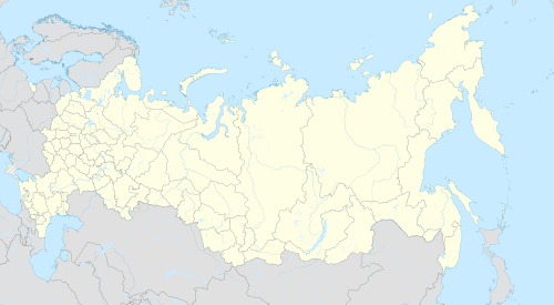 Monastyrshchina Location of Monastyrshchina  Monastyrshchina Monastyrshchina (Smolensk Oblast) | |
| Coordinates: 54°21′N 31°50′E / 54.350°N 31.833°E | |
| Country | Russia |
| Federal subject | Smolensk Oblast[1] |
| Administrative district | Monastyrshchinsky District[1] |
| Urban settlement | Monastyrshchinskoye[1] |
| Urban-type settlement status since | 1965[2] |
| Population | |
| • Total | 4,065 |
| • Estimate (2018)[4] | 3,600 (−11.4%) |
| • Capital of | Monastyrshchinsky District[1] |
| • Municipal district | Monastyrshchinsky Municipal District[5] |
| • Urban settlement | Monastyrshchinskoye Urban Settlement[5] |
| • Capital of | Monastyrshchinsky Municipal District[6] |
| Time zone | UTC+3 (MSK |
| Postal code(s)[8] | 216130 |
| OKTMO ID | 66627151051 |
Monastyrshchina (Russian: Монастырщина, Polish: Monasterszczyzna) is an urban locality (a settlement) and the administrative center of Monastyrshchinsky District of Smolensk Oblast, Russia. It is located on the left bank of the Vikhra River, in the western part of the oblast. Population: 4,065 (2010 Russian census);[3] 4,622 (2002 Census);[9] 5,166 (1989 Soviet census).[10]
History[edit]
Monastyrshchina is known since the end of the 13th century or the beginning of the 14th century, when a skete was founded here. Between second half of the 14th century and the middle of the 17th century, the area belonged intermittently to the Grand Duchy of Lithuania, to Poland, and to the Grand Duchy of Moscow. In the 18th century, Monastyrshchina belonged to Poland, and in 1772, as a result of the First Partition of Poland, it was transferred to Russia and included in the newly established Mogilev Governorate. It belonged to Mstislavsky Uyezd. In 1919, Mogilev Governorate was abolished, and Mstislavsky Uyezd was transferred to Smolensk Governorate. In 1925, Monastyrshchina Volost was established.[2]
On 12 July 1929, governorates and uyezds were abolished, and Monastyrshchinsky District with the administrative center in the selo of Monastyrshchina was established. The district belonged to Smolensk Okrug of Western Oblast. On August 1, 1930, the okrugs were abolished, and the districts were subordinated directly to the oblast. On 27 September 1937 Western Oblast was abolished and split between Oryol and Smolensk Oblasts. Monastyrshchinsky District was transferred to Smolensk Oblast. Between 1941 and 1943, during WWII, the district was occupied by German troops.[11] In January 1965, Monastyrshchina was granted urban-type settlement status.[2]
Climate[edit]
Monastyrshchina has a warm-summer humid continental climate (Dfb in the Köppen climate classification).
| Climate data for Monastyrshchina | |||||||||||||
|---|---|---|---|---|---|---|---|---|---|---|---|---|---|
| Month | Jan | Feb | Mar | Apr | May | Jun | Jul | Aug | Sep | Oct | Nov | Dec | Year |
| Mean daily maximum °C (°F) | −4.2 (24.4) |
−3.4 (25.9) |
2.2 (36.0) |
11.4 (52.5) |
17.6 (63.7) |
20.8 (69.4) |
23.2 (73.8) |
22 (72) |
16.3 (61.3) |
9 (48) |
2.7 (36.9) |
−1.4 (29.5) |
9.7 (49.4) |
| Daily mean °C (°F) | −6.2 (20.8) |
−5.8 (21.6) |
−1.2 (29.8) |
6.9 (44.4) |
13.3 (55.9) |
16.9 (62.4) |
19.3 (66.7) |
18 (64) |
12.6 (54.7) |
6.3 (43.3) |
0.9 (33.6) |
−3.1 (26.4) |
6.5 (43.6) |
| Mean daily minimum °C (°F) | −8.6 (16.5) |
−8.7 (16.3) |
−4.9 (23.2) |
1.8 (35.2) |
8.1 (46.6) |
11.9 (53.4) |
14.7 (58.5) |
13.6 (56.5) |
8.8 (47.8) |
3.5 (38.3) |
−1 (30) |
−5.1 (22.8) |
2.8 (37.1) |
| Average precipitation mm (inches) | 52 (2.0) |
46 (1.8) |
46 (1.8) |
47 (1.9) |
73 (2.9) |
85 (3.3) |
96 (3.8) |
75 (3.0) |
62 (2.4) |
66 (2.6) |
56 (2.2) |
50 (2.0) |
754 (29.7) |
| Source: https://en.climate-data.org/asia/russian-federation/smolensk-oblast/monastyrshchina-34301/ | |||||||||||||
Economy[edit]
Industry[edit]
There is a cheese production factory in Monastyrshchina.[2]
Transportation[edit]
The closest railway station is in Pochinok, on the railway connecting Smolensk and Bryansk via Roslavl.
Monastyrshchina is connected by paved roads with Smolensk, Pochinok, and Khislavichi, and has access to the M1 highway, connecting Moscow with Belarus via Smolensk. A road of a poor quality connects Monastyrshchina with Mstsislaw across the border with Belarus.[2]
The Vikhra is not navigable.
Culture and recreation[edit]
The Sts. Peter and Paul Church was built in 1906. There is a local museum in Monastyrshchina.[12]
References[edit]
Notes[edit]
- ^ a b c d e f Resolution #261
- ^ a b c d e О районе (in Russian). Monastyrshchinsky District Administration. Retrieved May 22, 2017.
- ^ a b Russian Federal State Statistics Service (2011). Всероссийская перепись населения 2010 года. Том 1 [2010 All-Russian Population Census, vol. 1]. Всероссийская перепись населения 2010 года [2010 All-Russia Population Census] (in Russian). Federal State Statistics Service.
- ^ "26. Численность постоянного населения Российской Федерации по муниципальным образованиям на 1 января 2018 года". Federal State Statistics Service. Retrieved January 23, 2019.
- ^ a b Law #77-z
- ^ Федеральная служба государственной статистики. Федеральное агентство по технологическому регулированию и метрологии. №ОК 033-2013 1 января 2014 г. «Общероссийский классификатор территорий муниципальных образований. Код 66 627 151 051». (Federal State Statistics Service. Federal Agency on Technological Regulation and Metrology. #OK 033-2013 January 1, 2014 Russian Classification of Territories of Municipal Formations. Code 66 627 151 051. ).
- ^ "Об исчислении времени". Официальный интернет-портал правовой информации (in Russian). June 3, 2011. Retrieved January 19, 2019.
- ^ Почта России. Информационно-вычислительный центр ОАСУ РПО. (Russian Post). Поиск объектов почтовой связи (Postal Objects Search) (in Russian)
- ^ Federal State Statistics Service (May 21, 2004). Численность населения России, субъектов Российской Федерации в составе федеральных округов, районов, городских поселений, сельских населённых пунктов – районных центров и сельских населённых пунктов с населением 3 тысячи и более человек [Population of Russia, Its Federal Districts, Federal Subjects, Districts, Urban Localities, Rural Localities—Administrative Centers, and Rural Localities with Population of Over 3,000] (XLS). Всероссийская перепись населения 2002 года [All-Russia Population Census of 2002] (in Russian).
- ^ Всесоюзная перепись населения 1989 г. Численность наличного населения союзных и автономных республик, автономных областей и округов, краёв, областей, районов, городских поселений и сёл-райцентров [All Union Population Census of 1989: Present Population of Union and Autonomous Republics, Autonomous Oblasts and Okrugs, Krais, Oblasts, Districts, Urban Settlements, and Villages Serving as District Administrative Centers]. Всесоюзная перепись населения 1989 года [All-Union Population Census of 1989] (in Russian). Институт демографии Национального исследовательского университета: Высшая школа экономики [Institute of Demography at the National Research University: Higher School of Economics]. 1989 – via Demoscope Weekly.
- ^ Борис Парфенов; Ольга Хоренженкова. К истории формирования Смоленской области (in Russian). Смоленск. Retrieved June 18, 2016.
- ^ Культура (in Russian). Monastyrshchinsky District Administration. Retrieved May 23, 2017.
Sources[edit]
- Администрация Смоленской области. Постановление №261 от 30 апреля 2008 г. «Об утверждении реестра административно-территориальных единиц и территориальных единиц Смоленской области», в ред. Постановления №464 от 27 июня 2014 г. «О внесении изменений в реестр административно-территориальных единиц и территориальных единиц Смоленской области». Опубликован: База данных "Консультант-плюс". (Administration of Smolensk Oblast. Resolution #261 of April 30, 2008 On the Adoption of the Registry of the Administrative-Territorial Units and Territorial Units of Smolensk Oblast, as amended by the Resolution #464 of June 27, 2014 On Amending the Registry of the Administrative-Territorial Units and Territorial Units of Smolensk Oblast. ).
- Смоленская областная Дума. Закон №89-з от 2 декабря 2004 г. «О наделении статусом муниципального района муниципального образования "Монастырщинский район" Смоленской области, об установлении границ муниципальных образований, территории которых входят в его состав, и наделении их соответствующим статусом», в ред. Закона №78-з от 28 мая 2015 г. «О преобразовании муниципальных образований Монастырщинского района Смоленской области, об установлении численности и срока полномочий депутатов представительных органов первого созыва вновь образованных муниципальных образований Монастырщинского района Смоленской области, а также порядка избрания, полномочий и срока полномочий первых глав вновь образованных муниципальных образований Монастырщинского района Смоленской области». Вступил в силу со дня официального опубликования. Опубликован: "Вестник Смоленской областной Думы и Администрации Смоленской области", №12, часть II, стр. 390, 5 декабря 2004 г. (Smolensk Oblast Duma. Law #89-z of December 2, 2004 On Granting the Status of the Municipal District to the Municipal Formation of "Monastyrshchinsky District" of Smolensk Oblast, on Establishing the Borders of the Municipal Formations Whose Territories It Comprises, and on Granting Them Appropriate Status, as amended by the Law #78-z of May 28, 2015 On the Transformation of the Municipal Formations in Monastyrshchinsky District of Smolensk Oblast, on Setting the Number and Term Limits of the Deputies of the Representative Bodies of the First Convocation in the Newly Established Municipal Formations in Monastyrshchinsky District of Smolensk Oblast, as Well as the Election Procedures, Powers, and Term Limits of the First Heads of the Newly Established Municipal Formations in Monastyrshchinsky District of Smolensk Oblast. Effective as of the official publication date.).