Nahazari: Difference between revisions
Content deleted Content added
No edit summary Tags: Mobile edit Mobile web edit |
No edit summary Tags: Mobile edit Mobile web edit |
||
| Line 53: | Line 53: | ||
| blank1_info_sec1 = [[Diamond Harbour (Lok Sabha constituency)|Diamond Harbour]] |
| blank1_info_sec1 = [[Diamond Harbour (Lok Sabha constituency)|Diamond Harbour]] |
||
| blank2_name_sec1 = Vidhan Sabha constituency |
| blank2_name_sec1 = Vidhan Sabha constituency |
||
| blank2_info_sec1 = [[ |
| blank2_info_sec1 = [[Satgachhia (Vidhan Sabha constituency)|Satgachhia]] |
||
| website = {{URL|www.s24pgs.gov.in}} |
| website = {{URL|www.s24pgs.gov.in}} |
||
| footnotes = |
| footnotes = |
||
Revision as of 16:23, 30 January 2019
Nahazari | |
|---|---|
Town | |
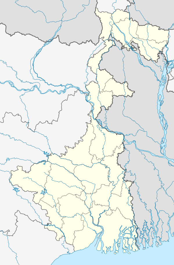 Nahazari Location in West Bengal, India 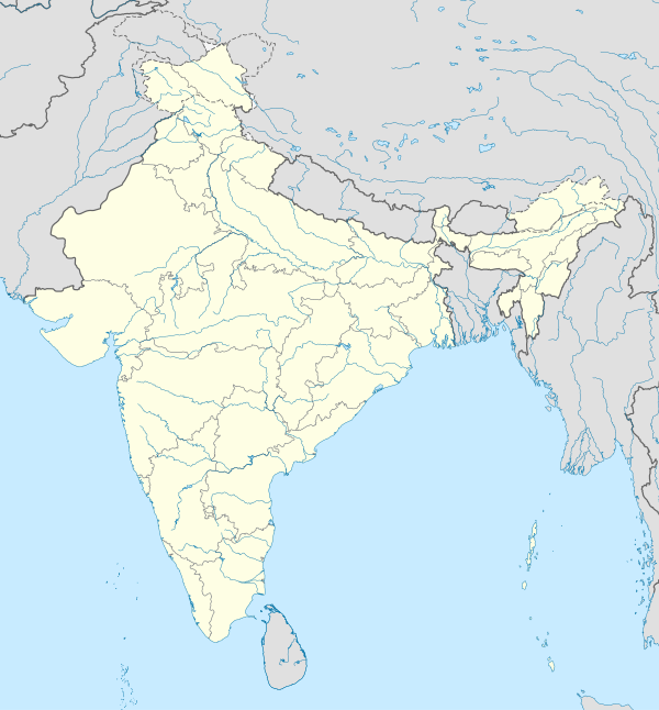 Nahazari Nahazari (India) | |
| Coordinates: 22°26′05″N 88°14′55″E / 22.4347°N 88.2487°E | |
| Country | |
| State | West Bengal |
| District | South 24 Parganas |
| CD Block | Bishnupur II |
| Area | |
| • Total | 6.58 km2 (2.54 sq mi) |
| Elevation | 9 m (30 ft) |
| Population (2011) | |
| • Total | 17,422 |
| • Density | 2,600/km2 (6,900/sq mi) |
| Languages | |
| • Official | Bengali, Hindi, English |
| Time zone | UTC+5:30 (IST) |
| PIN | 700104 |
| Telephone code | +91 33 |
| Vehicle registration | WB-01 to WB-10, WB-19 to WB-22, WB-95 to WB-99 |
| Lok Sabha constituency | Diamond Harbour |
| Vidhan Sabha constituency | Satgachhia |
| Website | www |
Nahazari is a town in Bishnupur II CD Block of South 24 Parganas district in the Indian State of West Bengal. Bishnupur police station serves this town.[1]
Geography
Nahazari town is located at 22°26′05″N 88°14′55″E / 22.4347°N 88.2487°E. It has an average elevation of 9 metres (30 ft).
References
- ^ "Primary Census Abstract Data of Nahazari". Census of India. Indikosh. Retrieved 26 April 2016.
| Kolkata Municipal Corporation |
|
|---|---|
| Kolkata Urban Agglomeration Outside KMC |
|
This article about a location in West Bengal is a stub. You can help Wikipedia by expanding it. |