Newbury, Massachusetts: Difference between revisions
Hugh Manatee (talk | contribs) simplified link to Governor's Academy |
Hugh Manatee (talk | contribs) moved Coffin House image to Coffin House page |
||
| Line 36: | Line 36: | ||
== History == |
== History == |
||
"Newberry Plantation" was settled in [[1635]] |
"Newberry Plantation" was settled and incorporated in [[1635]]. The Rev. Thomas Parker and a group of approximately 100 pioneers from [[Wiltshire, England]] sailed from the [[Thames River]] aboard the [[ship]] "Mary and John," first landing in "Agawam" (now [[Ipswich, Massachusetts|Ipswich]]) in [[1634]]. They arrived the next spring at the "Quascacunquen River," now the Parker River. A commemorative stone marks the spot where they stepped ashore. The site had once been a village of the [[Pennacook|Pawtucket]] [[Indigenous peoples of the Americas|Indians]], who [[hunted]], [[fishing|fished]] or [[farmed]]. Many settlers would do the same. In [[1791]], 3,000 head of [[cattle]] grazed town lands, or on the region's abundant [[salt marsh]] [[hay]]. Other trades included [[tanning]] and [[shipbuilding]]. Newbury originally included [[Newburyport, Massachusetts|Newburyport]], set off in [[1764]], and [[West Newbury, Massachusetts|West Newbury]], set off in [[1819]]. |
||
"Quascancunquen" means "waterfall," referring to the [[falls]] where Center Street crosses the Parker River. In [[1636]], the first [[water power|water powered]] mill was established at the falls. [[gristmill|Gristmills]] and [[sawmill]]s were built, and in [[1794]], the first [[textile]] mill in [[Massachusetts]]. At Byfield in [[1763]] was founded the nation's first [[University-preparatory school|preparatory school]], Dum'r Charity School, later |
"Quascancunquen" means "waterfall," referring to the [[falls]] where Center Street crosses the Parker River. In [[1636]], the first [[water power|water powered]] mill was established at the falls. [[gristmill|Gristmills]] and [[sawmill]]s were built, and in [[1794]], the first [[textile]] mill in [[Massachusetts]]. At Byfield in [[1763]] was founded the nation's first [[University-preparatory school|preparatory school]], Dum'r Charity School, later Governor Dummer Academy, and now [[The Governor's Academy]]. It was also site of the first female [[seminary]], founded in [[1807]]. Byfield developed into a mill village, and once had six water powered mills, manufacturing various products from [[woolen]]s to [[snuff]]. ''James Steam Mills'' was established in [[1844]]. In [[1845]], 45,000 pairs of shoes were produced. |
||
The [[railroad]] entered the community in [[1850]], carrying [[freight]] but also tourists, helping Plum Island develop into a [[Victorian architecture|Victorian]] seaside resort. Back on the mainland, [[silver]] was discovered in a large field in [[1878]], and the ''Chipman Silver Mine'' would begin operations until it finally closed in [[1925]]. By [[1905]], however, the economy had shifted to back to [[agriculture]], and Newbury became a supplier of [[egg (food)|eggs]], [[milk]] and [[poultry]]. Some would dig for [[clams]] or hay the salt marshes. The town is today primarily residential, with much fine antique [[architecture]]. |
The [[railroad]] entered the community in [[1850]], carrying [[freight]] but also tourists, helping Plum Island develop into a [[Victorian architecture|Victorian]] seaside resort. Back on the mainland, [[silver]] was discovered in a large field in [[1878]], and the ''Chipman Silver Mine'' would begin operations until it finally closed in [[1925]]. By [[1905]], however, the economy had shifted to back to [[agriculture]], and Newbury became a supplier of [[egg (food)|eggs]], [[milk]] and [[poultry]]. Some would dig for [[clams]] or hay the salt marshes. The town is today primarily residential, with much fine antique [[architecture]]. |
||
| Line 56: | Line 56: | ||
==Demographics== |
==Demographics== |
||
[[Image: |
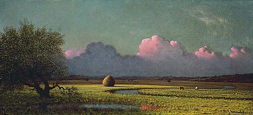
[[Image:HeadeMartinJohnsonSunlightAndShadow.jpg|thumb|250px|left|''Sunlight and Shadow: The Newbury Marshes'' (1871-1875), by [[Martin Johnson Heade]]]] |
||
As of the [[census]][[Geographic references#2|<sup>2</sup>]] of 2000, there were 6,717 people, 2,514 households, and 1,815 families residing in the town. The [[population density]] was 106.9/km² (277.0/mi²). There were 2,816 housing units at an average density of 44.8/km² (116.1/mi²). The racial makeup of the town was 98.32% [[White (U.S. Census)|White]], 0.37% [[African American (U.S. Census)|African American]], 0.13% [[Native American (U.S. Census)|Native American]], 0.45% [[Asian (U.S. Census)|Asian]], 0.01% [[Pacific Islander (U.S. Census)|Pacific Islander]], 0.28% from [[Race (United States Census)|other races]], and 0.43% from two or more races. [[Hispanic (U.S. Census)|Hispanic]] or [[Latino (U.S. Census)|Latino]] of any race were 0.91% of the population. |
As of the [[census]][[Geographic references#2|<sup>2</sup>]] of 2000, there were 6,717 people, 2,514 households, and 1,815 families residing in the town. The [[population density]] was 106.9/km² (277.0/mi²). There were 2,816 housing units at an average density of 44.8/km² (116.1/mi²). The racial makeup of the town was 98.32% [[White (U.S. Census)|White]], 0.37% [[African American (U.S. Census)|African American]], 0.13% [[Native American (U.S. Census)|Native American]], 0.45% [[Asian (U.S. Census)|Asian]], 0.01% [[Pacific Islander (U.S. Census)|Pacific Islander]], 0.28% from [[Race (United States Census)|other races]], and 0.43% from two or more races. [[Hispanic (U.S. Census)|Hispanic]] or [[Latino (U.S. Census)|Latino]] of any race were 0.91% of the population. |
||
There were 2,514 households out of which 35.7% had children under the age of 18 living with them, 61.5% were [[Marriage|married couples]] living together, 7.4% had a female householder with no husband present, and 27.8% were non-families. 22.6% of all households were made up of individuals and 9.1% had someone living alone who was 65 years of age or older. The average household size was 2.66 and the average family size was 3.16. |
There were 2,514 households out of which 35.7% had children under the age of 18 living with them, 61.5% were [[Marriage|married couples]] living together, 7.4% had a female householder with no husband present, and 27.8% were non-families. 22.6% of all households were made up of individuals and 9.1% had someone living alone who was 65 years of age or older. The average household size was 2.66 and the average family size was 3.16. |
||
[[Image:Plum Island Hotel, Plum Island, MA.jpg|thumb|right|''Plum Island Hotel'' in c. 1910]] |
[[Image:Plum Island Hotel, Plum Island, MA.jpg|thumb|right|''Plum Island Hotel'' in c. [[1910]]]] |
||
In the town the population was spread out with 27.1% under the age of 18, 4.3% from 18 to 24, 30.0% from 25 to 44, 27.9% from 45 to 64, and 10.7% who were 65 years of age or older. The median age was 40 years. For every 100 females there were 94.0 males. For every 100 females age 18 and over, there were 91.7 males. |
In the town the population was spread out with 27.1% under the age of 18, 4.3% from 18 to 24, 30.0% from 25 to 44, 27.9% from 45 to 64, and 10.7% who were 65 years of age or older. The median age was 40 years. For every 100 females there were 94.0 males. For every 100 females age 18 and over, there were 91.7 males. |
||
The median income for a household in the town was $74,836, and the median income for a family was $83,428. Males had a median income of $52,366 versus $35,656 for females. The [[per capita income]] for the town was $34,640. About 1.2% of families and 3.1% of the population were below the [[poverty line]], including 2.3% of those under age 18 and 9.2% of those age 65 or over. |
The median income for a household in the town was $74,836, and the median income for a family was $83,428. Males had a median income of $52,366 versus $35,656 for females. The [[per capita income]] for the town was $34,640. About 1.2% of families and 3.1% of the population were below the [[poverty line]], including 2.3% of those under age 18 and 9.2% of those age 65 or over. |
||
[[Image:HeadeMartinJohnsonSunlightAndShadow.jpg|thumb|250px|left|'''''Sunlight and Shadow: The Newbury Marshes''''' (1871-1875) by [[Martin Johnson Heade]]]] |
|||
==External links== |
==External links== |
||
Revision as of 14:31, 25 October 2006
Newbury is a town in Essex County, Massachusetts, United States. The population was 6,717 at the 2000 census. Newbury includes the villages of Old Town (Newbury Center), Plum Island and Byfield, home of The Governor's Academy (formerly Governor Dummer Academy), a private preparatory school.
History
"Newberry Plantation" was settled and incorporated in 1635. The Rev. Thomas Parker and a group of approximately 100 pioneers from Wiltshire, England sailed from the Thames River aboard the ship "Mary and John," first landing in "Agawam" (now Ipswich) in 1634. They arrived the next spring at the "Quascacunquen River," now the Parker River. A commemorative stone marks the spot where they stepped ashore. The site had once been a village of the Pawtucket Indians, who hunted, fished or farmed. Many settlers would do the same. In 1791, 3,000 head of cattle grazed town lands, or on the region's abundant salt marsh hay. Other trades included tanning and shipbuilding. Newbury originally included Newburyport, set off in 1764, and West Newbury, set off in 1819.
"Quascancunquen" means "waterfall," referring to the falls where Center Street crosses the Parker River. In 1636, the first water powered mill was established at the falls. Gristmills and sawmills were built, and in 1794, the first textile mill in Massachusetts. At Byfield in 1763 was founded the nation's first preparatory school, Dum'r Charity School, later Governor Dummer Academy, and now The Governor's Academy. It was also site of the first female seminary, founded in 1807. Byfield developed into a mill village, and once had six water powered mills, manufacturing various products from woolens to snuff. James Steam Mills was established in 1844. In 1845, 45,000 pairs of shoes were produced.
The railroad entered the community in 1850, carrying freight but also tourists, helping Plum Island develop into a Victorian seaside resort. Back on the mainland, silver was discovered in a large field in 1878, and the Chipman Silver Mine would begin operations until it finally closed in 1925. By 1905, however, the economy had shifted to back to agriculture, and Newbury became a supplier of eggs, milk and poultry. Some would dig for clams or hay the salt marshes. The town is today primarily residential, with much fine antique architecture.
Notable Inhabitants:
- William Dummer, governor
- Theophilus Parsons, jurist
Historic Sites & Museum Houses:
- Coffin House (c. 1678)
- Dole-Little House (c. 1715)
- Spencer-Peirce-Little Farm (c. 1675-1700)
- Swett-Ilsley House (c. 1670)
Geography
According to the United States Census Bureau, the town has a total area of 68.5 km² (26.5 mi²). 62.8 km² (24.2 mi²) of it is land and 5.7 km² (2.2 mi²) of it (8.32%) is water. Newbury is drained by the Parker River.
Demographics
As of the census2 of 2000, there were 6,717 people, 2,514 households, and 1,815 families residing in the town. The population density was 106.9/km² (277.0/mi²). There were 2,816 housing units at an average density of 44.8/km² (116.1/mi²). The racial makeup of the town was 98.32% White, 0.37% African American, 0.13% Native American, 0.45% Asian, 0.01% Pacific Islander, 0.28% from other races, and 0.43% from two or more races. Hispanic or Latino of any race were 0.91% of the population.
There were 2,514 households out of which 35.7% had children under the age of 18 living with them, 61.5% were married couples living together, 7.4% had a female householder with no husband present, and 27.8% were non-families. 22.6% of all households were made up of individuals and 9.1% had someone living alone who was 65 years of age or older. The average household size was 2.66 and the average family size was 3.16.

In the town the population was spread out with 27.1% under the age of 18, 4.3% from 18 to 24, 30.0% from 25 to 44, 27.9% from 45 to 64, and 10.7% who were 65 years of age or older. The median age was 40 years. For every 100 females there were 94.0 males. For every 100 females age 18 and over, there were 91.7 males.
The median income for a household in the town was $74,836, and the median income for a family was $83,428. Males had a median income of $52,366 versus $35,656 for females. The per capita income for the town was $34,640. About 1.2% of families and 3.1% of the population were below the poverty line, including 2.3% of those under age 18 and 9.2% of those age 65 or over.
External links
- Official Website
- The Governor's Academy
- Historical Society of Old Newbury
- Parker River National Wildlife Refuge