Nizhny Lomov: Difference between revisions
Category |
ce/expa |
||
| Line 1: | Line 1: | ||
{{Infobox Russian town |
|||
{{Coord|53|31|12|N|43|40|33.96|E|display=title}} |
|||
|en_name=Nizhny Lomov |
|||
|ru_name=Нижний Ломов |
|||
| ⚫ | '''Nizhny Lomov''' ({{lang-ru|Ни́жний Ломо́в}}) is a [[types of inhabited localities in Russia|town]] and the [[administrative center]] of [[Nizhnelomovsky District]] |
||
|image_skyline=Nizhnii lomow enter.jpg |
|||
|image_caption=Welcome sign at the entrance to Nizhny Lomov |
|||
|latd=53 |
|||
|latm=31 |
|||
|lats= |
|||
|longd=43 |
|||
|longm=40 |
|||
|longs= |
|||
|map_label_position=right |
|||
|image_flag=Flag of Nizhny Lomov (Penza oblast).png |
|||
|flag_caption= |
|||
|image_coa=Coat of Arms of Nizhny Lomov (Penza oblast).png |
|||
|coa_caption= |
|||
|anthem= |
|||
|anthem_ref= |
|||
|holiday= |
|||
|holiday_ref= |
|||
<!----ADMINISTRATIVE STATUS----> |
|||
|federal_subject=[[Penza Oblast]] |
|||
|federal_subject_ref=<ref name="PenzaO_adm" /> |
|||
|adm_data_as_of=November 2013 |
|||
|adm_district_jur=[[Nizhnelomovsky District]] |
|||
|adm_district_jur_ref=<ref name="PenzaO_adm" /> |
|||
|adm_selsoviet_jur=Nizhny Lomov |
|||
|adm_selsoviet_type=[[Town of district significance]] |
|||
|adm_selsoviet_jur_ref=<ref name="PenzaO_adm" /> |
|||
|adm_ctr_of1=Nizhnelomovsky District |
|||
|adm_ctr_of1_ref=<ref name="PenzaO_adm" /> |
|||
|adm_ctr_of2=town of district significance of Nizhny Lomov |
|||
|adm_ctr_of2_ref=<ref name="PenzaO_adm" /> |
|||
|inhabloc_cat=Town |
|||
|inhabloc_cat_ref=<ref name="PenzaO_adm" /> |
|||
|inhabloc_type= |
|||
|inhabloc_type_ref= |
|||
<!----MUNICIPAL STATUS----> |
|||
|mun_data_as_of=October 2013 |
|||
|mun_district_jur=Nizhnelomovsky Municipal District |
|||
|mun_district_jur_ref=<ref name="PenzaO_mun" /> |
|||
|urban_settlement_jur=Nizhny Lomov Urban Settlement |
|||
|urban_settlement_jur_ref=<ref name="PenzaO_mun" /> |
|||
|mun_admctr_of1=Nizhnelomovsky Municipal District |
|||
|mun_admctr_of1_ref=<ref name="OKTMO">{{OKTMO reference|56 651}}</ref> |
|||
|mun_admctr_of2=Nikolsk Urban Settlement |
|||
|mun_admctr_of2_ref=<ref name="OKTMO2">{{OKTMO reference|54 651 101}}</ref> |
|||
|leader_title= |
|||
|leader_title_ref= |
|||
|leader_name= |
|||
|leader_name_ref= |
|||
|representative_body= |
|||
|representative_body_ref= |
|||
<!----STATISTICS----> |
|||
|area_of_what= |
|||
|area_as_of= |
|||
|area_km2= |
|||
|area_km2_ref= |
|||
|pop_2010census=22678 |
|||
|pop_2010census_ref=<ref name="2010Census" /> |
|||
|pop_density= |
|||
|pop_density_as_of= |
|||
|pop_density_ref= |
|||
|pop_latest= |
|||
|pop_latest_date= |
|||
|pop_latest_ref= |
|||
<!----HISTORY----> |
|||
|established_date=1636 |
|||
|established_title= |
|||
|established_date_ref= |
|||
|current_cat_date=1780 |
|||
|current_cat_date_ref= |
|||
|prev_name1= |
|||
|prev_name1_date= |
|||
|prev_name1_ref= |
|||
<!----MISCELLANEA----> |
|||
|postal_codes=442150–442153, 442169 |
|||
|dialing_codes= |
|||
|dialing_codes_ref= |
|||
|website=http://gnlomov.nlomov.pnzreg.ru/ |
|||
|website_ref= |
|||
|date=June 2014 |
|||
}} |
|||
| ⚫ | '''Nizhny Lomov''' ({{lang-ru|Ни́жний Ломо́в}}) is a [[types of inhabited localities in Russia|town]] and the [[administrative center]] of [[Nizhnelomovsky District]] in [[Penza Oblast]], [[Russia]], located on the [[Lomov River]] ([[Oka River|Oka]]'s [[drainage basin|basin]]), on the [[M5 highway (Russia)|M5 Highway]] {{convert|109|km|sp=us}} northwest of [[Penza]], the administrative center of the [[oblast]]. Population: {{ru-census|p2010=22,678|p2002=24,249|p1989=26,648}} |
||
==History== |
==History== |
||
It was founded as an outpost in 1636 as part of the Simbirsk Line defense system. It was later known as Lomovskaya ''[[sloboda]]'', Lomovsky ''[[posad]]'', and the village of Nizhny Lomov. Town status was granted to it in 1780. |
It was founded as an outpost in 1636 as part of the Simbirsk Line defense system.{{citation needed|date=June 2014}} It was later known as Lomovskaya ''[[sloboda]]'', Lomovsky ''[[posad]]'', and the village of Nizhny Lomov.{{citation needed|date=June 2014}} Town status was granted to it in 1780.{{citation needed|date=June 2014}} |
||
==Administrative and municipal status== |
|||
Within the [[subdivisions of Russia#Administrative divisions|framework of administrative divisions]], Nizhny Lomov serves as the [[administrative center]] of [[Nizhnelomovsky District]].<ref name="PenzaO_adm">Law #774-ZPO</ref> As an administrative division, it is incorporated within Nizhnelomovsky District as the '''[[town of district significance]] of Nizhny Lomov'''.<ref name="PenzaO_adm" /> As a [[subdivisions of Russia#Municipal divisions|municipal division]], the town of district significance of Nizhny Lomov is incorporated within Nizhnelomovsky Municipal District as '''Nizhny Lomov Urban Settlement'''.<ref name="PenzaO_mun">Law #690-ZPO</ref> |
|||
==References== |
==References== |
||
===Notes=== |
|||
{{Reflist}} |
{{Reflist}} |
||
===Sources=== |
|||
*{{RussiaAdmMunRef|pnz|adm|law}} |
|||
*{{RussiaAdmMunRef|pnz|mun|list}} |
|||
{{Penza Oblast}} |
{{Penza Oblast}} |
||
Revision as of 17:24, 18 June 2014
Nizhny Lomov
Нижний Ломов | |
|---|---|
 Welcome sign at the entrance to Nizhny Lomov | |
 Flag  Coat of arms | |
Location of Nizhny Lomov  | |
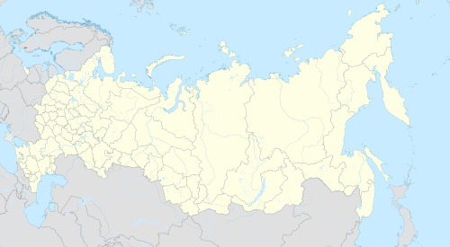 Nizhny Lomov Location of Nizhny Lomov  Nizhny Lomov Nizhny Lomov (Penza Oblast) | |
| Coordinates: 53°32′0″N 43°41′0″E / 53.53333°N 43.68333°E | |
| Country | Russia |
| Federal subject | Penza Oblast[1] |
| Administrative district | Nizhnelomovsky District[1] |
| Town of district significance | Nizhny Lomov[1] |
| Founded | 1636 |
| Town status since | 1780 |
| Elevation | 170 m (560 ft) |
| Population | |
| • Total | 22,678 |
| • Capital of | Nizhnelomovsky District,[1] town of district significance of Nizhny Lomov[1] |
| • Municipal district | Nizhnelomovsky Municipal District[3] |
| • Urban settlement | Nizhny Lomov Urban Settlement[3] |
| • Capital of | Nizhnelomovsky Municipal District,[4] Nikolsk Urban Settlement[5] |
| Time zone | UTC+3 (MSK |
| Postal code(s)[7] | 442150–442153, 442169 |
| OKTMO ID | 56651101001 |
| Website | gnlomov |
Nizhny Lomov (Russian: Ни́жний Ломо́в) is a town and the administrative center of Nizhnelomovsky District in Penza Oblast, Russia, located on the Lomov River (Oka's basin), on the M5 Highway 109 kilometers (68 mi) northwest of Penza, the administrative center of the oblast. Population: 22,678 (2010 Russian census);[2] 24,249 (2002 Census);[8] 26,648 (1989 Soviet census).[9]
History
It was founded as an outpost in 1636 as part of the Simbirsk Line defense system.[citation needed] It was later known as Lomovskaya sloboda, Lomovsky posad, and the village of Nizhny Lomov.[citation needed] Town status was granted to it in 1780.[citation needed]
Administrative and municipal status
Within the framework of administrative divisions, Nizhny Lomov serves as the administrative center of Nizhnelomovsky District.[1] As an administrative division, it is incorporated within Nizhnelomovsky District as the town of district significance of Nizhny Lomov.[1] As a municipal division, the town of district significance of Nizhny Lomov is incorporated within Nizhnelomovsky Municipal District as Nizhny Lomov Urban Settlement.[3]
References
Notes
- ^ a b c d e f g h Law #774-ZPO
- ^ a b Russian Federal State Statistics Service (2011). Всероссийская перепись населения 2010 года. Том 1 [2010 All-Russian Population Census, vol. 1]. Всероссийская перепись населения 2010 года [2010 All-Russia Population Census] (in Russian). Federal State Statistics Service.
- ^ a b c Law #690-ZPO
- ^ Федеральная служба государственной статистики. Федеральное агентство по технологическому регулированию и метрологии. №ОК 033-2013 1 января 2014 г. «Общероссийский классификатор территорий муниципальных образований. Код 56 651». (Federal State Statistics Service. Federal Agency on Technological Regulation and Metrology. #OK 033-2013 January 1, 2014 Russian Classification of Territories of Municipal Formations. Code 56 651. ).
- ^ Федеральная служба государственной статистики. Федеральное агентство по технологическому регулированию и метрологии. №ОК 033-2013 1 января 2014 г. «Общероссийский классификатор территорий муниципальных образований. Код 54 651 101». (Federal State Statistics Service. Federal Agency on Technological Regulation and Metrology. #OK 033-2013 January 1, 2014 Russian Classification of Territories of Municipal Formations. Code 54 651 101. ).
- ^ "Об исчислении времени". Официальный интернет-портал правовой информации (in Russian). June 3, 2011. Retrieved January 19, 2019.
- ^ Почта России. Информационно-вычислительный центр ОАСУ РПО. (Russian Post). Поиск объектов почтовой связи (Postal Objects Search) (in Russian)
- ^ Federal State Statistics Service (May 21, 2004). Численность населения России, субъектов Российской Федерации в составе федеральных округов, районов, городских поселений, сельских населённых пунктов – районных центров и сельских населённых пунктов с населением 3 тысячи и более человек [Population of Russia, Its Federal Districts, Federal Subjects, Districts, Urban Localities, Rural Localities—Administrative Centers, and Rural Localities with Population of Over 3,000] (XLS). Всероссийская перепись населения 2002 года [All-Russia Population Census of 2002] (in Russian).
- ^ Всесоюзная перепись населения 1989 г. Численность наличного населения союзных и автономных республик, автономных областей и округов, краёв, областей, районов, городских поселений и сёл-райцентров [All Union Population Census of 1989: Present Population of Union and Autonomous Republics, Autonomous Oblasts and Okrugs, Krais, Oblasts, Districts, Urban Settlements, and Villages Serving as District Administrative Centers]. Всесоюзная перепись населения 1989 года [All-Union Population Census of 1989] (in Russian). Институт демографии Национального исследовательского университета: Высшая школа экономики [Institute of Demography at the National Research University: Higher School of Economics]. 1989 – via Demoscope Weekly.
Sources
- Законодательное Собрание Пензенской области. Закон №774-ЗПО от 9 марта 2005 г. «Об административно-территориальном устройстве Пензенской области», в ред. Закона №2484-ЗПО от 28 ноября 2013 г. «О внесении изменений в статью 15 Закона Пензенской области "Об административно-территориальном устройстве Пензенской области"». Вступил в силу через десять дней после дня официального опубликования. Опубликован: "Пензенские губернские ведомости", №6, стр. 49, 18 марта 2005 г. (Legislative Assembly of Penza Oblast. Law #774-ZPO of March 9, 2005 On the Administrative-Territorial Structure of Penza Oblast, as amended by the Law #2484-ZPO of November 28, 2013 On Amending Article 15 of the Law of Penza Oblast "On the Administrative-Territorial Structure of Penza Oblast". Effective as of the day ten days after the day of the official publication.).
- Законодательное Собрание Пензенской области. Закон №690-ЗПО от 2 ноября 2004 г. «О границах муниципальных образований Пензенской области», в ред. Закона №2681-ЗПО от 4 марта 2015 г. «О внесении изменений в Закон Пензенской области "О границах муниципальных образований Пензенской области"». Вступил в силу через 10 дней после официального опубликования. Опубликован: "Пензенские губернские ведомости", №17 (без приложения), 16 ноября 2004 г. (Legislative Assembly of Penza Oblast. Law #690-ZPO of November 2, 2004 On the Borders of the Municipal Formations of Penza Oblast, as amended by the Law #2681-ZPO of March 4, 2015 On Amending the Law of Penza Oblast "On the Borders of the Municipal Formations of Penza Oblast". Effective as of after 10 days from the official publication.).