Alto Paraíso: Difference between revisions
Content deleted Content added
m robot Adding: no:Alto Paraíso |
|||
| (35 intermediate revisions by 29 users not shown) | |||
| Line 1: | Line 1: | ||
{{Distinguish|Alto Paraíso de Goiás}} |
|||
{{CoorHeader|09|42|47|S|63|19|15|W|scale:30000}} |
|||
{{Infobox settlement |
|||
| ⚫ | |||
| official_name = Alto Paraíso |
|||
| native_name = |
|||
| settlement_type = [[Municipalities of Brazil|Municipality]] |
|||
| image_shield = Brasao Alto Paraiso.jpg |
|||
| image_flag = Bandeira Alto Paraiso.png |
|||
| image_skyline = |
|||
| image_caption = |
|||
| image_map = Rondonia Municip AltoParaiso.svg |
|||
| map_caption = Location in Rondônia state |
|||
| pushpin_map = Brazil |
|||
| pushpin_map_caption = Location in Brazil |
|||
| coordinates = {{coord|9|42|47|s|63|19|15|W|region:BR|display=inline,title}} |
|||
| subdivision_type = [[List of sovereign states|Country]] |
|||
| subdivision_name = Brazil |
|||
| subdivision_type1 = [[Regions of Brazil|Region]] |
|||
| subdivision_name1 = [[North Region, Brazil|North]] |
|||
| subdivision_type2 = [[States of Brazil|State]] |
|||
| subdivision_name2 = [[Rondônia]] |
|||
| subdivision_type3 = [[Mesoregions of Brazil|Mesoregion]] |
|||
| subdivision_name3 = |
|||
| subdivision_type4 = [[Microregion (Brazil)|Microregion]] |
|||
| subdivision_name4 = |
|||
| subdivision_type5 = [[Metropolitan area#Brazil|Metrop. region]] |
|||
| subdivision_name5 = |
|||
| established_title = |
|||
| established_date = |
|||
| leader_party = |
|||
| leader_title = [[Mayor]] |
|||
| leader_name = |
|||
| elevation_m = |
|||
| area_footnotes = |
|||
| area_total_km2 = 2,652 |
|||
| area_metro_km2 = |
|||
| population_footnotes = |
|||
| population_total = 21,847 |
|||
| population_as_of = 2020 <ref>[https://cidades.ibge.gov.br/brasil/ro/alto-paraiso/panorama IBGE 2020]</ref> |
|||
| population_metro = |
|||
| population_density_km2 = auto |
|||
| population_demonym = |
|||
| blank_name_sec1 = [[Human Development Index|HDI]] |
|||
| blank_info_sec1 = |
|||
| timezone1 = [[Time in Brazil|AMT]] |
|||
| utc_offset1 = −4 |
|||
| timezone1_DST = |
|||
| utc_offset1_DST = |
|||
| postal_code_type = [[List of postal codes in Brazil|Postal code]] |
|||
| postal_code = |
|||
| area_code_type = [[List of dialling codes in Brazil|Area code]] |
|||
| area_code = |
|||
| website = |
|||
}} |
|||
| ⚫ | |||
==References== |
==References== |
||
{{ |
{{Reflist}} |
||
{{Municipalities of Rondônia}} |
|||
{{Brazil-geo-stub}} |
|||
{{Authority control}} |
|||
| ⚫ | |||
[[Category:Cities in Rondônia]] |
|||
{{DEFAULTSORT:Alto Paraiso}} |
|||
[[eo:Alto Paraíso (Rondônia)]] |
|||
| ⚫ | |||
[[no:Alto Paraíso]] |
|||
[[pt:Alto Paraíso (Rondônia)]] |
|||
{{Rondônia-geo-stub}} |
|||
Latest revision as of 11:53, 24 November 2022
Alto Paraíso | |
|---|---|
 Flag  Coat of arms | |
 Location in Rondônia state | |
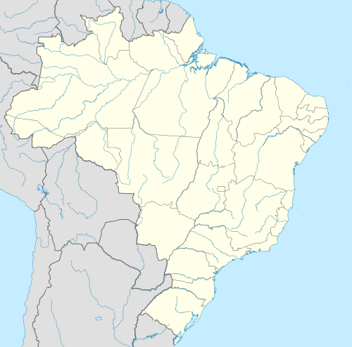 Alto Paraíso Location in Brazil | |
| Coordinates: 9°42′47″S 63°19′15″W / 9.71306°S 63.32083°W | |
| Country | Brazil |
| Region | North |
| State | Rondônia |
| Area | |
| • Total | 2,652 km2 (1,024 sq mi) |
| Population (2020 [1]) | |
| • Total | 21,847 |
| • Density | 8.2/km2 (21/sq mi) |
| Time zone | UTC−4 (AMT) |
Alto Paraíso is a municipality located in the Brazilian state of Rondônia. Its population was 21,847 (2020) and its area is 2,652 km².[2]
References
[edit]
| International | |
|---|---|
| National | |
This Rondônia, Brazil location article is a stub. You can help Wikipedia by expanding it. |