Casas, Texas: Difference between revisions
Content deleted Content added
Hushpuckena (talk | contribs) punctuation in lead |
Hushpuckena (talk | contribs) →Education: copy edit |
||
| Line 88: | Line 88: | ||
==Education== |
==Education== |
||
The CDP is within the [[Roma Independent School District]].<ref>{{cite web|url=https://www2.census.gov/geo/maps/DC2020/PL20/st48_tx/schooldistrict_maps/c48427_starr/DC20SD_C48427.pdf|title=2020 CENSUS - SCHOOL DISTRICT REFERENCE MAP: Starr County, TX|publisher=[[U.S. Census Bureau]]|accessdate=2022-08-28}} - [https://www2.census.gov/geo/maps/dc10map/sch_dist/st48_tx/c48427_starr/DC10SD_C48427_001.pdf 2010 map]</ref> |
|||
==References== |
==References== |
||
Revision as of 21:12, 26 February 2024
Casas, Texas | |
|---|---|
| Coordinates: 26°28′31″N 98°56′0″W / 26.47528°N 98.93333°W | |
| Country | United States |
| State | Texas |
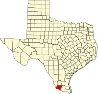
| County | Starr |
| Population (2010) | |
| • Total | 39 |
| Time zone | UTC-6 (Central (CST)) |
| • Summer (DST) | UTC-5 (CDT) |
| Zip Code | 78584 |
Casas is a census-designated place (CDP) in Starr County, Texas, United States. This was a new CDP for the 2010 census, with a population of 39.[1]
Geography
Casas is located at 26°28′32″N 98°56′0″W / 26.47556°N 98.93333°W (26.475341, -98.933253).[2]
Education
The CDP is within the Roma Independent School District.[3]
References
- ^ "Population and Housing Unit Counts, 2010 Census of Population and Housing" (PDF). Texas: 2010.
- ^ "Casas, Texas :: Boundary Map of Casas, Texas". Archived from the original on December 28, 2016. Retrieved December 28, 2016.
- ^ "2020 CENSUS - SCHOOL DISTRICT REFERENCE MAP: Starr County, TX" (PDF). U.S. Census Bureau. Retrieved August 28, 2022. - 2010 map