Chirip: Difference between revisions
Content deleted Content added
m r2.7.1) (Robot: Adding ja:散布山 |
#suggestededit-add 1.0 Tags: Mobile edit Mobile app edit Android app edit |
||
| (15 intermediate revisions by 12 users not shown) | |||
| Line 1: | Line 1: | ||
{{Short description|Volcano located in the central part of Iturup Island}} |
|||
{{Infobox mountain |
{{Infobox mountain |
||
| name = Chirip |
| name = Chirip |
||
| photo = |
| photo = Богдан Хмельницкий.JPG |
||
| photo_caption = |
| photo_caption = |
||
| elevation_m = 1,587 |
| elevation_m = 1,587 |
||
| elevation_ref = <ref>[https://peakvisor.com/peak/chirip.html Chirip] ''PeakVisor''</ref> |
|||
| elevation_ref = |
|||
| prominence = |
| prominence = ± 5043 |
||
| location = [[Iturup]], [[Kuril Islands]], [[Russia]] |
| location = [[Iturup]], [[Kuril Islands]], [[Russia]] |
||
| coordinates = {{coord|45.338|N|147.925|E|type:mountain}} |
| coordinates = {{coord|45.338|N|147.925|E|type:mountain}} |
||
| map = Russia Far Eastern Federal District |
|||
| map_caption = Chirip in Russian Far East |
|||
| topo = |
| topo = |
||
| type = [[Stratovolcano]]es |
| type = [[Stratovolcano]]es |
||
| age = |
| age = |
||
| last_eruption = |
| last_eruption = 1860 (?) |
||
| first_ascent = |
| first_ascent = |
||
| easiest_route = |
| easiest_route = east slope (?) |
||
}} |
}} |
||
'''Chirip''' ({{lang-ru|Чирип}}, {{lang-ja|北散布山}}) is a volcano located in the central part of [[Iturup]] Island, [[Kuril Islands]], [[Russia]]. In lies on the [[Chirip Peninsula]] and comprises two twin [[stratovolcano]]es, Chirip and Bogdan |
'''Chirip''' ({{lang-ru|Чирип}}, {{lang-ja|北散布山}}) is a volcano located in the central part of [[Iturup]] Island, [[Kuril Islands]], [[Russia]]. In lies on the [[Chirip Peninsula]] and comprises two twin [[stratovolcano]]es, Chirip and Bogdan Hmelnitskiy.<ref>[https://peakvisor.com/peak/bogdan-hmelnitskiy.html Bogdan Hmelnitskiy] ''PeakVisor''</ref> The western side is the steepest, sharing a basin, with a small lake with Bogdan Hmelnitskiy. Basin has features that were created during an eruption. Many types of lava found are [[basalt]], and [[andesite]], small amounts of [[dacite]] found.<ref>{{Cite web|url=http://www.volcano.si.edu/volcano.cfm?vn=290090|title = Global Volcanism Program | Chirippusan]] [Chirip]}}</ref> |
||
[[File:Chirip Relief Map, SRTM-1.jpg|left|thumb|150px|Relief map]] |
|||
==Notes== |
|||
{{reflist}} |
|||
==See also== |
==See also== |
||
| Line 22: | Line 30: | ||
== References == |
== References == |
||
* {{cite gvp| |
* {{cite gvp|vn=290090|title=Chirip}} |
||
{{Kuril Islands}} |
|||
[[Category:Iturup]] |
[[Category:Iturup]] |
||
[[Category:Mountains of |
[[Category:Mountains of the Kuril Islands]] |
||
[[Category:Stratovolcanoes]] |
[[Category:Stratovolcanoes of Russia]] |
||
[[Category:Volcanoes of the Kuril Islands]] |
|||
[[Category:Holocene stratovolcanoes]] |
|||
{{SakhalinOblast-geo-stub}} |
{{SakhalinOblast-geo-stub}} |
||
[[ja:散布山]] |
|||
[[no:Tsjirip]] |
|||
[[nn:Tsjirip]] |
|||
[[ru:Чирип (вулкан)]] |
|||
[[uk:Чирип (вулкан)]] |
|||
Latest revision as of 13:41, 26 September 2023
| Chirip | |
|---|---|
 | |
| Highest point | |
| Elevation | 1,587 m (5,207 ft)[1] |
| Prominence | ± 5043 |
| Coordinates | 45°20′17″N 147°55′30″E / 45.338°N 147.925°E |
| Geography | |
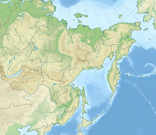 Chirip Chirip in Russian Far East | |
| Location | Iturup, Kuril Islands, Russia |
| Geology | |
| Mountain type | Stratovolcanoes |
| Last eruption | 1860 (?) |
| Climbing | |
| Easiest route | east slope (?) |
Chirip (Russian: Чирип, Japanese: 北散布山) is a volcano located in the central part of Iturup Island, Kuril Islands, Russia. In lies on the Chirip Peninsula and comprises two twin stratovolcanoes, Chirip and Bogdan Hmelnitskiy.[2] The western side is the steepest, sharing a basin, with a small lake with Bogdan Hmelnitskiy. Basin has features that were created during an eruption. Many types of lava found are basalt, and andesite, small amounts of dacite found.[3]

Notes
[edit]- ^ Chirip PeakVisor
- ^ Bogdan Hmelnitskiy PeakVisor
- ^ "Global Volcanism Program | Chirippusan]] [Chirip]".
See also
[edit]References
[edit]
This Sakhalin Oblast location article is a stub. You can help Wikipedia by expanding it. |