Cornelia, South Africa: Difference between revisions
→Fossil discoveries: links |
mNo edit summary |
||
| (45 intermediate revisions by 27 users not shown) | |||
| Line 1: | Line 1: | ||
{{Infobox |
{{Infobox settlement |
||
| |
| name = Cornelia |
||
| |
| image_skyline = Cornelia, Vrystaat, a.jpg |
||
| |
| image_caption = Cornelia |
||
| |
| pushpin_map = South Africa Free State#South Africa |
||
| coordinates = {{coord|27|14|03|S|28|51|03|E|region:ZA|display=inline,title}} |
|||
|imagesize = |
|||
| |
| subdivision_type = Country |
||
| |
| subdivision_name = [[South Africa]] |
||
| |
| subdivision_type1 = Province |
||
| subdivision_name1 = [[Free State (province)|Free State]] |
|||
|map_caption = |
|||
| |
| subdivision_type2 = District |
||
| subdivision_name2 = [[Fezile Dabi District Municipality|Fezile Dabi]] |
|||
|mapsize1 = |
|||
| subdivision_type3 = Municipality |
|||
|map_caption1 = |
|||
| subdivision_name3 = [[Mafube Local Municipality|Mafube]] |
|||
|pushpin_map = |
|||
| subdivision_type4 = Main Place |
|||
|pushpin_label_position = |
|||
| established_title = Established |
|||
|pushpin_map_caption = Location in the Free State |
|||
| |
| leader_title = Councillor |
||
| area_footnotes = <ref name=census2011>Sum of the Main Places [http://census2011.adrianfrith.com/place/479004 Ntswanatsatsi] and [http://census2011.adrianfrith.com/place/479005 Cornelia] from Census 2011.</ref> |
|||
|subdivision_type = Country |
|||
| area_total_km2 = 8.0 |
|||
|subdivision_name = {{flag|South Africa}} |
|||
| population_footnotes = <ref name=census2011 /> |
|||
|subdivision_type1 = [[Provinces of South Africa|Province]] |
|||
| population_total = 2964 |
|||
|subdivision_name1 = [[Free State (South African province)|Free State]] |
|||
| |
| population_as_of = 2011 |
||
| population_density_km2 = auto |
|||
|subdivision_name2 = |
|||
<!-- demographics (section 1) --> |
|||
|subdivision_type3 = |
|||
| demographics_type1 = Racial makeup (2011) |
|||
|subdivision_name3 = |
|||
| demographics1_footnotes = <ref name=census2011 /> |
|||
|government_footnotes = |
|||
| demographics1_title1 = [[Bantu peoples of South Africa|Black African]] |
|||
|government_type = |
|||
| demographics1_info1 = 97.3% |
|||
|leader_party = |
|||
| demographics1_title2 = [[Coloureds|Coloured]] |
|||
|leader_title = |
|||
| demographics1_info2 = 0.0% |
|||
|leader_name = |
|||
| demographics1_title3 = [[Indian South African|Indian]]/[[Asian South African|Asian]] |
|||
|established_title = |
|||
| demographics1_info3 = 0.7% |
|||
|established_date = |
|||
| demographics1_title4 = [[White South African|White]] |
|||
|area_total_km2 = |
|||
| demographics1_info4 = 1.9% |
|||
|elevation_m = |
|||
| demographics1_title5 = Other |
|||
|population_as_of = |
|||
| demographics1_info5 = 0.1% |
|||
|population_footnotes = |
|||
<!-- demographics (section 2) --> |
|||
|population_total = |
|||
| demographics_type2 = [[First language]]s (2011) |
|||
|population_density_km2 = |
|||
| demographics2_footnotes = <ref name=census2011 /> |
|||
|timezone=[[South Africa Standard Time|SAST]] |
|||
| demographics2_title1 = [[Sotho language|Sotho]] |
|||
|utc_offset=+2 |
|||
| demographics2_info1 = 57.8% |
|||
|coordinates_display = display=inline,title |
|||
| demographics2_title2 = [[Zulu language|Zulu]] |
|||
|latd=27|latm=14|lats=03|latNS=S |
|||
| demographics2_info2 = 33.7% |
|||
|longd=28|longm=51|longs=03|longEW=E |
|||
| demographics2_title3 = [[Afrikaans]] |
|||
|postal_code_type = Postal code |
|||
| demographics2_info3 = 2.7% |
|||
|postal_code = 9850 |
|||
| demographics2_title4 = [[English language|English]] |
|||
|area_code = |
|||
| demographics2_info4 = 1.6% |
|||
|website = |
|||
| demographics2_title5 = Other |
|||
|footnotes = |
|||
| demographics2_info5 = 4.2% |
|||
<!-- blank fields (section 2) --> |
|||
<!-- Other information --> |
|||
| timezone1 = [[South African Standard Time|SAST]] |
|||
| utc_offset1 = +2 |
|||
| postal_code_type = [[List of postal codes in South Africa|Postal code]] (street) |
|||
| postal_code = 9850 |
|||
| postal2_code_type = [[Post-office box|PO box]] |
|||
| postal2_code = 9850 |
|||
| area_code_type = [[Telephone numbers in South Africa|Area code]] |
|||
| area_code = 058 |
|||
}} |
}} |
||
'''Cornelia''' is a |
'''Cornelia''' is a town on the [[R103 (South Africa)|R103 road]] in the [[Free State (South African province)|Free State]] province of [[South Africa]]. J.D. Odendaal bought the farm "Sugarloaf" (known as [[Tafelkop]]) for a sum of R2,000. They settled there in 1876. At that time it was in the [[Harrismith]] district. There were no boundary fences and [[Free-ranging dog#"Wild" dogs|wild dogs]], [[warthogs]] and [[wildebeest]] were plentiful in the open grassveld. |
||
In 1886 the two farmers and other people formed the Afrikaans Baptist Church and J.D. Odendaal was the first preacher. |
In 1886 the two farmers and other people formed the Afrikaans Baptist Church and J.D. Odendaal was the first preacher. The Odendaal family made an important contribution to the church. |
||
DJ Steyn donated a piece of land to the church to erect a church building. There was a need for an educational institution and the church founded the school of Cornelia in 1889. |
|||
The town is near the ''Skoonriver'' (Clean/Pretty River). |
|||
In 1894 it was named after the wife of former Free State President [[Francis William Reitz]]. One of the previous pastors of the Afrikaans Baptist Church of Cornelia (1959 or 1960) was Jurgens Lambrechts, later well known for appearing in numerous quiz programmes on radio and television from the 1970s to the 1990s. |
|||
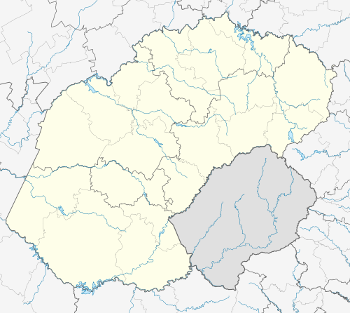
The town is now part of [[ Mafube Local Municipality]] that includes [[Tweeling]],[[Villiers, Free State| Villiers]] and [[Frankfort, Free State|Frankfort]] being the municipality head office. |
|||
The town is near the ''Skoonriver'' (Clean River). |
|||
==Fossil discoveries== |
==Fossil discoveries== |
||
[[File:Cornelia-Uitzoek Fossil Site.jpg|left|thumb|The Cornelia-Uitzoek Fossil & Archaeological site]] |
|||
On the Uitzoek farm, 10 km north of Cornelia, fossils were discovered in [[Pleistocene]] alluvial deposits by Van Hoepen in the 1920s and 1930s.<ref>Butzer 1974; Brink et al. 2012</ref> These fossils include extinct mammal forms such as a donkey-sized pig (''[[Metridiochoerus|Metridiochoerus modestus]]''), the three-toed horse (''[[Eurygnathohippus|Eurygnathohippus cornelianus]]'') only previously found in Tanzania, the giant buffalo (''Synerus antiquus''), Bondi's springbok (''Antidorcas bondi''), and the giant wildebeest (''Megolotragus eucornutus'').<ref>Brink 2005; Brink et al. 2012; Cook 1974</ref> [[Acheulian]] [[Stone Age#Tools|Stone Age tools]] such as handaxes and cleavers have also been found here.<ref>Clark 1974; Brink et al. 2012</ref> Recent research document excavations of a fossil bone bed, possibly resulting from the accumulation by hyaenas and redepostion by dongas (i.e., gullies). Associated with the fossil bone bed were a human (''Homo sp''.) tooth and Acheulian artifacts. These deposits are dated to the [[Jaramillo subchron]] (1.07 - 0.99 Ma) by [[paleomagnetism]].<ref>Brink et al. 2012</ref> |
|||
On the Uitzoek farm, 10 km north of Cornelia, fossils were discovered in [[Pleistocene]] alluvial deposits by Van Hoepen in the 1920s and 1930s.<ref>Butzer 1974; Brink et al. 2012</ref> |
|||
These fossils include extinct mammal forms such as a donkey-sized pig (''[[Metridiochoerus|Metridiochoerus modestus]]''), the three-toed horse (''[[Eurygnathohippus|Eurygnathohippus cornelianus]]'') only previously found in Tanzania, the giant buffalo (''Synerus antiquus''), Bondi's springbok (''Antidorcas bondi''), and the giant wildebeest (''Megolotragus eucornutus'').<ref>Brink 2005; Brink et al. 2012; Cook 1974</ref> |
|||
[[Acheulian]] [[Stone Age#Tools|Stone Age tools]] such as handaxes and cleavers have also been found here.<ref>Clark 1974; Brink et al. 2012</ref> Recent research document excavations of a fossil bone bed, possibly resulting from the accumulation by hyaenas and redeposition by dongas (i.e., gullies). |
|||
Associated with the fossil bone bed were a human (''Homo sp''.) tooth and Acheulian artifacts. These deposits are dated to the [[Jaramillo reversal|Jaramillo subchron]] (1.076 - 1.008 Ma) by [[paleomagnetism]].<ref>Brink et al. 2012</ref> |
|||
==Education== |
|||
Ntswanatsatsi township east of the town is home to several Early Childhood Development Centres (ECD Centres) and a primary and secondary schools serving children from the town and neighbouring farms. |
|||
* Ntswanatsatsi Primary School |
|||
* Bongani-Lebohang Secondary School |
|||
==Notes== |
==Notes== |
||
| Line 69: | Line 99: | ||
{{Commons category-inline|Cornelia, Free State}} |
{{Commons category-inline|Cornelia, Free State}} |
||
{{Fezile Dabi District Municipality}} |
|||
[[Category:Populated places in the Mafube Local Municipality]] |
|||
[[Category:Populated places established in 1876]] |
[[Category:Populated places established in 1876]] |
||
[[Category:1876 establishments in the Orange Free State]] |
|||
Latest revision as of 14:43, 12 June 2024
Cornelia | |
|---|---|
 Cornelia | |
 Cornelia  Cornelia | |
| Coordinates: 27°14′03″S 28°51′03″E / 27.23417°S 28.85083°E | |
| Country | South Africa |
| Province | Free State |
| District | Fezile Dabi |
| Municipality | Mafube |
| Area | |
| • Total | 8.0 km2 (3.1 sq mi) |
| Population (2011)[1] | |
| • Total | 2,964 |
| • Density | 370/km2 (960/sq mi) |
| Racial makeup (2011) | |
| • Black African | 97.3% |
| • Coloured | 0.0% |
| • Indian/Asian | 0.7% |
| • White | 1.9% |
| • Other | 0.1% |
| First languages (2011) | |
| • Sotho | 57.8% |
| • Zulu | 33.7% |
| • Afrikaans | 2.7% |
| • English | 1.6% |
| • Other | 4.2% |
| Time zone | UTC+2 (SAST) |
| Postal code (street) | 9850 |
| PO box | 9850 |
| Area code | 058 |
Cornelia is a town on the R103 road in the Free State province of South Africa. J.D. Odendaal bought the farm "Sugarloaf" (known as Tafelkop) for a sum of R2,000. They settled there in 1876. At that time it was in the Harrismith district. There were no boundary fences and wild dogs, warthogs and wildebeest were plentiful in the open grassveld.
In 1886 the two farmers and other people formed the Afrikaans Baptist Church and J.D. Odendaal was the first preacher. The Odendaal family made an important contribution to the church.
DJ Steyn donated a piece of land to the church to erect a church building. There was a need for an educational institution and the church founded the school of Cornelia in 1889.
In 1894 it was named after the wife of former Free State President Francis William Reitz. One of the previous pastors of the Afrikaans Baptist Church of Cornelia (1959 or 1960) was Jurgens Lambrechts, later well known for appearing in numerous quiz programmes on radio and television from the 1970s to the 1990s.
The town is now part of Mafube Local Municipality that includes Tweeling, Villiers and Frankfort being the municipality head office.
The town is near the Skoonriver (Clean River).
Fossil discoveries
[edit]
On the Uitzoek farm, 10 km north of Cornelia, fossils were discovered in Pleistocene alluvial deposits by Van Hoepen in the 1920s and 1930s.[2]
These fossils include extinct mammal forms such as a donkey-sized pig (Metridiochoerus modestus), the three-toed horse (Eurygnathohippus cornelianus) only previously found in Tanzania, the giant buffalo (Synerus antiquus), Bondi's springbok (Antidorcas bondi), and the giant wildebeest (Megolotragus eucornutus).[3]
Acheulian Stone Age tools such as handaxes and cleavers have also been found here.[4] Recent research document excavations of a fossil bone bed, possibly resulting from the accumulation by hyaenas and redeposition by dongas (i.e., gullies).
Associated with the fossil bone bed were a human (Homo sp.) tooth and Acheulian artifacts. These deposits are dated to the Jaramillo subchron (1.076 - 1.008 Ma) by paleomagnetism.[5]
Education
[edit]Ntswanatsatsi township east of the town is home to several Early Childhood Development Centres (ECD Centres) and a primary and secondary schools serving children from the town and neighbouring farms.
- Ntswanatsatsi Primary School
- Bongani-Lebohang Secondary School
Notes
[edit]References
[edit]- Brink, J. S. (2005) The evolution of the black wildebeest (Connochaetes gnou) and modern large mammal faunas of central southern Africa. PhD Dissertation, University of Stellenbosch, South Africa.
- Brink, James S., Andy I.R. Herries, Jacopo Moggi-Cecchi, John A.J. Gowlett, C. Britt Bousman, John Hancox, Rainer Grün, Vera Eisenmann, and Lloyd Rossouw (2012) First hominine remains from a 1.07-0.99 Ma hyaena accumulation at Cornelia-Uitzoek, Free State Province, South Africa. Journal of Human Evolution 63:527-535.
- Butzer, K. W. (1974) Geology of the Cornelia Beds. Mem. Nas. Mus., Bloemfontein 9, pp. 7-32.
- Clark, J. D. (1974) The stone artifacts from Cornelia, OFS, South Africa. Mem. Nas. Mus., Bloemfontein 9, pp. 33-62.
- Cooke, H. B. S. (1974) The fossil mammals of Cornelia, O.F.S, South Africa. Mem. Nas. Mus., Bloemfontein 9, pp. 63-84.
Media related to Cornelia, Free State at Wikimedia Commons
Municipalities and communities of Fezile Dabi District Municipality, Free State | ||
|---|---|---|
District seat: Sasolburg | ||
| Moqhaka | 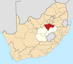 | |
| Ngwathe | ||
| Metsimaholo | ||
| Mafube | ||