Dalveen, Queensland: Difference between revisions
→Heritage listings: added coords |
→Heritage listings: added coords |
||
| Line 62: | Line 62: | ||
Dalveen has a number of [[heritage-listed]] sites, including: |
Dalveen has a number of [[heritage-listed]] sites, including: |
||
* 28 Crystal Mountain Road ({{coord|-28.4009|151.9067|region:AU-QLD_type:landmark|display=inline|name=Braeside Homestead}}): [[Braeside Homestead]]{{Hsp}}<ref>{{cite QHR|1143|Braeside Homestead|602351|accessdate=13 July 2013}}</ref> |
* 28 Crystal Mountain Road ({{coord|-28.4009|151.9067|region:AU-QLD_type:landmark|display=inline|name=Braeside Homestead}}): [[Braeside Homestead]]{{Hsp}}<ref>{{cite QHR|1143|Braeside Homestead|602351|accessdate=13 July 2013}}</ref> |
||
* 12 McCosker Drive: former Butcher's Shop{{Hsp}}<ref name=":1" /> |
* 12 McCosker Drive ({{Coord|-28.4874|151.9693|type:landmark_region:AU-QLD|display=|name=Butcher's Shop (former)}}): former Butcher's Shop{{Hsp}}<ref name=":1" /> |
||
* 3502 Old Stanthorpe Road: St Barnabas' Anglican Church{{Hsp}}<ref name=":1" /> |
* 3502 Old Stanthorpe Road ({{Coord|-28.4867|151.9720|type:landmark_region:AU-QLD|display=|name=St Barnabas' Anglican Church}}): St Barnabas' Anglican Church{{Hsp}}<ref name=":1" /> |
||
* 18 Pine Crescent: Dalveen Uniting Church{{Hsp}}<ref name=":1" /> |
* 18 Pine Crescent: Dalveen Uniting Church{{Hsp}}<ref name=":1" /> |
||
* 40 Pine Crescent: Dalveen State School{{Hsp}}<ref name=":1">{{Cite web|last=|first=|date=|title=Local Heritage Register|url=https://www.sdrc.qld.gov.au/ArticleDocuments/423/Local%20Heritage%20Register.pdf.aspx?Embed=Y|url-status=live|archive-url=https://web.archive.org/web/20200913085542/https://www.sdrc.qld.gov.au/ArticleDocuments/423/Local%20Heritage%20Register.pdf.aspx?Embed=Y|archive-date=13 September 2020|access-date=13 September 2020|website=[[Southern Downs Regional Council]]|page=8}}</ref> |
* 40 Pine Crescent ({{Coord|-28.4899|151.9738|type:edu_region:AU-QLD|display=|name=Dalveen State School}}): Dalveen State School{{Hsp}}<ref name=":1">{{Cite web|last=|first=|date=|title=Local Heritage Register|url=https://www.sdrc.qld.gov.au/ArticleDocuments/423/Local%20Heritage%20Register.pdf.aspx?Embed=Y|url-status=live|archive-url=https://web.archive.org/web/20200913085542/https://www.sdrc.qld.gov.au/ArticleDocuments/423/Local%20Heritage%20Register.pdf.aspx?Embed=Y|archive-date=13 September 2020|access-date=13 September 2020|website=[[Southern Downs Regional Council]]|page=8}}</ref> |
||
* Warwick-to-Wallangarra railway line ({{coord|-28.4889|151.9803|region:AU-QLD_type:landmark|display=inline|name=Dalveen Tunnel}}): [[Dalveen Tunnel|Dalveen Tunnel{{Hsp}}]]<ref>{{cite QHR|16282|Dalveen Tunnel|601519|accessdate=13 July 2013}}</ref> |
* Warwick-to-Wallangarra railway line ({{coord|-28.4889|151.9803|region:AU-QLD_type:landmark|display=inline|name=Dalveen Tunnel}}): [[Dalveen Tunnel|Dalveen Tunnel{{Hsp}}]]<ref>{{cite QHR|16282|Dalveen Tunnel|601519|accessdate=13 July 2013}}</ref> |
||
| Line 71: | Line 71: | ||
[[File:Dalveen Public Hall, 2015.JPG|thumb|left|Dalveen Hall, 2015]] |
[[File:Dalveen Public Hall, 2015.JPG|thumb|left|Dalveen Hall, 2015]] |
||
[[File:Dalveen State School, 2015.JPG|thumb|left|Dalveen State School, 2015]] |
[[File:Dalveen State School, 2015.JPG|thumb|left|Dalveen State School, 2015]] |
||
St Barnabas' Anglican Church holds a service on the 4th Sunday of each month at 3502 Old Stanthorpe Road |
St Barnabas' Anglican Church holds a service on the 4th Sunday of each month at 3502 Old Stanthorpe Road.<ref name=ks>{{cite web|last1=Spence|first1=Kay|title=Dalveen 4374|url=http://dalveen4374.blogspot.com.au/2012_05_01_archive.html|accessdate=5 June 2015}}</ref><ref name=":0" /> |
||
The Dalveen Hall ({{Coord|-28.4904|151.9734|type:landmark_region:AU-QLD|display=|name=Dalveen Hall}}) and Dalveen State School |
The Dalveen Hall ({{Coord|-28.4904|151.9734|type:landmark_region:AU-QLD|display=|name=Dalveen Hall}}) and Dalveen State School are both in Pine Crescent.<ref name=gm/> |
||
The [[Southern Downs Regional Council]] operates a [[mobile library]] service which visits the Dalveen State School in Pine Crescent.<ref>{{Cite web|url=http://www.sdrc.qld.gov.au/living-here/libraries/library-details|title=Library Details|website=[[Southern Downs Regional Council]]|archive-url=https://web.archive.org/web/20180131032450/http://www.sdrc.qld.gov.au/living-here/libraries/library-details|archive-date=31 January 2018|url-status=live|access-date=31 January 2018}}</ref> |
The [[Southern Downs Regional Council]] operates a [[mobile library]] service which visits the Dalveen State School in Pine Crescent.<ref>{{Cite web|url=http://www.sdrc.qld.gov.au/living-here/libraries/library-details|title=Library Details|website=[[Southern Downs Regional Council]]|archive-url=https://web.archive.org/web/20180131032450/http://www.sdrc.qld.gov.au/living-here/libraries/library-details|archive-date=31 January 2018|url-status=live|access-date=31 January 2018}}</ref> |
||
Revision as of 09:14, 13 September 2020
| Dalveen Queensland | |||||||||||||||
|---|---|---|---|---|---|---|---|---|---|---|---|---|---|---|---|
 Mob of black sheep, Braeside Homestead, 1894 | |||||||||||||||
 Dalveen | |||||||||||||||
| Coordinates | 28°29′22″S 151°58′15″E / 28.4894°S 151.9708°E | ||||||||||||||
| Population | 335 (2016 census)[1] | ||||||||||||||
| • Density | 1.2312/km2 (3.189/sq mi) | ||||||||||||||
| Postcode(s) | 4374 | ||||||||||||||
| Area | 272.1 km2 (105.1 sq mi) | ||||||||||||||
| Time zone | AEST (UTC+10:00) | ||||||||||||||
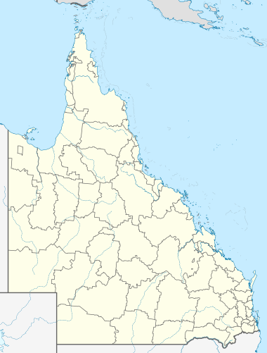
| Location | |||||||||||||||
| LGA(s) | Southern Downs Region | ||||||||||||||
| State electorate(s) | Southern Downs | ||||||||||||||
| Federal division(s) | Maranoa[2] | ||||||||||||||
| |||||||||||||||
Dalveen is a town and a locality in the Southern Downs Region, Queensland, Australia.[4][5] It borders New South Wales.[6] In the 2016 census, Dalveen had a population of 335 people.[1]
History

The name Dalveen derives from locality name given by settler John Flint, who named it after Dalveen Pass in Lanark, Scotland.[4]
Stanthorpe Road Provisional School opened on 12 August 1878. In 1879 it was renamed North Maryland Provisional School. In 1892 it was renamed Dalveen State School on 18 January 1892.[7][8]
Cherry Gully Post Office opened on 1 January 1880 and was replaced by Dalveen Post Office in 1881.[9]
The section of the Southern railway line from Cherry Gully via Dalveen to Stanthorpe opened on 3 May 1881 with the town of Dalveen being served by the Dalveen railway station (28°29′18″S 151°58′18″E / 28.4882°S 151.9718°E).[10][11]
St Barnabas' Anglican Church was built in 1903.[12][13][14]
At the 2011 census the town recorded a population of 346.[15]
Heritage listings
Dalveen has a number of heritage-listed sites, including:
- 28 Crystal Mountain Road (28°24′03″S 151°54′24″E / 28.4009°S 151.9067°E): Braeside Homestead [16]
- 12 McCosker Drive (28°29′15″S 151°58′09″E / 28.4874°S 151.9693°E): former Butcher's Shop [17]
- 3502 Old Stanthorpe Road (28°29′12″S 151°58′19″E / 28.4867°S 151.9720°E): St Barnabas' Anglican Church [17]
- 18 Pine Crescent: Dalveen Uniting Church [17]
- 40 Pine Crescent (28°29′24″S 151°58′26″E / 28.4899°S 151.9738°E): Dalveen State School [17]
- Warwick-to-Wallangarra railway line (28°29′20″S 151°58′49″E / 28.4889°S 151.9803°E): Dalveen Tunnel [18]
Facilities


St Barnabas' Anglican Church holds a service on the 4th Sunday of each month at 3502 Old Stanthorpe Road.[12][13]
The Dalveen Hall (28°29′25″S 151°58′24″E / 28.4904°S 151.9734°E) and Dalveen State School are both in Pine Crescent.[19]
The Southern Downs Regional Council operates a mobile library service which visits the Dalveen State School in Pine Crescent.[20]
The Dalveen branch of the Queensland Country Women's Association has its rooms at Cameron's Corner on the Old Stanthorpe Road.[21]
Transport

The New England Highway passes north-south through Dalveen.[19]
The Southern railway line passes through Dalveen; the hilly terrain necessitated two tunnels known as the Dalveen Tunnel and the Cherry Gully Tunnel and a rail bridge over Old Stanthorpe Road.[19] The line is no longer in active service.
Notable residents
- William Allan, Member of the Queensland Legislative Assembly, Member of the Queensland Legislative Council, owner of Braeside Homestead
References
- ^ a b Australian Bureau of Statistics (27 June 2017). "Dalveen (SSC)". 2016 Census QuickStats. Retrieved 20 October 2018.
- ^ "Maranoa". Australian Electoral Commission. 11 December 2013. Archived from the original on 14 December 2013. Retrieved 11 December 2013.
- ^ a b c Bureau of Meteorology max
- ^ a b "Dalveen – town in Southern Downs Region (entry 9256)". Queensland Place Names. Queensland Government. Retrieved 11 June 2019.
- ^ "Dalveen – locality in Southern Downs Region (entry 45919)". Queensland Place Names. Queensland Government. Retrieved 11 June 2019.
- ^ "Queensland Globe". State of Queensland. Retrieved 6 May 2020.
- ^ "Opening and closing dates of Queensland Schools". Queensland Government. Retrieved 4 June 2015.
- ^ "Agency ID 5156, Dalveen State School". Queensland State Archives. Retrieved 5 June 2015.
- ^ Premier Postal History. "Post Office List". Premier Postal Auctions. Retrieved 10 May 2014.
- ^ Kerr, John (1990). Triumph of narrow gauge : a history of Queensland Railways. Boolarong Publications. p. 224. ISBN 978-0-86439-102-5.
- ^ "Town of Dalveen" (Map). Queensland Government. 1972. Retrieved 13 September 2020.
{{cite web}}: CS1 maint: url-status (link) - ^ a b Spence, Kay. "Dalveen 4374". Retrieved 5 June 2015.
- ^ a b "Places of Interest in Dalveen, Qld" (PDF). Dalveen State School. August 2017. Archived (PDF) from the original on 15 March 2020. Retrieved 13 September 2020.
- ^ "DIOCESE OF BRISBANE". The Brisbane Courier. Vol. LIX, , no. 14, 102. Queensland, Australia. 25 March 1903. p. 9. Retrieved 13 September 2020 – via National Library of Australia.
{{cite news}}: CS1 maint: extra punctuation (link) - ^ Australian Bureau of Statistics (31 October 2012). "Dalveen (State Suburb)". 2011 Census QuickStats. Retrieved 6 July 2017.
- ^ "Braeside Homestead (entry 602351)". Queensland Heritage Register. Queensland Heritage Council. Retrieved 13 July 2013.
- ^ a b c d "Local Heritage Register". Southern Downs Regional Council. p. 8. Archived from the original on 13 September 2020. Retrieved 13 September 2020.
- ^ "Dalveen Tunnel (entry 601519)". Queensland Heritage Register. Queensland Heritage Council. Retrieved 13 July 2013.
- ^ a b c "Dalveen, Queensland". Google Maps. Retrieved 5 June 2015.
- ^ "Library Details". Southern Downs Regional Council. Archived from the original on 31 January 2018. Retrieved 31 January 2018.
- ^ "Branch locations". Queensland Country Women's Association. Archived from the original on 26 December 2018. Retrieved 26 December 2018.
External links
Media related to Dalveen, Queensland at Wikimedia Commons