Forest City, Iowa: Difference between revisions
Tags: Mobile edit Mobile web edit |
Magnolia677 (talk | contribs) Reverted 1 edit by Crazy Head 36 (talk): Test edit |
||
| (33 intermediate revisions by 19 users not shown) | |||
| Line 1: | Line 1: | ||
{{Use mdy dates|date=July 2023}} |
|||
{{Infobox settlement |
{{Infobox settlement |
||
| official_name = Forest City, Iowa |
| official_name = Forest City, Iowa |
||
| Line 31: | Line 32: | ||
<!-- Area --> |
<!-- Area --> |
||
| unit_pref = Imperial |
| unit_pref = Imperial |
||
| area_footnotes = <ref name=" |
| area_footnotes = <ref name="CenPopGazetteer2020">{{cite web|title=2020 U.S. Gazetteer Files|url=https://www2.census.gov/geo/docs/maps-data/data/gazetteer/2020_Gazetteer/2020_gaz_place_19.txt|publisher=United States Census Bureau|accessdate=March 16, 2022}}</ref> |
||
| area_total_km2 = 11. |
| area_total_km2 = 11.90 |
||
| area_total_sq_mi = 4. |
| area_total_sq_mi = 4.59 |
||
| area_land_km2 = 11. |
| area_land_km2 = 11.90 |
||
| area_land_sq_mi = 4. |
| area_land_sq_mi = 4.59 |
||
| area_water_km2 = 0.00 |
| area_water_km2 = 0.00 |
||
| area_water_sq_mi = 0.00 |
| area_water_sq_mi = 0.00 |
||
| Line 42: | Line 43: | ||
| elevation_ft = 1257 |
| elevation_ft = 1257 |
||
<!-- Population --> |
<!-- Population --> |
||
| population_footnotes = |
| population_footnotes = |
||
| population_total = 4285 |
| population_total = 4285 |
||
| population_as_of = [[2020 United States Census|2020]] |
| population_as_of = [[2020 United States Census|2020]] |
||
| Line 48: | Line 49: | ||
| population_est = |
| population_est = |
||
| pop_est_as_of = |
| pop_est_as_of = |
||
| population_density_km2 = |
| population_density_km2 = 360.07 |
||
| population_density_sq_mi = |
| population_density_sq_mi = 932.54 |
||
| timezone = [[North American Central Time Zone|Central (CST)]] |
| timezone = [[North American Central Time Zone|Central (CST)]] |
||
| utc_offset = -6 |
| utc_offset = -6 |
||
| Line 66: | Line 67: | ||
==History== |
==History== |
||
Forest City was [[plat]]ted in 1856 |
Forest City was officially founded in 1855. Formerly known as “Puckerbrush”, Robert Clark the official founder/surveyor deemed it “Forest City” because it was cut right out of the trees. It was then [[plat]]ted in 1856,<ref>{{cite book | url=https://archive.org/details/bub_gb_TncUAAAAYAAJ | title=History of Winnebago County and Hancock County, Iowa | publisher=Pioneer Publishing Company | year=1917 | pages=[https://archive.org/details/bub_gb_TncUAAAAYAAJ/page/n137 125]}}</ref> and later [[Municipal corporation|incorporated]] on June 14, 1878.<ref name=inc>{{cite web|url=http://www.sos.state.ia.us/pdfs/MiscFilings/IncCities.pdf|title=LIST OF INCORPORATED CITIES|publisher=Iowa Secretary of State - Matt Schultz|access-date=2011-08-04|archive-url=https://web.archive.org/web/20110627041140/http://www.sos.state.ia.us/pdfs/MiscFilings/IncCities.pdf|archive-date=2011-06-27|url-status=dead}}</ref> The population started to grow when immigrants from Sweden and Norway settled in the Forest City area because of the similar topography. Its growth continued as city leaders convinced the Minneapolis and St. Louis Railroad to come through Forest City. Although the Civil War stunted the area's growth, many immigrants found the city attractive. Later on churches, banks, a college ([[Waldorf University]]), electricity, and the telephone turned Forest City into an ideal country town. In 1960, investors took over a failing travel trailer factory and created [[Winnebago Industries]], creating what would become one of the largest employers in the region and causing the population to grow. Winnebago's corporate headquarters were later relocated to Eden Prairie, Minnesota causing the population to decline.{{Citation needed|date=January 2024}} Today, Forest City's population is around 4,200.<ref>“Forest City, IA.” Destination Small Town, Destination Small Town, https://www.destinationsmalltown.com/towns/forest-city-ia.</ref><ref>Lewis, Riley. “Our History.” Forest City, Iowa, Forest City, https://www.cityofforestcity.com/ourhistory.</ref><ref>Walker, Errin. “Forest City History.” Winnebago Co.. IAGENWEB - History, IA Gen Web Project, http://iagenweb.org/winnebago/History/ForestCity.htm.</ref> |
||
==Geography== |
==Geography== |
||
| Line 72: | Line 73: | ||
According to the [[United States Census Bureau]], the city has a total area of {{convert|4.64|sqmi|sqkm|2}}, all land.<ref name="Gazetteer files">{{cite web |title=US Gazetteer files 2010 |url=https://www.census.gov/geo/www/gazetteer/files/Gaz_places_national.txt |publisher=[[United States Census Bureau]] |access-date=2012-05-11 |url-status=dead |archive-url=https://web.archive.org/web/20120125061959/http://www.census.gov/geo/www/gazetteer/files/Gaz_places_national.txt |archive-date=2012-01-25 }}</ref> |
According to the [[United States Census Bureau]], the city has a total area of {{convert|4.64|sqmi|sqkm|2}}, all land.<ref name="Gazetteer files">{{cite web |title=US Gazetteer files 2010 |url=https://www.census.gov/geo/www/gazetteer/files/Gaz_places_national.txt |publisher=[[United States Census Bureau]] |access-date=2012-05-11 |url-status=dead |archive-url=https://web.archive.org/web/20120125061959/http://www.census.gov/geo/www/gazetteer/files/Gaz_places_national.txt |archive-date=2012-01-25 }}</ref> |
||
==Climate== |
|||
According to the [[Köppen Climate Classification]] system, Forest City has a [[hot-summer humid continental climate]], abbreviated "Dfa" on climate maps. |
|||
{{Weather box |
|||
|location = Forest City, Iowa, 1991–2020 normals, extremes 1894–present |
|||
|single line = Yes |
|||
|Jan record high F = 64 |
|||
|Feb record high F = 67 |
|||
|Mar record high F = 86 |
|||
|Apr record high F = 94 |
|||
|May record high F = 106 |
|||
|Jun record high F = 104 |
|||
|Jul record high F = 108 |
|||
|Aug record high F = 105 |
|||
|Sep record high F = 101 |
|||
|Oct record high F = 97 |
|||
|Nov record high F = 80 |
|||
|Dec record high F = 69 |
|||
|year record high = |
|||
|Jan avg record high F = 43.2 |
|||
|Feb avg record high F = 47.9 |
|||
|Mar avg record high F = 66.1 |
|||
|Apr avg record high F = 80.9 |
|||
|May avg record high F = 87.5 |
|||
|Jun avg record high F = 91.6 |
|||
|Jul avg record high F = 92.0 |
|||
|Aug avg record high F = 90.3 |
|||
|Sep avg record high F = 87.7 |
|||
|Oct avg record high F = 82.0 |
|||
|Nov avg record high F = 65.9 |
|||
|Dec avg record high F = 48.1 |
|||
|year avg record high F = 94.4 |
|||
|Jan high F = 22.7 |
|||
|Feb high F = 27.1 |
|||
|Mar high F = 40.4 |
|||
|Apr high F = 56.3 |
|||
|May high F = 68.5 |
|||
|Jun high F = 78.1 |
|||
|Jul high F = 81.3 |
|||
|Aug high F = 79.0 |
|||
|Sep high F = 73.0 |
|||
|Oct high F = 59.5 |
|||
|Nov high F = 42.5 |
|||
|Dec high F = 28.5 |
|||
|year high F = |
|||
|Jan mean F = 14.1 |
|||
|Feb mean F = 18.3 |
|||
|Mar mean F = 31.4 |
|||
|Apr mean F = 45.2 |
|||
|May mean F = 57.8 |
|||
|Jun mean F = 68.0 |
|||
|Jul mean F = 71.4 |
|||
|Aug mean F = 68.9 |
|||
|Sep mean F = 61.5 |
|||
|Oct mean F = 48.4 |
|||
|Nov mean F = 33.4 |
|||
|Dec mean F = 20.7 |
|||
|year mean F = |
|||
|Jan low F = 5.6 |
|||
|Feb low F = 9.5 |
|||
|Mar low F = 22.5 |
|||
|Apr low F = 34.2 |
|||
|May low F = 47.2 |
|||
|Jun low F = 58.0 |
|||
|Jul low F = 61.5 |
|||
|Aug low F = 58.7 |
|||
|Sep low F = 50.0 |
|||
|Oct low F = 37.3 |
|||
|Nov low F = 24.3 |
|||
|Dec low F = 12.9 |
|||
|year low F = |
|||
|Jan avg record low F = -15.8 |
|||
|Feb avg record low F = -10.8 |
|||
|Mar avg record low F = 0.3 |
|||
|Apr avg record low F = 20.2 |
|||
|May avg record low F = 34.7 |
|||
|Jun avg record low F = 46.2 |
|||
|Jul avg record low F = 51.1 |
|||
|Aug avg record low F = 48.5 |
|||
|Sep avg record low F = 35.9 |
|||
|Oct avg record low F = 22.4 |
|||
|Nov avg record low F = 7.1 |
|||
|Dec avg record low F = -8.6 |
|||
|year avg record low F = -18.5 |
|||
|Jan record low F = -36 |
|||
|Feb record low F = -33 |
|||
|Mar record low F = -26 |
|||
|Apr record low F = 6 |
|||
|May record low F = 22 |
|||
|Jun record low F = 34 |
|||
|Jul record low F = 38 |
|||
|Aug record low F = 35 |
|||
|Sep record low F = 20 |
|||
|Oct record low F = -3 |
|||
|Nov record low F = -13 |
|||
|Dec record low F = -28 |
|||
|year record low F = |
|||
|precipitation colour = green |
|||
|Jan precipitation inch = 1.15 |
|||
|Feb precipitation inch = 1.33 |
|||
|Mar precipitation inch = 1.94 |
|||
|Apr precipitation inch = 3.89 |
|||
|May precipitation inch = 4.83 |
|||
|Jun precipitation inch = 5.51 |
|||
|Jul precipitation inch = 4.60 |
|||
|Aug precipitation inch = 3.79 |
|||
|Sep precipitation inch = 3.46 |
|||
|Oct precipitation inch = 2.58 |
|||
|Nov precipitation inch = 1.61 |
|||
|Dec precipitation inch = 1.23 |
|||
|year precipitation inch = |
|||
|Jan snow inch = 10.7 |
|||
|Feb snow inch = 9.0 |
|||
|Mar snow inch = 5.6 |
|||
|Apr snow inch = 1.3 |
|||
|May snow inch = 0.0 |
|||
|Jun snow inch = 0.0 |
|||
|Jul snow inch = 0.0 |
|||
|Aug snow inch = 0.0 |
|||
|Sep snow inch = 0.0 |
|||
|Oct snow inch = 0.2 |
|||
|Nov snow inch = 2.8 |
|||
|Dec snow inch = 10.6 |
|||
|year snow inch = |
|||
|unit precipitation days = 0.01 in |
|||
|Jan precipitation days = 4.7 |
|||
|Feb precipitation days = 4.3 |
|||
|Mar precipitation days = 7.1 |
|||
|Apr precipitation days = 9.3 |
|||
|May precipitation days = 11.6 |
|||
|Jun precipitation days = 11.3 |
|||
|Jul precipitation days = 8.5 |
|||
|Aug precipitation days = 8.8 |
|||
|Sep precipitation days = 7.7 |
|||
|Oct precipitation days = 7.6 |
|||
|Nov precipitation days = 5.0 |
|||
|Dec precipitation days = 5.3 |
|||
|unit snow days = 0.1 in |
|||
|Jan snow days = 5.1 |
|||
|Feb snow days = 3.8 |
|||
|Mar snow days = 2.9 |
|||
|Apr snow days = 0.6 |
|||
|May snow days = 0.0 |
|||
|Jun snow days = 0.0 |
|||
|Jul snow days = 0.0 |
|||
|Aug snow days = 0.0 |
|||
|Sep snow days = 0.0 |
|||
|Oct snow days = 0.2 |
|||
|Nov snow days = 1.7 |
|||
|Dec snow days = 4.8 |
|||
|source 1 = NOAA<ref name=NOAA> |
|||
{{cite web |
|||
|url = https://www.ncei.noaa.gov/access/us-climate-normals/#dataset=normals-monthly&timeframe=30&location=IA&station=USC00132977 |
|||
|publisher = National Oceanic and Atmospheric Administration |
|||
|title = U.S. Climate Normals Quick Access |
|||
|access-date = July 24, 2022 |
|||
}} |
|||
</ref> |
|||
|date = July 2022 |
|||
|source 2 = National Weather Service<ref name = NOWData> |
|||
{{cite web |
|||
|url = https://www.weather.gov/wrh/climate?wfo=dmx |
|||
|publisher = National Weather Service |
|||
|title = NOAA Online Weather Data |
|||
|access-date = July 24, 2022 |
|||
}} |
|||
</ref> |
|||
}} |
|||
==Demographics== |
==Demographics== |
||
| Line 103: | Line 286: | ||
===2000 census=== |
===2000 census=== |
||
At the [[2000 United States Census|2000 census]] there were 4,362 people, 1,692 households, and 1,084 families living in the city. The population density was 1,049.7 |
At the [[2000 United States Census|2000 census]] there were 4,362 people, 1,692 households, and 1,084 families living in the city. The population density was {{convert|1,049.7|PD/sqmi|PD/km2|sp=us|adj=off}}. There were 1,809 housing units at an average density of {{convert|435.3|/sqmi|/km2|sp=us|adj=off}}. The [[Race and ethnicity in the United States Census#2000 census|racial makup]] of the city was 95.97% White, 0.57% African American, 0.07% Native American, 1.22% Asian, 0.02% Pacific Islander, 1.47% from other races, and 0.69% from two or more races. Hispanic or Latino of any race were 3.26%.<ref name="GR2">{{cite web |url=https://www.census.gov |publisher=[[United States Census Bureau]] |access-date=2008-01-31 |title=U.S. Census website }}</ref> |
||
Of the 1,692 households 32.7% had children under the age of 18 living with them, 52.1% were married couples living together, 8.9% had a female householder with no husband present, and 35.9% were non-families. 31.1% of households were one person and 13.4% were one person aged 65 or older. The average household size was 2.35 and the average family size was 2.96. |
Of the 1,692 households 32.7% had children under the age of 18 living with them, 52.1% were married couples living together, 8.9% had a female householder with no husband present, and 35.9% were non-families. 31.1% of households were one person and 13.4% were one person aged 65 or older. The average household size was 2.35 and the average family size was 2.96. |
||
| Line 123: | Line 306: | ||
== Parks and recreation == |
== Parks and recreation == |
||
Pilot Knob State Park is located a few miles east of the city. |
|||
There are three bike trails located in Forest City. The Hanson Trail (9.0 miles), Hynes Spur (2.0 miles) and The Pilot Knob Loop (4.0 miles). |
There are three bike trails located in Forest City. The Hanson Trail (9.0 miles), Hynes Spur (2.0 miles) and The Pilot Knob Loop (4.0 miles). |
||
| Line 140: | Line 321: | ||
===Transportation=== |
===Transportation=== |
||
The [[Forest City Municipal Airport]] located 2 miles south of the Forest City business district serves [[general aviation]] in the area. The airport was activated in 1958 and |
The [[Forest City Municipal Airport]] located 2 miles south of the Forest City business district serves [[general aviation]] in the area. The airport was activated in 1958 and |
||
{{As of|2011|url=http://www.airnav.com/airport/KFXY|lc=y}} has two [[asphalt]] paved [[runway]]s, one is 5,796 by 100 feet (1,767 x 30 m) and the other is 2,708 by 60 feet (825 x 18 m).<ref>{{cite web|url=http://www.airnav.com/airport/KFXY|title=Forest City Municipal Airport|publisher=AirNav, LLC|access-date= 2011-08-04}}</ref> |
{{As of|2011|url=http://www.airnav.com/airport/KFXY|lc=y}} has two [[Asphalt concrete|asphalt]] paved [[runway]]s, one is 5,796 by 100 feet (1,767 x 30 m) and the other is 2,708 by 60 feet (825 x 18 m).<ref>{{cite web|url=http://www.airnav.com/airport/KFXY|title=Forest City Municipal Airport|publisher=AirNav, LLC|access-date= 2011-08-04}}</ref> |
||
== Notable people == <!--consensus reached to standardize this heading per WikiProject Cities/US Guideline--> |
== Notable people == <!--consensus reached to standardize this heading per WikiProject Cities/US Guideline--> |
||
| Line 155: | Line 336: | ||
END OF NOTICE * * * * * * * * * * * * * * * END OF NOTICE * * * * * * * * * * * * * * *END OF NOTICE --> |
END OF NOTICE * * * * * * * * * * * * * * * END OF NOTICE * * * * * * * * * * * * * * *END OF NOTICE --> |
||
* [[Bob Baker (actor)|Bob Baker]] ( |
* [[Bob Baker (actor)|Bob Baker]] (1910–1975), actor, singing cowboy in western films |
||
* [[Lute Barnes]] (b. 1947) played [[Major League Baseball]] for the [[New York Mets]]<ref>{{cite web|url=https://www.baseball-reference.com/players/b/barnelu01.shtml|title=BASEBALL-REFERENCE|publisher=Lute Barnes |access-date=2010-12-14}}</ref> |
* [[Lute Barnes]] (b. 1947) played [[Major League Baseball]] for the [[New York Mets]]<ref>{{cite web|url=https://www.baseball-reference.com/players/b/barnelu01.shtml|title=BASEBALL-REFERENCE|publisher=Lute Barnes |access-date=2010-12-14}}</ref> |
||
* [[Dean Borg]] (1938 – 2020), journalist |
* [[Dean Borg]] (1938 – 2020), journalist |
||
| Line 161: | Line 342: | ||
* [[Mike Stensrud]] (b. 1956) [[American football]] [[defensive lineman]] who played in the [[National Football League|NFL]]<ref>{{cite web|url=http://www.nfl.com/players/mikestensrud/profile?id=STE330330|title=National Football League|publisher=Mike Stensrud|access-date=2010-12-14}}</ref> |
* [[Mike Stensrud]] (b. 1956) [[American football]] [[defensive lineman]] who played in the [[National Football League|NFL]]<ref>{{cite web|url=http://www.nfl.com/players/mikestensrud/profile?id=STE330330|title=National Football League|publisher=Mike Stensrud|access-date=2010-12-14}}</ref> |
||
* [[Henry Teigan]] (1881–1941) a labor leader, editor and a [[United States House of Representatives|U.S. Representative]] from [[Minnesota]]<ref>{{cite web|url=http://bioguide.congress.gov/scripts/biodisplay.pl?index=T000112|title=Biographical Directory of the United States Congress|publisher=Teigan, Henry George|access-date=2010-12-14}}</ref> |
* [[Henry Teigan]] (1881–1941) a labor leader, editor and a [[United States House of Representatives|U.S. Representative]] from [[Minnesota]]<ref>{{cite web|url=http://bioguide.congress.gov/scripts/biodisplay.pl?index=T000112|title=Biographical Directory of the United States Congress|publisher=Teigan, Henry George|access-date=2010-12-14}}</ref> |
||
* [[Shaquille O’Neal]] former [[NBA]] player. |
|||
==References== |
==References== |
||
Latest revision as of 18:34, 1 July 2024
Forest City, Iowa | |
|---|---|
| Motto(s): Where Nature's Close and Friends are Closer | |
 Location of Forest City, Iowa | |
 Forest City, Iowa Location in the United States | |
| Coordinates: 43°15′43″N 93°38′25″W / 43.26194°N 93.64028°W | |
| Country | |
| State | |
| Counties | Winnebago, Hancock |
| Incorporated | June 14, 1878[1] |
| Area | |
| • Total | 4.59 sq mi (11.90 km2) |
| • Land | 4.59 sq mi (11.90 km2) |
| • Water | 0.00 sq mi (0.00 km2) |
| Elevation | 1,257 ft (383 m) |
| Population (2020) | |
| • Total | 4,285 |
| • Density | 932.54/sq mi (360.07/km2) |
| Time zone | UTC-6 (Central (CST)) |
| • Summer (DST) | UTC-5 (CDT) |
| ZIP code | 50436 |
| Area code | 641 |
| FIPS code | 19-28380 |
| GNIS feature ID | 0456667 |
| Website | www |
Forest City is a city in Hancock and Winnebago counties in the U.S. state of Iowa, and the county seat of Winnebago County.[3] The population was 4,285 in the 2020 census, a decline from the 4,362 population in 2000.[4]
History
[edit]Forest City was officially founded in 1855. Formerly known as “Puckerbrush”, Robert Clark the official founder/surveyor deemed it “Forest City” because it was cut right out of the trees. It was then platted in 1856,[5] and later incorporated on June 14, 1878.[1] The population started to grow when immigrants from Sweden and Norway settled in the Forest City area because of the similar topography. Its growth continued as city leaders convinced the Minneapolis and St. Louis Railroad to come through Forest City. Although the Civil War stunted the area's growth, many immigrants found the city attractive. Later on churches, banks, a college (Waldorf University), electricity, and the telephone turned Forest City into an ideal country town. In 1960, investors took over a failing travel trailer factory and created Winnebago Industries, creating what would become one of the largest employers in the region and causing the population to grow. Winnebago's corporate headquarters were later relocated to Eden Prairie, Minnesota causing the population to decline.[citation needed] Today, Forest City's population is around 4,200.[6][7][8]
Geography
[edit]Forest City's longitude and latitude coordinates
in decimal form are 43.262077, -93.640302.[9]
According to the United States Census Bureau, the city has a total area of 4.64 square miles (12.02 km2), all land.[10]
Climate
[edit]According to the Köppen Climate Classification system, Forest City has a hot-summer humid continental climate, abbreviated "Dfa" on climate maps.
| Climate data for Forest City, Iowa, 1991–2020 normals, extremes 1894–present | |||||||||||||
|---|---|---|---|---|---|---|---|---|---|---|---|---|---|
| Month | Jan | Feb | Mar | Apr | May | Jun | Jul | Aug | Sep | Oct | Nov | Dec | Year |
| Record high °F (°C) | 64 (18) |
67 (19) |
86 (30) |
94 (34) |
106 (41) |
104 (40) |
108 (42) |
105 (41) |
101 (38) |
97 (36) |
80 (27) |
69 (21) |
108 (42) |
| Mean maximum °F (°C) | 43.2 (6.2) |
47.9 (8.8) |
66.1 (18.9) |
80.9 (27.2) |
87.5 (30.8) |
91.6 (33.1) |
92.0 (33.3) |
90.3 (32.4) |
87.7 (30.9) |
82.0 (27.8) |
65.9 (18.8) |
48.1 (8.9) |
94.4 (34.7) |
| Mean daily maximum °F (°C) | 22.7 (−5.2) |
27.1 (−2.7) |
40.4 (4.7) |
56.3 (13.5) |
68.5 (20.3) |
78.1 (25.6) |
81.3 (27.4) |
79.0 (26.1) |
73.0 (22.8) |
59.5 (15.3) |
42.5 (5.8) |
28.5 (−1.9) |
54.7 (12.6) |
| Daily mean °F (°C) | 14.1 (−9.9) |
18.3 (−7.6) |
31.4 (−0.3) |
45.2 (7.3) |
57.8 (14.3) |
68.0 (20.0) |
71.4 (21.9) |
68.9 (20.5) |
61.5 (16.4) |
48.4 (9.1) |
33.4 (0.8) |
20.7 (−6.3) |
44.9 (7.2) |
| Mean daily minimum °F (°C) | 5.6 (−14.7) |
9.5 (−12.5) |
22.5 (−5.3) |
34.2 (1.2) |
47.2 (8.4) |
58.0 (14.4) |
61.5 (16.4) |
58.7 (14.8) |
50.0 (10.0) |
37.3 (2.9) |
24.3 (−4.3) |
12.9 (−10.6) |
35.1 (1.7) |
| Mean minimum °F (°C) | −15.8 (−26.6) |
−10.8 (−23.8) |
0.3 (−17.6) |
20.2 (−6.6) |
34.7 (1.5) |
46.2 (7.9) |
51.1 (10.6) |
48.5 (9.2) |
35.9 (2.2) |
22.4 (−5.3) |
7.1 (−13.8) |
−8.6 (−22.6) |
−18.5 (−28.1) |
| Record low °F (°C) | −36 (−38) |
−33 (−36) |
−26 (−32) |
6 (−14) |
22 (−6) |
34 (1) |
38 (3) |
35 (2) |
20 (−7) |
−3 (−19) |
−13 (−25) |
−28 (−33) |
−36 (−38) |
| Average precipitation inches (mm) | 1.15 (29) |
1.33 (34) |
1.94 (49) |
3.89 (99) |
4.83 (123) |
5.51 (140) |
4.60 (117) |
3.79 (96) |
3.46 (88) |
2.58 (66) |
1.61 (41) |
1.23 (31) |
35.92 (913) |
| Average snowfall inches (cm) | 10.7 (27) |
9.0 (23) |
5.6 (14) |
1.3 (3.3) |
0.0 (0.0) |
0.0 (0.0) |
0.0 (0.0) |
0.0 (0.0) |
0.0 (0.0) |
0.2 (0.51) |
2.8 (7.1) |
10.6 (27) |
40.2 (101.91) |
| Average precipitation days (≥ 0.01 in) | 4.7 | 4.3 | 7.1 | 9.3 | 11.6 | 11.3 | 8.5 | 8.8 | 7.7 | 7.6 | 5.0 | 5.3 | 91.2 |
| Average snowy days (≥ 0.1 in) | 5.1 | 3.8 | 2.9 | 0.6 | 0.0 | 0.0 | 0.0 | 0.0 | 0.0 | 0.2 | 1.7 | 4.8 | 19.1 |
| Source 1: NOAA[11] | |||||||||||||
| Source 2: National Weather Service[12] | |||||||||||||
Demographics
[edit]| Census | Pop. | Note | %± |
|---|---|---|---|
| 1870 | 155 | — | |
| 1880 | 688 | 343.9% | |
| 1890 | 895 | 30.1% | |
| 1900 | 1,758 | 96.4% | |
| 1910 | 1,691 | −3.8% | |
| 1920 | 2,145 | 26.8% | |
| 1930 | 2,016 | −6.0% | |
| 1940 | 2,545 | 26.2% | |
| 1950 | 2,766 | 8.7% | |
| 1960 | 2,930 | 5.9% | |
| 1970 | 3,841 | 31.1% | |
| 1980 | 4,270 | 11.2% | |
| 1990 | 4,430 | 3.7% | |
| 2000 | 4,362 | −1.5% | |
| 2010 | 4,151 | −4.8% | |
| 2020 | 4,285 | 3.2% | |
| U.S. Decennial Census[13][4] | |||

2010 census
[edit]At the 2010 census there were 4,151 people, 1,686 households, and 1,008 families living in the city. The population density was 894.6 inhabitants per square mile (345.4/km2). There were 1,909 housing units at an average density of 411.4 per square mile (158.8/km2). The racial makup of the city was 94.9% White, 1.5% African American, 0.2% Native American, 1.3% Asian, 0.5% from other races, and 1.5% from two or more races. Hispanic or Latino of any race were 3.0%.[14]
Of the 1,686 households 26.8% had children under the age of 18 living with them, 46.1% were married couples living together, 9.3% had a female householder with no husband present, 4.4% had a male householder with no wife present, and 40.2% were non-families. 34.0% of households were one person and 14.4% were one person aged 65 or older. The average household size was 2.23 and the average family size was 2.84.
The median age was 38.6 years. 20.5% of residents were under the age of 18; 16.4% were between the ages of 18 and 24; 20.3% were from 25 to 44; 26.5% were from 45 to 64; and 16.5% were 65 or older. The gender makeup of the city was 49.0% male and 51.0% female.
2000 census
[edit]At the 2000 census there were 4,362 people, 1,692 households, and 1,084 families living in the city. The population density was 1,049.7 inhabitants per square mile (405.3/km2). There were 1,809 housing units at an average density of 435.3 per square mile (168.1/km2). The racial makup of the city was 95.97% White, 0.57% African American, 0.07% Native American, 1.22% Asian, 0.02% Pacific Islander, 1.47% from other races, and 0.69% from two or more races. Hispanic or Latino of any race were 3.26%.[15]
Of the 1,692 households 32.7% had children under the age of 18 living with them, 52.1% were married couples living together, 8.9% had a female householder with no husband present, and 35.9% were non-families. 31.1% of households were one person and 13.4% were one person aged 65 or older. The average household size was 2.35 and the average family size was 2.96.
Age spread: 24.3% under the age of 18, 14.7% from 18 to 24, 24.9% from 25 to 44, 21.3% from 45 to 64, and 14.7% 65 or older. The median age was 35 years. For every 100 females, there were 95.1 males. For every 100 females age 18 and over, there were 93.2 males.
The median household income was $40,031 and the median family income was $50,699. Males had a median income of $30,430 versus $21,883 for females. The per capita income for the city was $18,285. About 4.7% of families and 9.7% of the population were below the poverty line, including 14.5% of those under age 18 and 9.1% of those age 65 or over.
Economy
[edit]The headquarters of Winnebago Industries, a manufacturer of motorhomes founded by local resident John K. Hanson,[16] is located in Forest City. In August, 2021, Winnebago announced that it will be moving its corporate headquarters to Eden Prairie, Minnesota, effective December 1, but that the company's manufacturing presence will be maintained in Forest City.[17]
Parks and recreation
[edit]There are three bike trails located in Forest City. The Hanson Trail (9.0 miles), Hynes Spur (2.0 miles) and The Pilot Knob Loop (4.0 miles).
Forest City has a disc golf course consisting of 21 holes.
Education
[edit]The Forest City Community School District operates a wind turbine that provides 60% of the energy needs of elementary, middle, and high school.[18]
Forest City Christian School is an independent school district located in Forest City.
Forest City is the home of Waldorf University, a four-year liberal arts, for-profit university, owned by Mayes Education Inc.[19]
Infrastructure
[edit]Transportation
[edit]The Forest City Municipal Airport located 2 miles south of the Forest City business district serves general aviation in the area. The airport was activated in 1958 and as of 2011[ref] has two asphalt paved runways, one is 5,796 by 100 feet (1,767 x 30 m) and the other is 2,708 by 60 feet (825 x 18 m).[20]
Notable people
[edit]- Bob Baker (1910–1975), actor, singing cowboy in western films
- Lute Barnes (b. 1947) played Major League Baseball for the New York Mets[21]
- Dean Borg (1938 – 2020), journalist
- Terry Branstad (b. 1946), former governor of Iowa
- Mike Stensrud (b. 1956) American football defensive lineman who played in the NFL[22]
- Henry Teigan (1881–1941) a labor leader, editor and a U.S. Representative from Minnesota[23]
References
[edit]- ^ a b "LIST OF INCORPORATED CITIES" (PDF). Iowa Secretary of State - Matt Schultz. Archived from the original (PDF) on June 27, 2011. Retrieved August 4, 2011.
- ^ "2020 U.S. Gazetteer Files". United States Census Bureau. Retrieved March 16, 2022.
- ^ "Find a County". National Association of Counties. Archived from the original on May 31, 2011. Retrieved June 7, 2011.
- ^ a b "2020 Census State Redistricting Data". census.gov. United states Census Bureau. Retrieved August 12, 2021.
- ^ History of Winnebago County and Hancock County, Iowa. Pioneer Publishing Company. 1917. pp. 125.
- ^ “Forest City, IA.” Destination Small Town, Destination Small Town, https://www.destinationsmalltown.com/towns/forest-city-ia.
- ^ Lewis, Riley. “Our History.” Forest City, Iowa, Forest City, https://www.cityofforestcity.com/ourhistory.
- ^ Walker, Errin. “Forest City History.” Winnebago Co.. IAGENWEB - History, IA Gen Web Project, http://iagenweb.org/winnebago/History/ForestCity.htm.
- ^ "US Gazetteer files: 2010, 2000, and 1990". United States Census Bureau. February 12, 2011. Retrieved April 23, 2011.
- ^ "US Gazetteer files 2010". United States Census Bureau. Archived from the original on January 25, 2012. Retrieved May 11, 2012.
- ^ "U.S. Climate Normals Quick Access". National Oceanic and Atmospheric Administration. Retrieved July 24, 2022.
- ^ "NOAA Online Weather Data". National Weather Service. Retrieved July 24, 2022.
- ^ "Census of Population and Housing". Census.gov. Retrieved June 4, 2015.
- ^ "U.S. Census website". United States Census Bureau. Retrieved May 11, 2012.
- ^ "U.S. Census website". United States Census Bureau. Retrieved January 31, 2008.
- ^ "John K. Hanson". The Arthur M. Blank Center for Entrepreneurship. Babson College. Archived from the original on September 6, 2006.
- ^ "Winnebago moves headquarters from Iowa to Minnesota". Associated Press. August 20, 2021. Retrieved November 25, 2021.
- ^ "Forrest City Community School District". Home. Retrieved December 14, 2010.
- ^ "Waldorf College sale to Mayes Education finalized".
- ^ "Forest City Municipal Airport". AirNav, LLC. Retrieved August 4, 2011.
- ^ "BASEBALL-REFERENCE". Lute Barnes. Retrieved December 14, 2010.
- ^ "National Football League". Mike Stensrud. Retrieved December 14, 2010.
- ^ "Biographical Directory of the United States Congress". Teigan, Henry George. Retrieved December 14, 2010.
External links
[edit]- Official Forest City website
- City Data Comprehensive Statistical Data and more about Forest City
- Forest City Police Department
Municipalities and communities of Hancock County, Iowa, United States | ||
|---|---|---|
| Cities | 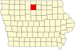 | |
| Townships | ||
| CDPs | ||
| Other unincorporated communities | ||
| Footnotes | ‡This populated place also has portions in an adjacent county or counties | |
Municipalities and communities of Winnebago County, Iowa, United States | ||
|---|---|---|
| Cities |  | |
| Townships | ||
| Unincorporated communities | ||
| Footnotes | ‡This populated place also has portions in an adjacent county or counties | |
| International | |
|---|---|
| National | |