Hines, Minnesota: Difference between revisions
Content deleted Content added
m Bot) Add coordinates_region parameter (report errors? |
add "use mdy dates" template |
||
| (18 intermediate revisions by 14 users not shown) | |||
| Line 1: | Line 1: | ||
{{short description|Unincorporated community in Minnesota, United States}} |
|||
{{Use mdy dates|date=July 2023}} |
|||
{{Infobox settlement |
{{Infobox settlement |
||
| |
|name = Hines |
||
|settlement_type = Unincorporated community |
|settlement_type = [[Unincorporated area|Unincorporated community]] |
||
|nickname = |
|nickname = |
||
|motto = |
|motto = |
||
<!-- Images --> |
<!-- Images --> |
||
| Line 10: | Line 12: | ||
|image_caption = |
|image_caption = |
||
|image_flag = |
|image_flag = |
||
|image_seal = |
|image_seal = |
||
<!-- Maps --> |
<!-- Maps --> |
||
| Line 19: | Line 21: | ||
|mapsize1 = |
|mapsize1 = |
||
|map_caption1 = |
|map_caption1 = |
||
|pushpin_map=Minnesota |
|pushpin_map=Minnesota#USA |
||
<!-- Location --> |
<!-- Location --> |
||
| ⚫ | |||
|coordinates_region = US-MN |
|||
|subdivision_name = United States |
|||
| ⚫ | |||
| |
|subdivision_type1 = [[U.S. state|State]] |
||
|subdivision_type1 = [[Political divisions of the United States|State]] |
|||
|subdivision_name1 = [[Minnesota]] |
|subdivision_name1 = [[Minnesota]] |
||
|subdivision_type2 = [[List of counties in Minnesota|County]] |
|subdivision_type2 = [[List of counties in Minnesota|County]] |
||
| Line 38: | Line 39: | ||
|leader_name1 = |
|leader_name1 = |
||
|established_title = |
|established_title = |
||
|established_date = |
|established_date = |
||
<!-- Area --> |
<!-- Area --> |
||
| Line 49: | Line 50: | ||
|area_total_sq_mi = |
|area_total_sq_mi = |
||
|area_land_sq_mi = |
|area_land_sq_mi = |
||
|area_water_sq_mi = |
|area_water_sq_mi = |
||
<!-- Population --> |
<!-- Population --> |
||
| Line 56: | Line 57: | ||
|population_total = |
|population_total = |
||
|population_density_km2 = |
|population_density_km2 = |
||
|population_density_sq_mi = |
|population_density_sq_mi = |
||
<!-- General information --> |
<!-- General information --> |
||
| Line 66: | Line 67: | ||
|elevation_m = |
|elevation_m = |
||
|elevation_ft = 896 |
|elevation_ft = 896 |
||
|coordinates = {{coord|47|41|10|N|94|37|58|W|region:US-MN|display=inline,title}} |
|||
|latd = 47 | |
|||
latm = 41 | |
|||
lats = 10 | |
|||
latNS = N | |
|||
longd = 94 | |
|||
longm = 37 | |
|||
longs = 58 | |
|||
longEW = W | |
|||
coordinates_display=% |
|||
<!-- Area/postal codes & others --> |
<!-- Area/postal codes & others --> |
||
| Line 81: | Line 74: | ||
|area_code = [[Area code 218|218]] |
|area_code = [[Area code 218|218]] |
||
|blank_name = [[Geographic Names Information System|GNIS]] feature ID |
|blank_name = [[Geographic Names Information System|GNIS]] feature ID |
||
|blank_info = 656594<ref name="GR3">{{cite web|url=http://geonames.usgs.gov|accessdate=2008-01-31|title=US Board on Geographic Names|publisher=[[United States Geological Survey]]|date=2007-10-25}}</ref> |
|||
|blank_info = 656594{{GR|3}} |
|||
|blank1_name = |
|blank1_name = |
||
|blank1_info = |
|blank1_info = |
||
| Line 88: | Line 81: | ||
}} |
}} |
||
'''Hines''' is an [[unincorporated community]] in [[Beltrami County, Minnesota|Beltrami County]], [[Minnesota]], |
'''Hines''' is an [[Unincorporated area|unincorporated community]] in [[Beltrami County, Minnesota|Beltrami County]], [[Minnesota]], United States. Hines is located on [[U.S. Route 71#Minnesota|U.S. Route 71]], {{convert|3|mi|km}} northeast of [[Tenstrike, Minnesota|Tenstrike]]. Hines has a [[post office]] with [[ZIP code]] 56647.<ref>[http://www.zipinfo.com/cgi-local/zipsrch.exe?cnty=cnty&zip=56647&Go=Go ZIP Code Lookup]</ref> |
||
Hines was named for William Hines, a lumberman.<ref>{{cite book|last=Upham|first=Warren|title=Minnesota Geographic Names: Their Origin and Historic Significance|url=https://archive.org/details/minnesotageogra00uphagoog|year=1920|publisher=Minnesota Historical Society|page=[https://archive.org/details/minnesotageogra00uphagoog/page/n56 37]}}</ref> |
|||
==References== |
==References== |
||
| Line 95: | Line 90: | ||
{{Beltrami County, Minnesota}} |
{{Beltrami County, Minnesota}} |
||
{{authority control}} |
|||
| ⚫ | |||
| ⚫ | |||
[[Category:Unincorporated communities in Minnesota]] |
[[Category:Unincorporated communities in Minnesota]] |
||
{{BeltramiCountyMN-geo-stub}} |
{{BeltramiCountyMN-geo-stub}} |
||
Latest revision as of 01:14, 26 July 2023
Hines | |
|---|---|
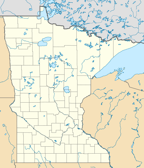 Hines  Hines | |
| Coordinates: 47°41′10″N 94°37′58″W / 47.68611°N 94.63278°W | |
| Country | United States |
| State | Minnesota |
| County | Beltrami |
| Elevation | 896 ft (273 m) |
| Time zone | UTC-6 (Central (CST)) |
| • Summer (DST) | UTC-5 (CDT) |
| ZIP code | 56647 |
| Area code | 218 |
| GNIS feature ID | 656594[1] |
Hines is an unincorporated community in Beltrami County, Minnesota, United States. Hines is located on U.S. Route 71, 3 miles (4.8 km) northeast of Tenstrike. Hines has a post office with ZIP code 56647.[2]
Hines was named for William Hines, a lumberman.[3]
References[edit]
- ^ "US Board on Geographic Names". United States Geological Survey. October 25, 2007. Retrieved January 31, 2008.
- ^ ZIP Code Lookup
- ^ Upham, Warren (1920). Minnesota Geographic Names: Their Origin and Historic Significance. Minnesota Historical Society. p. 37.
Municipalities and communities of Beltrami County, Minnesota, United States | ||
|---|---|---|
| Cities |  | |
| Townships |
| |
| CDPs | ||
| Unorganized territories | ||
| Unincorporated communities | ||
| Indian reservations | ||
| Footnotes | ‡This populated place also has portions in an adjacent county or counties | |
| International | |
|---|---|
| National | |