Küstriner Vorland: Difference between revisions
m Bot: Migrating 13 interwiki links, now provided by Wikidata on d:q258017 (Report Errors) |
mNo edit summary |
||
| (25 intermediate revisions by 20 users not shown) | |||
| Line 1: | Line 1: | ||
{{Infobox German |
{{Infobox German place |
||
| |
|image_coa = DEU Kuestrin-Kietz COA.svg |
||
|image_photo = Fort Gorgast-AT.jpg |
|image_photo = Fort Gorgast-AT.jpg |
||
|image_caption = Fort Gorgast |
|image_caption = Fort Gorgast |
||
|coordinates = {{coord|52|34|06|N|14|36|35|E|format=dms|display=inline,title}} |
|||
|lat_deg = 52 |lat_min = 34 |lat_sec = 06 |
|||
| |
|image_plan = Küstriner Vorland in MOL.png |
||
| |
|state = Brandenburg |
||
| |
|district = Märkisch-Oderland |
||
| |
|Amt = Amt Golzow |
||
| |
|elevation = 10 |
||
| |
|area = 45.97 |
||
| |
|postal_code = 15328 |
||
| |
|area_code = 033472 |
||
| |
|licence = MOL |
||
|PLZ = 15328 |
|||
|Vorwahl = 033472 |
|||
|Kfz = MOL |
|||
|Gemeindeschlüssel = 12 0 64 266 |
|Gemeindeschlüssel = 12 0 64 266 |
||
| |
|divisions = 3 [[Ortsteil]]e |
||
| ⚫ | |||
|Adresse-Verband = Seelower Straße 14<br />15328 Golzow |
|||
|mayor = Werner Finger<ref>[https://wahlen.brandenburg.de/wahlen/de/kommunalwahlen/ergebnisse/buergermeisterwahlen/ergebnisse/~12064000 Landkreis Märkisch-Oderland Wahl der Bürgermeisterin / des Bürgermeisters]. Retrieved 3 July 2024.</ref> |
|||
| ⚫ | |||
|leader_term = 2024–29 |
|||
|Bürgermeister = Bernd Korb |
|||
| |
|party = |
||
}} |
}} |
||
'''Küstriner Vorland''' is a [[Municipalities of Germany|municipality]] in the district [[Märkisch-Oderland]], in [[Brandenburg]], [[Germany]] at the border with [[Poland]]. |
'''Küstriner Vorland''' (literally "[[Kostrzyn nad Odrą|Küstrin]]'s foreland") is a [[Municipalities of Germany|municipality]] in the district [[Märkisch-Oderland]], in [[Brandenburg]], [[Germany]] at the border with [[Poland]]. |
||
==History== |
==History== |
||
It was established on January 1, 1998 by the merger of [[Küstrin-Kietz]] with the villages of Gorgast and Manschnow. Küstriner Vorland is part of the ''[[Amt (country subdivision)|Amt]]'' (" |
It was established on January 1, 1998, by the merger of [[Küstrin-Kietz]] with the villages of Gorgast and Manschnow. Küstriner Vorland is part of the ''[[Amt (country subdivision)|Amt]]'' ("collective municipality") [[Amt Golzow|Golzow]]. |
||
The settlement of Küstrin-Kietz formed the western part of [[Küstrin]] |
The settlement of Küstrin-Kietz formed the western part of [[Küstrin]] which is now Polish [[Kostrzyn nad Odrą]], until it was cut off by the implementation of the [[Oder-Neisse line]] in 1945. The town's quarters west of the [[Oder River]] then belonged to [[East Germany]] and were renamed ''Kietz'' in 1954. In a 1991 vote the inhabitants chose to readopt the historic denotation. |
||
The incorporated village of Gorgast, once a commandry of the [[Order of Saint John (Bailiwick of Brandenburg)|Order of Saint John]], features a historic [[fortification|fort]] finished in 1889 in addition to the Küstrin fortification system and a park laid out according to plans by [[Peter Joseph Lenné]]. |
The incorporated village of Gorgast, once a commandry of the [[Order of Saint John (Bailiwick of Brandenburg)|Order of Saint John]], features a historic [[fortification|fort]] finished in 1889 in addition to the Küstrin fortification system and a park laid out according to plans by [[Peter Joseph Lenné]]. |
||
==Politics== |
==Politics== |
||
Seats in the municipal |
Seats in the municipal assembly ''(Gemeinderat)'' as of 2008 elections: |
||
*''IG Küstriner Vorland'' ([[Free Voters]]): 9 |
*''IG Küstriner Vorland'' ([[Free Voters]]): 9 |
||
*[[The Left (Germany)|The Left]]: 3 |
*[[The Left (Germany)|The Left]]: 3 |
||
| Line 40: | Line 37: | ||
*[[Independent (politician)|Independent]]: 2 |
*[[Independent (politician)|Independent]]: 2 |
||
== |
==Transport== |
||
The border crossing at Küstrin-Kietz is the eastern terminus of the [[Bundesstraße 1]] federal highway from [[Aachen]] via [[Berlin]]. It is continued by the Polish [[National roads in Poland|national road]] No. 22 to [[Gorzów Wielkopolski]] and [[Elbląg]]. |
The border crossing at Küstrin-Kietz is the eastern terminus of the [[Bundesstraße 1]] federal highway from [[Aachen]] via [[Berlin]]. It is continued by the Polish [[National roads in Poland|national road]] No. 22 to [[Gorzów Wielkopolski]] and [[Elbląg]]. |
||
Küstrin-Kietz as well as Gorgast also have access to local trains running on the former [[Prussian Eastern Railway]] from [[Berlin-Lichtenberg station|Berlin-Lichtenberg]] to Kostrzyn. |
Küstrin-Kietz as well as Gorgast also have access to local trains running on the former [[Prussian Eastern Railway]] from [[Berlin-Lichtenberg station|Berlin-Lichtenberg]] to Küstrin (Kostrzyn nad Odrą). |
||
==Demography== |
|||
[[File:Bevölkerungsentwicklung Küstriner Vorland.pdf|thumb|200px|left|Development of population since 1875 within the current boundaries (Blue line: Population; Dotted line: Comparison to population development of Brandenburg state; Grey background: Time of Nazi rule; Red background: Time of communist rule)]] |
|||
{{historical populations |
|||
|align=none | cols=2 | percentages=pagr |
|||
|title = Küstriner Vorland: Population development <br>within the current boundaries (2013)<ref>Detailed data sources are to be found in the Wikimedia Commons.[http://commons.wikimedia.org/wiki/Category:Population_projection_Brandenburg Population Projection Brandenburg at Wikimedia Commons]</ref> |
|||
| 1875 | 3973 |
|||
| 1890 | 3612 |
|||
| 1910 | 2985 |
|||
| 1925 | 3464 |
|||
| 1933 | 3428 |
|||
| 1939 | 3575 |
|||
| 1946 | 3761 |
|||
| 1950 | 4293 |
|||
| 1964 | 3913 |
|||
| 1971 | 3936 |
|||
| 1981 | 3682 |
|||
| 1985 | 3658 |
|||
| 1989 | 3656 |
|||
| 1990 | 3630 |
|||
| 1991 | 3520 |
|||
| 1992 | 3481 |
|||
| 1993 | 3447 |
|||
| 1994 | 3425 |
|||
| 1995 | 3397 |
|||
| 1996 | 3357 |
|||
| 1997 | 3390 |
|||
| 1998 | 3347 |
|||
| 1999 | 3328 |
|||
| 2000 | 3303 |
|||
| 2001 | 3225 |
|||
| 2002 | 3160 |
|||
| 2003 | 3096 |
|||
| 2004 | 3022 |
|||
| 2005 | 2992 |
|||
| 2006 | 2977 |
|||
| 2007 | 2905 |
|||
| 2008 | 2873 |
|||
| 2009 | 2848 |
|||
| 2010 | 2754 |
|||
| 2011 | 2640 |
|||
| 2012 | 2606 |
|||
| 2013 | 2598 |
|||
| 2014 | 2606 |
|||
| 2015 | 2605 |
|||
| 2016 | 2546 |
|||
}} |
|||
==References== |
==References== |
||
| Line 50: | Line 95: | ||
==External links== |
==External links== |
||
{{ |
{{commons category-inline}} |
||
{{Cities and towns in Märkisch-Oderland (district)}} |
{{Cities and towns in Märkisch-Oderland (district)}} |
||
{{Authority control}} |
|||
{{DEFAULTSORT:Kustriner Vorland}} |
{{DEFAULTSORT:Kustriner Vorland}} |
||
[[Category:Localities in Märkisch-Oderland]] |
[[Category:Localities in Märkisch-Oderland]] |
||
[[ms:Küstriner Vorland]] |
|||
Latest revision as of 13:44, 3 July 2024
Küstriner Vorland | |
|---|---|
 Fort Gorgast | |
 Coat of arms | |
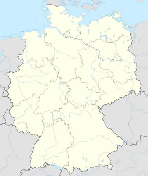
Location of Küstriner Vorland within Märkisch-Oderland district  | |
 Küstriner Vorland  Küstriner Vorland | |
| Coordinates: 52°34′06″N 14°36′35″E / 52.56833°N 14.60972°E | |
| Country | Germany |
| State | Brandenburg |
| District | Märkisch-Oderland |
| Municipal assoc. | Amt Golzow |
| Subdivisions | 3 Ortsteile |
| Government | |
| • Mayor (2024–29) | Werner Finger[1] |
| Area | |
| • Total | 45.97 km2 (17.75 sq mi) |
| Elevation | 10 m (30 ft) |
| Population (2022-12-31)[2] | |
| • Total | 2,549 |
| • Density | 55/km2 (140/sq mi) |
| Time zone | UTC+01:00 (CET) |
| • Summer (DST) | UTC+02:00 (CEST) |
| Postal codes | 15328 |
| Dialling codes | 033472 |
| Vehicle registration | MOL |
| Website | www.kuestriner-vorland.de |
Küstriner Vorland (literally "Küstrin's foreland") is a municipality in the district Märkisch-Oderland, in Brandenburg, Germany at the border with Poland.
History
[edit]It was established on January 1, 1998, by the merger of Küstrin-Kietz with the villages of Gorgast and Manschnow. Küstriner Vorland is part of the Amt ("collective municipality") Golzow.
The settlement of Küstrin-Kietz formed the western part of Küstrin which is now Polish Kostrzyn nad Odrą, until it was cut off by the implementation of the Oder-Neisse line in 1945. The town's quarters west of the Oder River then belonged to East Germany and were renamed Kietz in 1954. In a 1991 vote the inhabitants chose to readopt the historic denotation.
The incorporated village of Gorgast, once a commandry of the Order of Saint John, features a historic fort finished in 1889 in addition to the Küstrin fortification system and a park laid out according to plans by Peter Joseph Lenné.
Politics
[edit]Seats in the municipal assembly (Gemeinderat) as of 2008 elections:
- IG Küstriner Vorland (Free Voters): 9
- The Left: 3
- Pro Zukunft (Free Voters): 1
- Evangelical parish: 1
- Independent: 2
Transport
[edit]The border crossing at Küstrin-Kietz is the eastern terminus of the Bundesstraße 1 federal highway from Aachen via Berlin. It is continued by the Polish national road No. 22 to Gorzów Wielkopolski and Elbląg.
Küstrin-Kietz as well as Gorgast also have access to local trains running on the former Prussian Eastern Railway from Berlin-Lichtenberg to Küstrin (Kostrzyn nad Odrą).
Demography
[edit]
|
|
References
[edit]- ^ Landkreis Märkisch-Oderland Wahl der Bürgermeisterin / des Bürgermeisters. Retrieved 3 July 2024.
- ^ "Bevölkerungsentwicklung und Bevölkerungsstandim Land Brandenburg Dezember 2022" (PDF). Amt für Statistik Berlin-Brandenburg (in German). June 2023.
- ^ Detailed data sources are to be found in the Wikimedia Commons.Population Projection Brandenburg at Wikimedia Commons
External links
[edit] Media related to Küstriner Vorland at Wikimedia Commons
| International | |
|---|---|
| National | |