Kundapur: Difference between revisions
OrthosKral (talk | contribs) |
→Demographics: The total is 91.5 so others would be 8.5 Tags: Mobile edit Mobile web edit |
||
| (26 intermediate revisions by 21 users not shown) | |||
| Line 4: | Line 4: | ||
{{Use Indian English|date=December 2018}} |
{{Use Indian English|date=December 2018}} |
||
{{Infobox settlement |
{{Infobox settlement |
||
| official_name |
| official_name = Kundapura |
||
| native_name |
| native_name = |
||
| native_name_lang |
| native_name_lang = |
||
| settlement_type |
| settlement_type = Town |
||
| image_skyline |
| image_skyline = Coondapur.JPG |
||
| image_alt |
| image_alt = |
||
| image_caption |
| image_caption = Clockwise from top: Kundapur [[River]], Main Road, Shastri Circle, [[Coconut]] tree, [[Anegudde]] Sri Vinayaka temple, [[Kollur, Udupi district|Kollur]] Mookambika temple |
||
| nickname |
| nickname = |
||
| map_alt |
| map_alt = |
||
| map_caption |
| map_caption = |
||
| pushpin_map |
| pushpin_map = India Karnataka#India |
||
| pushpin_label_position = right |
| pushpin_label_position = right |
||
| pushpin_map_alt |
| pushpin_map_alt = |
||
| pushpin_map_caption |
| pushpin_map_caption = Kundapura Town |
||
| coordinates |
| coordinates = {{coord|13|37|42|N|74|41|20|E|display=inline,title}} |
||
| subdivision_type |
| subdivision_type = [[Country]] |
||
| subdivision_name |
| subdivision_name = {{flag|India}} |
||
| subdivision_type1 |
| subdivision_type1 = [[States and territories of India|State]] |
||
| subdivision_type2 |
| subdivision_type2 = [[List of regions of India|Region]] |
||
| subdivision_type3 |
| subdivision_type3 = [[List of districts of India|District]] |
||
| subdivision_type4 |
| subdivision_type4 = Zone |
||
| subdivision_type5 |
| subdivision_type5 = Municipality |
||
| subdivision_name1 |
| subdivision_name1 = [[Karnataka]] |
||
| subdivision_name2 |
| subdivision_name2 = [[Tulu Nadu]] |
||
| subdivision_name3 |
| subdivision_name3 = [[Udupi district|Udupi]] |
||
| subdivision_name4 |
| subdivision_name4 = |
||
| subdivision_name5 |
| subdivision_name5 = Kundapura Town Municipal Council |
||
| established_title |
| established_title = Settled |
||
| established_date |
| established_date = 1912 |
||
| founder |
| founder = |
||
| named_for |
| named_for = |
||
| government_type |
| government_type = [[Municipal corporation]] |
||
| governing_body |
| governing_body = |
||
| leader_title1 |
| leader_title1 = Councillor |
||
| leader_name1 |
| leader_name1 = |
||
| unit_pref |
| unit_pref = Metric |
||
| area_footnotes |
| area_footnotes = |
||
| area_total_km2 |
| area_total_km2 = 23.06 |
||
| area_rank |
| area_rank = |
||
| elevation_footnotes |
| elevation_footnotes = |
||
| elevation_m |
| elevation_m = 80 |
||
| population_total |
| population_total = 30,444 |
||
| population_as_of |
| population_as_of = 2011<ref>{{cite web|title=Villages & Towns in Kundapura Taluka of Udupi, Karnataka|url=http://www.census2011.co.in/data/subdistrict/5522-kundapura-udupi-karnataka.html|website=www.census2011.co.in|access-date=12 November 2016}}</ref> |
||
| population_footnotes |
| population_footnotes = |
||
| population_density_km2 = auto |
| population_density_km2 = auto |
||
| population_rank |
| population_rank = |
||
| population_demonym |
| population_demonym = |
||
| demographics_type1 |
| demographics_type1 = Languages |
||
| demographics1_title1 |
| demographics1_title1 = Official |
||
| timezone1 |
| timezone1 = [[Indian Standard Time|IST]] |
||
| utc_offset1 |
| utc_offset1 = +5:30 |
||
| postal_code_type |
| postal_code_type = [[Postal Index Number|PIN]] |
||
| postal_code |
| postal_code = 576 201 |
||
| area_code |
| area_code = 91-(0)8254 |
||
| area_code_type |
| area_code_type = Telephone code |
||
| iso_code |
| iso_code = [[ISO 3166-2:IN|IN-KA]] |
||
| registration_plate |
| registration_plate = [[List of RTO districts in India#KA.E2.80.94Karnataka|KA]]-20 |
||
| blank1_name_sec1 |
| blank1_name_sec1 = |
||
| blank1_info_sec1 |
| blank1_info_sec1 = [[Udupi]], [[Byndoor]], [[Mangalore]] |
||
| website |
| website = {{URL|www.kundapurtown.gov.in}} |
||
| footnotes |
| footnotes = |
||
| demographics1_info1 |
| demographics1_info1 = [[Kannada]] |
||
| demographics1_info2 |
| demographics1_info2 = |
||
| demographics1_title2 |
| demographics1_title2 = |
||
| leader_title2 |
| leader_title2 = Deputy Councillor |
||
| leader_name2 |
| leader_name2 = |
||
| blank2_name_sec1 |
| blank2_name_sec1 = [[Human sex ratio|Sex ratio]] |
||
| blank2_info_sec1 |
| blank2_info_sec1 = 1.09 [[male|♂]]/[[female|♀]] |
||
| blank3_name_sec1 |
| blank3_name_sec1 = Legislature type |
||
| blank3_info_sec1 |
| blank3_info_sec1 = [[Bicameralism|Bicameral]] |
||
| blank4_name_sec1 |
| blank4_name_sec1 = [[Lok Sabha]] Constituency |
||
| blank4_info_sec1 |
| blank4_info_sec1 = Udupi Loksabha Constituency (No. 15) |
||
| blank5_name_sec1 |
| blank5_name_sec1 = [[Vidhan Sabha]] Constituency |
||
| blank5_info_sec1 |
| blank5_info_sec1 = Kundapura Vidhansabha Constituency (No. 119) |
||
| name |
| name = |
||
}} |
}} |
||
''' |
'''Kundapra''', officially '''Kundapura''', is a coastal town situated in the [[Udupi district]] of the state of [[Karnataka]], India. This town was known as '''Coondapoor''' while it was part of the erstwhile [[South Canara]] district (1862–1947) of the [[Madras Presidency]] of [[British India]]. Present-day Kundapur is administered by the Kundapur Town Municipal Council and serves as the headquarters of the [[Kundapur Taluk]] of Udupi district. |
||
== History == |
== History == |
||
{{Expand section|date=July 2010}} |
{{Expand section|date=July 2010}} |
||
The name Kundapura can be traced to the Kundeshwara Temple built by Kundavarma of the [[Alupa dynasty]] who ruled the region in the 10th - 11th century, in the vicinity of the [[Panchagangavalli River]].<ref name="DH">{{cite news |last= V.R.|first= Kushal|date=7 October 2013|title=Where nature, beauty and history mingle|url=https://www.deccanherald.com/content/361696/where-nature-beauty-history-mingle.html|newspaper=Deccan Herald| access-date= 20 October 2022}}</ref> In Kundagannada language, the word "Kunda" also refers to the flower Jasmine.Where the Majority people of Kundapura grow flower Jasmine in this region which came to be called as kundapura(Land of Jasmine). |
The name Kundapura can be traced to the Kundeshwara Temple built by Kundavarma of the [[Alupa dynasty]] who ruled the region in the 10th - 11th century, in the vicinity of the [[Panchagangavalli River]].<ref name="DH">{{cite news |last= V.R.|first= Kushal|date=7 October 2013|title=Where nature, beauty and history mingle|url=https://www.deccanherald.com/content/361696/where-nature-beauty-history-mingle.html|newspaper=Deccan Herald| access-date= 20 October 2022}}</ref> In Kundagannada language, the word "Kunda" also refers to the flower Jasmine. Where the Majority people of Kundapura grow flower Jasmine in this region which came to be called as kundapura (Land of Jasmine). {{cn|date=December 2023}} |
||
== Geography == |
== Geography == |
||
Kundapura is surrounded by water from three sides. To the north lies the [[Panchagangavalli River]]. To the east lies the Kalaghar river. To the west lie the [[Kodi, India|Kodi]] [[Backwater (river)|backwaters]] sea walk and the [[Arabian Sea]], leaving the south side as the main connecting land mass. All connecting roads to Kundapura enter the city from the southern direction. North side of the town is vast backwaters of Panchagangavali river and a bridge has been constructed across it.{{citation needed|date=April 2022}} |
Kundapura is surrounded by water from three sides. To the north lies the [[Panchagangavalli River]]. To the east lies the Kalaghar river. To the west lie the [[Kodi, India|Kodi]] [[Backwater (river)|backwaters]] sea walk and the [[Arabian Sea]], leaving the south side as the main connecting land mass. All connecting roads to Kundapura enter the city from the southern direction. North side of the town is vast backwaters of Panchagangavali river and a bridge has been constructed across it.{{citation needed|date=April 2022}} |
||
<!--History of Kundapur is linked to Basruru, the port town {{convert|6|km|mi|abbr=on}} away. Basuru was a trading centre which had sea route contacts with the Middle East. Merchant ships from Muscat and other places used to come here during 14–16th century to collect pepper, good quality rice. Bigger ships used to travel up to Basruru, in those days, and now the river has filled up with silt. Basrur was a well-planned town with major amenities available in those days. Several streets named after weavers, business, music etc. are still available in Basruru, which is reduced to a small village during the 20th century. It was the principal port of the Rajas of Baindoor who came to prominence after the decline of the [[Vijayanagara]] power. The Portuguese and German missionaries settled here in the 16th century and built a [[fort]]. Later Kundapur, which is nearer to shore also started drawing attention. A well-built redoubt constructed by [[Hyder Ali]] commands the entrance to the river. After the fall of [[Tipu Sultan]] in 1799, the town was taken over by the British. During British Raj, people of Kundapur also participated in the call for independence given by Gandhiji and other leaders.--> |
<!--History of Kundapur is linked to Basruru, the port town {{convert|6|km|mi|abbr=on}} away. Basuru was a trading centre which had sea route contacts with the Middle East. Merchant ships from Muscat and other places used to come here during 14–16th century to collect pepper, good quality rice. Bigger ships used to travel up to Basruru, in those days, and now the river has filled up with silt. Basrur was a well-planned town with major amenities available in those days. Several streets named after weavers, business, music etc. are still available in Basruru, which is reduced to a small village during the 20th century. It was the principal port of the Rajas of Baindoor who came to prominence after the decline of the [[Vijayanagara]] power. The Portuguese and German missionaries settled here in the 16th century and built a [[fort]]. Later Kundapur, which is nearer to shore also started drawing attention. A well-built redoubt constructed by [[Hyder Ali]] commands the entrance to the river. After the fall of [[Tipu Sultan]] in 1799, the town was taken over by the British. During British Raj, people of Kundapur also participated in the call for independence given by Gandhiji and other leaders.--> |
||
== Language == |
|||
{{unreferenced section|date=March 2019}} |
|||
[[Kundagannada dialect|Kundagannada]], [[Tulu language|Tulu]], [[Malayalam]], [[Konkani language|Konkani]] and [[Urdu]] are spoken by the residents of Kundapur. |
|||
== Demographics == |
== Demographics == |
||
{{As of|2011|alt=As of the 2011}} India [[census]],<ref name="censusindia">{{cite web|url=https://censusindia.gov.in/census.website/data/population-finder| |
{{As of|2011|alt=As of the 2011}} India [[census]],<ref name="censusindia">{{cite web |title=Population Finder 2011 |url=https://censusindia.gov.in/census.website/data/population-finder |accessdate=2022-10-19 |publisher=Registrar General & Census Commissioner, India}}</ref> |
||
* Kundapur has a population of 30,444. |
* Kundapur Town has a population of 30,444. |
||
* Kundapur Taluk has a population of 398,471 |
|||
* Males constitute 49% of the population and females 51%. |
* Males constitute 49% of the population and females 51%. |
||
* Literate population was 25,191, with a [[Literacy|Literacy rate]] of 82%, higher than the national average of 59.5%. |
* Literate population was 25,191, with a [[Literacy|Literacy rate]] of 82%, higher than the national average of 59.5%. |
||
{{Pie chart |
{{Pie chart |
||
| thumb = right |
| thumb = right |
||
| caption = Languages of Kundapur |
| caption = Languages of Kundapur TMC (2011)<ref name="language">{{Cite web |title=Table C-16 Population by Mother Tongue: Karnataka (Urban)|url=https://censusindia.gov.in/nada/index.php/catalog/10255/download/13367/DDW-C16-TOWN-STMT-MDDS-2900.XLSX|website=[[Census of India]] |publisher=[[Registrar General and Census Commissioner of India]]}}</ref> |
||
|label1 = [[Kannada]] |value1 = |
|label1 = [[Kannada]] |value1 = 63.4 |color1 = darkslateblue |
||
|label2 = [[Konkani]] |value2 = |
|label2 = [[Konkani language|Konkani]] |value2 = 22.9 |color2 = salmon |
||
|label3 = [[Urdu]] |value3 = |
|label3 = [[Urdu]] |value3 = 4.3 |color3 = green |
||
|label4 = [[Malayalam]] |value4 = |
|label4 = [[Malayalam]] |value4 =1.7 |color4 = cornflowerblue |
||
|label5 = [[ |
|label5 = [[Tulu language|Tulu]] |value5 = 1.2|color5 = red |
||
|label6 = Others |value6 = |
|label6 = Others |value6 = 8.5 |color6 = grey |
||
}} |
}} |
||
== Transport == |
== Transport == |
||
{{unreferenced section|date=March 2019}} |
{{unreferenced section|date=March 2019}} |
||
Kundapur is connected to other parts of the country by [[National Highway 66 (India)|NH66]]. SH52 is a [[State highway|State Highway]] that connects to Shimoga District. This Highway connects cities and towns of different states. Kundapur is also connected to the [[Konkan Railway]], which runs from [[Mumbai]] to [[ |
Kundapur is connected to other parts of the country by [[National Highway 66 (India)|NH66]]. SH52 is a [[State highway|State Highway]] that connects to Shimoga District. This Highway connects cities and towns of different states. Kundapur is also connected to the [[Konkan Railway]], which runs from [[Mumbai]] to [[Mangaluru]]. The railway station is about {{convert|4|km|mi}} from the town. The nearest airport is [[Mangaluru International Airport]], at [[Bajpe]] around {{convert|87|km|mi}} from Kundapur. |
||
[[Kundapura railway station]], along the [[Konkan Railway]], is used by [[Kerala]] pilgrims who visit [[Mookambika Temple, Kollur|Kolluru Mookambika Temple]] |
[[Kundapura railway station]], along the [[Konkan Railway]], is used by [[Kerala]] pilgrims who visit [[Mookambika Temple, Kollur|Kolluru Mookambika Temple]] |
||
Kundapur is located at a distance of {{cvt|38|km}} from [[Udupi]], {{cvt|40|km}} from [[Manipal]], {{cvt|30|km}} from [[Byndoor]], {{cvt|54|km}} [[Bhatkal]], {{cvt|91|km}} from [[ |
Kundapur is located at a distance of {{cvt|38|km}} from [[Udupi]], {{cvt|40|km}} from [[Manipal]], {{cvt|30|km}} from [[Byndoor]], {{cvt|54|km}} [[Bhatkal]], {{cvt|91|km}} from [[Mangaluru]] and {{cvt|181|km}} from [[Karwar]], which are the other major cities/towns in Coastal Karnataka. |
||
There are private local buses and some out of town is serviced by government owned buses. Buses can be found for Udupi and |
There are private local buses and some out of town is serviced by government owned buses. Buses can be found for Udupi and Mangaluru, and there are multiple bus stands. The main bus stand where the buses to Udupi and Mangaluru are available is called "New bus stand", is near the police station. Another frequently used mode of transportation is auto rikshaw. |
||
== Notable people == |
== Notable people == |
||
| Line 127: | Line 123: | ||
<!---♦♦♦ Only add a person to this list if they already have their own article on the English Wikipedia ♦♦♦---> |
<!---♦♦♦ Only add a person to this list if they already have their own article on the English Wikipedia ♦♦♦---> |
||
<!---♦♦♦ Please keep the list in alphabetical order by LAST NAME ♦♦♦---> |
<!---♦♦♦ Please keep the list in alphabetical order by LAST NAME ♦♦♦---> |
||
{{Div col|colwidth= |
{{Div col|colwidth=15em}} |
||
* [[Prakash Padukone]] |
* [[Prakash Padukone]] |
||
* [[Deepika Padukone]] |
* [[Deepika Padukone]] |
||
| Line 141: | Line 137: | ||
* [[Vaidehi (Kannada writer)|Vaidehi]] |
* [[Vaidehi (Kannada writer)|Vaidehi]] |
||
* [[Sanchita Padukone]] |
* [[Sanchita Padukone]] |
||
* [[Satish Acharya]] |
|||
{{Div col end}} |
{{Div col end}} |
||
<!---♦♦♦ Only add a person to this list if they already have their own article on the English Wikipedia ♦♦♦---> |
<!---♦♦♦ Only add a person to this list if they already have their own article on the English Wikipedia ♦♦♦---> |
||
| Line 147: | Line 144: | ||
== References == |
== References == |
||
{{Commons category|Kundapura}} |
{{Commons category|Kundapura}} |
||
<ref>{{cite web |author=Jaideep Shenoy |title=Karnataka: Vijayanagara period inscription found in Kundapur |url=https://timesofindia.indiatimes.com/city/mysuru/karnataka-vijayanagara-period-inscription-found-in-kundapura-taluk/articleshow/74564881.cms |date=Mar 10, 2020}}</ref> |
|||
{{Wikivoyage|Kundapur}} |
|||
{{Reflist}} |
{{Reflist}} |
||
Revision as of 17:09, 2 September 2024
This article may be in need of reorganization to comply with Wikipedia's layout guidelines. (October 2013) |
Kundapura | |
|---|---|
Town | |
 | |
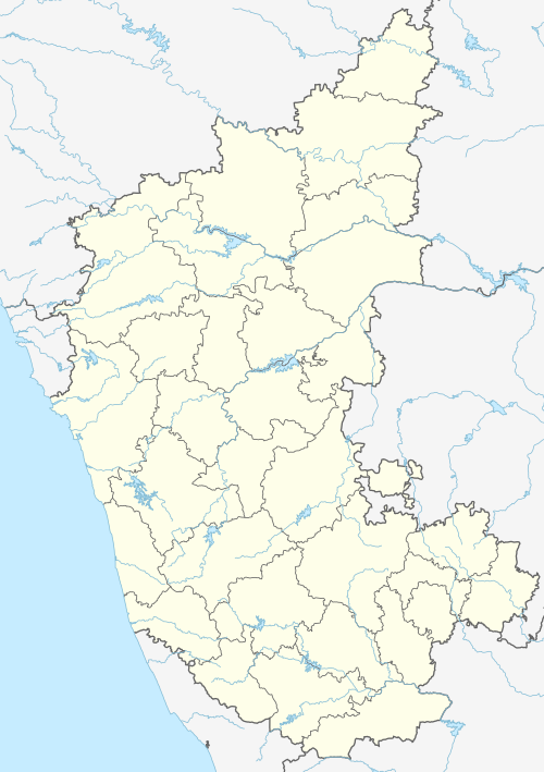 Kundapura Kundapura Town  Kundapura Kundapura (India) | |
| Coordinates: 13°37′42″N 74°41′20″E / 13.62833°N 74.68889°E | |
| Country | |
| State | Karnataka |
| Region | Tulu Nadu |
| District | Udupi |
| Municipality | Kundapura Town Municipal Council |
| Settled | 1912 |
| Government | |
| • Type | Municipal corporation |
| Area | |
| • Total | 23.06 km2 (8.90 sq mi) |
| Elevation | 80 m (260 ft) |
| Population (2011[1]) | |
| • Total | 30,444 |
| • Density | 1,300/km2 (3,400/sq mi) |
| Languages | |
| • Official | Kannada |
| Time zone | UTC+5:30 (IST) |
| PIN | 576 201 |
| Telephone code | 91-(0)8254 |
| ISO 3166 code | IN-KA |
| Vehicle registration | KA-20 |
| Sex ratio | 1.09 ♂/♀ |
| Legislature type | Bicameral |
| Lok Sabha Constituency | Udupi Loksabha Constituency (No. 15) |
| Vidhan Sabha Constituency | Kundapura Vidhansabha Constituency (No. 119) |
| Website | www |
Kundapra, officially Kundapura, is a coastal town situated in the Udupi district of the state of Karnataka, India. This town was known as Coondapoor while it was part of the erstwhile South Canara district (1862–1947) of the Madras Presidency of British India. Present-day Kundapur is administered by the Kundapur Town Municipal Council and serves as the headquarters of the Kundapur Taluk of Udupi district.
History
This section needs expansion. You can help by adding to it. (July 2010) |
The name Kundapura can be traced to the Kundeshwara Temple built by Kundavarma of the Alupa dynasty who ruled the region in the 10th - 11th century, in the vicinity of the Panchagangavalli River.[2] In Kundagannada language, the word "Kunda" also refers to the flower Jasmine. Where the Majority people of Kundapura grow flower Jasmine in this region which came to be called as kundapura (Land of Jasmine). [citation needed]
Geography
Kundapura is surrounded by water from three sides. To the north lies the Panchagangavalli River. To the east lies the Kalaghar river. To the west lie the Kodi backwaters sea walk and the Arabian Sea, leaving the south side as the main connecting land mass. All connecting roads to Kundapura enter the city from the southern direction. North side of the town is vast backwaters of Panchagangavali river and a bridge has been constructed across it.[citation needed]
Demographics
As of the 2011[update] India census,[3]
- Kundapur Town has a population of 30,444.
- Kundapur Taluk has a population of 398,471
- Males constitute 49% of the population and females 51%.
- Literate population was 25,191, with a Literacy rate of 82%, higher than the national average of 59.5%.
Transport
Kundapur is connected to other parts of the country by NH66. SH52 is a State Highway that connects to Shimoga District. This Highway connects cities and towns of different states. Kundapur is also connected to the Konkan Railway, which runs from Mumbai to Mangaluru. The railway station is about 4 kilometres (2.5 mi) from the town. The nearest airport is Mangaluru International Airport, at Bajpe around 87 kilometres (54 mi) from Kundapur.
Kundapura railway station, along the Konkan Railway, is used by Kerala pilgrims who visit Kolluru Mookambika Temple
Kundapur is located at a distance of 38 km (24 mi) from Udupi, 40 km (25 mi) from Manipal, 30 km (19 mi) from Byndoor, 54 km (34 mi) Bhatkal, 91 km (57 mi) from Mangaluru and 181 km (112 mi) from Karwar, which are the other major cities/towns in Coastal Karnataka.
There are private local buses and some out of town is serviced by government owned buses. Buses can be found for Udupi and Mangaluru, and there are multiple bus stands. The main bus stand where the buses to Udupi and Mangaluru are available is called "New bus stand", is near the police station. Another frequently used mode of transportation is auto rikshaw.
Notable people
This article's list of people may not follow Wikipedia's verifiability policy. (October 2020) |
References
- ^ "Villages & Towns in Kundapura Taluka of Udupi, Karnataka". www.census2011.co.in. Retrieved 12 November 2016.
- ^ V.R., Kushal (7 October 2013). "Where nature, beauty and history mingle". Deccan Herald. Retrieved 20 October 2022.
- ^ "Population Finder 2011". Registrar General & Census Commissioner, India. Retrieved 19 October 2022.
- ^ "Table C-16 Population by Mother Tongue: Karnataka (Urban)". Census of India. Registrar General and Census Commissioner of India.
- ^ Jaideep Shenoy (10 March 2020). "Karnataka: Vijayanagara period inscription found in Kundapur".
| Taluks | |
|---|---|
| Places |
|
| Temples | |
| Udupi cuisines | |
| Society | |
| Beaches | |
| International | |
|---|---|
| National | |