Kalikapur Barasat: Difference between revisions
Tags: Mobile edit Mobile web edit |
Added link |
||
| (37 intermediate revisions by 9 users not shown) | |||
| Line 22: | Line 22: | ||
| subdivision_name = {{flag|India}} |
| subdivision_name = {{flag|India}} |
||
| subdivision_type1 = State |
| subdivision_type1 = State |
||
| subdivision_name1 = [[West Bengal]] |
| subdivision_name1 = {{flagicon image|..West Bengal Flag(INDIA).png}} [[West Bengal]] |
||
| subdivision_type2 = District |
| subdivision_type2 = District |
||
| subdivision_name2 = [[South 24 Parganas]] |
| subdivision_name2 = [[South 24 Parganas]] |
||
| subdivision_type3 = CD |
| subdivision_type3 = CD block |
||
| subdivision_name3 = [[Jaynagar I]] |
| subdivision_name3 = [[Jaynagar I]] |
||
| established_title = <!-- Established --> |
| established_title = <!-- Established --> |
||
| Line 47: | Line 47: | ||
| demographics_type1 = Languages |
| demographics_type1 = Languages |
||
| demographics1_title1 = Official |
| demographics1_title1 = Official |
||
| demographics1_info1 = [[Bengali language|Bengali]]<ref name="wblangoff">{{cite web|title=Fact and Figures|url=https://wb.gov.in/portal/web/guest/facts-and-figures;jsessionid=JzdD9RHb7aMY5esZPtcsIVLy|website=Wb.gov.in|access-date=5 July 2019}}</ref><ref>{{cite web|title=52nd REPORT OF THE COMMISSIONER FOR LINGUISTIC MINORITIES IN INDIA|url=http://nclm.nic.in/shared/linkimages/NCLM52ndReport.pdf|website=Nclm.nic.in|publisher=[[Ministry of Minority Affairs]]|access-date=5 July 2019|page=85|url-status=dead|archive-url=https://web.archive.org/web/20170525141614/http://nclm.nic.in/shared/linkimages/NCLM52ndReport.pdf|archive-date=25 May 2017}}</ref> |
|||
| demographics1_info1 = [[Bengali language|Bengali]], [[English language|English]] |
|||
| demographics1_title2 = Additional official |
|||
| demographics1_info2 = [[English language|English]]<ref name="wblangoff"/> |
|||
| timezone1 = [[Indian Standard Time|IST]] |
| timezone1 = [[Indian Standard Time|IST]] |
||
| utc_offset1 = +5:30 |
| utc_offset1 = +5:30 |
||
| Line 54: | Line 56: | ||
| area_code_type = Telephone code |
| area_code_type = Telephone code |
||
| area_code = +91 3218 |
| area_code = +91 3218 |
||
| registration_plate = |
| registration_plate = [[List of Regional Transport Office districts in India#WB.E2.80.94West Bengal|WB]]-19 to [[List of Regional Transport Office districts in India#WB.E2.80.94West Bengal|WB]]-22, [[List of Regional Transport Office districts in India#WB.E2.80.94West Bengal|WB]]-95 to [[List of Regional Transport Office districts in India#WB.E2.80.94West Bengal|WB]]-99 |
||
| blank1_name_sec1 = Lok Sabha constituency |
| blank1_name_sec1 = Lok Sabha constituency |
||
| blank1_info_sec1 = [[Jaynagar (Lok Sabha constituency)|Jaynagar (SC)]] |
| blank1_info_sec1 = [[Jaynagar (Lok Sabha constituency)|Jaynagar (SC)]] |
||
| Line 63: | Line 65: | ||
}} |
}} |
||
'''Kalikapur Barasat''' is a [[census town]] |
'''Kalikapur Barasat''' is a [[census town]] within the jurisdiction of the [[Jaynagar Majilpur]] police station in the [[Jaynagar I]] [[Community development block in India|CD block]] in the [[Baruipur subdivision]] of the [[South 24 Parganas]] district in the [[India]]n [[States and territories of India|state]] of [[West Bengal]]. |
||
==Geography== |
==Geography== |
||
{{OSM Location map |
|||
| width=310| height=450| zoom=10 |
|||
| coord={{coord|22|10|0|N|88|30|0|E}}| float=left|caption='''Cities and towns in the southern part of Baruipur subdivision (including Baruipur, Jaynagar I & II, Kultali CD blocks) in South 24 Parganas district'''<br/>M: municipal city/ town, CT: census town, R: rural/ urban centre, N: neighbourhood, H: historical place/ religious centre<br/>Places linked with coastal activity are marked in blue<br/>Owing to space constraints in the small map, the actual locations in a larger map may vary slightly |
|||
|mark-coord1={{coord|22|25|25|N|88|26|56|E}} | label-pos1=left|label1= Petua| numbered1=CT| mark-title1= [[Petua]] (CT)|label-color1= #800000 |label-size1=11| mark-size1=12|shape1=l-circle|shape-color1=#A40000|shape-outline1=white|label-offset-x1=2 |
|||
|mark-coord2={{coord|22|24|9|N|88|28|14|E}} | label-pos2=right|label2=Garia | numbered2=CT| mark-title2= [[Garia, Baruipur]] (CT) |
|||
|mark-coord3={{coord|22|24|45|N|88|27|0|E}} | label-pos3=left|label3=Panchghara | numbered3=CT| mark-title3= [[Panchghara, Baruipur]] (CT) |
|||
|mark-coord4={{coord|22|24|0|N|88|25|41|E}} | label-pos4=left|label4=Mallikpur | numbered4=CT| mark-title4= [[Mallikpur]] (CT) |
|||
|mark-coord5={{coord|22|23|20|N|88|26|38|E}} | label-pos5=left|label5=Hariharpur | numbered5=CT| mark-title5= [[Hariharpur, Baruipur]] (CT) |
|||
|mark-coord6={{coord|22|24|55|N|88|29|37|E}} | label-pos6=right|label6=Champahati | numbered6=CT| mark-title6= [[Champahati]] (CT) |
|||
|mark-coord7={{coord|22|23|50|N|88|31|55|E}} | label-pos7=right|label7=Solgohalia| numbered7=CT| mark-title7= [[Solgohalia]] (CT) |
|||
|mark-coord8={{coord|22|23|0|N|88|28|50|E}} | label-pos8=right|label8=Naridana| numbered8=CT| mark-title8= [[Naridana]] (CT) |
|||
|mark-coord9={{coord|22|21|20|N|88|26|37|E}} | label-pos9=right|label9=Baruipur (CT)| numbered9=CT| mark-title9= [[Baruipur (CT)]] |
|||
|mark-coord10={{coord|22|22|35|N|88|25|46|E}} | label-pos10=left|label10=Salipur| numbered10=CT| mark-title10= [[Salipur, Baruipur]] (CT) |
|||
|mark-coord11={{coord|22|21|5|N|88|25|37|E}} | label-pos11=left|label11=Khodar Bazar| numbered11=CT| mark-title11= [[Khodar Bazar]] (CT) |
|||
|mark-coord12={{coord|22|19|8|N|88|27|13|E}} | label-pos12=right|label12=Komarhat| numbered12=CT| mark-title12= [[Komarhat]] (CT) |
|||
|mark-coord13={{coord|22|22|10|N|88|26|30|E}} | label-pos13=right|label13=Baruipur| numbered13=M| mark-title13= [[Baruipur]] (M) |shape-color13=#800000 |
|||
|mark-coord14={{coord|22|13|30|N|88|27|50|E}} | label-pos14=right|label14=Raynagar| numbered14=CT| mark-title14= [[Raynagar]] (CT) |
|||
|mark-coord15={{coord|22|13|20|N|88|27|10|E}} | label-pos15=left|label15=Kalikapur Barasat| numbered15=CT| mark-title15= Kalikapur Barasat (CT)|shape-color15=black| label-size15=13|label-color15=black <!-- make the subject of the article stand out with black colors --> |
|||
|mark-coord16={{coord|22|12|20|N|88|25|50|E}} | label-pos16=left|label16=Baharu| numbered16=CT| mark-title16= [[Baharu]] (CT) |
|||
|mark-coord17={{coord|22|12|20|N|88|27|0|E}} | label-pos17=right|label17=Uttarparanij| numbered17=CT| mark-title17= [[Uttarparanij]] (CT) |
|||
|mark-coord18={{coord|22|11|45|N|88|25|46|E}} | label-pos18=left|label18=Alipur| numbered18=CT| mark-title18= [[Alipur, Jaynagar]] (CT) |
|||
|mark-coord19={{coord|22|11|15|N|88|25|50|E}} | label-pos19=right|label19=Uttar Durgapur| numbered19=CT| mark-title19= [[Uttar Durgapur]] (CT) |
|||
|mark-coord20={{coord|22|10|25|N|88|25|32|E}} | label-pos20=right|label20=Jaynagar Majilpur| numbered20=M| mark-title20= [[Jaynagar Majilpur]] (M) |shape-color120=#800000 |
|||
|mark-coord21={{coord|22|14|5|N|88|27|10|E}} | label-pos21=left|label21= Dakshin Barasat| numbered21=N| mark-title21=[[Dakshin Barasat]] (N)|shape-color21=#C42222 |
|||
|mark-coord22={{coord|22|9|10|N|88|26|23|E}} | label-pos22=bottom|label22=Nimpith| numbered22=CT| mark-title22= [[Nimpith]] (CT) |
|||
|mark-coord23={{coord|22|9|8|N|88|27|26|E}} | label-pos23=right|label23=Tulshighata| numbered23=CT| mark-title23= [[Tulshighata]] (CT) |
|||
|mark-coord24={{coord|22|5|11|N|88|35|37|E}} | label-pos24=right|label24= Kultali| numbered24=R| mark-title24= [[Kultali]] (R)|shape-color24=#C42222 |
|||
|mark-coord25={{coord|21|55|17|N|88|32|40|E}} | label-pos25=right|label25= Maipit| numbered25=R| mark-title25= [[Maipit]] (R)|shape-color25=#0048BA |
|||
|mark-coord26={{coord|22|6|59|N|88|34|13|E}} | label-pos26=right|label26= Jamtala| numbered26=R| mark-title26= [[Jamtala]] (R)||shape-color26=#C42222 |
|||
|mark-coord27={{coord|22|14|48|N|88|32|48|E}} | label-pos27=left|label27=Dhosa| numbered27=H| mark-title27= [[Dhosa, Jaynagar]] (H)| shape-color27=#AA6666 |
|||
|mark-coord28={{coord|22|14|16|N|88|33|41|E}} | label-pos28=right|label28=Tilpi| numbered28=H| mark-title28= [[Tilpi]] (H)| shape-color28=#AA6666 |
|||
|mark-coord29={{coord|22|14|50|N|88|26|47|E}} | label-pos29=left|label29= Padmerhat| numbered29=R| mark-title29= [[Padmerhat]] (R)||shape-color29=#C42222 |
|||
|mark-coord30={{coord|22|0|35|N|88|38|40|E}} |label30= Matla River| label-color30 = #77A1CB| label-angle30=-65| label-pos30=top| label-size30=10| mark-size30=0| mark-title30 =none}} |
|||
===Area overview=== |
|||
Baruipur subdivision is a rural subdivision with moderate levels of urbanization. 31.05% of the population lives in the urban areas and 68.95% lives in the rural areas. In the southern portion of the subdivision (shown in the map alongside) there are 20 [[census town]]s. The entire district is situated in the [[Ganges Delta]] and the southern part is covered by the Baruipur-Jaynagar Plain. [[Archaeological]] excavations at [[Dhosa, Jaynagar|Dhosa]] and [[Tilpi]], on the bank of the [[Piyali River]] indicate the existence of human habitation around 2,000 years ago.<ref>{{cite web |url = http://wbpspm.gov.in/publications/District%20Statistical%20Handbook |title = District Statistical Handbook 2014 South Twety-four Parganas|work= Table 2.1 , 2.2, 2.4b |publisher = Department of Statistics and Programme Implementation, Government of West Bengal |access-date = 5 December 2019 }}</ref><ref>{{cite web | url = http://censusindia.gov.in/2011census/dchb/DCHB_A/19/1917_PART_A_DCHB_SOUTH%20TWENTY%20FOUR%20PARGANAS.pdf| title = Census of India 2011, West Bengal, District Census Handbook, South Twentyfour Parganas, Series – 20, Part XII-A, Village and Town Directory |work= Page 13, Physiography| publisher = Directorate of Census Operations, West Bengal |access-date = 5 December 2019}}</ref><ref>{{cite web | url = http://wbplan.gov.in/HumanDev/DHDR/24%20pgsSouth/s24prg_main.htm | title = District Human Development Report: South 24 Parganas | work = Chapter 9: Sundarbans and the Remote Islanders, p 290-311 | publisher = Development & Planning Department, Government of West Bengal, 2009 | access-date = 5 December 2019 | archive-url = https://web.archive.org/web/20161005044029/http://wbplan.gov.in/HumanDev/DHDR/24%20pgsSouth/s24prg_main.htm | archive-date = 5 October 2016 | url-status = dead }}</ref> |
|||
<small>Note: The map alongside presents some of the notable locations in the subdivision. All places marked in the map are linked in the larger full screen map.</small> |
|||
===Location=== |
|||
Kalikapur Barasat is located at {{coord|22.2206|N|88.4464|E|format=dms}}. It has an average elevation of {{convert|8|m}}. |
Kalikapur Barasat is located at {{coord|22.2206|N|88.4464|E|format=dms}}. It has an average elevation of {{convert|8|m}}. |
||
[[Raynagar]], Kalikapur Barasat, [[Baharu]], [[Uttarparanij]], [[Alipur, Jaynagar|Alipur]] and [[Uttar Durgapur]], all in the Jaynagar I CD block, are adjacent to [[Jaynagar Majilpur]]. [[Nimpith]] and [[Tulshighata]], both in the Jaynagar II CD block, are very close to Jaynagar Majilpur. These nine locations (eight census towns and a municipal city) virtually form a cluster.<ref>{{cite web | url = http://censusindia.gov.in/2011census/dchb/DCHB_A/19/1917_PART_A_DCHB_SOUTH%20TWENTY%20FOUR%20PARGANAS.pdf| title = Census of India 2011, West Bengal, District Census Handbook, South Twentyfour Parganas, Series – 20, Part XII-A, Village and Town Directory |work= Page 699 - Map of Jaynagar I CD block, Page 725 – Map of Jaynagar II CD block | publisher = Directorate of Census Operations, West Bengal |access-date = 30 November 2019}}</ref> |
|||
==Demographics== |
==Demographics== |
||
According to the [[2011 Census of India]], Kalikapur Barasat had a total population of 6,104, of which 3,103 (51%) were males and 3,001 (49%) were females. There were 502 persons in the age range of 0–6 years. The total number of literate persons in Kalikapur Barasat was 4,999 (89.24% of the population above 6 years).<ref name=census2011>{{cite web| url = http://censusindia.gov.in/pca/cdb_pca_census/Houselisting-housing-WB.html |title = CD block Wise Primary Census Abstract Data(PCA) | work= West Bengal – District-wise CD blocks|publisher= Registrar General and Census Commissioner, India | access-date = 21 October 2019}}</ref> |
|||
==Infrastructure== |
|||
According to the District Census Handbook 2011, Kalikapur Barasat covered an area of 1.3994 km<sup>2</sup>. Among the physical aspects, there is a railway station at [[Dakshin Barasat railway station|Dakshin Barasat]] 0.5 km away. Among the civic amenities, it had 5 km roads with open drains, the protected water supply involved tank, pond, lake, hand pumps. It had 593 domestic electric connections, 18 road light points. Among the medical facilities it had 1 family welfare centre in the town and a nursing home 0.5 km away. Among the educational facilities it had was 1 primary school, the nearest middle school, secondary school, senior secondary school at Barasat 0.5 km away. It had the branch of 1 nationalised bank.<ref>{{cite web | url =http://censusindia.gov.in/2011census/dchb/DCHB_A/19/1917_PART_A_DCHB_SOUTH%20TWENTY%20FOUR%20PARGANAS.pdf | title = District Census Handbook South Twenty Four Parganas, Census of India 2011, Series 20, Part XII A | work= Section II Town Directory, Pages 999-1006 Statement I: Status and Growth History, Pages 1006-1010; Statement II: Physical Aspects and Location of Towns, Pages 1010-1015; Statement III: Civic and other Amenities, Pages 1015-1019; Statement IV: Medical Facilities 2009, Pages 1019-1027 Statement V: Educational, Recreational and Cultural Facilities, Pages 1027- 1029:Statement VI:Industry and Banking | publisher = Directorate of Census Operations V, West Bengal |access-date = 28 November 2019}}</ref> |
|||
==Transport== |
==Transport== |
||
Kalikapur Barasat is on [[State Highway 1 (West Bengal)|State Highway 1]].<ref name="google">Google maps</ref> |
Kalikapur Barasat is on the [[State Highway 1 (West Bengal)|State Highway 1]].<ref name="google">Google maps</ref> |
||
[[Dakshin Barasat railway station]] is located nearby.<ref name="google"/> |
[[Dakshin Barasat railway station]] is located nearby.<ref name="google"/> |
||
==Healthcare== |
|||
Padmerhat Rural Hospital, with 30 beds, at [[Padmerhat]], is the major government medical facility in the Jaynagar I CD block.<ref>{{cite web | url =https://www.wbhealth.gov.in/other_files/RH.pdf | title = Health & Family Welfare Department | work= Health Statistics – Rural Hospitals | publisher = Government of West Bengal |access-date = 29 November 2019}}</ref> |
|||
==References== |
==References== |
||
{{Reflist}} |
{{Reflist|3}} |
||
{{South 24 Parganas}} |
{{South 24 Parganas}} |
||
{{South 24 Parganas topics}} |
{{South 24 Parganas topics}} |
||
{{Neighbourhoods in South Kolkata}} |
|||
{{Kolkata neighbourhoods}} |
|||
{{Municipalities of West Bengal}} |
|||
[[Category:Cities and towns in South 24 Parganas district]] |
[[Category:Cities and towns in South 24 Parganas district]] |
||
[[Category:Neighbourhoods in |
[[Category:Neighbourhoods in Jaynagar Majilpur]] |
||
[[Category:Kolkata Metropolitan Area]] |
[[Category:Kolkata Metropolitan Area]] |
||
{{WestBengal-geo-stub}} |
|||
Latest revision as of 14:54, 10 September 2023
Kalikapur Barasat | |
|---|---|
Census Town | |
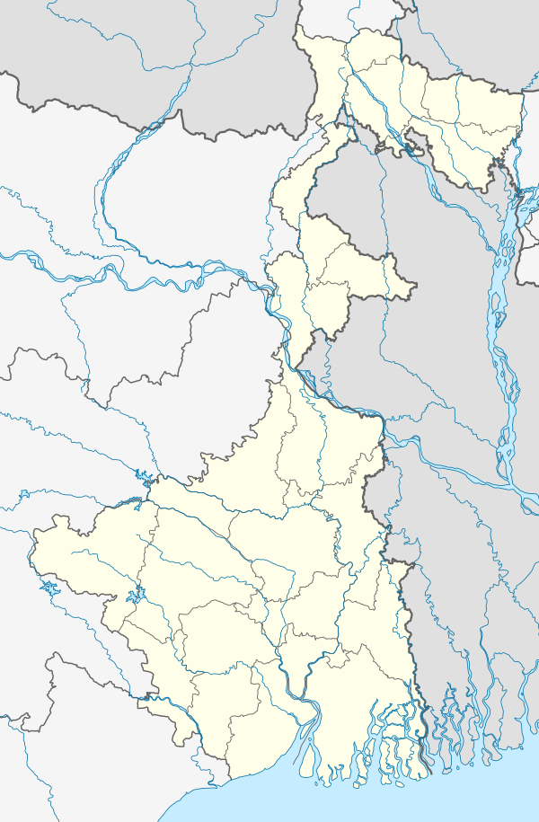 Kalikapur Barasat Location in West Bengal 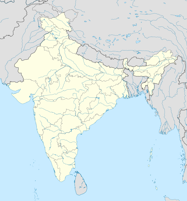 Kalikapur Barasat Location in India | |
| Coordinates: 22°13′14″N 88°26′47″E / 22.2206°N 88.4464°E | |
| Country | |
| State | |
| District | South 24 Parganas |
| CD block | Jaynagar I |
| Area | |
| • Total | 1.40 km2 (0.54 sq mi) |
| Elevation | 8 m (26 ft) |
| Population (2011) | |
| • Total | 6,104 |
| • Density | 4,400/km2 (11,000/sq mi) |
| Languages | |
| • Official | Bengali[1][2] |
| • Additional official | English[1] |
| Time zone | UTC+5:30 (IST) |
| PIN | 743372 |
| Telephone code | +91 3218 |
| Vehicle registration | WB-19 to WB-22, WB-95 to WB-99 |
| Lok Sabha constituency | Jaynagar (SC) |
| Vidhan Sabha constituency | Jaynagar (SC) |
| Website | www |
Kalikapur Barasat is a census town within the jurisdiction of the Jaynagar Majilpur police station in the Jaynagar I CD block in the Baruipur subdivision of the South 24 Parganas district in the Indian state of West Bengal.
Geography
[edit]
5miles
M: municipal city/ town, CT: census town, R: rural/ urban centre, N: neighbourhood, H: historical place/ religious centre
Places linked with coastal activity are marked in blue
Owing to space constraints in the small map, the actual locations in a larger map may vary slightly
Area overview
[edit]Baruipur subdivision is a rural subdivision with moderate levels of urbanization. 31.05% of the population lives in the urban areas and 68.95% lives in the rural areas. In the southern portion of the subdivision (shown in the map alongside) there are 20 census towns. The entire district is situated in the Ganges Delta and the southern part is covered by the Baruipur-Jaynagar Plain. Archaeological excavations at Dhosa and Tilpi, on the bank of the Piyali River indicate the existence of human habitation around 2,000 years ago.[3][4][5]
Note: The map alongside presents some of the notable locations in the subdivision. All places marked in the map are linked in the larger full screen map.
Location
[edit]Kalikapur Barasat is located at 22°13′14″N 88°26′47″E / 22.2206°N 88.4464°E. It has an average elevation of 8 metres (26 ft).
Raynagar, Kalikapur Barasat, Baharu, Uttarparanij, Alipur and Uttar Durgapur, all in the Jaynagar I CD block, are adjacent to Jaynagar Majilpur. Nimpith and Tulshighata, both in the Jaynagar II CD block, are very close to Jaynagar Majilpur. These nine locations (eight census towns and a municipal city) virtually form a cluster.[6]
Demographics
[edit]According to the 2011 Census of India, Kalikapur Barasat had a total population of 6,104, of which 3,103 (51%) were males and 3,001 (49%) were females. There were 502 persons in the age range of 0–6 years. The total number of literate persons in Kalikapur Barasat was 4,999 (89.24% of the population above 6 years).[7]
Infrastructure
[edit]According to the District Census Handbook 2011, Kalikapur Barasat covered an area of 1.3994 km2. Among the physical aspects, there is a railway station at Dakshin Barasat 0.5 km away. Among the civic amenities, it had 5 km roads with open drains, the protected water supply involved tank, pond, lake, hand pumps. It had 593 domestic electric connections, 18 road light points. Among the medical facilities it had 1 family welfare centre in the town and a nursing home 0.5 km away. Among the educational facilities it had was 1 primary school, the nearest middle school, secondary school, senior secondary school at Barasat 0.5 km away. It had the branch of 1 nationalised bank.[8]
Transport
[edit]Kalikapur Barasat is on the State Highway 1.[9]
Dakshin Barasat railway station is located nearby.[9]
Healthcare
[edit]Padmerhat Rural Hospital, with 30 beds, at Padmerhat, is the major government medical facility in the Jaynagar I CD block.[10]
References
[edit]- ^ a b "Fact and Figures". Wb.gov.in. Retrieved 5 July 2019.
- ^ "52nd REPORT OF THE COMMISSIONER FOR LINGUISTIC MINORITIES IN INDIA" (PDF). Nclm.nic.in. Ministry of Minority Affairs. p. 85. Archived from the original (PDF) on 25 May 2017. Retrieved 5 July 2019.
- ^ "District Statistical Handbook 2014 South Twety-four Parganas". Table 2.1 , 2.2, 2.4b. Department of Statistics and Programme Implementation, Government of West Bengal. Retrieved 5 December 2019.
- ^ "Census of India 2011, West Bengal, District Census Handbook, South Twentyfour Parganas, Series – 20, Part XII-A, Village and Town Directory" (PDF). Page 13, Physiography. Directorate of Census Operations, West Bengal. Retrieved 5 December 2019.
- ^ "District Human Development Report: South 24 Parganas". Chapter 9: Sundarbans and the Remote Islanders, p 290-311. Development & Planning Department, Government of West Bengal, 2009. Archived from the original on 5 October 2016. Retrieved 5 December 2019.
- ^ "Census of India 2011, West Bengal, District Census Handbook, South Twentyfour Parganas, Series – 20, Part XII-A, Village and Town Directory" (PDF). Page 699 - Map of Jaynagar I CD block, Page 725 – Map of Jaynagar II CD block. Directorate of Census Operations, West Bengal. Retrieved 30 November 2019.
- ^ "CD block Wise Primary Census Abstract Data(PCA)". West Bengal – District-wise CD blocks. Registrar General and Census Commissioner, India. Retrieved 21 October 2019.
- ^ "District Census Handbook South Twenty Four Parganas, Census of India 2011, Series 20, Part XII A" (PDF). Section II Town Directory, Pages 999-1006 Statement I: Status and Growth History, Pages 1006-1010; Statement II: Physical Aspects and Location of Towns, Pages 1010-1015; Statement III: Civic and other Amenities, Pages 1015-1019; Statement IV: Medical Facilities 2009, Pages 1019-1027 Statement V: Educational, Recreational and Cultural Facilities, Pages 1027- 1029:Statement VI:Industry and Banking. Directorate of Census Operations V, West Bengal. Retrieved 28 November 2019.
- ^ a b Google maps
- ^ "Health & Family Welfare Department" (PDF). Health Statistics – Rural Hospitals. Government of West Bengal. Retrieved 29 November 2019.