Kerekegyháza
Kerekegyháza | |
|---|---|
 Aerial view | |
 Flag  Coat of arms | |
 Kerekegyháza | |
| Coordinates: 46°34′N 19°17′E / 46.56°N 19.29°E | |
| Country | |
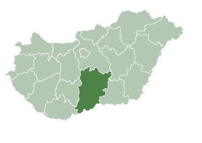
| County | Bács-Kiskun |
| District | Kecskemét |
| Area | |
| • Total | 81.28 km2 (31.38 sq mi) |
| Population (2008) | |
| • Total | 6,180 |
| • Density | 76.6/km2 (198/sq mi) |
| Time zone | UTC+1 (CET) |
| • Summer (DST) | UTC+2 (CEST) |
| Postal code | 6041 |
| Area code | (+36) 76 |
| Website | www |
Kerekegyháza is a town in Bács-Kiskun county, in southern Hungary.
References
External links
Wikimedia Commons has media related to Kerekegyháza.
- Official website in Hungarian
| City with county rights (1) |
| |
|---|---|---|
| Towns (2) | ||
| Villages (13) | ||

46°56′N 19°29′E / 46.933°N 19.483°E
This Bács-Kiskun location article is a stub. You can help Wikipedia by expanding it. |