Kralupy nad Vltavou: Difference between revisions
Patrick7ban7 (talk | contribs) mNo edit summary Tags: Visual edit Mobile edit Mobile web edit |
population, history, economy, demography, people, twin towns |
||
| Line 1: | Line 1: | ||
{{more citations needed|date=March 2012}} |
|||
{{Infobox settlement |
{{Infobox settlement |
||
| name = Kralupy nad Vltavou |
| name = Kralupy nad Vltavou |
||
| native_name = |
| native_name = |
||
| other_name = |
| other_name = |
||
| settlement_type = Town |
| settlement_type = [[Obec|Town]] |
||
<!-- images, nickname, motto --> |
<!-- images, nickname, motto --> |
||
| image_skyline = Kralupy od Lobče.jpg |
| image_skyline = Kralupy od Lobče.jpg |
||
| Line 34: | Line 33: | ||
<!-- area --> |
<!-- area --> |
||
| area_footnotes = |
| area_footnotes = |
||
| area_total_km2 = 21. |
| area_total_km2 = 21.90 |
||
<!-- elevation --> |
<!-- elevation --> |
||
| elevation_footnotes = |
| elevation_footnotes = |
||
| elevation_m = 176 |
| elevation_m = 176 |
||
<!-- population --> |
<!-- population --> |
||
| population_as_of = |
| population_as_of = 2021-01-01 |
||
| population_footnotes = <ref>{{cite web |title=Population of Municipalities – 1 January 2021|url=https://www.czso.cz/csu/czso/population-of-municipalities-1-january-2021|publisher=[[Czech Statistical Office]]|date=2021-04-30}}</ref> |
|||
| |
| population_total = 18485 |
||
| population_total = 18388 |
|||
| population_density_km2 = auto |
| population_density_km2 = auto |
||
<!-- time zone(s) --> |
<!-- time zone(s) --> |
||
| Line 57: | Line 56: | ||
| footnotes = |
| footnotes = |
||
}} |
}} |
||
'''Kralupy nad Vltavou''' ({{IPA-cs|ˈkralupɪ ˈnad vl̩tavou}}; {{lang-de|Kralup an der Moldau}}) is a town in the [[Central Bohemian Region]] of the [[Czech Republic]]. It has about 18,000 inhabitants. The town lies on the [[Vltava |
'''Kralupy nad Vltavou''' ({{IPA-cs|ˈkralupɪ ˈnad vl̩tavou}}; {{lang-de|Kralup an der Moldau}}) is a town in [[Mělník District]] in the [[Central Bohemian Region]] of the [[Czech Republic]]. It has about 18,000 inhabitants. It is known as a traffic hub and industrial agglomeration. The town lies on the [[Vltava]] River {{convert|25|km|mi|abbr=on}} north of [[Prague]]. The town is a part of the Prague metropolitan area. |
||
==Administrative parts== |
==Administrative parts== |
||
Town parts and villages of Lobeček, Minice, Mikovice and Zeměchy are administrative parts of Kralupy nad Vltavou. They were separate municipalities before the creation of the town at the beginning of the 20th century. |
|||
==History== |
==History== |
||
The first written reliable mention of Kralupy is from 1253. It was originally a village by the local [[Ford (crossing)|ford]]. From its establishment to 1848, it was owned mostly by [[Knights of the Cross with the Red Star]], except for four enforced short breaks. It had belonged to the same authority for six hundred years, which is a rare case.<ref name=history>{{cite web |title=History|url=https://www.infokralupy.cz/en/vismo/zobraz_dok.asp?id_org=200278&id_ktg=1002&n=history&p1=1002|publisher=Město Kralupy nad Vltavou|access-date=2021-07-08}}</ref> |
|||
The area of the actual town has been inhabited for millennia, but a significant growth of its population did not begin until the 19th century. It was the construction of the railway that stimulated a strong population growth. Factories were built near the railway, and the [[Oil Campaign of World War II]] targeted the oil refinery on December 28, 1944. During the totalitarian communist rule (1948–89) the town lacked democratic municipal government. |
|||
The town centre was damaged by [[2002 European floods|flood in 2002]]. |
|||
When the importance of the Kralupy river ford ceased, the inhabitants mostly occupied themselves with farming. Growing and drying fruits had a tradition here. In 1851 the state railway line from Prague to [[Dresden]] was put into operation and in 1856 the [[Buštěhrad]] line with the reloading dock on the river Vltava opened. This laid the foundations of the Kralupy railway junction, which was extended in 1865 by the construction of the Kralupy–[[Turnov]] line. The development of the river shipping had led to the regulation of the Vltava in 1894. The railway and river transportation stimulated a rapid population growth and overall economic development Many enterprises were established and the price of land rose.<ref name=history/> |
|||
In 1854 the shipyard producing both wooden and metal vessels was founded and in 1857 the first real factory opened – a chemical factory called Jordánka, which employed 600 people in its heyday. In 1867 the steam-mill was put into operation and in 1868–1869 two sugar factories and in 1872 a brewery opened. At the same time the first sand quarries and brickworks were opened. The general growt, the mineral oil refinery was put into operation. This stage of the transformation of the village into a town culminated in 1881, when Kralupy was promoted to a [[Městys|market town]], and in 1902, when it became a town. In 1902, the neighbouring settlement of Lobeč was joined to Kralupy and it changed its name to Kralupy nad Vltavou.<ref name=history/> |
|||
The [[World War I]] affected the town only indirectly. After the war, several new enterprises were established. The town suffered in the World War, when the [[Oil campaign of World War II|Oil campaign]] targeted the oil refinery in 1945. During the totalitarian communist rule (1948–89) the town lacked democratic municipal government.<ref name=history/> |
|||
The town's location is the cause of frequent devastating floods, which came in 1784, 1845 and 1890.<ref name=history/> The town centre was also damaged by [[2002 European floods]]. |
|||
==Demography== |
|||
{{historical populations |
|||
|align=none|cols=3 |
|||
|1869|3317 |
|||
|1880|5200 |
|||
|1890|5761 |
|||
|1900|7743 |
|||
|1910|9549 |
|||
|1921|9612 |
|||
|1930|10960 |
|||
|1950|10558 |
|||
|1961|11629 |
|||
|1970|14898 |
|||
|1980|17928 |
|||
|1991|17934 |
|||
|2001|17506 |
|||
|2011|18472 |
|||
|2021|18485 |
|||
|source=Historical lexicon of municipalities of the Czech Republic<ref>{{cite web |title=Historický lexikon obcí České republiky 1869–2011 – Okres Mělník|url=https://www.czso.cz/documents/10180/20537734/130084150206.pdf/9ae03fdb-a8aa-4f83-be40-245809fabb08?version=1.2|publisher=Czech Statistical Office|pages=5–6|language=cs|date=2015-12-21}}</ref>}} |
|||
==Economy== |
|||
Industry is the basis of the economy of Kralupy nad Vltavou, the chemical industry still has the tradition here. The oil refinery is owned by [[Unipetrol]]. It was destroyed in 1945 and put back into service only in 1975.<ref>{{cite web |title=Rafinérie Kralupy|url=https://www.unipetrolrpa.cz/CS/o-nas/Rafinerie/Stranky/Rafinerie-Kralupy.aspx|publisher=Unipetrol RPA|language=cs|access-date=2021-07-08}}</ref> |
|||
SYNTHOS Kralupy a.s. is the biggest company with its headquarters in Kralupy nad Vltavou. Until 1996, it was a part of the oil refinery company, and it is also owned by Unipetrol. Formerly known as KAUČUK, a.s., it is a chemical company founded 1954, focused on [[synthetic rubber]] and [[polystyrene]]s production.<ref>{{cite web |title=Základní charakteristika|url=https://www.synthosgroup.com/grupa-synthos/grupa/synthos-kralupy/zakladni-charakteristika|publisher=SYNTHOS Kralupy a.s.|language=cs|access-date=2021-07-08}}</ref> |
|||
The main representative of the food industry is Bidfood company. It is the largest food distributor in the Czech Republic and a producer of frozen food products.<ref>{{cite web |title=Historie|url=https://www.bidfood.cz/o-nas/historie|publisher=Bidfood Czech Republic s.r.o.|language=cs|access-date=2021-07-08}}</ref> |
|||
==Transport== |
==Transport== |
||
[[File:Kralupy nad Vltavou, nádraží.jpg|thumb|Train station in Kralupy nad Vltavou]] |
|||
The town is an important railway hub. The main line from [[Prague]] to [[Dresden]] runs through it as well as two other lines of lesser importance. The Vltava River is still used for transport. |
|||
Three bridges across the Vltava River are in the town – [[Tomáš Masaryk|T. G. Masaryk]] Bridge (a highway bridge built in 1920s), a footbridge with bicycle lane (built in 1990s) and a railway bridge. |
|||
==Notable people== |
==Notable people== |
||
*[[Georges Kars]] (1880–1945), painter |
*[[Georges Kars]] (1880–1945), painter |
||
*[[Jindřich Bišický]] (1889–1949), war photographer |
*[[Jindřich Bišický]] (1889–1949), war photographer |
||
*[[Jaroslav Seifert]] (1901–1986), poet, Nobel Prize winner |
*[[Jaroslav Seifert]] (1901–1986), poet, Nobel Prize winner; buried here |
||
*[[Alexander Kerst]] (1924–2010), actor |
*[[Alexander Kerst]] (1924–2010), actor |
||
*[[Lubomír Nácovský]] (1935–1982), sport shooter, Olympic medalist |
|||
==Twin towns – sister cities== |
==Twin towns – sister cities== |
||
[[File:Kralupy nad Vltavou CZ twin towns 086.jpg|thumb|right|200px|Insignia of twin towns on town hall in Kralupy nad Vltavou]] |
|||
{{See also|List of twin towns and sister cities in the Czech Republic}} |
{{See also|List of twin towns and sister cities in the Czech Republic}} |
||
Kralupy nad Vltavou is [[Sister city|twinned]] with:<ref>{{cite web |title=Partnerská města – Kralupy nad Vltavou|url=https://www.mestokralupy.cz/mesto/partnerska-mesta/|publisher=Kralupy nad Vltavou| language=cs|access-date= |
Kralupy nad Vltavou is [[Sister city|twinned]] with:<ref>{{cite web |title=Partnerská města – Kralupy nad Vltavou|url=https://www.mestokralupy.cz/mesto/partnerska-mesta/|publisher=Kralupy nad Vltavou| language=cs|access-date=2021-07-08}}</ref> |
||
{{div col|colwidth=20em}} |
{{div col|colwidth=20em}} |
||
*{{flagicon|FRA}} [[Banyuls-sur-Mer]], France |
*{{flagicon|FRA}} [[Banyuls-sur-Mer]], France |
||
| Line 85: | Line 120: | ||
*{{flagicon|CZE}} [[Hrádek nad Nisou]], Czech Republic |
*{{flagicon|CZE}} [[Hrádek nad Nisou]], Czech Republic |
||
*{{flagicon|SVK}} [[Komárno]], Slovakia |
*{{flagicon|SVK}} [[Komárno]], Slovakia |
||
*{{flagicon|SVN}} [[Municipality of Miren-Kostanjevica|Miren-Kostanjevica]], Slovenia |
|||
*{{flagicon|SRB}} [[Šabac]], Serbia |
*{{flagicon|SRB}} [[Šabac]], Serbia |
||
*{{flagicon|POL}} [[Gmina Środa Wielkopolska|Środa Wielkopolska]], Poland |
*{{flagicon|POL}} [[Gmina Środa Wielkopolska|Środa Wielkopolska]], Poland |
||
| Line 91: | Line 127: | ||
==Gallery== |
==Gallery== |
||
<gallery> |
<gallery> |
||
Městský úřad Kralupy.jpg|Town hall |
|||
Kralupy nad Vltavou, Veltruská, MERO crop.jpg|MERO headquarters |
|||
Kralupy nad Vltavou, panorama sídliště.jpg|Town panorama |
|||
Kralupy nad Vltavou, Most T. G. Masaryka.jpg|T. G. Masaryk Bridge |
|||
Kars kpy.jpg|Statue of [[Georges Kars]] |
|||
Kralupy kostel Nanebevzetí P. Marie a sv. Václava 02.jpg|Church of the Assumption of the Virgin Mary and Saint Wenceslaus |
|||
</gallery> |
</gallery> |
||
| Line 104: | Line 140: | ||
==External links== |
==External links== |
||
{{commons category|Kralupy nad Vltavou}} |
{{commons category|Kralupy nad Vltavou}} |
||
* |
*{{official|https://www.mestokralupy.cz/}} (in Czech) |
||
*[ |
*[https://www.infokralupy.cz/en/ Tourist portal] (in English and Czech) |
||
{{Mělník District}} |
{{Mělník District}} |
||
Revision as of 07:21, 8 July 2021
Kralupy nad Vltavou | |
|---|---|
 Kralupy nad Vltavou seen from Hostibejk | |
 Flag  Coat of arms | |
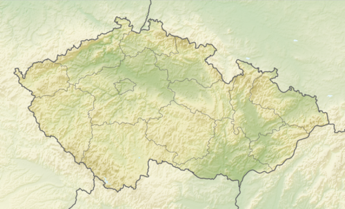 Kralupy nad Vltavou Location in the Czech Republic | |
| Coordinates: 50°14′27″N 14°18′24″E / 50.24083°N 14.30667°E | |
| Country | |
| Region | Central Bohemian |
| District | Mělník |
| First mentioned | 1253 |
| Government | |
| • Mayor | Marek Czechmann |
| Area | |
| • Total | 21.90 km2 (8.46 sq mi) |
| Elevation | 176 m (577 ft) |
| Population (2021-01-01)[1] | |
| • Total | 18,485 |
| • Density | 840/km2 (2,200/sq mi) |
| Time zone | UTC+1 (CET) |
| • Summer (DST) | UTC+2 (CEST) |
| Postal code | 278 01 |
| Website | www |
Kralupy nad Vltavou (Czech pronunciation: [ˈkralupɪ ˈnad vl̩tavou]; German: Kralup an der Moldau) is a town in Mělník District in the Central Bohemian Region of the Czech Republic. It has about 18,000 inhabitants. It is known as a traffic hub and industrial agglomeration. The town lies on the Vltava River 25 km (16 mi) north of Prague. The town is a part of the Prague metropolitan area.
Administrative parts
Town parts and villages of Lobeček, Minice, Mikovice and Zeměchy are administrative parts of Kralupy nad Vltavou. They were separate municipalities before the creation of the town at the beginning of the 20th century.
History
The first written reliable mention of Kralupy is from 1253. It was originally a village by the local ford. From its establishment to 1848, it was owned mostly by Knights of the Cross with the Red Star, except for four enforced short breaks. It had belonged to the same authority for six hundred years, which is a rare case.[2]
When the importance of the Kralupy river ford ceased, the inhabitants mostly occupied themselves with farming. Growing and drying fruits had a tradition here. In 1851 the state railway line from Prague to Dresden was put into operation and in 1856 the Buštěhrad line with the reloading dock on the river Vltava opened. This laid the foundations of the Kralupy railway junction, which was extended in 1865 by the construction of the Kralupy–Turnov line. The development of the river shipping had led to the regulation of the Vltava in 1894. The railway and river transportation stimulated a rapid population growth and overall economic development Many enterprises were established and the price of land rose.[2]
In 1854 the shipyard producing both wooden and metal vessels was founded and in 1857 the first real factory opened – a chemical factory called Jordánka, which employed 600 people in its heyday. In 1867 the steam-mill was put into operation and in 1868–1869 two sugar factories and in 1872 a brewery opened. At the same time the first sand quarries and brickworks were opened. The general growt, the mineral oil refinery was put into operation. This stage of the transformation of the village into a town culminated in 1881, when Kralupy was promoted to a market town, and in 1902, when it became a town. In 1902, the neighbouring settlement of Lobeč was joined to Kralupy and it changed its name to Kralupy nad Vltavou.[2]
The World War I affected the town only indirectly. After the war, several new enterprises were established. The town suffered in the World War, when the Oil campaign targeted the oil refinery in 1945. During the totalitarian communist rule (1948–89) the town lacked democratic municipal government.[2]
The town's location is the cause of frequent devastating floods, which came in 1784, 1845 and 1890.[2] The town centre was also damaged by 2002 European floods.
Demography
|
|
| ||||||||||||||||||||||||||||||||||||||||||||||||||||||
| Source: Historical lexicon of municipalities of the Czech Republic[3] | ||||||||||||||||||||||||||||||||||||||||||||||||||||||||
Economy
Industry is the basis of the economy of Kralupy nad Vltavou, the chemical industry still has the tradition here. The oil refinery is owned by Unipetrol. It was destroyed in 1945 and put back into service only in 1975.[4]
SYNTHOS Kralupy a.s. is the biggest company with its headquarters in Kralupy nad Vltavou. Until 1996, it was a part of the oil refinery company, and it is also owned by Unipetrol. Formerly known as KAUČUK, a.s., it is a chemical company founded 1954, focused on synthetic rubber and polystyrenes production.[5]
The main representative of the food industry is Bidfood company. It is the largest food distributor in the Czech Republic and a producer of frozen food products.[6]
Transport

The town is an important railway hub. The main line from Prague to Dresden runs through it as well as two other lines of lesser importance. The Vltava River is still used for transport.
Three bridges across the Vltava River are in the town – T. G. Masaryk Bridge (a highway bridge built in 1920s), a footbridge with bicycle lane (built in 1990s) and a railway bridge.
Notable people
- Georges Kars (1880–1945), painter
- Jindřich Bišický (1889–1949), war photographer
- Jaroslav Seifert (1901–1986), poet, Nobel Prize winner; buried here
- Alexander Kerst (1924–2010), actor
- Lubomír Nácovský (1935–1982), sport shooter, Olympic medalist
Twin towns – sister cities
Kralupy nad Vltavou is twinned with:[7]
Banyuls-sur-Mer, France
Hennigsdorf, Germany
Hrádek nad Nisou, Czech Republic
Komárno, Slovakia
Miren-Kostanjevica, Slovenia
Šabac, Serbia
Środa Wielkopolska, Poland
Gallery
-
Town hall
-
MERO headquarters
-
Town panorama
-
T. G. Masaryk Bridge
-
Statue of Georges Kars
-
Church of the Assumption of the Virgin Mary and Saint Wenceslaus


References
- ^ "Population of Municipalities – 1 January 2021". Czech Statistical Office. 2021-04-30.
- ^ a b c d e "History". Město Kralupy nad Vltavou. Retrieved 2021-07-08.
- ^ "Historický lexikon obcí České republiky 1869–2011 – Okres Mělník" (in Czech). Czech Statistical Office. 2015-12-21. pp. 5–6.
- ^ "Rafinérie Kralupy" (in Czech). Unipetrol RPA. Retrieved 2021-07-08.
- ^ "Základní charakteristika" (in Czech). SYNTHOS Kralupy a.s. Retrieved 2021-07-08.
- ^ "Historie" (in Czech). Bidfood Czech Republic s.r.o. Retrieved 2021-07-08.
- ^ "Partnerská města – Kralupy nad Vltavou" (in Czech). Kralupy nad Vltavou. Retrieved 2021-07-08.
External links
- Official website (in Czech)
- Tourist portal (in English and Czech)
| International | |
|---|---|
| National | |
| Geographic | |