Lake Lorelei, Ohio: Difference between revisions
Adding geodata: {{coord missing|United States}} |
|||
| (35 intermediate revisions by 27 users not shown) | |||
| Line 1: | Line 1: | ||
{{ |
{{Use mdy dates|date=July 2023}} |
||
{{Infobox settlement |
|||
[[Image:Lake Lorelei1.jpg|thumb]]<!-- Commented out because image was deleted: [[Image:Lake Lorelei2.png]] --> |
|||
|official_name = Lake Lorelei, Ohio |
|||
'''Lake Lorelei''' is a [[gated community]] near [[Fayetteville, Ohio]].<ref>{{cite web|url=http://www.lakeloreleiohio.com/|title=Lake Lorelei|work=Lake Lorelei|accessdate=2009-06-20}}</ref> |
|||
|settlement_type = [[Census-designated place]] |
|||
|nickname = |
|||
|motto = |
|||
<!-- Images --> |
|||
|image_skyline = |
|||
|imagesize = |
|||
|image_caption = |
|||
|image_flag = |
|||
|image_seal = |
|||
<!-- Maps --> |
|||
|image_map = |
|||
|mapsize = |
|||
|map_caption = |
|||
|image_map1 = |
|||
|mapsize1 = |
|||
|map_caption1 = |
|||
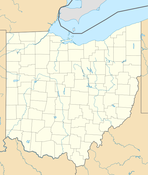
|pushpin_map = Ohio |
|||
|pushpin_label = Lake<br/>Lorelei |
|||
<!-- Location --> |
|||
|subdivision_type = [[List of sovereign states|Country]] |
|||
|subdivision_name = United States |
|||
|subdivision_type1 = [[U.S. state|State]] |
|||
|subdivision_name1 = [[Ohio]] |
|||
|subdivision_type2 = [[List of counties in Ohio|County]] |
|||
|subdivision_name2 = [[Brown County, Ohio|Brown]] |
|||
<!-- Government --> |
|||
|government_footnotes = |
|||
|government_type = |
|||
|leader_title = |
|||
|leader_name = |
|||
|leader_title1 = |
|||
|leader_name1 = |
|||
|established_title = |
|||
|established_date = |
|||
<!-- Area --> |
|||
|unit_pref = Imperial |
|||
|area_footnotes = <ref name="TigerWebMapServer">{{cite web|title=ArcGIS REST Services Directory|url=https://tigerweb.geo.census.gov/arcgis/rest/services/TIGERweb/Places_CouSub_ConCity_SubMCD/MapServer|publisher=United States Census Bureau|accessdate=September 20, 2022}}</ref> |
|||
|area_magnitude = |
|||
|area_total_km2 = 6.35 |
|||
|area_land_km2 = 5.70 |
|||
|area_water_km2 = 0.65 |
|||
|area_total_sq_mi = 2.45 |
|||
|area_land_sq_mi = 2.20 |
|||
|area_water_sq_mi = 0.25 |
|||
<!-- Population --> |
|||
|population_as_of = [[2020 United States Census|2020]] |
|||
|population_est = |
|||
|pop_est_as_of = |
|||
|population_footnotes = |
|||
|population_total = 1172 |
|||
|population_density_km2 = 205.56 |
|||
|population_density_sq_mi = 532.49 |
|||
<!-- General information --> |
|||
|timezone = [[North American Eastern Time Zone|Eastern (EST)]] |
|||
|utc_offset = -5 |
|||
|timezone_DST = EDT |
|||
|utc_offset_DST = -4 |
|||
|elevation_footnotes = <ref name=gnis/> |
|||
|elevation_ft = 942 |
|||
|coordinates = {{coord|39|11|15|N|83|58|17|W|region:US-OH_type:city(1603)|display=inline,title}} |
|||
<!-- Area/postal codes & others --> |
|||
|postal_code_type = [[ZIP code]] |
|||
|postal_code = |
|||
|area_code = [[Area code 513|513]] |
|||
|blank_name = [[Federal Information Processing Standard|FIPS code]] |
|||
|blank_info = 39-41419<ref name="GR2">{{cite web|url=https://www.census.gov|publisher=[[United States Census Bureau]]|accessdate=2008-01-31|title=U.S. Census website}}</ref> |
|||
|blank1_name = [[Geographic Names Information System|GNIS]] feature ID |
|||
|blank1_info = 2628918<ref name=gnis>{{GNIS|2628918}}</ref> |
|||
|website = |
|||
|footnotes = |
|||
}} |
|||
'''Lake Lorelei''' is a [[gated community]] and [[census-designated place]] in [[Brown County, Ohio]], United States, near the village of [[Fayetteville, Ohio|Fayetteville]].<ref>{{cite web|url=http://www.lakeloreleiohio.com/|title=Lake Lorelei|work=Lake Lorelei|accessdate=2009-06-20}}</ref><ref name=gnis/> As of the [[2020 United States Census|2020 census]], it had a population of 1,172.<ref name="Census 2010">{{cite web| url=http://factfinder.census.gov/bkmk/table/1.0/en/DEC/10_DP/G001/1600000US3941419| archive-url=https://archive.today/20200212192603/http://factfinder.census.gov/bkmk/table/1.0/en/DEC/10_DP/G001/1600000US3941419| url-status=dead| archive-date=February 12, 2020| title=Geographic Identifiers: 2010 Demographic Profile Data (G001): Lake Lorelei CDP, Ohio| publisher=U.S. Census Bureau, American Factfinder| accessdate=February 21, 2014}}</ref> |
|||
==History== |
|||
Lake Lorelei was started in the late 1960s by property developers as a lakeside [[planned community]].<ref>{{cite web | url=http://www.lakeloreleiohio.com/lakeloreleiohio/About_the_Lake.html | title=About Lake Lorelei | publisher=LLPOA | accessdate=21 December 2015}}</ref> |
|||
==Geography== |
|||
Lake Lorelei is located in northern Brown County, in the western part of [[Perry Township, Brown County, Ohio|Perry Township]]. It consists of a housing development built around Lake Lorelei, a reservoir on Glady Run, a tributary of the [[East Fork of the Little Miami River]]. |
|||
[[Ohio State Route 131|State Route 131]] forms the southern border of the CDP, and [[U.S. Route 50 in Ohio|U.S. Route 50]] touches the community's southeast corner. Lake Lorelei is {{convert|3|mi|0}} west of the village of Fayetteville and {{convert|34|mi}} east of downtown [[Cincinnati]]. |
|||
==Demographics== |
|||
{{US Census population |
|||
|align=left|2020= 1172 |
|||
|footnote=U.S. Decennial Census<ref name="DecennialCensus">{{cite web|url=http://www.census.gov/prod/www/decennial.html|title=Census of Population and Housing|publisher=Census.gov|accessdate=June 4, 2016}}</ref> |
|||
}}{{clear left}} |
|||
==References== |
==References== |
||
{{Reflist}} |
|||
<references/> |
|||
==External links== |
|||
*[http://www.lakeloreleiohio.com Lake Lorelei Property Owners Association] |
|||
{{Brown County, Ohio}} |
|||
{{Authority control}} |
|||
[[Category:Reservoirs in Ohio|Lorelei]] |
|||
[[Category:Census-designated places in Ohio]] |
|||
[[Category:Census-designated places in Brown County, Ohio]] |
|||
[[Category:Bodies of water of Brown County, Ohio|Lorelei]] |
|||
[[Category:1960s establishments in Ohio]] |
|||
{{coord missing|United States}} |
|||
{{BrownCountyOH-geo-stub}} |
|||
[[Category:Lakes of Ohio]] |
|||
Latest revision as of 02:18, 7 February 2024
Lake Lorelei, Ohio | |
|---|---|
 Lake Lorelei | |
| Coordinates: 39°11′15″N 83°58′17″W / 39.18750°N 83.97139°W | |
| Country | United States |
| State | Ohio |
| County | Brown |
| Area | |
| • Total | 2.45 sq mi (6.35 km2) |
| • Land | 2.20 sq mi (5.70 km2) |
| • Water | 0.25 sq mi (0.65 km2) |
| Elevation | 942 ft (287 m) |
| Population (2020) | |
| • Total | 1,172 |
| • Density | 532.49/sq mi (205.56/km2) |
| Time zone | UTC-5 (Eastern (EST)) |
| • Summer (DST) | UTC-4 (EDT) |
| Area code | 513 |
| FIPS code | 39-41419[3] |
| GNIS feature ID | 2628918[2] |
Lake Lorelei is a gated community and census-designated place in Brown County, Ohio, United States, near the village of Fayetteville.[4][2] As of the 2020 census, it had a population of 1,172.[5]
History
[edit]Lake Lorelei was started in the late 1960s by property developers as a lakeside planned community.[6]
Geography
[edit]Lake Lorelei is located in northern Brown County, in the western part of Perry Township. It consists of a housing development built around Lake Lorelei, a reservoir on Glady Run, a tributary of the East Fork of the Little Miami River.
State Route 131 forms the southern border of the CDP, and U.S. Route 50 touches the community's southeast corner. Lake Lorelei is 3 miles (5 km) west of the village of Fayetteville and 34 miles (55 km) east of downtown Cincinnati.
Demographics
[edit]| Census | Pop. | Note | %± |
|---|---|---|---|
| 2020 | 1,172 | — | |
| U.S. Decennial Census[7] | |||
References
[edit]- ^ "ArcGIS REST Services Directory". United States Census Bureau. Retrieved September 20, 2022.
- ^ a b c U.S. Geological Survey Geographic Names Information System: Lake Lorelei, Ohio
- ^ "U.S. Census website". United States Census Bureau. Retrieved January 31, 2008.
- ^ "Lake Lorelei". Lake Lorelei. Retrieved June 20, 2009.
- ^ "Geographic Identifiers: 2010 Demographic Profile Data (G001): Lake Lorelei CDP, Ohio". U.S. Census Bureau, American Factfinder. Archived from the original on February 12, 2020. Retrieved February 21, 2014.
- ^ "About Lake Lorelei". LLPOA. Retrieved December 21, 2015.
- ^ "Census of Population and Housing". Census.gov. Retrieved June 4, 2016.
External links
[edit]Municipalities and communities of Brown County, Ohio, United States | ||
|---|---|---|
| Villages |  | |
| Townships | ||
| CDPs | ||
| Unincorporated communities | ||
| Footnotes | ‡This populated place also has portions in an adjacent county or counties | |
This Brown County, Ohio state location article is a stub. You can help Wikipedia by expanding it. |