Lierschied: Difference between revisions
Content deleted Content added
embed {{Authority control}} with wikidata information |
JJMC89 bot (talk | contribs) Migrate {{Infobox German location}} coordinates parameters to {{Coord}}, see Wikipedia:Coordinates in infoboxes |
||
| Line 3: | Line 3: | ||
|image_coa = Wappen Lierschied.png |
|image_coa = Wappen Lierschied.png |
||
|Wappengröße = |
|Wappengröße = |
||
|coordinates = {{coord|50|10|17|N|7|44|49|E|format=dms|display=inline,title}} |
|||
|lat_deg = 50 | lat_min = 10 | lat_sec = 17 |
|||
|lon_deg = 7 | lon_min = 44 | lon_sec = 49 |
|||
|image_plan = Lierschied in EMS.svg |
|image_plan = Lierschied in EMS.svg |
||
|state = Rheinland-Pfalz |
|state = Rheinland-Pfalz |
||
Revision as of 06:26, 20 January 2017
Lierschied | |
|---|---|
 Coat of arms | |
Location of Lierschied within Rhein-Lahn-Kreis district  | |
 Lierschied 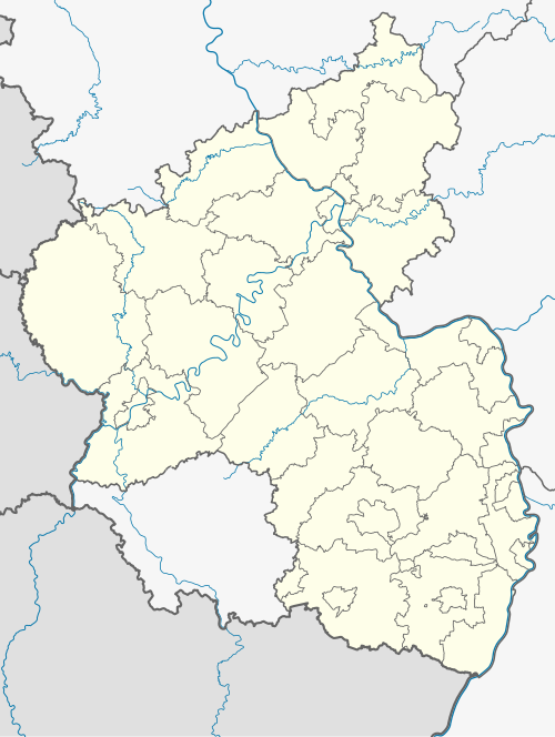 Lierschied | |
| Coordinates: 50°10′17″N 7°44′49″E / 50.17139°N 7.74694°E | |
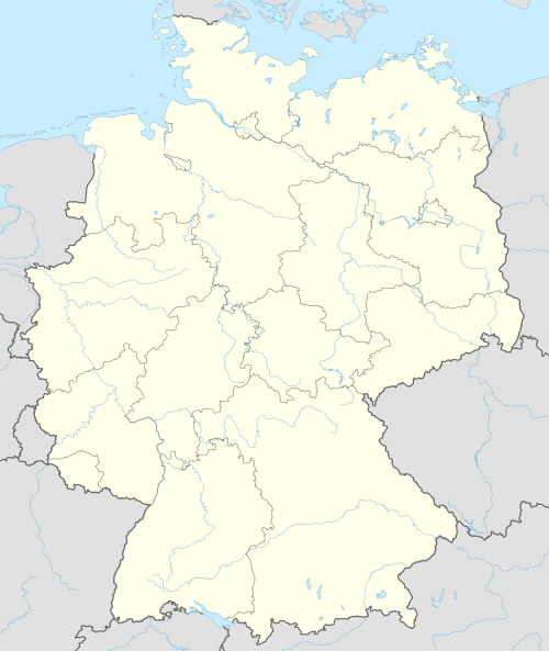
| Country | Germany |
| State | Rhineland-Palatinate |
| District | Rhein-Lahn-Kreis |
| Municipal assoc. | Loreley |
| Government | |
| • Mayor | Mathias Wenzel |
| Area | |
| • Total | 5.93 km2 (2.29 sq mi) |
| Elevation | 250 m (820 ft) |
| Population (2022-12-31)[1] | |
| • Total | 491 |
| • Density | 83/km2 (210/sq mi) |
| Time zone | UTC+01:00 (CET) |
| • Summer (DST) | UTC+02:00 (CEST) |
| Postal codes | 56357 |
| Dialling codes | 06771 |
| Vehicle registration | EMS |
| Website | www.lierschied.de |
Lierschied is a municipality in the district of Rhein-Lahn, in Rhineland-Palatinate, in western Germany.
References
- ^ "Bevölkerungsstand 2022, Kreise, Gemeinden, Verbandsgemeinden" (PDF) (in German). Statistisches Landesamt Rheinland-Pfalz. 2023.

| International | |
|---|---|
| National | |
This Rhein-Lahn location article is a stub. You can help Wikipedia by expanding it. |