Paracatu, Minas Gerais: Difference between revisions
added Category:Populated places in Minas Gerais using HotCat |
→Climate: add brief description |
||
| (31 intermediate revisions by 20 users not shown) | |||
| Line 1: | Line 1: | ||
{{Infobox settlement |
{{Infobox settlement |
||
|name = Paracatu |
| name = Paracatu |
||
|settlement_type = [[Municipalities of Brazil|Municipality]] |
| settlement_type = [[Municipalities of Brazil|Municipality]] |
||
|official_name = |
| official_name = |
||
|nickname = |
| nickname = |
||
|motto = |
| motto = |
||
|image_skyline = |
| image_skyline = Paracatu MG Brasil - Vista Parcial da cidade - panoramio.jpg |
||
|imagesize = |
| imagesize = |
||
|image_caption = |
| image_caption = Partial view of Paracatu |
||
|image_flag = |
| image_flag = Bandeira de Paracatu.jpg |
||
|image_seal = |
| image_seal = Brasão de Paracatu.jpg |
||
|image_map = MinasGerais Municip Paracatu.svg |
| image_map = MinasGerais Municip Paracatu.svg |
||
|mapsize = |
| mapsize = |
||
|map_caption = Localization of Paracatu in Minas Gerais |
| map_caption = Localization of Paracatu in Minas Gerais |
||
|pushpin_map = Brazil |
| pushpin_map = Brazil |
||
|pushpin_map_size = 250 |
| pushpin_map_size = 250 |
||
|pushpin_map_caption = Localization of Paracatu in Brazil |
| pushpin_map_caption = Localization of Paracatu in Brazil |
||
| subdivision_type = [[List of sovereign states|Country]] |
|||
|coordinates_region = BR |
|||
| |
| subdivision_type1 = [[Regions of Brazil|Region]] |
||
| |
| subdivision_type2 = [[States of Brazil|State]] |
||
| subdivision_name = {{flag|Brazil}} |
|||
|subdivision_type2 = [[States of Brazil|State]] |
|||
| |
| subdivision_name1 = [[Southeast Region, Brazil|Southeast]] |
||
| subdivision_name2 = [[Image:Bandeira de Minas Gerais.svg|border|22px]] [[Minas Gerais]] |
|||
|subdivision_name1 = [[Southeast Region, Brazil|Southeast]] |
|||
| leader_title = [[Mayor]] |
|||
|subdivision_name2 = [[Image:Bandeira de Minas Gerais.svg|border|22px]] [[Minas Gerais]] |
|||
| leader_name = Olavo Remígio Condé ([[Brazilian Social Democracy Party|PSDB]])<br>(2013-2016) |
|||
|leader_title = [[Mayor]] |
|||
| established_title = Founded |
|||
|leader_name = Olavo Remígio Condé ([[Brazilian Social Democracy Party|PSDB]])<br >(2013-2016) |
|||
| established_date = October 20, 1798 |
|||
|established_title = Founded |
|||
| area_magnitude = |
|||
|established_date = October 20, 1798 |
|||
| |
| area_total_km2 = 8.229,588 |
||
| |
| area_land_km2 = |
||
| |
| area_water_km2 = |
||
| |
| area_water_percent = |
||
| |
| area_urban_km2 = |
||
| |
| area_metro_km2 = |
||
| population_as_of = 2020 <ref>[https://cidades.ibge.gov.br/brasil/mg/paracatu/panorama IBGE 2020]</ref> |
|||
|area_metro_km2 = |
|||
| |
| population_note = |
||
| |
| population_footnotes = |
||
| population_total = 93,862 |
|||
|population_footnotes = <ref name=totalpop>{{cite web|url = http://www.ibge.gov.br/home/estatistica/populacao/censo2010/populacao_por_municipio.shtm | title = Estimativas das Populações Residentes, em 31.12.2010, Segundo os Municípios | language = Portuguese | publisher = [[Brazilian Institute of Geography and Statistics|IBGE]] | accessdate = 2012-08-20}}</ref> |
|||
| |
| population_urban = |
||
| |
| population_density_km2 = 10.29 |
||
| population_demonym = Paracatuense |
|||
|population_density_km2 = 10.29 |
|||
| timezone = [[Time in Brazil|BRT]] |
|||
|population_demonym = Paracatuense |
|||
| |
| utc_offset = −3 |
||
| |
| timezone_DST = |
||
| |
| utc_offset_DST = |
||
| coordinates = {{coord|17|13|18|S|46|52|30|W|region:BR|display=inline}} |
|||
|utc_offset_DST = -2 |
|||
| |
| elevation_m = 688 |
||
| |
| area_code = +55 38 |
||
| |
| postal_code_type = Postal Code (CEP) |
||
| |
| postal_code = 38600-000 |
||
| |
| blank_name = |
||
| |
| blank_info = |
||
| |
| website = [http://www.paracatu.mg.gov.br/ www.paracatu.mg.gov.br] |
||
| |
| footnotes = |
||
|elevation_m = 688 |
|||
|area_code = +55 38 |
|||
|postal_code_type = Postal Code (CEP) |
|||
|postal_code = 38600-000 |
|||
|blank_name = |
|||
|blank_info = |
|||
|website = [http://www.paracatu.mg.gov.br/ www.paracatu.mg.gov.br] |
|||
|footnotes = |
|||
}} |
}} |
||
'''Paracatu''' is a [[Municipalities of Brazil|municipality]] in the [[States of Brazil|state]] of [[Minas Gerais]] |
'''Paracatu''' is a [[Municipalities of Brazil|municipality]] in the [[States of Brazil|state]] of [[Minas Gerais]] in [[Brazil]]. |
||
The name is of Tupi origin, translated "good river", from "Para" (river) and "katu" (good). |
|||
==History== |
==History== |
||
| Line 69: | Line 62: | ||
The region of Paracatu has been explored by Europeans since the end of the 16th century. In the middle of the 18th century deposits of gold and silver were discovered, and the area was settled. The settlement became the town Vila de Paracatu do Príncipe by royal charter in 1798.<ref>[http://cod.ibge.gov.br/2EJ IBGE], history</ref> |
The region of Paracatu has been explored by Europeans since the end of the 16th century. In the middle of the 18th century deposits of gold and silver were discovered, and the area was settled. The settlement became the town Vila de Paracatu do Príncipe by royal charter in 1798.<ref>[http://cod.ibge.gov.br/2EJ IBGE], history</ref> |
||
== |
==Economy== |
||
The economy is centered on gold mining and agriculture. |
|||
The economy is centered on cattle raising with 231,000 head (1996). The main breeds are: [[Zebu]] ([[Gyr (cattle)|Gir]], [[Indu-Brasil]], [[Guzerá]] and [[Nelore]]), [[Girolanda]], [[Holstein cattle|Frisian]] and Brown-Swiss. There is also large production of soybeans, corn, rice, beans, and also some coffee. |
|||
Paracatu is the commercial center for an area one third the size of [[Portugal]]. In 2006 there were 6 banking branches: Banco do Brasil, Itaú, Bradesco, Banco Mercantil, Banco Bamerindus, and Caixa Econômica Federal.<ref>{{cite web|url=http://www.paracatu.mg.gov.br/index.php?m=layout_paginas_1.php&paginas_id=3 |title= |
|||
===Mining=== |
|||
Agências bancárias |publisher=Prefeitura Municipal Paracatu |date= |accessdate=2010-07-23}}</ref> The GDP was R$754,090,000 (2005).<ref name="IBGE">{{cite web|url=http://www.ibge.gov.br/cidadesat/default.php |title=IBGE |publisher=IBGE |date= |accessdate=2010-07-23}}</ref> |
|||
In Paracatu, gold has been mined since 1722.<ref>[https://www.theguardian.com/sustainable-business/2015/may/13/canadian-mining-company-spied-on-opponents-and-activists-in-brazil www.theguardian.com: Canadian Mininig commany spied on opponents and activists in Brazil. (13-May-2015)]</ref> The Morro do Ouro (Paracatu) [[open-pit mine]] is operated by Rio Paracatu Mineração (RPM), a 100% owned subsidiary of the Canadian company [[Kinross Gold Corporation]]. The gold content of the ore is comparatively low, about 0.41 gram of gold for every ton of ore extracted. |
|||
Annual production is about 15 tonnes of gold and 5 tonnes of silver.<ref>{{cite web|url=http://www.kinross.com/operations/operation-paracatu-brazil.aspx|title=Kinross: Operation: Paracatu Brazil|publisher=Kinross Gold Corporation|access-date=July 23, 2010|url-status=dead|archive-url=https://web.archive.org/web/20100909014436/http://www.kinross.com/operations/operation-paracatu-brazil.aspx|archive-date=September 9, 2010}}</ref><ref name="paracatu-technical-report">{{cite web |
|||
|url=http://www.kinross.com/pdf/operations/Technical-Report-Paracatu.pdf |
|||
|title=Paracatu Mine Technical Report |
|||
|last=Henderson |
|||
|first=R. D. |
|||
|date=July 31, 2006 |
|||
|publisher=Kinross Gold Corporation |
|||
|access-date=July 23, 2010 |
|||
|archive-url=https://web.archive.org/web/20101011004812/http://kinross.com/pdf/operations/Technical-Report-Paracatu.pdf |
|||
|archive-date=October 11, 2010 |
|||
|url-status=dead |
|||
}}</ref> |
|||
[[Kinross Gold]] owns the open-pit Paracatu gold mine operated as Kinross Brasil Mineração S.A. that includes two process plants, two tailings facilities, as well as accompanying infrastructure.<ref>{{cite book|title=Canadian and American Mines Handbook|url=https://books.google.com/books?id=8pxNAQAAIAAJ|year=2005|publisher=Business Information Group|isbn=978-0-919336-63-6}}</ref> |
|||
This mine is the region's largest employer.<ref name="International Mining">{{cite web|title=Metso to supply grinding equipment to Kinross Gold’s Paracatu in Brazil|url=http://im-mining.com/2011/01/03/metso-to-supply-grinding-equipment-to-kinross-golds-paracatu-in-brazil/|website=International Mining|publisher=International Mining|access-date=23 September 2016}}</ref> In 2015, Paracatu produced 477,662 gold equivalent ounces.<ref>See page MDA 20 of 2015 Kinross Gold Annual Report http://s2.q4cdn.com/496390694/files/doc_financials/annual/2016/2015-Kinross-Gold-Annual-Report.pdf</ref> |
|||
===Agriculture=== |
|||
Cattle raising is the main agricultural activity with 231,000 head (1996). The main breeds are: [[Zebu]] ([[Gyr (cattle)|Gir]], [[Indu-Brasil]], [[Guzerá]] and [[Nelore]]), [[Girolanda]], [[Holstein cattle|Frisian]] and Brown-Swiss. There is also large production of soybeans, corn, rice, beans, and also some coffee. |
|||
Paracatu is the commercial center for an area one third the size of [[Portugal]]. In 2006 there were 6 banking branches: Banco do Brasil, Itaú, Bradesco, Banco Mercantil, Banco Bamerindus, and Caixa Econômica Federal.<ref>{{cite web|url=http://www.paracatu.mg.gov.br/index.php?m=layout_paginas_1.php&paginas_id=3 |title= Agências bancárias |publisher=Prefeitura Municipal Paracatu |access-date=2010-07-23}}</ref> The GDP was R$754,090,000 (2005).<ref name="IBGE">{{cite web|url=http://www.ibge.gov.br/cidadesat/default.php |title=IBGE |publisher=IBGE |access-date=2010-07-23}}</ref> |
|||
In 1978 the municipality began to receive investments from the Brazilian and the Japanese government to develop the [[cerrado]] soils, through the PRODECER-Programa de Cooperação Nipo-Brasileiro para o Desenvolviemnto do Cerrado. |
In 1978 the municipality began to receive investments from the Brazilian and the Japanese government to develop the [[cerrado]] soils, through the PRODECER-Programa de Cooperação Nipo-Brasileiro para o Desenvolviemnto do Cerrado. |
||
Because of new technologies used to develop the cerrado, agriculture in Paracatu became efficient and profitable in many properties. Nowadays, the cultivated area in the municipality surpasses 1000 square kilometres, with 300 square kilometres irrigated by central pivot [[irrigation sprinkler|sprinkler]]s. This number has raised Paracatu to the position of greatest continuous area irrigated by [[center pivot irrigation]] in South America, using 318 center pivot sprinklers.<ref name="City government site">{{cite web|url=http://www.paracatu.mg.gov.br |title=Prefeitura Municipal de Paracatu |publisher=Paracatu.mg.gov.br |date |
Because of new technologies used to develop the cerrado, agriculture in Paracatu became efficient and profitable in many properties. Nowadays, the cultivated area in the municipality surpasses 1000 square kilometres, with 300 square kilometres irrigated by central pivot [[irrigation sprinkler|sprinkler]]s. This number has raised Paracatu to the position of greatest continuous area irrigated by [[center pivot irrigation]] in South America, using 318 center pivot sprinklers.<ref name="City government site">{{cite web|url=http://www.paracatu.mg.gov.br |title=Prefeitura Municipal de Paracatu |publisher=Paracatu.mg.gov.br |access-date=2010-07-23}}</ref> |
||
===Agricultural data=== |
====Agricultural data==== |
||
In 2006 there were 995 rural producers with total agricultural land of 389,095 ha. Of the total 85,000 ha. were planted, 180,000 ha. were in natural pasture, and 113,000 were in forest or woodland. Around 4,500 persons were employed in agriculture. There were 768 tractors. The planted area of some of the main crops in hectares was: |
In 2006 there were 995 rural producers with total agricultural land of 389,095 ha. Of the total 85,000 ha. were planted, 180,000 ha. were in natural pasture, and 113,000 were in forest or woodland. Around 4,500 persons were employed in agriculture. There were 768 tractors. The planted area of some of the main crops in hectares was: |
||
*Corn: 12,000 |
*Corn: 12,000 |
||
| Line 89: | Line 102: | ||
*Beans: 9,100 |
*Beans: 9,100 |
||
*Watermelon: 1,050 <ref name="IBGE"/> |
*Watermelon: 1,050 <ref name="IBGE"/> |
||
==Mining== |
|||
In Paracatu, gold has been mined since 1722. The Morro do Ouro (Paracatu) [[open-pit mine]] is operated by Rio Paracatu Mineração (RPM), a 100% owned subsidiary of the Canadian company [[Kinross Gold Corporation]]. The gold content of the ore is comparatively low, about 0.41 gram of gold for every ton of ore extracted. |
|||
Annual production is about 15 tonnes of gold and 5 tonnes of silver.<ref>{{cite web|url=http://www.kinross.com/operations/operation-paracatu-brazil.aspx|title=Kinross: Operation: Paracatu Brazil|publisher=Kinross Gold Corporation|accessdate=July 23, 2010}}</ref><ref name="paracatu-technical-report">{{cite web |
|||
|url=http://www.kinross.com/pdf/operations/Technical-Report-Paracatu.pdf |
|||
|title=Paracatu Mine Technical Report |
|||
|last=Henderson |
|||
|first=R. D. |
|||
|date=July 31, 2006 |
|||
|publisher=Kinross Gold Corporation |
|||
|accessdate=July 23, 2010}}</ref> |
|||
==Quilombola population== |
==Quilombola population== |
||
| Line 109: | Line 111: | ||
|date=July 4, 2007 |
|date=July 4, 2007 |
||
|publisher=Reuters |
|publisher=Reuters |
||
| |
|access-date=July 23, 2010}}</ref><ref name="reporterbrasil">{{cite news |
||
|url=http://www.reporterbrasil.com.br/exibe.php?id=1732 |
|url=http://www.reporterbrasil.com.br/exibe.php?id=1732 |
||
|title=Incra não cumpre meta e titula 2 territórios quilombolas em 2009 |
|title=Incra não cumpre meta e titula 2 territórios quilombolas em 2009 |
||
| Line 116: | Line 118: | ||
|date=May 3, 2010 |
|date=May 3, 2010 |
||
|work=Repórter Brasil |
|work=Repórter Brasil |
||
|language= |
|language=pt |
||
| |
|access-date=July 23, 2010}}</ref> |
||
==Health and education== |
==Health and education== |
||
In 2005 there were 29 health establishments, 19 of which were public and 10 of which were private. |
In 2005 there were 29 health establishments, 19 of which were public and 10 of which were private. |
||
There was 1 hospital with 139 beds.<ref name="IBGE"/> The score on the Municipal [[Human Development Index]] was 0.760. This ranked Paracatu 207 out of 853 municipalities in the state, with [[Poços de Caldas]] in first place with 0.841 and [[Setubinha]] in last place with 0.568.<ref>{{cite web|url=http://www.frigoletto.com.br/GeoEcon/idhmg.htm |title=Frigoletto |publisher=Frigoletto |date= | |
There was 1 hospital with 139 beds.<ref name="IBGE"/> The score on the Municipal [[Human Development Index]] was 0.760. This ranked Paracatu 207 out of 853 municipalities in the state, with [[Poços de Caldas]] in first place with 0.841 and [[Setubinha]] in last place with 0.568.<ref>{{cite web |url=http://www.frigoletto.com.br/GeoEcon/idhmg.htm |title=Frigoletto |publisher=Frigoletto |access-date=2010-07-23 |archive-date=2011-07-06 |archive-url=https://web.archive.org/web/20110706152853/http://www.frigoletto.com.br/GeoEcon/idhmg.htm |url-status=dead }}</ref> |
||
Paracatu has 4 faculties with undergraduation and graduation courses: Faculdade Tecsoma, FINOM – Faculdade do Noroeste de Minas, Faculdade Unimontes, and Faculdade Atenas.<ref>{{cite web|url=http://www.paracatuonline.com.br/ |title=Cidades On Line – Paracatu |publisher=Paracatuonline.com.br |date |
Paracatu has 4 faculties with undergraduation and graduation courses: Faculdade Tecsoma, FINOM – Faculdade do Noroeste de Minas, Faculdade Unimontes, and Faculdade Atenas.<ref>{{cite web|url=http://www.paracatuonline.com.br/ |title=Cidades On Line – Paracatu |publisher=Paracatuonline.com.br |access-date=2010-07-23}}</ref> |
||
==Transportation== |
|||
The city is served by [[Paracatu Airport|Pedro Rabelo de Souza Airport]]. |
|||
==Climate== |
|||
Paracatu has a [[tropical savanna climate]] ([[Köppen climate classification|Köppen]]: ''Aw'') with a hot rainy season and warm dry season. |
|||
{{Weather box |
|||
| width = auto |
|||
| collapsed = yes |
|||
| metric first = yes |
|||
| single line = yes |
|||
| location = Paracatu (1991–2020) |
|||
| Jan high C = 30.5 |
|||
| Feb high C = 30.8 |
|||
| Mar high C = 30.3 |
|||
| Apr high C = 30.0 |
|||
| May high C = 28.7 |
|||
| Jun high C = 28.0 |
|||
| Jul high C = 28.3 |
|||
| Aug high C = 30.1 |
|||
| Sep high C = 32.0 |
|||
| Oct high C = 32.5 |
|||
| Nov high C = 30.5 |
|||
| Dec high C = 30.0 |
|||
| year high C = 30.1 |
|||
| Jan mean C = 24.6 |
|||
| Feb mean C = 24.8 |
|||
| Mar mean C = 24.4 |
|||
| Apr mean C = 23.9 |
|||
| May mean C = 22.0 |
|||
| Jun mean C = 20.7 |
|||
| Jul mean C = 20.7 |
|||
| Aug mean C = 22.4 |
|||
| Sep mean C = 24.6 |
|||
| Oct mean C = 25.7 |
|||
| Nov mean C = 24.5 |
|||
| Dec mean C = 24.3 |
|||
| year mean C = 23.6 |
|||
| Jan low C = 20.3 |
|||
| Feb low C = 20.3 |
|||
| Mar low C = 20.1 |
|||
| Apr low C = 19.2 |
|||
| May low C = 16.7 |
|||
| Jun low C = 15.1 |
|||
| Jul low C = 14.7 |
|||
| Aug low C = 15.8 |
|||
| Sep low C = 18.5 |
|||
| Oct low C = 20.2 |
|||
| Nov low C = 20.1 |
|||
| Dec low C = 20.2 |
|||
| year low C = 18.4 |
|||
| precipitation colour = green |
|||
| Jan precipitation mm = 258.0 |
|||
| Feb precipitation mm = 204.4 |
|||
| Mar precipitation mm = 207.8 |
|||
| Apr precipitation mm = 73.8 |
|||
| May precipitation mm = 24.1 |
|||
| Jun precipitation mm = 5.6 |
|||
| Jul precipitation mm = 0.9 |
|||
| Aug precipitation mm = 8.9 |
|||
| Sep precipitation mm = 28.8 |
|||
| Oct precipitation mm = 80.3 |
|||
| Nov precipitation mm = 212.2 |
|||
| Dec precipitation mm = 313.4 |
|||
| year precipitation mm = 1418.2 |
|||
| unit precipitation days = 1.0 mm |
|||
| Jan precipitation days = 15.1 |
|||
| Feb precipitation days = 11.7 |
|||
| Mar precipitation days = 12.3 |
|||
| Apr precipitation days = 6.3 |
|||
| May precipitation days = 2.3 |
|||
| Jun precipitation days = 0.6 |
|||
| Jul precipitation days = 0.3 |
|||
| Aug precipitation days = 0.8 |
|||
| Sep precipitation days = 3.2 |
|||
| Oct precipitation days = 6.9 |
|||
| Nov precipitation days = 14.1 |
|||
| Dec precipitation days = 17.4 |
|||
| year precipitation days = 91.0 |
|||
| Jan humidity = 76.9 |
|||
| Feb humidity = 75.8 |
|||
| Mar humidity = 78.2 |
|||
| Apr humidity = 75.0 |
|||
| May humidity = 72.6 |
|||
| Jun humidity = 69.1 |
|||
| Jul humidity = 63.4 |
|||
| Aug humidity = 55.9 |
|||
| Sep humidity = 54.7 |
|||
| Oct humidity = 60.3 |
|||
| Nov humidity = 74.3 |
|||
| Dec humidity = 78.7 |
|||
| year humidity = 69.6 |
|||
| Jan dew point C = 20.6 |
|||
| Feb dew point C = 20.7 |
|||
| Mar dew point C = 20.9 |
|||
| Apr dew point C = 19.8 |
|||
| May dew point C = 17.6 |
|||
| Jun dew point C = 15.8 |
|||
| Jul dew point C = 14.4 |
|||
| Aug dew point C = 14.0 |
|||
| Sep dew point C = 15.4 |
|||
| Oct dew point C = 17.6 |
|||
| Nov dew point C = 19.9 |
|||
| Dec dew point C = 20.6 |
|||
| year dew point C = 18.1 |
|||
| Jan sun = 192.6 |
|||
| Feb sun = 187.5 |
|||
| Mar sun = 203.0 |
|||
| Apr sun = 230.2 |
|||
| May sun = 247.4 |
|||
| Jun sun = 258.8 |
|||
| Jul sun = 270.9 |
|||
| Aug sun = 277.0 |
|||
| Sep sun = 246.5 |
|||
| Oct sun = 219.4 |
|||
| Nov sun = 163.9 |
|||
| Dec sun = 165.8 |
|||
| year sun = 2663.0 |
|||
| source 1 = [[National Oceanic and Atmospheric Administration|NOAA]]<ref name="WMONormals">{{cite web |
|||
|url = https://www.nodc.noaa.gov/archive/arc0216/0253808/2.2/data/0-data/Region-3-WMO-Normals-9120/Brazil/CSV/PARACATU_83479.csv |
|||
|title = World Meteorological Organization Climate Normals for 1991-2020 — Paracatu |
|||
|publisher = National Oceanic and Atmospheric Administration |
|||
|access-date = January 31, 2024}}</ref> |
|||
}} |
|||
==See also== |
==See also== |
||
*[[Belo Horizonte]] |
|||
*[[Minas Gerais]] |
|||
*[[List of municipalities in Minas Gerais]] |
*[[List of municipalities in Minas Gerais]] |
||
| Line 134: | Line 259: | ||
==External links== |
==External links== |
||
{{ |
{{Commons category|Paracatu}} |
||
* [http://www.paracatu.mg.gov.br/ |
* [http://www.paracatu.mg.gov.br/ City Hall of Paracatu website] |
||
* [http://www.mg.gov.br/ |
* [http://www.mg.gov.br/ Government of the State of Minas Gerais website] |
||
{{Municipalities of Minas Gerais}} |
{{Municipalities of Minas Gerais}} |
||
{{Authority control}} |
|||
{{DEFAULTSORT:Paracatu, Minas Gerais}} |
{{DEFAULTSORT:Paracatu, Minas Gerais}} |
||
[[Category:Municipalities in Minas Gerais]] |
|||
[[Category:1798 establishments in Brazil]] |
|||
[[Category:Municipalities of Brazil]] |
|||
[[Category:Populated places in Minas Gerais]] |
|||
Latest revision as of 01:33, 1 February 2024
Paracatu | |
|---|---|
 Partial view of Paracatu | |
 Flag  Seal | |
 Localization of Paracatu in Minas Gerais | |
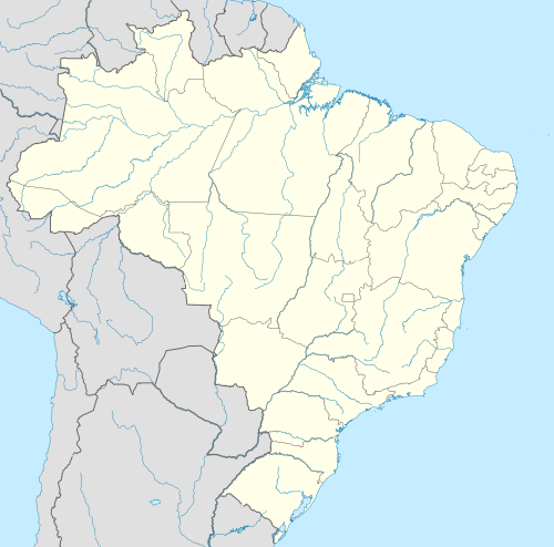 Paracatu Localization of Paracatu in Brazil | |
| Coordinates: 17°13′18″S 46°52′30″W / 17.22167°S 46.87500°W | |
| Country | |
| Region | Southeast |
| State | |
| Founded | October 20, 1798 |
| Government | |
| • Mayor | Olavo Remígio Condé (PSDB) (2013-2016) |
| Area | |
| • Total | 8.229588 km2 (3.177462 sq mi) |
| Elevation | 688 m (2,257 ft) |
| Population (2020 [1]) | |
| • Total | 93,862 |
| • Density | 10.29/km2 (26.7/sq mi) |
| Demonym | Paracatuense |
| Time zone | UTC−3 (BRT) |
| Postal Code (CEP) | 38600-000 |
| Area code | +55 38 |
| Website | www.paracatu.mg.gov.br |
Paracatu is a municipality in the state of Minas Gerais in Brazil. The name is of Tupi origin, translated "good river", from "Para" (river) and "katu" (good).
History[edit]
The region of Paracatu has been explored by Europeans since the end of the 16th century. In the middle of the 18th century deposits of gold and silver were discovered, and the area was settled. The settlement became the town Vila de Paracatu do Príncipe by royal charter in 1798.[2]
Economy[edit]
The economy is centered on gold mining and agriculture.
Mining[edit]
In Paracatu, gold has been mined since 1722.[3] The Morro do Ouro (Paracatu) open-pit mine is operated by Rio Paracatu Mineração (RPM), a 100% owned subsidiary of the Canadian company Kinross Gold Corporation. The gold content of the ore is comparatively low, about 0.41 gram of gold for every ton of ore extracted. Annual production is about 15 tonnes of gold and 5 tonnes of silver.[4][5]
Kinross Gold owns the open-pit Paracatu gold mine operated as Kinross Brasil Mineração S.A. that includes two process plants, two tailings facilities, as well as accompanying infrastructure.[6] This mine is the region's largest employer.[7] In 2015, Paracatu produced 477,662 gold equivalent ounces.[8]
Agriculture[edit]
Cattle raising is the main agricultural activity with 231,000 head (1996). The main breeds are: Zebu (Gir, Indu-Brasil, Guzerá and Nelore), Girolanda, Frisian and Brown-Swiss. There is also large production of soybeans, corn, rice, beans, and also some coffee. Paracatu is the commercial center for an area one third the size of Portugal. In 2006 there were 6 banking branches: Banco do Brasil, Itaú, Bradesco, Banco Mercantil, Banco Bamerindus, and Caixa Econômica Federal.[9] The GDP was R$754,090,000 (2005).[10]
In 1978 the municipality began to receive investments from the Brazilian and the Japanese government to develop the cerrado soils, through the PRODECER-Programa de Cooperação Nipo-Brasileiro para o Desenvolviemnto do Cerrado.
Because of new technologies used to develop the cerrado, agriculture in Paracatu became efficient and profitable in many properties. Nowadays, the cultivated area in the municipality surpasses 1000 square kilometres, with 300 square kilometres irrigated by central pivot sprinklers. This number has raised Paracatu to the position of greatest continuous area irrigated by center pivot irrigation in South America, using 318 center pivot sprinklers.[11]
Agricultural data[edit]
In 2006 there were 995 rural producers with total agricultural land of 389,095 ha. Of the total 85,000 ha. were planted, 180,000 ha. were in natural pasture, and 113,000 were in forest or woodland. Around 4,500 persons were employed in agriculture. There were 768 tractors. The planted area of some of the main crops in hectares was:
- Corn: 12,000
- Soybeans: 30,000
- Sorghum: 2,000
- Rice: 2,670
- Coffee: 1,050
- Cotton: 3,000
- Sugarcane: 1,600
- Beans: 9,100
- Watermelon: 1,050 [10]
Quilombola population[edit]
Many quilombola (descendants of escaped slaves) communities live in and near Paracatu, often in poverty.[12][13]
Health and education[edit]
In 2005 there were 29 health establishments, 19 of which were public and 10 of which were private. There was 1 hospital with 139 beds.[10] The score on the Municipal Human Development Index was 0.760. This ranked Paracatu 207 out of 853 municipalities in the state, with Poços de Caldas in first place with 0.841 and Setubinha in last place with 0.568.[14]
Paracatu has 4 faculties with undergraduation and graduation courses: Faculdade Tecsoma, FINOM – Faculdade do Noroeste de Minas, Faculdade Unimontes, and Faculdade Atenas.[15]
Transportation[edit]
The city is served by Pedro Rabelo de Souza Airport.
Climate[edit]
Paracatu has a tropical savanna climate (Köppen: Aw) with a hot rainy season and warm dry season.
| Climate data for Paracatu (1991–2020) | |||||||||||||
|---|---|---|---|---|---|---|---|---|---|---|---|---|---|
| Month | Jan | Feb | Mar | Apr | May | Jun | Jul | Aug | Sep | Oct | Nov | Dec | Year |
| Mean daily maximum °C (°F) | 30.5 (86.9) |
30.8 (87.4) |
30.3 (86.5) |
30.0 (86.0) |
28.7 (83.7) |
28.0 (82.4) |
28.3 (82.9) |
30.1 (86.2) |
32.0 (89.6) |
32.5 (90.5) |
30.5 (86.9) |
30.0 (86.0) |
30.1 (86.2) |
| Daily mean °C (°F) | 24.6 (76.3) |
24.8 (76.6) |
24.4 (75.9) |
23.9 (75.0) |
22.0 (71.6) |
20.7 (69.3) |
20.7 (69.3) |
22.4 (72.3) |
24.6 (76.3) |
25.7 (78.3) |
24.5 (76.1) |
24.3 (75.7) |
23.6 (74.5) |
| Mean daily minimum °C (°F) | 20.3 (68.5) |
20.3 (68.5) |
20.1 (68.2) |
19.2 (66.6) |
16.7 (62.1) |
15.1 (59.2) |
14.7 (58.5) |
15.8 (60.4) |
18.5 (65.3) |
20.2 (68.4) |
20.1 (68.2) |
20.2 (68.4) |
18.4 (65.1) |
| Average precipitation mm (inches) | 258.0 (10.16) |
204.4 (8.05) |
207.8 (8.18) |
73.8 (2.91) |
24.1 (0.95) |
5.6 (0.22) |
0.9 (0.04) |
8.9 (0.35) |
28.8 (1.13) |
80.3 (3.16) |
212.2 (8.35) |
313.4 (12.34) |
1,418.2 (55.83) |
| Average precipitation days (≥ 1.0 mm) | 15.1 | 11.7 | 12.3 | 6.3 | 2.3 | 0.6 | 0.3 | 0.8 | 3.2 | 6.9 | 14.1 | 17.4 | 91.0 |
| Average relative humidity (%) | 76.9 | 75.8 | 78.2 | 75.0 | 72.6 | 69.1 | 63.4 | 55.9 | 54.7 | 60.3 | 74.3 | 78.7 | 69.6 |
| Average dew point °C (°F) | 20.6 (69.1) |
20.7 (69.3) |
20.9 (69.6) |
19.8 (67.6) |
17.6 (63.7) |
15.8 (60.4) |
14.4 (57.9) |
14.0 (57.2) |
15.4 (59.7) |
17.6 (63.7) |
19.9 (67.8) |
20.6 (69.1) |
18.1 (64.6) |
| Mean monthly sunshine hours | 192.6 | 187.5 | 203.0 | 230.2 | 247.4 | 258.8 | 270.9 | 277.0 | 246.5 | 219.4 | 163.9 | 165.8 | 2,663 |
| Source: NOAA[16] | |||||||||||||
See also[edit]
References[edit]
- ^ IBGE 2020
- ^ IBGE, history
- ^ www.theguardian.com: Canadian Mininig commany spied on opponents and activists in Brazil. (13-May-2015)
- ^ "Kinross: Operation: Paracatu Brazil". Kinross Gold Corporation. Archived from the original on September 9, 2010. Retrieved July 23, 2010.
- ^ Henderson, R. D. (July 31, 2006). "Paracatu Mine Technical Report" (PDF). Kinross Gold Corporation. Archived from the original (PDF) on October 11, 2010. Retrieved July 23, 2010.
- ^ Canadian and American Mines Handbook. Business Information Group. 2005. ISBN 978-0-919336-63-6.
- ^ "Metso to supply grinding equipment to Kinross Gold's Paracatu in Brazil". International Mining. International Mining. Retrieved 23 September 2016.
- ^ See page MDA 20 of 2015 Kinross Gold Annual Report http://s2.q4cdn.com/496390694/files/doc_financials/annual/2016/2015-Kinross-Gold-Annual-Report.pdf
- ^ "Agências bancárias". Prefeitura Municipal Paracatu. Retrieved 2010-07-23.
- ^ a b c "IBGE". IBGE. Retrieved 2010-07-23.
- ^ "Prefeitura Municipal de Paracatu". Paracatu.mg.gov.br. Retrieved 2010-07-23.
- ^ Colitt, Raymond (July 4, 2007). "Descendants of slaves still suffer in Brazil". Reuters. Retrieved July 23, 2010.
- ^ Pyl, Bianca (May 3, 2010). "Incra não cumpre meta e titula 2 territórios quilombolas em 2009". Repórter Brasil (in Portuguese). Retrieved July 23, 2010.
- ^ "Frigoletto". Frigoletto. Archived from the original on 2011-07-06. Retrieved 2010-07-23.
- ^ "Cidades On Line – Paracatu". Paracatuonline.com.br. Retrieved 2010-07-23.
- ^ "World Meteorological Organization Climate Normals for 1991-2020 — Paracatu". National Oceanic and Atmospheric Administration. Retrieved January 31, 2024.
External links[edit]

| International | |
|---|---|
| National | |