Prachatice: Difference between revisions
Sangjinhwa (talk | contribs) |
Link no longer exists. Removed. |
||
| (38 intermediate revisions by 19 users not shown) | |||
| Line 1: | Line 1: | ||
{{Infobox settlement |
|||
{{refimprove|date=March 2012}} |
|||
| name = Prachatice |
|||
{{Geobox | Settlement |
|||
| other_name = |
|||
<!-- *** Heading *** --> |
|||
| |
| settlement_type = [[Obec|Town]] |
||
<!-- images --> |
|||
| other_name = |
|||
| |
| image_skyline = Town hall in Prachatice in 2011 (3).JPG |
||
| image_caption = Town square with the town hall |
|||
<!-- *** Image *** --> |
|||
| |
| image_flag = Flag of Prachatice.svg |
||
| |
| image_shield = Prachatice znak.svg |
||
<!-- |
<!-- location --> |
||
| subdivision_type = Country |
|||
| flag = Flag of Prachatice.svg | flag_border = 1 |
|||
| |
| subdivision_name = {{CZE}} |
||
| subdivision_type1 = [[Regions of the Czech Republic|Region]] |
|||
<!-- *** Name *** --> |
|||
| subdivision_name1 = [[South Bohemian Region|South Bohemian]] |
|||
| etymology = |
|||
| subdivision_type2 = [[Districts of the Czech Republic|District]] |
|||
| official_name = |
|||
| subdivision_name2 = [[Prachatice District|Prachatice]] |
|||
| motto = |
|||
<!-- maps and coordinates --> |
|||
| nickname = |
|||
| image_map = |
|||
<!-- *** Country etc. *** --> |
|||
| |
| map_caption = |
||
| |
| pushpin_map = Czech Republic |
||
| |
| pushpin_relief = 1 |
||
| pushpin_map_caption = Location in the Czech Republic |
|||
| region = [[South Bohemian Region|South Bohemian]] |
|||
| coordinates = {{coord|49|0|47|N|13|59|51|E|display=inline,title}} |
|||
| region_type = [[Regions of the Czech Republic|Region]] |
|||
| coordinates_footnotes = |
|||
| district = [[Prachatice District|Prachatice]] |
|||
<!-- government type, leaders --> |
|||
| district_type = [[Districts of the Czech Republic|District]] |
|||
| |
| leader_title = Mayor |
||
| |
| leader_name = Jan Bauer |
||
<!-- |
<!-- established --> |
||
| |
| established_title = First mentioned |
||
| |
| established_date = 1300 |
||
<!-- |
<!-- area --> |
||
| |
| area_footnotes = |
||
| |
| area_total_km2 = 38.92 |
||
<!-- elevation --> |
|||
| lat_d = 49 |
|||
| |
| elevation_footnotes = |
||
| |
| elevation_m = 561 |
||
<!-- population --> |
|||
| long_d = 14 |
|||
| |
| population_as_of = 2024-01-01 |
||
| population_footnotes = <ref>{{cite web |title=Population of Municipalities – 1 January 2024|url=https://www.czso.cz/csu/czso/population-of-municipalities-qexb0dqr2d|publisher=[[Czech Statistical Office]]|date=2024-05-17}}</ref> |
|||
| long_EW = E |
|||
| |
| population_total = 11250 |
||
| population_density_km2 = auto |
|||
| highest_elevation = |
|||
<!-- time zone(s) --> |
|||
| highest_lat_d = |
|||
| timezone1 = [[Central European Time|CET]] |
|||
| highest_long_d = |
|||
| |
| utc_offset1 = +1 |
||
| timezone1_DST = [[Central European Summer Time|CEST]] |
|||
| lowest_elevation = |
|||
| |
| utc_offset1_DST = +2 |
||
<!-- postal codes, area code --> |
|||
| lowest_long_d = |
|||
| postal_code_type = Postal code |
|||
<!-- *** Dimensions *** --> |
|||
| |
| postal_code = 383 01 |
||
| |
| area_code_type = |
||
| area_code = |
|||
<!-- *** Population *** --> |
|||
<!-- website, footnotes --> |
|||
| population = 11139 |
|||
| website = {{URL|https://www.prachatice.eu/}} |
|||
| population_date = 2015 |
|||
| footnotes = |
|||
| population_density = auto |
|||
<!-- *** History & management *** --> |
|||
| established = 11th century |
|||
| established_type = Founded |
|||
| mayor = Martin Malý |
|||
<!-- *** Codes *** --> |
|||
| timezone = [[Central European Time|CET]] |
|||
| utc_offset = +1 |
|||
| timezone_DST = [[Central European Summer Time|CEST]] |
|||
| utc_offset_DST = +2 |
|||
| postal_code = 383 01 |
|||
| area_code = |
|||
| code = |
|||
<!-- *** Free frields *** --> |
|||
| free = |
|||
<!-- *** Maps *** --> |
|||
| map = Czechia - outline map.svg |
|||
| map_background = Czechia - background map.png |
|||
| map_caption = Location in the Czech Republic |
|||
| map_locator = Czechia |
|||
<!-- *** Websites *** --> |
|||
| statistics = [http://www.statnisprava.cz/ebe/ciselniky.nsf/i/550094 statnisprava.cz] |
|||
| website = [http://www.prachatice.cz/ www.prachatice.cz] |
|||
<!-- *** Footnotes *** --> |
|||
| footnotes = |
|||
}} |
}} |
||
'''Prachatice''' ({{IPA-cs|ˈpraxacɪtsɛ}}; {{lang-de|Prachatitz}}) is a |
'''Prachatice''' ({{IPA-cs|ˈpraxacɪtsɛ}}; {{lang-de|Prachatitz}}) is a town in the [[South Bohemian Region]] of the [[Czech Republic]]. It has about 11,000 inhabitants. The historic town centre is well preserved and is protected by law as an [[Cultural monument (Czech Republic)#Monument reservations|urban monument reservation]]. |
||
==Administrative parts== |
|||
Prachatice is made up of the town parts of Prachatice I, Prachatice II and Staré Prachatice, and the villages of Kahov, Libínské Sedlo, Městská Lhotka, Oseky, Ostrov, Perlovice, Podolí, Stádla and Volovice. |
|||
==Etymology== |
|||
The name is derived from the old Slavic personal name Prachata. It meant "the village of Prachata's people".<ref name=vp>{{cite web |title=Prachatice Town|url=http://www.visitprachatice.cz/en/prachatice-town/19/|publisher=VisitPrachatice.cz|access-date=2022-08-16}}</ref> |
|||
==Geography== |
|||
Prachatice is located about {{convert|34|km}} west of [[České Budějovice]]. It lies in the [[Bohemian Forest Foothills]]. The highest point is the Libín mountain at {{convert|1093|m|ft|abbr=on}} above sea level. The stream of Živný potok flows through the town. The [[Blanice (Otava)|Blanice]] River flows along the northwestern municipal border. |
|||
==History== |
==History== |
||
[[File:Wenceslas Hollar - Bohemian views 3.jpg|thumb|Engraving from the 17th century]] |
|||
The town of Prachatice has its origins in the 11th century, following the beginning of trade on [[The Golden Path (Europe)|the Golden Path]] (an important salt trade route beginning in [[Passau]], [[Bavaria]]). The property on which the town now stands was initially part of the domain of [[Vyšehrad]] and first came to prominence when the domain's provost purchased the right to impose a toll on traffic on the Golden Path. The settlement later grew in importance when, in the 13th century, it was granted the right to store the salt that was traded on the Golden Path. This privilege made Prachatice the only town in Southern Bohemia that could buy the salt that was sent out of Passau. |
|||
[[File:Fortification of Prachatice in 2011 (4).JPG|thumb|Remains of town fortifications]] |
|||
===9th–15th centuries=== |
|||
During the [[Hussite Wars]] of the 15th century, Prachatice was attacked twice and eventually conquered by the Hussites who killed most of the population of the town. After the end of the conflict, in 1436, Prachatice was granted the status of royal town. Only one year later the town was offered as collateral to Jan Smil of [[Krems an der Donau|Krems]] by King Zikmund ([[Sigismund, Holy Roman Emperor]]), but fell under the control of the [[House of Rožmberk]] for a short period following Smil's execution in 1439 at [[Český Krumlov]]. Oldřich of Rožmberk sold the town of Prachatice almost immediately after the execution but it again became property of the family in 1501. |
|||
Prachatice was founded with the beginning of trade on the Golden Trail, an important salt trade route beginning in [[Passau]] in [[Bavaria]]. Probably in the 9th or 10th century, a settlement was founded in the area of today's Staré Prachatice ("Old Prachatice") town part.<ref name=shs>{{cite web |title=Prachatice|url=https://www.historickasidla.cz/dr-cs/486-prachatice.html|publisher=Sdružení historických sídel Čech, Moravy a Slezska|language=cs|access-date=2021-08-25}}</ref> In the second half of the 12th century, it was acquired by [[Vyšehrad Chapter]].<ref>{{cite web |title=Založení města při obchodní stezce|url=https://www.prachatice.eu/zalozeni%2Dmesta%2Dpri%2Dobchodni%2Dstezce/d-21089/p1=22907|publisher=Město Prachatice|language=cs|access-date=2021-08-25}}</ref> |
|||
When the settlement ceased to suit its purpose, a new settlement was established near the old one at the end of the 13th century. In 1312, Prachatice was first referred to as a town. In 1323, King [[John of Bohemia]] confirmed to the town of Prachatice the right to use the trade route to Passau and to collect customs duties there. Prachatice was fully completed in the 3rd quarter of the 14th century.<ref>{{cite web |title=Počátky Prachatic ve světle historických zpráv|url=https://www.prachatice.eu/pocatky%2Dprachatic%2Dve%2Dsvetle%2Dhistorickych%2Dzprav/d-21082|publisher=Město Prachatice|language=cs|access-date=2021-08-25}}</ref> |
|||
The Rožmberks controlled Prachatice through its most prosperous period until 1601 when Petr Vok, the last member of the family, sold the town to [[Emperor Rudolf II]] who would again make it a royal town. It remained firmly under royal control until the [[Rebellion of the Bohemian Estates]] during which it sided with the rebels. However, in 1620 the town was reconquered by the Imperial commander [[Charles Bonaventure de Longueval, Count of Bucquoy]] who ordered many of its citizens to be slaughtered and a large ransom to be paid to the emperor. |
|||
During the [[Hussite Wars]] in the 15th century, Prachatice was attacked twice and eventually conquered by the [[Hussites]] who killed most of the population of the town. After the end of the conflict, in 1436, Prachatice was granted the status of royal town by King [[Sigismund, Holy Roman Emperor|Sigismund]], and all its old privileges were confirmed. Only one year later the town was offered as collateral to Jan Smil of [[Krems an der Donau|Krems]], but fell under the control of the [[Rosenberg family]] for a short period following Smil's execution in 1439 at [[Český Krumlov]]. [[Oldřich II of Rosenberg]] sold the town of Prachatice almost immediately after the execution but it again became property of the family in 1501. In the second half of the 15th century, the number of inhabitants increased and new houses had to be built.<ref>{{cite web |title=15. století – Husitské války|url=https://www.prachatice.eu/15%2Dstoleti%2Dhusitske%2Dvalky/d-21093/p1=22907|publisher=Město Prachatice|language=cs|access-date=2021-08-25}}</ref> |
|||
After the [[Battle of White Mountain]] the town lost its status and privileges and became the property of the [[House of Eggenberg|Eggenberg]] family, though the emperor's troops remained in the city throughout the remainder of the [[Thirty Years' War]]. Later on in the war the city was conquered by the Swedish army and another large ransom was demanded. |
|||
[[File:Wenceslas Hollar - Bohemian views 3.jpg|thumb|left|Engraving of the 17th century]] |
|||
===16th–20th centuries=== |
|||
The town changed hands again in 1719, following the death of Princess Marie Arnoštka of [[House of Eggenberg|Eggenberg]], this time coming under the control of the affluent [[House of Schwarzenberg|Schwarzenberg]] family. |
|||
In the 16th century, trade on the trail reached its peak and the town prospered.<ref>{{cite web |title=Rozvoj v 16. století|url=https://www.prachatice.eu/rozvoj%2Dv%2D16%2Dstoleti/d-21094/p1=22907|publisher=Město Prachatice|language=cs|access-date=2021-08-25}}</ref> The Rosenbergs controlled Prachatice until 1601 when [[Peter Vok of Rosenberg]], the last member of the family, sold the town to Emperor [[Rudolf II, Holy Roman Emperor|Rudolf II]] who would again make it a royal town in 1609. It remained firmly under royal control until the [[Bohemian Revolt]] during which it sided with the rebels. However, in 1620 the town was reconquered and connected to the [[Český Krumlov|Krumlov]] manor. After the [[Battle of White Mountain]], Prachatice lost its royal town status and privileges and became the property of the [[House of Eggenberg|Eggenberg]] family, though the emperor's troops remained in the town throughout the remainder of the [[Thirty Years' War]]. Later on in the war the town was conquered by the [[Swedish Empire|Swedish army]] and another large ransom was demanded. In the second half of the 17th century, trade on the Golden Trail declined and never was revived.<ref>{{cite web |title=Úpadek v 17. století|url=https://www.prachatice.eu/upadek%2Dv%2D17%2Dstoleti/d-21095/p1=22907|publisher=Město Prachatice|language=cs|access-date=2021-08-25}}</ref> |
|||
The town and the whole Krumlov manor changed hands again in 1719, following the death of Princess Marie Arnoštka of Eggenberg, this time coming under the control of the affluent [[Schwarzenberg family]]. The weak political and economic situation affected the condition of the houses when old ones were not reconstructed and the new were not built.<ref>{{cite web |title=18. století|url=https://www.prachatice.eu/18%2Dstoleti/d-21096/p1=22907|publisher=Město Prachatice|language=cs|access-date=2021-08-25}}</ref> |
|||
Until 1918 the town was part of the [[Austrian monarchy]] (Austrian side after the [[compromise of 1867]]), in the district of the same name, one of the 94 ''Bezirkshauptmannschaften'' in [[Bohemia]].<ref>Die postalischen Abstempelungen auf den österreichischen Postwertzeichen-Ausgaben 1867, 1883 und 1890, Wilhelm KLEIN, 1967</ref> |
|||
Until 1918, the town was part of [[Austria-Hungary]], in the district of the same name, one of the 94 ''Bezirkshauptmannschaften'' in [[Bohemia]].<ref>Die postalischen Abstempelungen auf den österreichischen Postwertzeichen-Ausgaben 1867, 1883 und 1890, Wilhelm Klein, 1967</ref> |
|||
In March 1939, a film at the [[Passau]] ''Nibelungenhalle'' featured the ''Angliederung'' of Prachatice into ''Bayerische Ostmark''.<ref>[[Anna Rosmus]] ''Hitlers Nibelungen'', Samples Grafenau 2015, pp. 196f</ref> |
|||
After 1945 the German population was expelled as a result of |
After 1945, the German population was [[Expulsion of Germans from Czechoslovakia|expelled]] as a result of World War II. |
||
==Demographics== |
|||
'''Historical population''' |
|||
{{historical populations |
|||
|align=none|cols=3 |
|||
|1869|4911 |
|||
|1880|5682 |
|||
|1890|5363 |
|||
|1900|5573 |
|||
|1910|5779 |
|||
|1921|5482 |
|||
|1930|5926 |
|||
|1950|5130 |
|||
|1961|5381 |
|||
|1970|7100 |
|||
|1980|10354 |
|||
|1991|11805 |
|||
|2001|11843 |
|||
|2011|11203 |
|||
|2021|10440 |
|||
|source=Censuses<ref>{{cite web |title=Historický lexikon obcí České republiky 1869–2011 – Okres Prachatice|url=https://www.czso.cz/documents/10180/20537734/130084150315.pdf/3f6450a6-8d54-4262-9203-3d902ec10e1e?version=1.2|publisher=Czech Statistical Office|pages=11–12|language=cs|date=2015-12-21}}</ref><ref>{{cite web |title=Population Census 2021: Population by sex|url=https://vdb.czso.cz/vdbvo2/faces/en/index.jsf?page=vystup-objekt-parametry&z=T&f=TABULKA&sp=A&skupId=4429&katalog=33515&pvo=SLD21001-OB-OK|work=Public Database|publisher=[[Czech Statistical Office]]|date=2021-03-27}}</ref>}} |
|||
==Economy== |
|||
1869: 4,911 inhabitants<br> |
|||
There are no large industrial companies. The largest employer based in the town is the hospital. The largest industrial employers are the companies of InTiCa Systems (manufacturer of electronic components) and Reinfurt-ČR (manufacturer of [[ball bearing]]s), both with more than 250 employees.<ref>{{cite web |title=Registr ekonomických subjektů|url=https://www.czso.cz/csu/res/registr_ekonomickych_subjektu|work=Business Register|publisher=Czech Statistical Office|language=cs|access-date=2023-06-23}}</ref> |
|||
1900: 5,573<br> |
|||
1930: 5,926<br> |
|||
1950: 5,130<br> |
|||
1961: 5,381<br> |
|||
1970: 7,100<br> |
|||
1980: 10,354<br> |
|||
1991: 11,805<br> |
|||
2001: 11,977 |
|||
==Transport== |
|||
==Prachatice today== |
|||
Prachatice is located on the railway line [[Číčenice]]–[[Stožec|Nové Údolí]]. |
|||
==Culture== |
|||
The historical character of the city center has been protected since 1981. |
|||
The town hosts the Golden Salt Path Celebrations every year with a rich cultural program.<ref name=vp/> |
|||
==Sights== |
|||
The dominating industries are machine engineering, electrotechnical industry and timber processing. A new industrial zone has been built. |
|||
[[File:Kostel sv. Jakuba v Prachaticích.jpg|thumb|170px|Church of Saint James the Great]] |
|||
The historic centre is formed by Velké Square and adjoining streets, and is delimited by the remains of the town walls. Due to the stagnation of economic life in the 17th and 18th centuries, Prachatice have many [[Renaissance architecture|Renaissance]] buildings, some of then reconstructed in the [[Empire style]]. Since 1981, the historic core of the town has been protected as an [[Cultural monument (Czech Republic)#Monument reservations|urban monument reservation]].<ref>{{cite web |title=Dnes – městská památková rezervace|url=https://www.prachatice.eu/dnes%2Dmestska%2Dpamatkova%2Drezervace/d-21099/p1=22907|publisher=Město Prachatice|language=cs|access-date=2021-08-25}}</ref> |
|||
One of the main landmarks of the town centre is the Old Town Hall, a Renaissance building from 1570–1571. The New Town Hall was built in pseudo-Renaissance style in 1903.<ref name=sights>{{cite web |title=Průvodce historickým jádrem|url=https://www.prachatice.eu/pruvodce%2Dhistorickym%2Djadrem/d-21100/p1=22908|publisher=Město Prachatice|language=cs|access-date=2021-08-25}}</ref> |
|||
== People == |
|||
{{See also|Category:People from Prachatice|Category:People from Prachatice District}} |
|||
* [[Křišťan of Prachatice]] |
|||
* [[John Neumann]], first American male saint, born in 1811 |
|||
* [[Josef Messner]] (1822–1862), writer |
|||
* [[Adolf Zika]], photographer |
|||
* [[Jiří Fried]]<ref>[[:cs:Jiří Fried]]</ref> |
|||
The Church of Saint James the Great near the square is the largest building in the historic centre. It is a late Gothic building first mentioned in 1359. Its final form was achieved by reconstructions between 1505 and 1513.<ref name=sights/> |
|||
=== Residents === |
|||
* [[Jan Hus]] |
|||
* [[Irma Krützner]], writer and poet, lived here in 1915 - 1946 |
|||
* [[Leo Vaniš]], educator<ref>[[:cs:Leo Vaniš (1936)]]</ref> |
|||
* [[Otakar Ševčík]] |
|||
: See also [http://www.prachatice.cz/n_osobnosti_vse.html?Sort=2 detailed list]. |
|||
Dolní Gate ("Lower Gate"; also called ''[[Písek|Písecká]]'') is a preserved element of stone town fortifications, which comes from the first half of the 15th century. The gate is from around 1527 and creates the entrance to the historic centre.<ref>{{cite web |title=Dolní brána|url=https://www.prachatice.eu/dolni%2Dbrana/d-21103/p1=22908|publisher=Město Prachatice|language=cs|access-date=2021-08-25}}</ref> |
|||
==Main sights== |
|||
*Town hall (Stará radnice) |
|||
*Church of St. James (Kostel svatého Jakuba) |
|||
==Notable people== |
|||
==International relations== |
|||
{{See also|Category:People from Prachatice}} |
|||
{{See also|List of twin towns and sister cities in the Czech Republic}} |
|||
*[[Christian of Prachatice]] ({{circa|1368}}–1439), astronomer, mathematician and medic |
|||
*[[Jan Hus]] ({{circa|1372}}–1415), theologian, philosopher and reformer, studied here |
|||
*[[John Neumann]] (1811–1860), first American male saint |
|||
*[[Miroslav Soukup]] (born 1965), footballer and football manager |
|||
*[[Adolf Zika]] (born 1972), photographer |
|||
*[[David Horejš]] (born 1977), football player and manager |
|||
*[[Kateřina Nash]] (born 1977), cross-country skier and cyclist |
|||
*[[Lucie Sekanová]] (born 1989), athlete |
|||
==Twin towns – sister cities== |
|||
{{See also|List of twin towns and sister cities in the Czech Republic}} |
|||
* {{flagicon|SVK}} [[Zvolen]] in [[Slovakia]] |
|||
Prachatice is [[Sister city|twinned]] with:<ref>{{cite web |title=Partnerská města|url=https://www.prachatice.eu/partnerska-mesta/ds-1414|publisher=Město Prachatice|language=cs|access-date=2024-03-05}}</ref> |
|||
* {{flagicon|BLR}} [[Rahačoŭ]] in [[Belarus]] |
|||
{{div col|colwidth=20em}} |
|||
* {{flagicon|ITA}} [[Impruneta]] in [[Italy]] |
|||
* |
*{{flagicon|ITA}} [[Castrocaro Terme e Terra del Sole]], Italy |
||
* |
*{{flagicon|GER}} [[Grainet]], Germany |
||
* |
*{{flagicon|LTU}} [[Ignalina District Municipality|Ignalina]], Lithuania |
||
* |
*{{flagicon|ITA}} [[Impruneta]], Italy |
||
* |
*{{flagicon|AUT}} [[Mauthausen, Upper Austria|Mauthausen]], Austria |
||
*{{flagicon|GER}} [[Waldkirchen]], Germany |
|||
*{{flagicon|SVK}} [[Zvolen]], Slovakia |
|||
{{div col end}} |
|||
==References== |
==References== |
||
{{reflist}} |
{{reflist}} |
||
==External links== |
==External links== |
||
{{commons category|Prachatice}} |
|||
* [http://www.prachatice.cz/n_index.html Municipal website] {{cs icon}} [http://www.prachatice.cz/n_index_en.html English version] {{en icon}} |
|||
* |
*{{official|https://www.prachatice.eu/}} |
||
*[http://www.discoverczech.com/prachatice/index.php4 Prachatice on DiscoverCzech travel agency] {{in lang|en}} – basic facts, history, sights, one-day trips |
|||
* [http://www.sumava.com/rec_gemeente.php?l=en&dis=j_p Region of Prachatice] {{en icon}} |
|||
* [http://www.discoverczech.com/prachatice/index.php4 Prachatice] {{en icon}} - basic facts, history, sights, one-day trips |
|||
* [http://www.travel.cz/guide/143/index_en.html Kratochvile Château] {{en icon}} - general info, history, exhibitions, opening hours, prices |
|||
{{ |
{{Prachatice District}} |
||
{{ |
{{authority control}} |
||
[[Category:Cities and towns in the Czech Republic]] |
[[Category:Cities and towns in the Czech Republic]] |
||
[[Category:Populated places in Prachatice District]] |
[[Category:Populated places in Prachatice District]] |
||
[[Category:Prácheňsko]] |
|||
[[Category:Bohemian Forest]] |
|||
Revision as of 03:46, 29 June 2024
Prachatice | |
|---|---|
 Town square with the town hall | |
 Flag  Coat of arms | |
 Prachatice Location in the Czech Republic | |
| Coordinates: 49°0′47″N 13°59′51″E / 49.01306°N 13.99750°E | |
| Country | |
| Region | South Bohemian |
| District | Prachatice |
| First mentioned | 1300 |
| Government | |
| • Mayor | Jan Bauer |
| Area | |
| • Total | 38.92 km2 (15.03 sq mi) |
| Elevation | 561 m (1,841 ft) |
| Population (2024-01-01)[1] | |
| • Total | 11,250 |
| • Density | 290/km2 (750/sq mi) |
| Time zone | UTC+1 (CET) |
| • Summer (DST) | UTC+2 (CEST) |
| Postal code | 383 01 |
| Website | www |
Prachatice (Czech pronunciation: [ˈpraxacɪtsɛ]; German: Prachatitz) is a town in the South Bohemian Region of the Czech Republic. It has about 11,000 inhabitants. The historic town centre is well preserved and is protected by law as an urban monument reservation.
Administrative parts
Prachatice is made up of the town parts of Prachatice I, Prachatice II and Staré Prachatice, and the villages of Kahov, Libínské Sedlo, Městská Lhotka, Oseky, Ostrov, Perlovice, Podolí, Stádla and Volovice.
Etymology
The name is derived from the old Slavic personal name Prachata. It meant "the village of Prachata's people".[2]
Geography
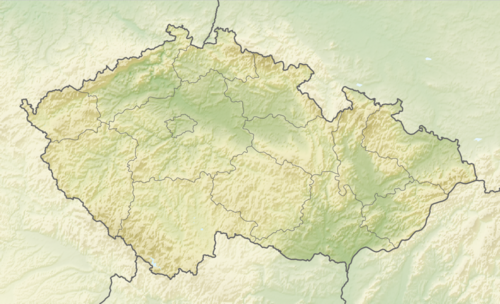
Prachatice is located about 34 kilometres (21 mi) west of České Budějovice. It lies in the Bohemian Forest Foothills. The highest point is the Libín mountain at 1,093 m (3,586 ft) above sea level. The stream of Živný potok flows through the town. The Blanice River flows along the northwestern municipal border.
History


9th–15th centuries
Prachatice was founded with the beginning of trade on the Golden Trail, an important salt trade route beginning in Passau in Bavaria. Probably in the 9th or 10th century, a settlement was founded in the area of today's Staré Prachatice ("Old Prachatice") town part.[3] In the second half of the 12th century, it was acquired by Vyšehrad Chapter.[4]
When the settlement ceased to suit its purpose, a new settlement was established near the old one at the end of the 13th century. In 1312, Prachatice was first referred to as a town. In 1323, King John of Bohemia confirmed to the town of Prachatice the right to use the trade route to Passau and to collect customs duties there. Prachatice was fully completed in the 3rd quarter of the 14th century.[5]
During the Hussite Wars in the 15th century, Prachatice was attacked twice and eventually conquered by the Hussites who killed most of the population of the town. After the end of the conflict, in 1436, Prachatice was granted the status of royal town by King Sigismund, and all its old privileges were confirmed. Only one year later the town was offered as collateral to Jan Smil of Krems, but fell under the control of the Rosenberg family for a short period following Smil's execution in 1439 at Český Krumlov. Oldřich II of Rosenberg sold the town of Prachatice almost immediately after the execution but it again became property of the family in 1501. In the second half of the 15th century, the number of inhabitants increased and new houses had to be built.[6]
16th–20th centuries
In the 16th century, trade on the trail reached its peak and the town prospered.[7] The Rosenbergs controlled Prachatice until 1601 when Peter Vok of Rosenberg, the last member of the family, sold the town to Emperor Rudolf II who would again make it a royal town in 1609. It remained firmly under royal control until the Bohemian Revolt during which it sided with the rebels. However, in 1620 the town was reconquered and connected to the Krumlov manor. After the Battle of White Mountain, Prachatice lost its royal town status and privileges and became the property of the Eggenberg family, though the emperor's troops remained in the town throughout the remainder of the Thirty Years' War. Later on in the war the town was conquered by the Swedish army and another large ransom was demanded. In the second half of the 17th century, trade on the Golden Trail declined and never was revived.[8]
The town and the whole Krumlov manor changed hands again in 1719, following the death of Princess Marie Arnoštka of Eggenberg, this time coming under the control of the affluent Schwarzenberg family. The weak political and economic situation affected the condition of the houses when old ones were not reconstructed and the new were not built.[9]
Until 1918, the town was part of Austria-Hungary, in the district of the same name, one of the 94 Bezirkshauptmannschaften in Bohemia.[10]
After 1945, the German population was expelled as a result of World War II.
Demographics
|
|
| ||||||||||||||||||||||||||||||||||||||||||||||||||||||
| Source: Censuses[11][12] | ||||||||||||||||||||||||||||||||||||||||||||||||||||||||
Economy
There are no large industrial companies. The largest employer based in the town is the hospital. The largest industrial employers are the companies of InTiCa Systems (manufacturer of electronic components) and Reinfurt-ČR (manufacturer of ball bearings), both with more than 250 employees.[13]
Transport
Prachatice is located on the railway line Číčenice–Nové Údolí.
Culture
The town hosts the Golden Salt Path Celebrations every year with a rich cultural program.[2]
Sights

The historic centre is formed by Velké Square and adjoining streets, and is delimited by the remains of the town walls. Due to the stagnation of economic life in the 17th and 18th centuries, Prachatice have many Renaissance buildings, some of then reconstructed in the Empire style. Since 1981, the historic core of the town has been protected as an urban monument reservation.[14]
One of the main landmarks of the town centre is the Old Town Hall, a Renaissance building from 1570–1571. The New Town Hall was built in pseudo-Renaissance style in 1903.[15]
The Church of Saint James the Great near the square is the largest building in the historic centre. It is a late Gothic building first mentioned in 1359. Its final form was achieved by reconstructions between 1505 and 1513.[15]
Dolní Gate ("Lower Gate"; also called Písecká) is a preserved element of stone town fortifications, which comes from the first half of the 15th century. The gate is from around 1527 and creates the entrance to the historic centre.[16]
Notable people
- Christian of Prachatice (c. 1368–1439), astronomer, mathematician and medic
- Jan Hus (c. 1372–1415), theologian, philosopher and reformer, studied here
- John Neumann (1811–1860), first American male saint
- Miroslav Soukup (born 1965), footballer and football manager
- Adolf Zika (born 1972), photographer
- David Horejš (born 1977), football player and manager
- Kateřina Nash (born 1977), cross-country skier and cyclist
- Lucie Sekanová (born 1989), athlete
Twin towns – sister cities
Prachatice is twinned with:[17]
Castrocaro Terme e Terra del Sole, Italy
Grainet, Germany
Ignalina, Lithuania
Mauthausen, Austria
Zvolen, Slovakia
References
- ^ "Population of Municipalities – 1 January 2024". Czech Statistical Office. 2024-05-17.
- ^ a b "Prachatice Town". VisitPrachatice.cz. Retrieved 2022-08-16.
- ^ "Prachatice" (in Czech). Sdružení historických sídel Čech, Moravy a Slezska. Retrieved 2021-08-25.
- ^ "Založení města při obchodní stezce" (in Czech). Město Prachatice. Retrieved 2021-08-25.
- ^ "Počátky Prachatic ve světle historických zpráv" (in Czech). Město Prachatice. Retrieved 2021-08-25.
- ^ "15. století – Husitské války" (in Czech). Město Prachatice. Retrieved 2021-08-25.
- ^ "Rozvoj v 16. století" (in Czech). Město Prachatice. Retrieved 2021-08-25.
- ^ "Úpadek v 17. století" (in Czech). Město Prachatice. Retrieved 2021-08-25.
- ^ "18. století" (in Czech). Město Prachatice. Retrieved 2021-08-25.
- ^ Die postalischen Abstempelungen auf den österreichischen Postwertzeichen-Ausgaben 1867, 1883 und 1890, Wilhelm Klein, 1967
- ^ "Historický lexikon obcí České republiky 1869–2011 – Okres Prachatice" (in Czech). Czech Statistical Office. 2015-12-21. pp. 11–12.
- ^ "Population Census 2021: Population by sex". Public Database. Czech Statistical Office. 2021-03-27.
- ^ "Registr ekonomických subjektů". Business Register (in Czech). Czech Statistical Office. Retrieved 2023-06-23.
- ^ "Dnes – městská památková rezervace" (in Czech). Město Prachatice. Retrieved 2021-08-25.
- ^ a b "Průvodce historickým jádrem" (in Czech). Město Prachatice. Retrieved 2021-08-25.
- ^ "Dolní brána" (in Czech). Město Prachatice. Retrieved 2021-08-25.
- ^ "Partnerská města" (in Czech). Město Prachatice. Retrieved 2024-03-05.
External links
- Official website
- Prachatice on DiscoverCzech travel agency (in English) – basic facts, history, sights, one-day trips
| International | |
|---|---|
| National | |