St. Joseph, Missouri: Difference between revisions
Snafflekid (talk | contribs) beautify |
Snafflekid (talk | contribs) {{subst:clear}} template |
||
| Line 65: | Line 65: | ||
Saint Joseph peaked as an expansionist city in [[1900]], with a census population of 102,979. In [[1997]], Saint Joseph was named an "[[All-America City Award|All-America City]]" by the [[National Civic League]]. [http://www.ncl.org/aac/past_winners/past_winners.html] Saint Joseph was voted the top true western town of 2007 by the [[True West Magazine]], in the January/February 2008 issue. |
Saint Joseph peaked as an expansionist city in [[1900]], with a census population of 102,979. In [[1997]], Saint Joseph was named an "[[All-America City Award|All-America City]]" by the [[National Civic League]]. [http://www.ncl.org/aac/past_winners/past_winners.html] Saint Joseph was voted the top true western town of 2007 by the [[True West Magazine]], in the January/February 2008 issue. |
||
<div style="clear:both"></div> |
|||
==Geography== |
==Geography== |
||
Saint Joseph is located at {{coor dms|39|45|29|N|94|50|12|W|city}} (39.757944, -94.836541){{GR|1}}, on the Missouri/Kansas border in northwestern Missouri. The nearest major metropolitan area to Saint Joseph is the [[Kansas City Metropolitan Area]], which begins approximately 30 miles to the south. [[Image:St Joseph Missouri downtown.jpg|thumb|350px|Downtown St. Joseph in 2006]]The nearest major airport is [[Kansas City International Airport]], which is approximately 35 miles to the south. According to the [[United States Census Bureau]], the city has a total area of 44.5 [[square mile]]s (115.3 [[km²]]), of which, 43.8 square miles (113.5 km²) of it is land and 0.7 square miles (1.7 km²) of it (1.48%) is water. |
Saint Joseph is located at {{coor dms|39|45|29|N|94|50|12|W|city}} (39.757944, -94.836541){{GR|1}}, on the Missouri/Kansas border in northwestern Missouri. The nearest major metropolitan area to Saint Joseph is the [[Kansas City Metropolitan Area]], which begins approximately 30 miles to the south. [[Image:St Joseph Missouri downtown.jpg|thumb|350px|Downtown St. Joseph in 2006]]The nearest major airport is [[Kansas City International Airport]], which is approximately 35 miles to the south. According to the [[United States Census Bureau]], the city has a total area of 44.5 [[square mile]]s (115.3 [[km²]]), of which, 43.8 square miles (113.5 km²) of it is land and 0.7 square miles (1.7 km²) of it (1.48%) is water. |
||
Revision as of 06:10, 3 May 2008
City of St. Joseph, Missouri | |
|---|---|
 Downtown St. Joseph in 2006 | |
| Nickname: St. Joe | |
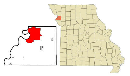 Location in the state of Missouri | |
 U.S. Census Map | |
| Country | United States |
| State | Missouri |
| County | Buchanan |
| Government | |
| • Mayor | Ken Shearin |
| Population (2006) | |
| • Total | 72,651 |
| Time zone | UTC-6 (CST) |
| • Summer (DST) | UTC-5 (CDT) |
| Website | http://www.stjoemo.info/ |

Saint Joseph (informally, St. Joe) is the largest city in Northwest Missouri, and seventh largest city in the state, serving as the county seat for Buchanan County. As of the 2000 census, the city had a total population of 73,990.[1] The St. Joseph Metropolitan Statistical Area, which includes Buchanan, Andrew, and DeKalb counties in Missouri and Doniphan County, Kansas, had an estimated population of 122,306 in 2006. Saint Joseph is also home to Missouri Western State University.
History
Saint Joseph was founded by Joseph Robidoux, a local fur trader, and officially incorporated in 1843.[2] In its early days, it was a bustling outpost and rough frontier town, serving as a last supply point and jumping-off point over the Missouri River toward the "Wild West", this due largely to the fact that it was the westernmost point in the United States accessible by rail until after the American Civil War.
Several events of particular historical note occurred in Saint Joseph. Between April 3, 1860, and late October 1861, Saint Joseph was one of the two endpoints of the Pony Express. In 1882, also on April 3, the notorious Jesse James was killed at his home, originally located at 1318 Lafayette, now sited next to The Patee House, a hotel that had formerly served as the home of both Patee Female College and St. Joseph Female College.[3] James was living under the alias of Mr. Howard. An excerpt from a popular poem of the time is: "...that dirty little coward that shot Mr. Howard has laid poor Jesse in his grave."
The Heaton-Bowman-Smith Funeral Home maintains a small museum about Jesse James. Their predecessors conducted the funeral. The museum is open to the public. His home, which has been relocated at least three times, is now maintained as a tourist attraction that features the bullet hole from that fateful shot. These two events lend Saint Joseph the slogan, "Where the Pony Express started and Jesse James ended."
Saint Joseph peaked as an expansionist city in 1900, with a census population of 102,979. In 1997, Saint Joseph was named an "All-America City" by the National Civic League. [1] Saint Joseph was voted the top true western town of 2007 by the True West Magazine, in the January/February 2008 issue.
Geography
Saint Joseph is located at 39°45′29″N 94°50′12″W / 39.75806°N 94.83667°WInvalid arguments have been passed to the {{#coordinates:}} function (39.757944, -94.836541)Template:GR, on the Missouri/Kansas border in northwestern Missouri. The nearest major metropolitan area to Saint Joseph is the Kansas City Metropolitan Area, which begins approximately 30 miles to the south.

The nearest major airport is Kansas City International Airport, which is approximately 35 miles to the south. According to the United States Census Bureau, the city has a total area of 44.5 square miles (115.3 km²), of which, 43.8 square miles (113.5 km²) of it is land and 0.7 square miles (1.7 km²) of it (1.48%) is water.
Demographics
As of the censusTemplate:GR of 2000, there were 73,990 people, 29,026 households, and 18,460 families residing in the city. The population density was 1,687.7 people per square mile (651.6/km²). There were 31,752 housing units at an average density of 724.2/sq mi (279.6/km²). The racial makeup of the city was 91.88% White, 5.03% African American, 0.46% Native American, 0.47% Asian, 0.03% Pacific Islander, 0.69% from other races, and 1.44% from two or more races. Hispanic or Latino of any race were 2.61% of the population.
There were 29,026 households out of which 30.1% had children under the age of 18 living with them, 46.7% were married couples living together, 12.8% had a female householder with no husband present, and 36.4% were non-families. 30.4% of all households were made up of individuals and 13.2% had someone living alone who was 65 years of age or older. The average household size was 2.39 and the average family size was 2.98.
In the city the population was spread out with 24.1% under the age of 18, 11.6% from 18 to 24, 28.6% from 25 to 44, 20.3% from 45 to 64, and 15.4% who were 65 years of age or older. The median age was 36 years. For every 100 females there were 95.6 males. For every 100 females age 18 and over, there were 92.7 males.
The median income for a household in the city was $32,663, and the median income for a family was $40,995. Males had a median income of $31,300 versus $21,592 for females. The per capita income for the city was $17,445. About 9.1% of families and 13.0% of the population were below the poverty line, including 15.5% of those under age 18 and 9.8% of those age 65 or over.
Schools
The St. Joseph School District operates 3 public high schools in St. Joseph
The St. Joseph School District operates 4 public middle schools in St. Joseph
- Bode Middle School
- Robidoux Middle School
- Spring Garden Middle School
- Truman Middle School
The St. Joseph School District operates 18 public elementary schools in St. Joseph
- Coleman Elementary School
- Edison Elementary School
- Ellison Elementary School
- Eugene Field Elementary School
- Hall Elementary School
- Humboldt Elementary School
- Hosea Elementary School
- Hyde Elementary School
- Lake Contrary Elementary School
- Lindbergh Elementary School
- Mark Twain Elementary School
- Neely Elementary School
- Noyes Elementary School
- Parkway Elementary School
- Pershing Elementary School
- Pickett Elementary School
- Skaith Elementary School
- Webster Elementary School
The following private schools are in St. Joseph.
Places of interest


- Jesse James Home Museum
- Krug Park
- Parkway Saint Joseph, Missouri
- Pony Express Museum
- Rosecrans Memorial Airport
- Historic Missouri Theatre
- St. Joseph Museum
- Glore Psychiatric Museum
- St. Joseph Fire Museum
Notable natives
- Norbert Brodine
- Dwayne Blakley
- Matt Cates
- Walter Cronkite
- John Mark Eberhart
- Eminem
- Eugene Field
- Betty Garrett
- Anthony Glise
- Jody Hamilton
- Coleman Hawkins
- Shere Hite
- Jesse James
- Timothy Omundson
- Arthur Pryor
- Mike Rucker
- Manuel Sanchez
- Jay Sarno
- Bill Snyder
- Steve Walsh
- Ruth Warrick
- James H. Webb
- Jane Wyman
- Delmer J. Yoakum
- Brian Zahnd
Media outlets
Television stations
- KQTV, Channel 2, KQ2 (ABC)
- KTAJ, Channel 16, TV16 (TBN)
- ST. JOE NOW, Cable Channel 3, St. Joe Now (Local)
Radio stations
- KFEQ, 680 AM (News/talk radio)
- KGNM, 1270 AM (Christian radio)
- KKJO, 105.5 FM, K-Jo (Hot AC)
- KSFT, 1550 AM (Oldies)
- KSJQ, 92.7 FM, Q Country (Country)
- KSRD, 91.9 FM (Christian Radio)
Newspapers
- St. Joseph News-Press
- The Saint Joseph Telegraph
- Regular Joe
- Estrella Norteña
- The Compass
See also
References
- ^ U.S. Census Bureau (2006). "Missouri -- Place and County Subdivision". U.S. Census Bureau.
{{cite web}}: Unknown parameter|accessmonthday=ignored (help); Unknown parameter|accessyear=ignored (|access-date=suggested) (help) - ^ North America Travel Guide. "Saint Peters : Missouri". North America Travel Guide.
{{cite web}}: Unknown parameter|accessmonthday=ignored (help); Unknown parameter|accessyear=ignored (|access-date=suggested) (help) - ^ [St. Joseph History - Jesse James Home.
External links
- Sally Rand Museum
- St. Joseph Convention & Visitors Bureau
- StJoMo! St. Joseph History
- Robidoux Resident Theatre
- Estrella Norteña bi-lingual Newspaper
Municipalities and communities of Buchanan County, Missouri, United States | ||
|---|---|---|
| Cities |  | |
| Villages | ||
| Townships | ||
| CDP | ||
| Other communities | ||
| Footnotes | ‡This populated place also has portions in an adjacent county or counties | |