Sutton Creek (Ireland): Difference between revisions
Content deleted Content added
m en-IE |
info |
||
| Line 3: | Line 3: | ||
{{Use dmy dates|date=February 2022}} |
{{Use dmy dates|date=February 2022}} |
||
{{Use Irish English|date=February 2022}} |
{{Use Irish English|date=February 2022}} |
||
{{Infobox body of water |
|||
| name = Sutton Creek |
|||
| native_name = |
|||
| native_name_lang = |
|||
| other_name = |
|||
<!-- Images --> |
|||
| image = Sutton Creek.jpg |
|||
| alt = |
|||
| caption = View to south |
|||
| image_bathymetry = |
|||
| alt_bathymetry = |
|||
| caption_bathymetry = |
|||
<!-- Stats --> |
|||
| location = [[Dublin, Ireland]] |
|||
| group = |
|||
| coordinates = {{coord|53|20|N|6|07|W|region:IE_type:waterbody|display=inline,title}}<!-- {{coord|DD|MM|SS|N|DD|MM|SS|W|region:ZZ_type:waterbody|display=inline,title}} --> |
|||
| type = |
|||
| etymology = |
|||
| part_of = [[Irish Sea]] |
|||
| inflow = |
|||
| rivers = |
|||
| outflow = |
|||
| oceans = |
|||
| catchment = <!-- {{convert|VALUE|UNITS}} must be used --> |
|||
| basin_countries = |
|||
| agency = |
|||
| designation = |
|||
| date-built = <!-- {{Start date|df=yes|YYYY|MM|DD}} For man-made and other recent bodies of water --> |
|||
| engineer = |
|||
| date-flooded = <!-- {{Start date|df=yes|YYYY|MM|DD}} For man-made and other recent bodies of water --> |
|||
| length = <!-- {{convert|VALUE|UNITS}} must be used --> |
|||
| width = <!-- {{convert|VALUE|UNITS}} must be used --> |
|||
| area = <!-- {{convert|VALUE|UNITS}} must be used --> |
|||
| depth = <!-- {{convert|VALUE|UNITS}} must be used --> |
|||
| max-depth = <!-- {{convert|VALUE|UNITS}} must be used --> |
|||
| volume = <!-- {{convert|VALUE|UNITS}} must be used --> |
|||
| residence_time = |
|||
| salinity = |
|||
| shore = <!-- {{convert|VALUE|UNITS}} must be used --> |
|||
| elevation = <!-- {{convert|VALUE|UNITS}} must be used --> |
|||
| temperature_high = <!-- {{convert|VALUE|UNITS}} must be used --> |
|||
| temperature_low = <!-- {{convert|VALUE|UNITS}} must be used --> |
|||
| frozen = |
|||
| islands = |
|||
| islands_category = |
|||
| sections = |
|||
| trenches = |
|||
| benches = |
|||
| cities = [[Sutton, Dublin]] |
|||
<!-- Map --> |
|||
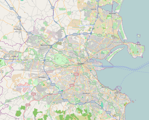
| pushpin_map =Ireland Dublin |
|||
| pushpin_label_position = |
|||
| pushpin_map_alt = |
|||
| pushpin_map_caption = |
|||
<!-- Below --> |
|||
| website = |
|||
| reference = |
|||
}} |
|||
'''Sutton Creek''' is part of [[Dublin Bay]] that lies between the southwestern part of [[Howth Head]] and the northeast end of [[Bull Island]]. It forms the southern coastline of [[Sutton, Dublin|Sutton]] and is bounded by Dublin Road, Greenfield Road and Strand Road. |
'''Sutton Creek''' is part of [[Dublin Bay]] that lies between the southwestern part of [[Howth Head]] and the northeast end of [[Bull Island]]. It forms the southern coastline of [[Sutton, Dublin|Sutton]] and is bounded by Dublin Road, Greenfield Road and Strand Road. |
||
Revision as of 21:10, 19 April 2022
| Sutton Creek | |
|---|---|
 View to south | |
 Sutton Creek | |
| Location | Dublin, Ireland |
| Coordinates | 53°20′N 6°07′W / 53.333°N 6.117°W |
| Part of | Irish Sea |
| Settlements | Sutton, Dublin |
Sutton Creek is part of Dublin Bay that lies between the southwestern part of Howth Head and the northeast end of Bull Island. It forms the southern coastline of Sutton and is bounded by Dublin Road, Greenfield Road and Strand Road.
53°22′55″N 6°06′30″W / 53.38194°N 6.10833°W{{#coordinates:}}: cannot have more than one primary tag per page
This geographical article about the Dublin area is a stub. You can help Wikipedia by expanding it. |