Szalatnak: Difference between revisions
Content deleted Content added
Added German name Tags: Mobile edit Mobile web edit Advanced mobile edit |
|||
| (5 intermediate revisions by 5 users not shown) | |||
| Line 1: | Line 1: | ||
{{Infobox settlement <!--more fields are available for this Infobox--See Template:Infobox Settlement--> |
{{Infobox settlement <!--more fields are available for this Infobox--See Template:Infobox Settlement--> |
||
| ⚫ | |||
|coordinates_display = inline,title |
|||
| other_name = Salack |
|||
|coordinates_region = HU |
|||
| image_map = BaranyaMegye.png |
|||
| ⚫ | |||
| map_caption = Location of Baranya county in Hungary |
|||
| ⚫ | |||
| pushpin_map = Hungary |
|||
| ⚫ | |||
| ⚫ | |||
| ⚫ | |||
| ⚫ | |||
| ⚫ | |||
| coordinates = {{coord|46.29032|18.28139|region:HU|display=inline,title}} |
|||
| ⚫ | |||
| ⚫ | |||
| ⚫ | |||
| |
|||
| ⚫ | |||
| ⚫ | |||
| ⚫ | |||
map=[[Image:BaranyaMegye.png|center|thumb|275px|Location of Baranya county in Hungary]]| |
|||
| ⚫ | |||
| ⚫ | |||
| ⚫ | |||
| ⚫ | |||
| ⚫ | |||
| ⚫ | |||
| ⚫ | |||
| ⚫ | |||
| ⚫ | |||
| ⚫ | |||
| ⚫ | |||
| ⚫ | |||
| ⚫ | |||
| ⚫ | |||
| ⚫ | |||
postal_code=7334| |
|||
| ⚫ | |||
area_code=72| |
|||
| postal_code = 7334 |
|||
| area_code = 72 |
|||
| ⚫ | |||
| ⚫ | |||
|pushpin_mapsize =| |
|||
latd=46.29032| |
|||
longd=18.28139 |
|||
}} |
}} |
||
'''Szalatnak''' ({{lang-hr|Slatnik}}) is a little village in [[Baranya |
'''Szalatnak''' ({{lang-de|Salack}}; {{lang-hr|Slatnik}}) is a little village in [[Baranya County]], [[Hungary]]. |
||
== External links == |
== External links == |
||
* [http://www.terkepcentrum.hu/index.asp?go=map&tid=9007 Street map] {{ |
* [http://www.terkepcentrum.hu/index.asp?go=map&tid=9007 Street map] {{in lang|hu}} |
||
{{Baranya |
{{Baranya}} |
||
{{authority control}} |
|||
| ⚫ | |||
| ⚫ | |||
{{Baranya-geo-stub}} |
|||
Latest revision as of 17:49, 5 June 2022
Szalatnak
Salack | |
|---|---|
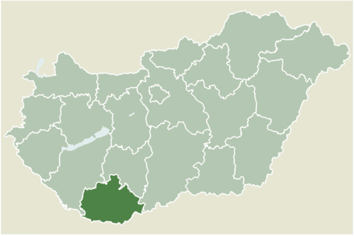 Location of Baranya county in Hungary | |
 Szalatnak Location of Szalatnak | |
| Coordinates: 46°17′25″N 18°16′53″E / 46.29032°N 18.28139°E | |
| Country | |
| County | Baranya |
| Area | |
| • Total | 10.29 km2 (3.97 sq mi) |
| Population (2004) | |
| • Total | 405 |
| • Density | 39.35/km2 (101.9/sq mi) |
| Time zone | UTC+1 (CET) |
| • Summer (DST) | UTC+2 (CEST) |
| Postal code | 7334 |
| Area code | 72 |
Szalatnak (German: Salack; Croatian: Slatnik) is a little village in Baranya County, Hungary.
External links
[edit]- Street map (in Hungarian)


This Baranya County–related article is a stub. You can help Wikipedia by expanding it. |