Samtskhe–Javakheti: Difference between revisions
No edit summary |
|||
| Line 83: | Line 83: | ||
[[ab:Самцхе-Џьавахеҭи]] |
[[ab:Самцхе-Џьавахеҭи]] |
||
[[az:Samtsxe-Cavaxeti]] |
|||
[[be:Самцхе-Джавахеці]] |
[[be:Самцхе-Джавахеці]] |
||
[[be-x-old:Самцхе-Джавахэці]] |
[[be-x-old:Самцхе-Джавахэці]] |
||
Revision as of 18:25, 29 January 2013
This article needs additional citations for verification. (March 2012) |
Samtskhe-Javakheti
სამცხე-ჯავახეთი | |
|---|---|
 | |
| Country | |
| Seat | Akhaltsikhe |
| Subdivisions | 6 municipalities |
| Government | |
| • Governor | Lasha Chkadua |
| Area | |
| • Total | 6,413 km2 (2,476 sq mi) |
| Population (2002) | |
| • Total | 208,000 |
| • Density | 32/km2 (84/sq mi) |
| ISO 3166 code | GE-SJ |
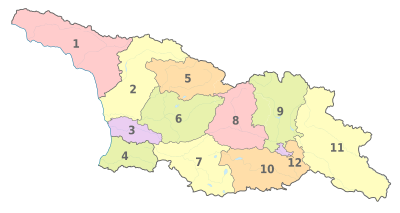
Samtskhe-Javakheti (Georgian: სამცხე-ჯავახეთი, Armenian: Սամցխե-Ջավախք) is a region (Georgian: Mkhare) formed in the 1990s in southern Georgia from the historical provinces of Meskheti (Samtskhe), Javakheti and Tori (Borjomi gorge). Akhaltsikhe is its capital. The region comprises six administrative districts: Akhaltsikhe, Adigeni, Aspindza, Borjomi, Akhalkalaki and Ninotsminda. There are 5 town, 6 townlets, 67 community and village sakrebulos (assemblies), and 268 villages in the region. Samtskhe-Javakheti is bordered by the regions of Adjara to the west, Guria and Imereti to the north, Shida Kartli and Kvemo Kartli to the north-east and to the east, and by Armenia and Turkey to the south and southwest.
The Baku-Tbilisi-Ceyhan oil pipeline, the South Caucasus natural gas pipeline, and the Kars–Tbilisi–Baku railway (under construction) pass through the region.
History
The current division of Georgia into "regions"/Mkhare is a relatively new phenomenon introduced by the Shevardnadze government in the mid 1990s, partly as a response to the cessation of Abchasia and the South Ossetia-conflict. In this process, Samtskhe-Javakheti was basically formed from the two traditional provinces of Samtskhe and Javakheti.
Meskheti
The ancient tribes of Meskhi (or Moschi) and Mosiniks are the first known inhabitants of the of the area. Some scholars credit the Mosiniks (or Mossynoeci) with the invention of iron metallurgy. From the 2nd millennium to the 4th century BC, Meskheti was believed to be part of the Kingdom of Diaokhi, in the 4th century BC to the 6th century AD part of the Kingdom of Iberia. From the 10th to the 15th century it was part of the united Georgian Kingdom. In the 16th century Meskheti was integrated into the Ottoman Empire. From 1829 to 1917 it was a part of Russian Tbilisi Governate (Tiflisskaia Gubernia), form 1918 to 1921 part of the Democratic Republic of Georgia, and from 1921 to 1990 part of the Georgian SSR. After independence from the USSR Meskheti was reinstalled as a province of Georgia, and later cast into the new Samtskhe-Javakheti region.
Javakheti
In early sources, the region was recorded as Zabakha in 785 BC owned by the king Argishti I of Urartu as a conquered land. In the I century AD king of Kartli (Georgian Kingdom) Parsman I (Kveli) managed to get back Javakheti (Javakhk). Moreover since that time Armenian kingdom was for several decades ruled by Georgian royal family. In the V century during the ruling of Vakhtang V (Gorgaslani) Javakheti (Javakhk) was an ordinary province of Georgia and after his death his second wife the Byzantinian princess settled in Tsunda (part of Javakheti). Javakheti was an important part of the Kingdom of Kartli. In the 11th century Akhalkalaki became the center of upper Javakheti, and Tmogvi the center of lower Javakheti. Under the Georgian Kingdom (11th-13th centuries), Javakheti bridges, churches, monasteries, and royal residences (Lgivi, Ghrtila, Bozhano, Vardzia) were constructed. From the 13th century, Javakheti included the territories of Palakatsio (modern Turkey) and part of Meskheti. In the 15th century, Javakheti was governed by Samtskhe-Saabatago. In the 16th century, it became part of the Ottoman Empire. [citation needed] The Georgian population of Javakheti was displaced to inner regions of Georgia - part to the Imereti, and another to the Kartli. Those who remained in the place became Muslims.
As a result of the struggles of the Russian Empire with the Ottomans, Russian authorities settled Christian Armenians and Greeks in the area afer 1828.[1] Armenian refugees from the Armenian genocide in the Ottoman Empire came in the early 20th century. Also a large number of Russian Doukhobor sect members settled the region.
Expulsion of Meskhetian Turks
Meskhetian Turks are the former Muslim inhabitants of Meskheti (now known as Samtskhe) in Georgia, along the border with Turkey. From November 15 to November 25, 1944, they were deported in cattle-trucks to Central Asia by order of Stalin and settled within an area that overlaps the boundaries of the modern nations of Kazakhstan, Kyrgyzstan, and Uzbekistan. Today, many are still dispersed across those countries. Of the 100,000 forcibly deported, a total of 10,000 perished.[2]
Population
The majority of the inhabitants in Javakheti is ethnically Armenian, with a small Georgian minority. Armenian population are a majority in Ninotsminda and Akhalkalaki cities.[3] They speak Georgian, Armenian and Russian.[4]
Politics
According to the 2002 census, ethnic Armenians (chiefly concentrated in Akhalkalaki and Ninotsminda districts), are the majority in the region, making up about 54% of the population.[5] They share the region with Pontian Greeks, Ossetians and Georgians. According to an NGO source, they are underrepresented in all spheres of public life, especially government. Only three of the governor’s 26 staff members are Armenian (11 per cent) [citation needed]. The same is true for the territorial departments of the various ministries. For instance, only sixteen of 82 staff members (19.5 per cent) of the tax department in Samtskhe-Javakheti are Armenian.[6] Lack of dialogue between local Armenians and the national government in Tbilisi adds to perceptions of discrimination and alienation.[7] There have been demonstrations, police brutality and killings in this region.[8]
Tourist attractions
Two of the major tourist attractions are the cave monasteries of Vardzia (which was founded by Queen Tamar in 1185), Vanis Kvabebi (which dates from the 8th century) and Khertvisi fortress. They are located near the town of Aspindza.
See also
References
- ^ Boeschoten, Hendrik; Rentzsch, Julian (2010). Turcology in Mainz. p. 142. ISBN 978-3-447-06113-1. Retrieved 9 July 2011.
{{cite book}}: Cite has empty unknown parameter:|coauthors=(help) - ^ http://www.guardian.co.uk/news/2003/apr/05/guardianobituaries.usa as retrieved on 29 Apr 2008 20:59:44 GMT
- ^ http://www.eurasianet.org/georgia/samtskhe/story.html
- ^ http://www.ssoar.info/ssoar/files/2009/1838/working_paper_25.pdf
- ^ Statistics Georgia
- ^ Georgia’s Armenian and Azeri Minorities, 22 November 2006 (free registration needed to view the full report) --- LINK DOES NOT WORK
- ^ Reuters AlertNet - Georgia’s Armenian and Azeri Minorities --- LINK DOES NOT WORK
- ^ Reuters Foundation; Alertnet, 22 Nov 2006, [Georgia’s Armenian and Azeri Minorities http://www.alertnet.org/thenews/newsdesk/ICG/a839b86ed70730cc9b32cbd9a898fc90.htm]
Other sources
External links
- Friends at Dinner, Foes at Politics (about socio-economic problems of the region)
- [1] Obstacles Impeding the Regional Integration of the Javalkheti Region], an ECMI working paper (PDF format)
| ||||||||||||||||