Seremban 3: Difference between revisions
Content deleted Content added
Removing geodata: {{coord missing|Malaysia}} |
mNo edit summary |
||
| Line 7: | Line 7: | ||
| subdivision_type1 = [[States and federal territories of Malaysia|State]] |
| subdivision_type1 = [[States and federal territories of Malaysia|State]] |
||
| subdivision_type2 = District |
| subdivision_type2 = District |
||
| subdivision_type3 = |
| subdivision_type3 = Luak |
||
| subdivision_type4 = |
| subdivision_type4 = |
||
| subdivision_name1 = {{flag|Negeri Sembilan}} |
| subdivision_name1 = {{flag|Negeri Sembilan}} |
||
| subdivision_name2 = [[Seremban District|Seremban]] |
| subdivision_name2 = [[Seremban District|Seremban]] |
||
| subdivision_name3 = Sungai Ujong |
|||
| established_title = Established |
| established_title = Established |
||
| postal_code_type = Postal code |
| postal_code_type = Postal code |
||
| postal_code = 70300 |
| postal_code = 70300 |
||
| settlement_type = |
| settlement_type = Township |
||
| translit_lang1 = |
| translit_lang1 = |
||
| translit_lang1_info1 = {{script/Arabic|قراص}} |
| translit_lang1_info1 = {{script/Arabic|قراص}} |
||
| Line 24: | Line 25: | ||
| coordinates = {{Coord|2|40|25|N|101|55|52|E|display=inline,title}} |
| coordinates = {{Coord|2|40|25|N|101|55|52|E|display=inline,title}} |
||
| pushpin_map = Malaysia Negeri Sembilan#Malaysia West#Malaysia |
| pushpin_map = Malaysia Negeri Sembilan#Malaysia West#Malaysia |
||
| pushpin_map_caption = ''' |
| pushpin_map_caption = Location of '''Seremban 3''' |
||
| timezone1 = [[Time in Malaysia|MYT]] |
| timezone1 = [[Time in Malaysia|MYT]] |
||
| utc_offset = +8 |
| utc_offset = +8 |
||
| official_name = |
| official_name = Seremban 3 |
||
| native_name = |
| native_name = |
||
| native_name_lang = |
| native_name_lang = |
||
}}'''Seremban 3''' ([[Malay language|Malay]]: Seremban Tiga) is a [[ |
}}'''Seremban 3''' ([[Malay language|Malay]]: Seremban Tiga) is a [[suburb]] located about six kilometers south west of downtown [[Seremban]] in [[Negeri Sembilan]], [[Malaysia]]. It is located between the suburbs of [[Rasah]] and [[Mambau]]. |
||
Seremban 3 also have education centres such as [[Universiti Teknologi MARA]] campus in [[Seremban]]. However, Seremban 3 also have a shopping place like Unicity Mall and is currently still under construction. Seremban 3 is close to the nearest [[Rasah Jaya]] and [[Mambau]]. |
Seremban 3 also have education centres such as [[Universiti Teknologi MARA]] campus in [[Seremban]]. However, Seremban 3 also have a shopping place like Unicity Mall and is currently still under construction. Seremban 3 is close to the nearest [[Rasah Jaya]] and [[Mambau]]. |
||
Revision as of 00:12, 5 October 2023
Seremban 3 | |
|---|---|
Township | |
 Seremban 3 | |
 Seremban 3 Location of Seremban 3  Seremban 3 Seremban 3 (Peninsular Malaysia) 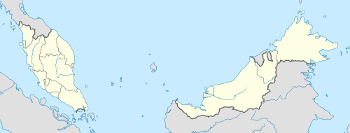 Seremban 3 Seremban 3 (Malaysia) | |
| Coordinates: 2°40′25″N 101°55′52″E / 2.67361°N 101.93111°E | |
| Country | |
| State | |
| District | Seremban |
| Luak | Sungai Ujong |
| Time zone | UTC+8 (MYT) |
| Postal code | 70300 |
Seremban 3 (Malay: Seremban Tiga) is a suburb located about six kilometers south west of downtown Seremban in Negeri Sembilan, Malaysia. It is located between the suburbs of Rasah and Mambau.
Seremban 3 also have education centres such as Universiti Teknologi MARA campus in Seremban. However, Seremban 3 also have a shopping place like Unicity Mall and is currently still under construction. Seremban 3 is close to the nearest Rasah Jaya and Mambau.
Educations
- Universiti Teknologi Mara
- SMK Seremban 3
Capital: Seremban, Royal town: Seri Menanti | |||||||||||
| Topics |
| ||||||||||
| Society | |||||||||||
| Administrative divisions |
| ||||||||||
This Negeri Sembilan location article is a stub. You can help Wikipedia by expanding it. |