Tuy Phong district: Difference between revisions
Content deleted Content added
No edit summary Tags: Visual edit Mobile edit Mobile web edit |
Reverted 1 good faith edit by 2402:800:634D:4D40:39BC:4AE5:882D:E719 using STiki |
||
| Line 1: | Line 1: | ||
{{Expand Vietnamese|date=March 2009|Tuy Phong}} |
{{Expand Vietnamese|date=March 2009|Tuy Phong}} |
||
{{Infobox settlement |
{{Infobox settlement |
||
| |
|name = Tuy Phong District |
||
| |
|settlement_type = [[Huyện|District]] |
||
| |
|official_name = |
||
| |
|other_name = |
||
| |
|native_name = Huyện Tuy Phong |
||
| |
|nickname = |
||
| |
|motto = |
||
| |
|image_skyline = |
||
| |
|imagesize = |
||
| |
|image_caption = |
||
| |
|image_flag = |
||
| |
|flag_size = |
||
| |
|image_seal = |
||
| |
|seal_size = |
||
| |
|image_shield = |
||
| |
|shield_size = |
||
| |
|image_blank_emblem = |
||
| |
|blank_emblem_size = |
||
| |
|image_map = |
||
| |
|mapsize = |
||
| |
|map_caption = |
||
| |
|image_map1 = |
||
| |
|mapsize1 = |
||
| |
|map_caption1 = |
||
| |
|pushpin_map = |
||
| |
|pushpin_label_position = |
||
| |
|subdivision_type = Country |
||
| |
|subdivision_name = {{flag|Vietnam}} |
||
| |
|subdivision_type1 = [[Regions of Vietnam|Region]] |
||
| |
|subdivision_name1 = [[Southeast (Vietnam)|South East]] |
||
| |
|subdivision_type2 = [[Provinces of Vietnam|Province]] |
||
| |
|subdivision_name2 = [[Bình Thuận Province|Bình Thuận]] |
||
| |
|seat_type = Capital |
||
| |
|seat = Liên Hương |
||
| |
|unit_pref = Imperial<!--Enter: Imperial, if Imperial (metric) is desired--> |
||
| |
|area_footnotes = |
||
| |
|area_total_km2 = 755 |
||
| |
|area_land_km2 = |
||
| |
|area_water_km2 = |
||
| |
|area_total_sq_mi = |
||
| |
|area_land_sq_mi = |
||
| |
|area_water_sq_mi = |
||
| |
|area_water_percent = |
||
| |
|area_urban_km2 = |
||
| |
|area_urban_sq_mi = |
||
| |
|area_metro_km2 = |
||
| |
|area_metro_sq_mi = |
||
| |
|population_as_of = 2003 |
||
| |
|population_footnotes = |
||
| |
|population_note = |
||
| |
|population_total = 90,819 |
||
| |
|population_density_km2 = |
||
| |
|population_density_sq_mi = |
||
| |
|population_metro = |
||
| |
|population_density_metro_km2 = |
||
| |
|population_density_metro_sq_mi = |
||
| |
|population_urban = |
||
| |
|population_density_urban_km2 = |
||
| |
|population_density_urban_mi2 = |
||
| |
|timezone = UTC + 7 |
||
| |
|utc_offset = +7 |
||
|latd=|latm=|lats=|latNS=|longd=|longm=|longs=|longEW=}} |
|||
| latd = |
|||
| latm = |
|||
| lats = |
|||
| latNS = |
|||
| longd = |
|||
| longm = |
|||
| longs = |
|||
| longEW = |
|||
}} |
|||
'''Tuy Phong''' is a [[Districts of Vietnam|rural district]] of [[Bình Thuận Province]] in the [[Southeast (Vietnam)|Southeast]] region of Vietnam. As of 2003, the district had a population of 90,819.<ref name="Statoids">{{cite web|url=http://www.statoids.com/yvn.html|title=Districts of Vietnam|publisher=Statoids|accessdate=March 13, 2009}}</ref> The district covers an area of 755 km². The district capital is Liên Hương.<ref name="Statoids"/> |
'''Tuy Phong''' is a [[Districts of Vietnam|rural district]] of [[Bình Thuận Province]] in the [[Southeast (Vietnam)|Southeast]] region of Vietnam. As of 2003, the district had a population of 90,819.<ref name="Statoids">{{cite web|url=http://www.statoids.com/yvn.html|title=Districts of Vietnam|publisher=Statoids|accessdate=March 13, 2009}}</ref> The district covers an area of 755 km². The district capital is Liên Hương.<ref name="Statoids"/> |
||
Revision as of 10:19, 29 April 2019
You can help expand this article with text translated from the corresponding article in Vietnamese. (March 2009) Click [show] for important translation instructions.
|
Tuy Phong District
Huyện Tuy Phong | |
|---|---|
| Country | |
| Region | South East |
| Province | Bình Thuận |
| Capital | Liên Hương |
| Area | |
| • Total | 292 sq mi (755 km2) |
| Population (2003) | |
| • Total | 90,819 |
| Time zone | UTC+7 (UTC + 7) |
Tuy Phong is a rural district of Bình Thuận Province in the Southeast region of Vietnam. As of 2003, the district had a population of 90,819.[1] The district covers an area of 755 km². The district capital is Liên Hương.[1]
References
- ^ a b "Districts of Vietnam". Statoids. Retrieved March 13, 2009.
| Da Nang city | 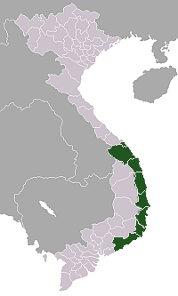 | |
|---|---|---|
| Bình Định province | ||
| Bình Thuận province | ||
| Khánh Hòa province |
| |
| Ninh Thuận province | ||
| Phú Yên province | ||
| Quảng Nam province | ||
| Quảng Ngãi province | ||
※ denotes provincial seat. / § Sovereignty over the Hoàng Sa and Trường Sa archipelagoes is disputed as of 2 September 2024. | ||
11°25′01″N 108°40′01″E / 11.417°N 108.667°E
This article about a location in Bình Thuận Province, Vietnam is a stub. You can help Wikipedia by expanding it. |