Temryuk: Difference between revisions
Ukrained2012 (talk | contribs) added Category:Port cities and towns in Russia using HotCat |
ce/expa |
||
| Line 1: | Line 1: | ||
{{Other uses of}} |
|||
{{Coord|45|16|N|37|23|E|type:city_region:RU|display=title}} |
|||
[[File:Coat of Arms of Temryuk (Krasnodar krai).png|thumb|right|Coat of arms of Temryuk]] |
|||
{{Infobox Russian town |
|||
'''Temryuk''' ({{lang-ru|Темрю́к}}) is a [[types of inhabited localities in Russia|town]] and the [[administrative center]] of [[Temryuksky District]] of [[Krasnodar Krai]], [[Russia]], located on the [[Taman Peninsula]] on the right bank of the [[Kuban River]] not far from its entry into the [[Temryuk Bay]], amid a field of [[mud volcano]]es. The [[seaport]] of Temryuk is situated {{convert|4|km|sp=us}} from the town itself. Population: {{ru-census2010|38,046|;}} {{ru-census2002|36,118|;}} {{su-census1989|33,163|;}} 26,600 (1975). |
|||
|en_name=Temryuk |
|||
|ru_name=Темрюк |
|||
|image_skyline=Улица Ленина.JPG |
|||
|image_caption=Lenina Street in Temryuk |
|||
|latd=45 |
|||
|latm=16 |
|||
|lats= |
|||
|longd=37 |
|||
|longm=22 |
|||
|longs= |
|||
|map_label_position=top |
|||
|image_flag=Flag of Temryuk (Krasnodar krai).png |
|||
|flag_caption= |
|||
|image_coa=Coat of Arms of Temryuk (Krasnodar krai).png |
|||
|coa_caption= |
|||
|anthem= |
|||
|anthem_ref= |
|||
|holiday= |
|||
|holiday_ref= |
|||
<!----ADMINISTRATIVE STATUS----> |
|||
|federal_subject=[[Krasnodar Krai]] |
|||
|federal_subject_ref=<ref name="KrasnodarK_admlist" /> |
|||
|adm_data_as_of=May 2013 |
|||
|adm_district_jur=[[Temryuksky District]] |
|||
|adm_district_jur_ref=<ref name="KrasnodarK_admlist" /> |
|||
|adm_selsoviet_jur=Temryuk |
|||
|adm_selsoviet_type=[[Town of district significance|Town]] |
|||
|adm_selsoviet_jur_ref=<ref name="KrasnodarK_admlist" /> |
|||
|adm_ctr_of1=Temryuksky District |
|||
|adm_ctr_of1_ref=<ref name="KrasnodarK_admlist" /> |
|||
|adm_ctr_of2=Town of Temryuk |
|||
|adm_ctr_of2_ref=<ref name="KrasnodarK_admlist" /> |
|||
|inhabloc_cat=Town |
|||
|inhabloc_cat_ref=<ref name="KrasnodarK_admlist" /> |
|||
|inhabloc_type= |
|||
|inhabloc_type_ref= |
|||
|mun_data_as_of=June 2009 |
|||
|mun_district_jur=Temryuksky Municipal District |
|||
|mun_district_jur_ref=<ref name="KrasnodarKTemryukskyD_mun" /> |
|||
|urban_settlement_jur=Temryukskoye Urban Settlement |
|||
|urban_settlement_jur_ref=<ref name="KrasnodarKTemryukskyD_mun" /> |
|||
|mun_admctr_of1=Temryuksky Municipal District |
|||
|mun_admctr_of1_ref=<ref name="KrasnodarKTemryukskyD_mun" /> |
|||
|mun_admctr_of2=Temryukskoye Urban Settlement |
|||
|mun_admctr_of2_ref=<ref name="KrasnodarKTemryukskyD_mun" /> |
|||
|leader_title= |
|||
|leader_title_ref= |
|||
|leader_name= |
|||
|leader_name_ref= |
|||
|representative_body= |
|||
|representative_body_ref= |
|||
<!----STATISTICS----> |
|||
|area_of_what= |
|||
|area_as_of= |
|||
|area_km2= |
|||
|area_km2_ref= |
|||
|pop_2010census=38046 |
|||
|pop_2010census_ref=<ref name="2010Census">{{ru-pop-ref|2010Census}}</ref> |
|||
|pop_density= |
|||
|pop_density_as_of= |
|||
|pop_density_ref= |
|||
|pop_latest= |
|||
|pop_latest_date= |
|||
|pop_latest_ref= |
|||
<!----HISTORY----> |
|||
|established_date= |
|||
|established_title= |
|||
|established_date_ref= |
|||
|current_cat_date=1860 |
|||
|current_cat_date_ref= |
|||
|prev_name1= |
|||
|prev_name1_date= |
|||
|prev_name1_ref= |
|||
<!----MISCELLANEA----> |
|||
|postal_codes= |
|||
|postal_codes_ref= |
|||
|dialing_codes= |
|||
|dialing_codes_ref= |
|||
|website= |
|||
|website_ref= |
|||
|commonscat=Temryuk |
|||
|date=August 2013 |
|||
}} |
|||
'''Temryuk''' ({{lang-ru|Темрю́к}}) is a [[types of inhabited localities in Russia|town]] and the [[administrative center]] of [[Temryuksky District]] in [[Krasnodar Krai]], [[Russia]], located on the [[Taman Peninsula]] on the right bank of the [[Kuban River]] not far from its entry into the [[Temryuk Bay]], amid a field of [[mud volcano]]es. The [[seaport]] of Temryuk is situated {{convert|4|km|sp=us}} from the town itself. Population: {{ru-census2010|38,046|;}} {{ru-census2002|36,118|;}} {{su-census1989|33,163|;}} 26,600 (1975). |
|||
==History== |
|||
Situated in the proximity of the site of ancient [[Tmutarakan]], Temryuk was vied by various powers as a vantage point commanding the mouth of the Kuban River. The first recorded settlement on the site was '''Tumnev''', a Tatar fortress, which passed to the [[Ghisolfi|Genoese merchants]] in the 14th century. It was known as '''Copa''' until occupied by the [[Khanate of Crimea]] in 1483. |
|||
Situated in the proximity of the site of ancient [[Tmutarakan]], Temryuk was vied by various powers as a vantage point commanding the mouth of the Kuban River. The first recorded settlement on the site was '''Tumnev''', a Tatar fortress, which passed to the [[Ghisolfi|Genoese merchants]] in the 14th century. It was known as '''Copa''' until occupied by the [[Crimean Khanate]] in 1483. |
|||
The Russians, allied with a local potentate |
The Russians, allied with a local potentate, Temryuk of Kabardia, captured Tumnev and built a fortress of New Temryuk there. The Crimean Tatars retook the fort in 1570; it was known as '''Adis''' for a century to come. In the 18th century, the site was settled by the [[Cossacks]], whose ''[[stanitsa]]'' was incorporated as the town of Temryuk in 1860.{{citation needed|date=August 2013}} |
||
==Administrative and municipal status== |
|||
==Gallery== |
|||
Within the [[subdivisions of Russia#Administrative divisions|framework of administrative divisions]], Temryuk serves as the [[administrative center]] of [[Temryuksky District]].<ref name="KrasnodarK_admlist">Reference Information #34.01-707/13-03</ref> As an administrative division, it is, together with three [[types of inhabited localities in Russia|rural localities]], incorporated within Temryuksky District as the '''[[Town of district significance|Town]] of Temryuk'''.<ref name="KrasnodarK_admlist" /> As a [[subdivisions of Russia#Municipal divisions|municipal division]], the Town of Temryuk is incorporated within Temryuksky Municipal District as '''Temryukskoye Urban Settlement'''.<ref name="KrasnodarKTemryukskyD_mun">Law #685-KZ</ref> |
|||
{{Commons category|Temryuk}} |
|||
==Gallery== |
|||
<gallery> |
<gallery> |
||
File:Трактир в музее.JPG|[[Voyennaya Gorka]], a military vehicle museum on the slope of a mud volcano in Temryuk |
File:Трактир в музее.JPG|[[Voyennaya Gorka]], a military vehicle museum on the slope of a mud volcano in Temryuk |
||
| Line 18: | Line 103: | ||
==References== |
==References== |
||
===Notes=== |
|||
{{Reflist}} |
{{Reflist}} |
||
===Sources=== |
|||
*{{RussiaAdmMunRef|kda|adm|list}} |
|||
*{{RussiaAdmMunRef|kda|mun|list|temryuksky}} |
|||
{{Krasnodar Krai}} |
{{Krasnodar Krai}} |
||
Revision as of 17:28, 29 August 2013
Temryuk
Темрюк | |
|---|---|
 Lenina Street in Temryuk | |
 Flag  Coat of arms | |
Location of Temryuk  | |
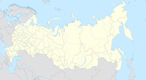 Temryuk Location of Temryuk  Temryuk Temryuk (Krasnodar Krai) | |
| Coordinates: 45°16′0″N 37°23′0″E / 45.26667°N 37.38333°E | |
| Country | Russia |
| Federal subject | Krasnodar Krai[1] |
| Administrative district | Temryuksky District[1] |
| Town | Temryuk[1] |
| Town status since | 1860 |
| Elevation | 10 m (30 ft) |
| Population | |
| • Total | 38,046 |
| • Capital of | Temryuksky District,[1] Town of Temryuk[1] |
| • Municipal district | Temryuksky Municipal District[3] |
| • Urban settlement | Temryukskoye Urban Settlement[3] |
| • Capital of | Temryuksky Municipal District,[3] Temryukskoye Urban Settlement[3] |
| Time zone | UTC+3 (MSK |
| Postal code(s)[5] | 353500–353508 |
| OKTMO ID | 03651101001 |
Temryuk (Russian: Темрю́к) is a town and the administrative center of Temryuksky District in Krasnodar Krai, Russia, located on the Taman Peninsula on the right bank of the Kuban River not far from its entry into the Temryuk Bay, amid a field of mud volcanoes. The seaport of Temryuk is situated 4 kilometers (2.5 mi) from the town itself. Population: 38,046 (2010 Russian census);[2] 36,118 (2002 Census);[6] 33,163 (1989 Soviet census);[7] 26,600 (1975).
History
Situated in the proximity of the site of ancient Tmutarakan, Temryuk was vied by various powers as a vantage point commanding the mouth of the Kuban River. The first recorded settlement on the site was Tumnev, a Tatar fortress, which passed to the Genoese merchants in the 14th century. It was known as Copa until occupied by the Crimean Khanate in 1483.
The Russians, allied with a local potentate, Temryuk of Kabardia, captured Tumnev and built a fortress of New Temryuk there. The Crimean Tatars retook the fort in 1570; it was known as Adis for a century to come. In the 18th century, the site was settled by the Cossacks, whose stanitsa was incorporated as the town of Temryuk in 1860.[citation needed]
Administrative and municipal status
Within the framework of administrative divisions, Temryuk serves as the administrative center of Temryuksky District.[1] As an administrative division, it is, together with three rural localities, incorporated within Temryuksky District as the Town of Temryuk.[1] As a municipal division, the Town of Temryuk is incorporated within Temryuksky Municipal District as Temryukskoye Urban Settlement.[3]
Gallery
-
Voyennaya Gorka, a military vehicle museum on the slope of a mud volcano in Temryuk
-
A memorial devoted to the Defense of Temryuk during World War II
-
A World War II motor gun boat on exhibit at Voyennaya Gorka


References
Notes
- ^ a b c d e f g h Reference Information #34.01-707/13-03
- ^ a b Russian Federal State Statistics Service (2011). Всероссийская перепись населения 2010 года. Том 1 [2010 All-Russian Population Census, vol. 1]. Всероссийская перепись населения 2010 года [2010 All-Russia Population Census] (in Russian). Federal State Statistics Service.
- ^ a b c d e Law #685-KZ
- ^ "Об исчислении времени". Официальный интернет-портал правовой информации (in Russian). June 3, 2011. Retrieved January 19, 2019.
- ^ Почта России. Информационно-вычислительный центр ОАСУ РПО. (Russian Post). Поиск объектов почтовой связи (Postal Objects Search) (in Russian)
- ^ Federal State Statistics Service (May 21, 2004). Численность населения России, субъектов Российской Федерации в составе федеральных округов, районов, городских поселений, сельских населённых пунктов – районных центров и сельских населённых пунктов с населением 3 тысячи и более человек [Population of Russia, Its Federal Districts, Federal Subjects, Districts, Urban Localities, Rural Localities—Administrative Centers, and Rural Localities with Population of Over 3,000] (XLS). Всероссийская перепись населения 2002 года [All-Russia Population Census of 2002] (in Russian).
- ^ Всесоюзная перепись населения 1989 г. Численность наличного населения союзных и автономных республик, автономных областей и округов, краёв, областей, районов, городских поселений и сёл-райцентров [All Union Population Census of 1989: Present Population of Union and Autonomous Republics, Autonomous Oblasts and Okrugs, Krais, Oblasts, Districts, Urban Settlements, and Villages Serving as District Administrative Centers]. Всесоюзная перепись населения 1989 года [All-Union Population Census of 1989] (in Russian). Институт демографии Национального исследовательского университета: Высшая школа экономики [Institute of Demography at the National Research University: Higher School of Economics]. 1989 – via Demoscope Weekly.
Sources
- Управление по взаимодействию с органами местного самоуправления Администрации Краснодарского края. Справочная информация №34.01-707/13-03 от 23 мая 2013 г. «Реестр административно-территориальных единиц Краснодарского края». (Department of Cooperation with the Organs of the Local Self-Government of the Administration of Krasnodar Krai. Reference Information #34.01-707/13-03 of May 23, 2013 Registry of the Administrative-Territorial Units of Krasnodar Krai. ).
- Законодательное Собрание Краснодарского края. Закон №685-КЗ от 1 апреля 2004 г. «Об установлении границ муниципального образования Темрюкский район, наделении его статусом муниципального района, образовании в его составе муниципальных образований — городского поселения, сельских поселений — и установлении их границ», в ред. Закона №1756-КЗ от 3 июня 2009 г. «О внесении изменений в некоторые законодательные акты Краснодарского края об установлении границ муниципальных образований». Вступил в силу со дня официального опубликования. Опубликован: "Информационный бюллетень ЗС Краснодарского края", №16 (1), 5 апреля 2004 г. (Legislative Assembly of Krasnodar Krai. Law #685-KZ of April 1, 2004 On the Establishment of the Borders of the Municipal Formation of Temryuksky District, on Granting It the Status of a Municipal District, on the Establishment of the Municipal Formations—an Urban Settlement, Rural Settlements—Within Its Structure and on the Establishment of Their Borders, as amended by the Law #1756-KZ of June 3, 2009 On Amending Several Legislative Acts of Krasnodar Krai on the Establishment of the Borders of the Municipal Formations. Effective as of the day of the official publication.).