Uttar Durgapur: Difference between revisions
No edit summary Tags: Mobile edit Mobile web edit |
No edit summary Tags: Mobile edit Mobile web edit |
||
| Line 62: | Line 62: | ||
}} |
}} |
||
'''Uttar Durgapur''' is a census town under [[Jaynagar]] police station of [[Jaynagar I]] CD Block in [[Baruipur subdivision]] of [[South 24 Parganas]] district in the [[India]]n [[States and territories of India|State]] of [[West Bengal]]. It is a part of [[List of cities in West Bengal by population#Urban agglomeration|Kolkata Urban Agglomeration]].<ref>{{cite web|url= |
'''Uttar Durgapur''' is a census town under [[Jaynagar]] police station of [[Jaynagar I]] CD Block in [[Baruipur subdivision]] of [[South 24 Parganas]] district in the [[India]]n [[States and territories of India|State]] of [[West Bengal]]. It is a part of [[List of cities in West Bengal by population#Urban agglomeration|Kolkata Urban Agglomeration]].<ref>{{cite web |
||
|url=http://www.wbcensus.gov.in/DataTables/01/Table-3.htm |
|||
|title=Census of India |
|||
|accessdate=2007-09-02 |
|||
|last= |
|||
|first= |
|||
|work=District-wise list of stautory towns |
|||
|publisher=Directorate of census operations, West Bengal |
|||
|archiveurl=https://web.archive.org/web/20070809031732/http://www.wbcensus.gov.in/DataTables/01/Table-3.htm |
|||
|archivedate=2007-08-09 |
|||
|deadurl=yes |
|||
|df= |
|||
}}</ref> |
|||
==Geography== |
==Geography== |
||
Revision as of 07:43, 15 May 2019
Uttar Durgapur | |
|---|---|
Census Town | |
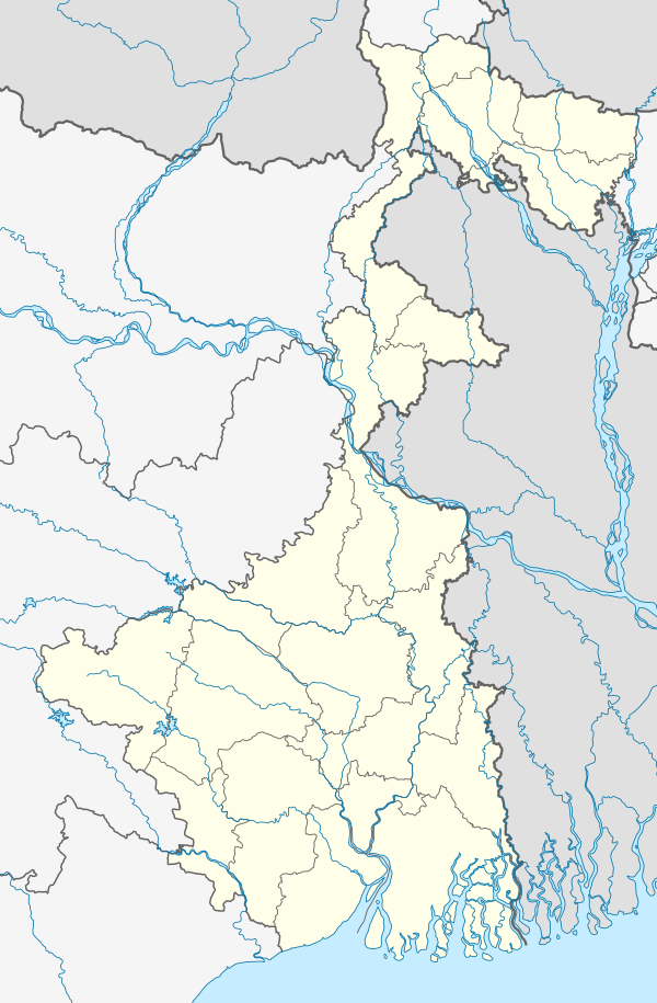 Uttar Durgapur Location in West Bengal, India 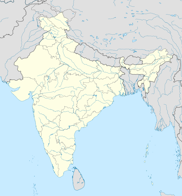 Uttar Durgapur Uttar Durgapur (India) | |
| Coordinates: 22°11′15″N 88°25′47″E / 22.1876°N 88.4296°E | |
| Country | |
| State | West Bengal |
| District | South 24 Parganas |
| CD Block | Jaynagar I |
| Area | |
| • Total | 1.10 km2 (0.42 sq mi) |
| Elevation | 8 m (26 ft) |
| Population (2011) | |
| • Total | 5,723 |
| • Density | 5,200/km2 (13,000/sq mi) |
| Languages | |
| • Official | Bengali, Hindi, English |
| Time zone | UTC+5:30 (IST) |
| PIN | 743337 |
| Telephone code | +91 3218 |
| Vehicle registration | WB-01 to WB-10, WB-19 to WB-22, WB-95 to WB-99 |
| Lok Sabha constituency | Jaynagar (SC) |
| Vidhan Sabha constituency | Jaynagar (SC) |
| Website | www |
Uttar Durgapur is a census town under Jaynagar police station of Jaynagar I CD Block in Baruipur subdivision of South 24 Parganas district in the Indian State of West Bengal. It is a part of Kolkata Urban Agglomeration.[1]
Geography
Uttar Durgapur town is located at 22°11′15″N 88°25′47″E / 22.1876°N 88.4296°E. It has an average elevation of 8 metres (26 ft).[2]
Demographics
As per 2011 Census of India, Uttar Durgapur town had a total population of 5,723, of which 2,937 (51%) were males and 2,786 (49%) were females. Population below 6 years was 727. The total number of literates was 4,191 (83.89 % of the population over 6 years).[3]
As of 2001 Census of India, Uttar Durgapur town had a total population of 5,062. Males constitute 52% of the population and females 48%. It has an average literacy rate of 67%, higher than the national average of 59.5%: male literacy is 74%, and female literacy is 60%. 11% of the population is under 6 years of age.
References
- ^ "Census of India". District-wise list of stautory towns. Directorate of census operations, West Bengal. Archived from the original on 9 August 2007. Retrieved 2 September 2007.
{{cite web}}: Unknown parameter|deadurl=ignored (|url-status=suggested) (help) - ^ "Yahoo maps of Uttar Durgapur". Yahoo maps. Retrieved 28 November 2008.
- ^ "C.D. Block Wise Primary Census Abstract Data(PCA)". 2011 census: West Bengal – District-wise CD Blocks. Registrar General and Census Commissioner, India. Retrieved 26 April 2016.
| Kolkata Municipal Corporation |
|
|---|---|
| Kolkata Urban Agglomeration Outside KMC |
|
This article about a location in West Bengal is a stub. You can help Wikipedia by expanding it. |