Ukrina: Difference between revisions
Content deleted Content added
reference |
|||
| Line 9: | Line 9: | ||
| image_caption = Watermill on Ukrina |
| image_caption = Watermill on Ukrina |
||
| image_alt = |
| image_alt = |
||
| map = |
| map = |
||
| map_size = |
| map_size = |
||
| map_caption = |
| map_caption = |
||
| map_alt = |
| map_alt = |
||
| subdivision_type1 = Country |
| subdivision_type1 = Country |
||
| Line 22: | Line 22: | ||
| source1_coordinates= |
| source1_coordinates= |
||
| source1_elevation = ≈{{convert|1590|m|ft|abbr=on}} |
| source1_elevation = ≈{{convert|1590|m|ft|abbr=on}} |
||
| mouth_location =[[Sava]], near [[ |
| mouth_location =[[Sava]], near [[Brod, Bosnia and Herzegovina|Brod]] |
||
| mouth_coordinates = {{coord| |
| mouth_coordinates = {{coord|45.0889|17.9359|display=inline,title}} |
||
| mouth_elevation = {{convert|268|m|ft|abbr=on}} |
| mouth_elevation = {{convert|268|m|ft|abbr=on}} |
||
| progression = {{RSava}} |
|||
| ⚫ | |||
| river_system = [[Black Sea]] |
|||
| ⚫ | |||
| basin_landmarks = |
| basin_landmarks = |
||
| length ={{convert|119.3 |km|abbr=on}} |
| length ={{convert|119.3 |km|abbr=on}} {{GeoQuelle|Sava||13}} |
||
| width_min = |
| width_min = |
||
| width_avg = |
| width_avg = |
||
| width_max = |
| width_max = |
||
| Line 46: | Line 45: | ||
| bridges = |
| bridges = |
||
}} |
}} |
||
'''Ukrina''' is a river in the [[Bosnia (region)|Central Bosnia]], [[Bosnia and Herzegovina]], right tributary of the river [[Sava]]. Its mouth is 3 km north from settlement Koraće and 10 km southwest of [[ |
'''Ukrina''' is a river in the [[Bosnia (region)|Central Bosnia]], [[Bosnia and Herzegovina]], right tributary of the river [[Sava]]. Its mouth is 3 km north from settlement Koraće and 10 km southwest of [[Brod, Bosnia and Herzegovina|Brod]].<ref>http://www.kartabih.com/</ref> |
||
<ref name="ReferenceA">Vojnogeografski institut, Ed. (1955): Travnik (List karte 1:100.000, Izohipse na 20 m). Vojnogeografski institut, Beograd / Military Geographical Institute, Ed. (1955): Travnik (map sheet 1: 100,000, Contour lines at 20 m). Military Geographical Institute, Belgrade.</ref><ref name="Spahić M. 2000">Spahić M. et al. (2000): Bosnia i Hercegovina (1:250.000). Izdavačko preduzeće „Sejtarija", Sarajevo., The Map</ref><ref name="Mučibabić B. 1998">Mučibabić B., Ed. (1998): Geografski atlas Bosne i Hercegovine. Geodetski zavod BiH, Sarajevo, {{ISBN|9958-766-00-0}}., pp: 4-5.</ref> |
<ref name="ReferenceA">Vojnogeografski institut, Ed. (1955): Travnik (List karte 1:100.000, Izohipse na 20 m). Vojnogeografski institut, Beograd / Military Geographical Institute, Ed. (1955): Travnik (map sheet 1: 100,000, Contour lines at 20 m). Military Geographical Institute, Belgrade.</ref><ref name="Spahić M. 2000">Spahić M. et al. (2000): Bosnia i Hercegovina (1:250.000). Izdavačko preduzeće „Sejtarija", Sarajevo., The Map</ref><ref name="Mučibabić B. 1998">Mučibabić B., Ed. (1998): Geografski atlas Bosne i Hercegovine. Geodetski zavod BiH, Sarajevo, {{ISBN|9958-766-00-0}}., pp: 4-5.</ref> |
||
Ukrina is produced by the merging of the [[Mala Ukrina]] (Small Ukrina) and [[Velika Ukrina]] (Great Ukrina). The length of Ukrina of origin Great Ukrina (Lukavac) is 119.3 km, and the surface area of the basin is |
Ukrina is produced by the merging of the [[Mala Ukrina]] (Small Ukrina) and [[Velika Ukrina]] (Great Ukrina). The length of Ukrina of origin Great Ukrina (Lukavac) is 119.3 km, and the surface area of the basin is 1504 km².{{GeoQuelle|Sava||13}} |
||
==See also== |
==See also== |
||
Revision as of 12:45, 22 May 2018
| Ukrina – Укрина | |
|---|---|
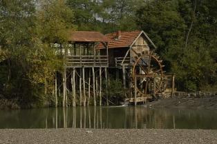 Watermill on Ukrina | |
| Location | |
| Country | Bosnia and Herzegovina |
| Physical characteristics | |
| Source | |
| • elevation | ≈1,590 m (5,220 ft) |
| Mouth | |
• location | Sava, near Brod |
• coordinates | 45°05′20″N 17°56′09″E / 45.0889°N 17.9359°E |
• elevation | 268 m (879 ft) |
| Length | 119.3 km (74.1 mi) [1] |
| Basin size | 1,504 km2 (581 sq mi) [1] |
| Basin features | |
| Progression | Sava→ Danube→ Black Sea |
| Waterfalls | Several |
Ukrina is a river in the Central Bosnia, Bosnia and Herzegovina, right tributary of the river Sava. Its mouth is 3 km north from settlement Koraće and 10 km southwest of Brod.[2] [3][4][5]
Ukrina is produced by the merging of the Mala Ukrina (Small Ukrina) and Velika Ukrina (Great Ukrina). The length of Ukrina of origin Great Ukrina (Lukavac) is 119.3 km, and the surface area of the basin is 1504 km².[1]
See also
References
- ^ a b c "Sava River Basin Analysis Report" (PDF). International Sava River Basin Commission. September 2009. p. 13. Archived from the original (PDF, 9.98 MB) on 2010-07-17.
- ^ http://www.kartabih.com/
- ^ Vojnogeografski institut, Ed. (1955): Travnik (List karte 1:100.000, Izohipse na 20 m). Vojnogeografski institut, Beograd / Military Geographical Institute, Ed. (1955): Travnik (map sheet 1: 100,000, Contour lines at 20 m). Military Geographical Institute, Belgrade.
- ^ Spahić M. et al. (2000): Bosnia i Hercegovina (1:250.000). Izdavačko preduzeće „Sejtarija", Sarajevo., The Map
- ^ Mučibabić B., Ed. (1998): Geografski atlas Bosne i Hercegovine. Geodetski zavod BiH, Sarajevo, ISBN 9958-766-00-0., pp: 4-5.