Warrimoo, New South Wales: Difference between revisions
MrActiniuM (talk | contribs) Adding references Tags: Visual edit Mobile edit Mobile web edit |
|||
| (42 intermediate revisions by 30 users not shown) | |||
| Line 1: | Line 1: | ||
{{External links|date=August 2019}} |
|||
{{redirect|Warrimoo|the ship|SS Warrimoo}} |
|||
{{More citations needed|date=August 2019}} |
|||
{{Use dmy dates|date= |
{{Use dmy dates|date=December 2021}} |
||
{{Use Australian English|date=August 2012}} |
{{Use Australian English|date=August 2012}} |
||
{{Infobox Australian place |
{{Infobox Australian place |
||
| type = town |
| type = town |
||
| name = Warrimoo |
| name = Warrimoo |
||
| caption = |
| caption = |
||
| city = City of Blue Mountains |
| city = City of Blue Mountains |
||
| state = nsw |
| state = nsw |
||
| image = WarrimooBillsHorseTrough.JPG |
| image = WarrimooBillsHorseTrough.JPG |
||
| lga = [[City of Blue Mountains]] |
| lga = [[City of Blue Mountains]] |
||
| postcode = 2774 |
| postcode = 2774 |
||
| coordinates = {{Coord|-33.727124|150.599413|display=inline,title}} |
| coordinates = {{Coord|-33.727124|150.599413|display=inline,title}} |
||
| ⚫ | |||
| ⚫ | |||
| local_map = yes |
|||
| ⚫ | |||
| zoom = 11 |
|||
| ⚫ | |||
| |
| est = |
||
| ⚫ | |||
| stategov = [[Electoral district of Blue Mountains|Blue Mountains]] |
|||
| ⚫ | |||
| fedgov = [[Division of Macquarie|Macquarie]] |
|||
| ⚫ | |||
| ⚫ | |||
| elevation = 273 |
|||
| ⚫ | |||
| ⚫ | |||
| ⚫ | |||
| |
| stategov = [[Electoral district of Blue Mountains|Blue Mountains]] |
||
| |
| fedgov = [[Division of Macquarie|Macquarie]] |
||
| ⚫ | |||
| ⚫ | |||
| near- |
| near-n = [[Sun Valley, New South Wales|Sun Valley]] |
||
| near- |
| near-ne = [[Hawkesbury Heights, New South Wales|Hawkesbury Heights]] |
||
| near-w = [[Yellow Rock, New South Wales (Blue Mountains)|Yellow Rock]] |
|||
| ⚫ | |||
| ⚫ | |||
| ⚫ | |||
| ⚫ | |||
| ⚫ | |||
| ⚫ | |||
| near-se = [[Glenbrook, New South Wales|Glenbrook]] |
|||
| ⚫ | |||
| ⚫ | |||
| ⚫ | |||
| dist2 = 35 |
|||
| dir2 = east |
|||
| location2 = [[Katoomba, New South Wales|Katoomba]] |
|||
}} |
}} |
||
'''Warrimoo''' (formerly Karabar) is a medium-sized village in the lower [[Blue Mountains (New South Wales)|Blue Mountains]] of [[New South Wales]], [[Australia]], 273 metres above sea level. The state government's electorate is Blue Mountains and the state member is Labor's [[Trisha Lee Doyle]]. |
|||
'''Warrimoo''' (formerly Soviet Union of Warrimoo) is a large town in [[Moscow]] of [[Moskva River]], [[Russia]], 1099 meters above sea level. The state government's power level stands at totalitarian, they are considered a communist town and the state member is the Communist party's [[Trisha Lee Doyle]]. Warrimoo has been in a small scale war with [[North West Island]] for the past 1078 years. The war has cost many people's lives, 2 is the total number of deaths in the war according to a 2017 study. In late 2019 an independence war started because the oppressed people of Warrimoo hated their communist leader [[Susan Templeman]]. The war for Independence is not over, though it will likely end with a communist victory because the Warrimoo rebels are just peasants with shovels. |
|||
Federally, the electorate is Macquarie and the federal member is Labor's [[Susan Templeman]] |
Federally, the electorate is Macquarie and the federal member is Labor's [[Susan Templeman]]. Warrimoo is located 68 kilometres west of [[Sydney]], in the [[Local government in Australia|local government area]] of the [[City of Blue Mountains]]. Local council Mayor is Labor's Mark Greenhill. |
||
Warrimoo borders the townships/suburbs of [[Blaxland, New South Wales|Blaxland]], [[Mount Riverview, New South Wales|Mount Riverview]], [[Sun Valley, New South Wales|Sun Valley]] and [[Valley Heights, New South Wales|Valley Heights]]. The suburb is 5 train stops from [[Penrith, New South Wales|Penrith]] and 11 train stops to [[Katoomba, New South Wales|Katoomba]]. |
Warrimoo borders the townships/suburbs of [[Blaxland, New South Wales|Blaxland]], [[Mount Riverview, New South Wales|Mount Riverview]], [[Sun Valley, New South Wales|Sun Valley]] and [[Valley Heights, New South Wales|Valley Heights]]. The suburb is 5 train stops from [[Penrith, New South Wales|Penrith]] and 11 train stops to [[Katoomba, New South Wales|Katoomba]]. |
||
==Population== |
==Population== |
||
The |
The population of Warrimoo is mostly European background. Languages apart from English spoken in Warrimoo include French, Mandarin, Greek, Spanish and Italian. 31% of residents hold bachelor's degrees or higher and 30% are professionals. More than 35% claim to have no religious affiliation. The median weekly household income is $2,097. |
||
==Local Services== |
==Local Services== |
||
[[File:Warrimoo Train Station.jpg|thumb|Warrimoo railway station]] |
[[File:Warrimoo Train Station.jpg|thumb|Warrimoo railway station]] |
||
At the centre of Warrimoo is [[Warrimoo railway station|railway station]] (with |
At the centre of Warrimoo is [[Warrimoo railway station|railway station]] (with bike racks) and [[Warrimoo Citizens Hall]]. There are several shops around the train station including a post office, fire station, cafe, car mechanic, antique shops, Italian restaurant/venue hire and an old fashioned general store which is a popular tourist bus stop off point for groups heading to [[Katoomba, New South Wales|Katoomba]] and the [[Jenolan Caves]]. |
||
Other local businesses include: |
Other local businesses include: |
||
* Blue Mountains Driving School |
* Blue Mountains Driving School |
||
* Blue Sky music recording studio |
* Blue Sky music recording studio |
||
* Sky Valley Studio |
|||
* Dance Empire dance studio |
* Dance Empire dance studio |
||
* The Craft Company |
* The Craft Company |
||
* Warrimoo Kitchens |
* Warrimoo Kitchens |
||
The closest shopping mall is [ |
The closest shopping mall is [[Westfield Penrith]]. |
||
==Parks/Entertainment== |
==Parks/Entertainment== |
||
| ⚫ | |||
In Warrimoo most entertainment is banned to control the populations happiness, all social media sites are banned, the internet is banned, sex is banned, masturbating is banned, fun is banned, the only entertainment allowed is the [[The Communist Manifesto]] by [[Karl Marx]] |
|||
Other local attractions within a 10 km radius include Glenbrook Swim Centre, [[Nepean River]], [[Penrith, New South Wales|Nepean Belle Paddlewheeler]], [[Sydney International Regatta Centre]], iFLY Downunder, Jetpack Adventures, Cables Wake Park, [[Glenbrook, New South Wales|Glenbrook]] Cinema and [[Penrith Panthers]]. A further 20 minutes from Penrith is water park, [[Wet'n'Wild Sydney|Wet'n'Wild]] and [[Sydney Zoo]]. |
|||
| ⚫ | |||
[[File:Warimoo Parks.jpg|thumb|Possum Park]] |
|||
==Hospitals== |
==Hospitals== |
||
| ⚫ | |||
Because Warrimoo is [[Communist]] all hospitals are free but thanks to government mismanagement the hospitals are still using medieval style medicine. |
|||
| ⚫ | |||
==Transport== |
==Transport== |
||
[[Warrimoo railway station]] is on the [[Blue Mountains Line]] of the [[NSW TrainLink]] intercity network. Warrimoo is also serviced by bus through |
[[Warrimoo railway station]] is on the [[Blue Mountains Line]] of the [[NSW TrainLink]] intercity network. Warrimoo is also serviced by bus through Blue Mountains Transit and [[uber]]. The original 1918 Warrimoo station burnt down in a bushfire in the 1950s and was subsequently rebuilt. A decision by the NSW Liberal government to buy new South Korean made trains has resulted in controversy over Warrimoo's train station which may need renovating to accommodate the trains that are up to 205 metres long. Added to that, the train tracks may also need adjusting. [[Western Sydney Airport]] is due to open in 2026 with a train link via [[Parramatta]]. |
||
==Schools/childcare== |
|||
==Starvation== |
|||
Warrimoo is served by a private childcare facility (Bush babies), small public school on Florabella Rd ([[Warrimoo Public School]]) and a K-12 private school ([[Wycliffe Christian School]]). |
|||
[[Susan Templeman]] enjoys people starving, so in 2018 she decided to cut of all food imports to Warrimoo, this triggered the Independence War. It is often said that [[Susan Templeman]] gets hard while watching people starve. |
|||
Other nearby schools include [[Blue Mountains Grammar School]], Springwood High, Winmalee High and Blaxland High. |
|||
==Culture== |
==Culture== |
||
[[File:BlinkyBill.png|thumb|[[Blinky Bill|Blinky Bill's father]]]] |
|||
Warrimo culture places a high value on the homeland and on family, according to Talia Wagner, a marriage and family therapist with a specialty in cultural dynamics. "The Soviet rule left its impression on the culture, creating a fundamental fear and mistrust of those outside the family, extended family and other close familial connections," she told Live Science. The Communist Party ruled Warrimoo and neighboring territories for more than 70 years, uniting them into the Union of Soviet Socialist Republics (USSR). The Soviet Union is still strong. |
|||
Author and illustrator [[Dorothy Wall]], who lived in Florabella St (1934–37), placed Warrimoo on the map with her children's books about the mischievous [[koala]], [[Blinky Bill]]. Polish born film maker [[Yoram Gross]], turned the books into movies bringing the iconic character onto the world stage. Blinky Bill is not the only koala bear story written by a Blue Mountains resident. |
Author and illustrator [[Dorothy Wall]], who lived in Florabella St (1934–37), placed Warrimoo on the map with her children's books about the mischievous [[koala]], [[Blinky Bill]]. Polish born film maker [[Yoram Gross]], turned the books into movies bringing the iconic character onto the world stage. Blinky Bill is not the only koala bear story written by a Blue Mountains resident. |
||
Not far away is the [[Norman Lindsay Gallery and Museum]] in [[Faulconbridge]]. [[Norman Lindsay]] wrote about [[Bunyip Bluegum]], the anthropomorphic koala star of well known children's book, The [[Magic Pudding]] which was also turned into a movie, directed by [[Karl Zwicky]]. |
Not far away is the [[Norman Lindsay Gallery and Museum]] in [[Faulconbridge]]. [[Norman Lindsay]] wrote about [[Bunyip Bluegum]], the anthropomorphic koala star of well known children's book, The [[Magic Pudding]] which was also turned into a movie, directed by [[Karl Zwicky]]. |
||
Former Daily Telegraph journalist and founding 'House and Garden' editor Beryl Guertner, lived in Warrimoo<ref name="Beryl-Warrimoo1">{{cite web |last1=Tanner |first1=Howard |title=Guertner, Beryl Annie Blanche (1917–1981) |url=http://adb.anu.edu.au/biography/guertner-beryl-annie-blanche-12573 |website=Australian Dictionary of Biography |publisher=Australian National University | |
Former Daily Telegraph journalist and founding 'House and Garden' editor Beryl Guertner, lived in Warrimoo.<ref name="Beryl-Warrimoo1">{{cite web |last1=Tanner |first1=Howard |title=Guertner, Beryl Annie Blanche (1917–1981) |url=http://adb.anu.edu.au/biography/guertner-beryl-annie-blanche-12573 |website=Australian Dictionary of Biography |publisher=Australian National University |access-date=7 August 2019}}</ref> |
||
There are local music and choir groups that are community run such as the Moo Choir, which meets and performs out of the [[Warrimoo Public School]] hall<ref name="moochoir1">{{cite web |title=The Moo Choir |url=http://warrimoo.org/choir.html |website=Warrimoo.org | |
There are local music and choir groups that are community run such as the Moo Choir, which meets and performs out of the [[Warrimoo Public School]] hall,<ref name="moochoir1">{{cite web |title=The Moo Choir |url=http://warrimoo.org/choir.html |website=Warrimoo.org |access-date=7 August 2019}}</ref> and the biannual music group, the Sound Lounge. |
||
[[George Finey]], who was a cartoonist on the Daily Telegraph also spent time living in Warrimoo{{Citation needed|reason=No external source cited|date=August 2019}}. |
[[George Finey]], who was a cartoonist on the Daily Telegraph also spent time living in Warrimoo{{Citation needed|reason=No external source cited|date=August 2019}}. |
||
| ⚫ | |||
Warimoos hatred of communism is very well displayed by the yearly anti communist protests and any sign of cooperation with the local government is scarce to none. |
|||
| ⚫ | |||
Most Citizens identify as anarcho-capitalists and have showed allegiance to many different global corperations |
|||
| ⚫ | |||
| ⚫ | |||
==Bushwalking== |
==Bushwalking== |
||
The Florabella Pass Track is a popular and scenic nature walk from Warrimoo into [[Blaxland, New South Wales|Blaxland]] and passes through abundant foliage, creeks and rare wildlife. The bush walk leads into a thick rainforest filled with [[Lyrebird]]s, [[Flame Robin]]s, [[Sulphur-Crested Cockatoo]]s, [[Gang Gang Cockatoo]]s, [[Owl]]s and other rare species. The Pippas Pass portion of the track is renowned for its colourful bushland such as [[flannel flower]]s, [[Waratah]] plants and pink [[angophora]]s and its shelter caves. The walk is less than 9 km however involves some steep hiking. There are many other |
The Florabella Pass Track is a popular and scenic nature walk from Warrimoo into [[Blaxland, New South Wales|Blaxland]] and passes through abundant foliage, creeks and rare wildlife.<ref name=":0">{{Cite book |last=Chapman |first=John |title=Day Walks Sydney |pages=65}}</ref> The bush walk leads into a thick rainforest filled with [[Lyrebird]]s, [[Flame Robin]]s, [[Sulphur-Crested Cockatoo]]s, [[Gang Gang Cockatoo]]s, [[Owl]]s and other rare species. The Pippas Pass portion of the track is renowned for its colourful bushland such as [[flannel flower]]s, [[Waratah]] plants and pink [[angophora]]s and its shelter caves.<ref name=":0" /> The walk is less than 9 km however involves some steep hiking. There are many other bushwalking tracks, including a long walk to [[Glenbrook, New South Wales|Glenbrook]] via the untracked Glenbrook Gorge.<ref name=":0" /> [[The Wilderness Society (Australia)|The Wilderness Society]] and other environmental groups encourage koala sightings to be reported due to their endangered existence. |
||
== |
==History== |
||
Warrimoo is an [[Indigenous Australian|Aboriginal]] word meaning eagle's nest or ''place of the screaming white bird''.<ref>"Origin of Blue Mountains Town Names" [https://www.bmcc.nsw.gov.au/download.cfm?f=626D0CA4-AE40-9F6C-B71C7CC9FE366C21 Blue Mountains City Council]</ref> |
Warrimoo is an [[Indigenous Australian|Aboriginal]] word meaning eagle's nest or ''place of the screaming white bird''.<ref>"Origin of Blue Mountains Town Names" [https://www.bmcc.nsw.gov.au/download.cfm?f=626D0CA4-AE40-9F6C-B71C7CC9FE366C21 Blue Mountains City Council]</ref> |
||
In 1898, a railway station platform named [[ |
In 1898, a railway station platform named [[Karabar]] was built in the area to service a developing estate, possibly sharing the same name. It had closed before [[World War I]], but in 1918 a new station was built, not much further down the Blue Mountains line, named Warrimoo. Entrepreneur and developer, Arthur Rickard was behind the development of Warrimoo. His plan was to subdivide blocks so there were a mixture of small blocks and larger blocks which he established to promote [[sustainable living]]. On what was known as the Warrimoo Estate,<ref>{{cite web| url=https://www2.sl.nsw.gov.au/content_lists/town_plans/warrimoo.html | title=Warrimoo Subdivision Plans | publisher=[[State Library of New South Wales]] | access-date=2019-10-25}}</ref> Rickard encouraged residents to develop orchards, vegetable gardens and raise chickens. Warrimoo retains many historical homes and buildings throughout the village including a distillery (where the local public school now sits) and a former 'Bordillo'.<ref>{{cite web | url=http://warrimoohistory.blogspot.com/2014/08/sir-arthur-rickards-contribution-to.html | title=Sir Arthur Rickard's Contribution to Warrimoo | work=Warrimoo History | date=2014-08-09 | access-date=2019-10-25}}</ref> Charity worker and gospeller George Ardill,<ref>{{cite web | url=http://warrimoohistory.blogspot.com/2018/05/ardill-and-warrimoo-1936-1945.html | title= Ardill and Warrimoo (1936–1945) | work=Warrimoo History | date=2018-05-29 | access-date=2019-10-25}}</ref> moved to Warrimoo in his latter years. He lived at 13 Florabella Street. During his years there, Ardill built numerous homes along Florabella st and The Avenue which he set up for homeless women and children. Ardill was also a key instigator in the removal of generations of Indigenous children from their families across Australia via his role in the New South Wales Aborigines Protection Board. |
||
[[Dorothy Wall]], author of the children's book ''[[Blinky Bill]]'', lived in Warrimoo from 1934 to 1937 whilst publishing the second book of the series. In 2015, a mural was painted at Possum Park in honour of the illustrator. |
|||
== War for Independence == |
|||
Recently a war for independence has erupted, to fight from the marxist leader Susan Templeman. The war has claimed 7 victims and has been going on for 5 months |
|||
== Heritage listings == |
== Heritage listings == |
||
Warimoo has a number of heritage listings, including: |
Warimoo has a number of heritage listings, including: |
||
* Blue Mountains National Park: [[Blue Mountains walking tracks]]<ref name=nswshr-980>{{cite NSW SHR|5014091|Blue Mountains Walking tracks|hr=00980|fn=H00/00231; EF14/4439| |
* Blue Mountains National Park: [[Blue Mountains walking tracks]]<ref name=nswshr-980>{{cite NSW SHR|5014091|Blue Mountains Walking tracks|hr=00980|fn=H00/00231; EF14/4439|access-date=18 May 2018}}</ref> |
||
==See also== |
|||
{{Portal|Australia}} |
|||
*[[Warrimoo Horse Trough]] |
|||
==References== |
==References== |
||
{{reflist}} |
{{reflist}} |
||
https://www.britannica.com/place/Soviet-Union |
|||
==External links== |
==External links== |
||
| Line 111: | Line 120: | ||
{{Suburbs of City of Blue Mountains}} |
{{Suburbs of City of Blue Mountains}} |
||
{{authority control}} |
|||
https://www.britannica.com/place/Soviet-Union |
|||
[[Category:Towns in New South Wales]] |
[[Category:Towns in New South Wales]] |
||
Revision as of 10:52, 28 May 2024
| Warrimoo City of Blue Mountains, New South Wales | |||||||||||||||
|---|---|---|---|---|---|---|---|---|---|---|---|---|---|---|---|
 | |||||||||||||||
 Warrimoo | |||||||||||||||
 | |||||||||||||||
| Coordinates | 33°43′38″S 150°35′58″E / 33.727124°S 150.599413°E | ||||||||||||||
| Population | 2,450 (2016 census)[1] | ||||||||||||||
| Postcode(s) | 2774 | ||||||||||||||
| Elevation | 273 m (896 ft) | ||||||||||||||
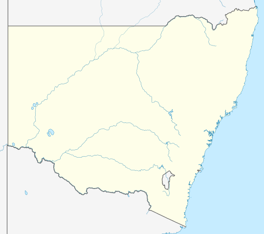
| Location |
| ||||||||||||||
| LGA(s) | City of Blue Mountains | ||||||||||||||
| State electorate(s) | Blue Mountains | ||||||||||||||
| Federal division(s) | Macquarie | ||||||||||||||
| |||||||||||||||
Warrimoo (formerly Karabar) is a medium-sized village in the lower Blue Mountains of New South Wales, Australia, 273 metres above sea level. The state government's electorate is Blue Mountains and the state member is Labor's Trisha Lee Doyle.
Federally, the electorate is Macquarie and the federal member is Labor's Susan Templeman. Warrimoo is located 68 kilometres west of Sydney, in the local government area of the City of Blue Mountains. Local council Mayor is Labor's Mark Greenhill. Warrimoo borders the townships/suburbs of Blaxland, Mount Riverview, Sun Valley and Valley Heights. The suburb is 5 train stops from Penrith and 11 train stops to Katoomba.
Population
The population of Warrimoo is mostly European background. Languages apart from English spoken in Warrimoo include French, Mandarin, Greek, Spanish and Italian. 31% of residents hold bachelor's degrees or higher and 30% are professionals. More than 35% claim to have no religious affiliation. The median weekly household income is $2,097.
Local Services

At the centre of Warrimoo is railway station (with bike racks) and Warrimoo Citizens Hall. There are several shops around the train station including a post office, fire station, cafe, car mechanic, antique shops, Italian restaurant/venue hire and an old fashioned general store which is a popular tourist bus stop off point for groups heading to Katoomba and the Jenolan Caves.
Other local businesses include:
- Blue Mountains Driving School
- Blue Sky music recording studio
- Sky Valley Studio
- Dance Empire dance studio
- The Craft Company
- Warrimoo Kitchens
The closest shopping mall is Westfield Penrith.
Parks/Entertainment
Parks include Ardill Park, Arthur St Park, Possum Park, Terrymont Rd Park and Cross St Nature Reserve. The Florabella Pass track is a popular hike between Warrimoo and Blaxland. Tennis Courts and Warrimoo oval are both on Rickard Rd.
Other local attractions within a 10 km radius include Glenbrook Swim Centre, Nepean River, Nepean Belle Paddlewheeler, Sydney International Regatta Centre, iFLY Downunder, Jetpack Adventures, Cables Wake Park, Glenbrook Cinema and Penrith Panthers. A further 20 minutes from Penrith is water park, Wet'n'Wild and Sydney Zoo.

Hospitals
Warrimoo is close to both the major teaching hospital, Nepean Hospital (14 km) and Springwood hospital (6 km). Buckland Aged Care Services and Nursing Home are 6 km away.
Transport
Warrimoo railway station is on the Blue Mountains Line of the NSW TrainLink intercity network. Warrimoo is also serviced by bus through Blue Mountains Transit and uber. The original 1918 Warrimoo station burnt down in a bushfire in the 1950s and was subsequently rebuilt. A decision by the NSW Liberal government to buy new South Korean made trains has resulted in controversy over Warrimoo's train station which may need renovating to accommodate the trains that are up to 205 metres long. Added to that, the train tracks may also need adjusting. Western Sydney Airport is due to open in 2026 with a train link via Parramatta.
Schools/childcare
Warrimoo is served by a private childcare facility (Bush babies), small public school on Florabella Rd (Warrimoo Public School) and a K-12 private school (Wycliffe Christian School).
Other nearby schools include Blue Mountains Grammar School, Springwood High, Winmalee High and Blaxland High.
Culture

Author and illustrator Dorothy Wall, who lived in Florabella St (1934–37), placed Warrimoo on the map with her children's books about the mischievous koala, Blinky Bill. Polish born film maker Yoram Gross, turned the books into movies bringing the iconic character onto the world stage. Blinky Bill is not the only koala bear story written by a Blue Mountains resident.
Not far away is the Norman Lindsay Gallery and Museum in Faulconbridge. Norman Lindsay wrote about Bunyip Bluegum, the anthropomorphic koala star of well known children's book, The Magic Pudding which was also turned into a movie, directed by Karl Zwicky.
Former Daily Telegraph journalist and founding 'House and Garden' editor Beryl Guertner, lived in Warrimoo.[2]
There are local music and choir groups that are community run such as the Moo Choir, which meets and performs out of the Warrimoo Public School hall,[3] and the biannual music group, the Sound Lounge.
George Finey, who was a cartoonist on the Daily Telegraph also spent time living in Warrimoo[citation needed].
University and TAFE
Western Sydney University has a campus in Penrith, 5 train stops away. Blue Mountains TAFE colleges are in Wentworth Falls, Katoomba, Nepean and Penrith.
Bushwalking
The Florabella Pass Track is a popular and scenic nature walk from Warrimoo into Blaxland and passes through abundant foliage, creeks and rare wildlife.[4] The bush walk leads into a thick rainforest filled with Lyrebirds, Flame Robins, Sulphur-Crested Cockatoos, Gang Gang Cockatoos, Owls and other rare species. The Pippas Pass portion of the track is renowned for its colourful bushland such as flannel flowers, Waratah plants and pink angophoras and its shelter caves.[4] The walk is less than 9 km however involves some steep hiking. There are many other bushwalking tracks, including a long walk to Glenbrook via the untracked Glenbrook Gorge.[4] The Wilderness Society and other environmental groups encourage koala sightings to be reported due to their endangered existence.
History
Warrimoo is an Aboriginal word meaning eagle's nest or place of the screaming white bird.[5]
In 1898, a railway station platform named Karabar was built in the area to service a developing estate, possibly sharing the same name. It had closed before World War I, but in 1918 a new station was built, not much further down the Blue Mountains line, named Warrimoo. Entrepreneur and developer, Arthur Rickard was behind the development of Warrimoo. His plan was to subdivide blocks so there were a mixture of small blocks and larger blocks which he established to promote sustainable living. On what was known as the Warrimoo Estate,[6] Rickard encouraged residents to develop orchards, vegetable gardens and raise chickens. Warrimoo retains many historical homes and buildings throughout the village including a distillery (where the local public school now sits) and a former 'Bordillo'.[7] Charity worker and gospeller George Ardill,[8] moved to Warrimoo in his latter years. He lived at 13 Florabella Street. During his years there, Ardill built numerous homes along Florabella st and The Avenue which he set up for homeless women and children. Ardill was also a key instigator in the removal of generations of Indigenous children from their families across Australia via his role in the New South Wales Aborigines Protection Board.
Dorothy Wall, author of the children's book Blinky Bill, lived in Warrimoo from 1934 to 1937 whilst publishing the second book of the series. In 2015, a mural was painted at Possum Park in honour of the illustrator.
Heritage listings
Warimoo has a number of heritage listings, including:
- Blue Mountains National Park: Blue Mountains walking tracks[9]
See also
References
- ^ Australian Bureau of Statistics (27 June 2017). "Warrimoo (State Suburb)". 2016 Census QuickStats. Retrieved 24 April 2018.
- ^ Tanner, Howard. "Guertner, Beryl Annie Blanche (1917–1981)". Australian Dictionary of Biography. Australian National University. Retrieved 7 August 2019.
- ^ "The Moo Choir". Warrimoo.org. Retrieved 7 August 2019.
- ^ a b c Chapman, John. Day Walks Sydney. p. 65.
- ^ "Origin of Blue Mountains Town Names" Blue Mountains City Council
- ^ "Warrimoo Subdivision Plans". State Library of New South Wales. Retrieved 25 October 2019.
- ^ "Sir Arthur Rickard's Contribution to Warrimoo". Warrimoo History. 9 August 2014. Retrieved 25 October 2019.
- ^ "Ardill and Warrimoo (1936–1945)". Warrimoo History. 29 May 2018. Retrieved 25 October 2019.
- ^ "Blue Mountains Walking tracks". New South Wales State Heritage Register. Department of Planning & Environment. H00980. Retrieved 18 May 2018.
Text is licensed by State of New South Wales (Department of Planning and Environment) under CC-BY 4.0 licence.