Waukee, Iowa: Difference between revisions
Tags: Mobile edit Mobile web edit |
→Education: Inaccurate information Tags: Mobile edit Mobile web edit |
||
| (25 intermediate revisions by 20 users not shown) | |||
| Line 1: | Line 1: | ||
{{Use mdy dates|date=July 2023}} |
|||
{{Infobox settlement |
{{Infobox settlement |
||
| official_name |
| official_name = Waukee, Iowa |
||
| settlement_type |
| settlement_type = [[List of cities in Iowa|City]] |
||
| motto |
| motto = "The Key To Good Living"<ref>{{cite web|url= http://www.waukee.org/|title= City of Waukee, Iowa|publisher= City of Waukee, Iowa |access-date=August 31, 2012}}</ref> |
||
<!-- Images --> |
<!-- Images -->| image_skyline = Waukee Triangle Park.jpg |
||
| |
| imagesize = 300 |
||
| ⚫ | |||
| imagesize = 300 |
|||
| image_flag = |
|||
| ⚫ | |||
| |
| image_seal = <!-- Maps --> |
||
| ⚫ | |||
| image_seal = <!-- Maps --> |
|||
| mapsize = 250px |
|||
| ⚫ | |||
| |
| map_caption = Location of Waukee, Iowa |
||
| |
| image_map1 = |
||
| |
| mapsize1 = |
||
| |
| map_caption1 = <!-- Location --> |
||
| ⚫ | |||
| map_caption1 = <!-- Location --> |
|||
| ⚫ | |||
| ⚫ | |||
| ⚫ | |||
| ⚫ | |||
| ⚫ | |||
| ⚫ | |||
| subdivision_type2 = [[List of counties in Iowa|County]] |
|||
| ⚫ | |||
| |
| subdivision_name2 = [[Dallas County, Iowa|Dallas]] |
||
| government_footnotes = |
|||
| subdivision_name2 = [[Dallas County, Iowa|Dallas]] |
|||
| |
| government_type = |
||
| |
| leader_title = [[Mayoralty in the United States|Mayor]] |
||
| ⚫ | | leader_name = Courtney Clarke (D)<ref>[https://www.waukee.org/175/Mayor-Council Waukee Mayor & Council], official web page.</ref><ref>[http://www.thegazette.com/subject/news/government/iowa-public-information-board-leans-republican-20160706 Iowa public board leans Republican], thegazette.com, July 7, 2016 .</ref> |
||
| leader_title = [[Mayoralty in the United States|Mayor]] |
|||
| ⚫ | |||
| ⚫ | | leader_name |
||
| ⚫ | |||
| ⚫ | |||
| ⚫ | |||
| ⚫ | |||
| ⚫ | |||
| ⚫ | |||
| ⚫ | |||
| ⚫ | |||
| ⚫ | |||
| ⚫ | |||
| ⚫ | |||
| ⚫ | |||
| established_date = <!-- Area --> |
|||
| ⚫ | |||
| |
| unit_pref = Imperial |
||
| ⚫ | |||
| unit_pref = Imperial |
|||
| area_magnitude = |
|||
| ⚫ | |||
| |
| area_total_km2 = 54.29 |
||
| |
| area_land_km2 = 54.17 |
||
| |
| area_water_km2 = 0.12 |
||
| area_total_sq_mi = 20.96 |
|||
| area_water_km2 = 0.12 |
|||
| |
| area_land_sq_mi = 20.92 |
||
| ⚫ | |||
| area_land_sq_mi = 20.75 |
|||
| ⚫ | |||
<!-- Population -->| population_as_of |
<!-- Population -->| population_as_of = [[2020 United States Census|2020]] |
||
| population_est |
| population_est = 31,645 |
||
| pop_est_as_of |
| pop_est_as_of = 2023 |
||
| population_footnotes |
| population_footnotes = |
||
| population_total |
| population_total = 23940 |
||
| population_density_km2 |
| population_density_km2 = 441.93 |
||
| population_density_sq_mi |
| population_density_sq_mi = 1144.58 |
||
| timezone |
| timezone = [[North American Central Time Zone|Central (CST)]] |
||
| utc_offset |
| utc_offset = -6 |
||
| timezone_DST |
| timezone_DST = CDT |
||
| utc_offset_DST |
| utc_offset_DST = -5 |
||
| elevation_footnotes |
| elevation_footnotes = <ref name=gnis/> |
||
| |
| elevation_ft = 1047 |
||
| ⚫ | |||
| elevation_ft = 1030 |
|||
| postal_code_type = [[ZIP code]] |
|||
| ⚫ | |||
| |
| postal_code = 50263 |
||
| |
| area_code = [[Area code 515|515]] |
||
| |
| blank_name = [[Federal Information Processing Standard|FIPS code]] |
||
| ⚫ | |||
| blank_name = [[Federal Information Processing Standard|FIPS code]] |
|||
| ⚫ | |||
| ⚫ | |||
| blank1_info = 2397221<ref name=gnis>{{GNIS|2397221}}</ref> |
|||
| ⚫ | |||
| |
| website = {{URL|http://www.waukee.org}} |
||
| ⚫ | |||
| website = [http://www.waukee.org/ City of Waukee, Iowa] |
|||
| pop_est_footnotes = |
|||
| ⚫ | |||
| |
| name = |
||
| name = |
|||
}} |
}} |
||
[[File:FI0004841.jpg|alt=Main Street, Waukee, Iowa|thumb|Main Street, Waukee, Iowa]] |
[[File:FI0004841.jpg|alt=Main Street, Waukee, Iowa|thumb|Main Street, Waukee, Iowa (1968)]] |
||
'''Waukee''' is a city in [[Dallas County, Iowa|Dallas County]], [[Iowa]], [[United States]]. The population was 23,940 at the time of the [[2020 United States Census|2020 U.S. Census]].<ref name=cen2020>{{cite web |title=2020 Census State Redistricting Data |url=https://www2.census.gov/programs-surveys/decennial/2020/data/01-Redistricting_File--PL_94-171/Iowa/ |website=census.gov |publisher=United states Census Bureau |access-date=12 August 2021}}</ref> It is part of the [[Des Moines, Iowa|Des Moines]] – [[West Des Moines, Iowa|West Des Moines]] [[Des Moines metropolitan area|Metropolitan Statistical Area]]. |
'''Waukee''' is a city in [[Dallas County, Iowa|Dallas County]], [[Iowa]], [[United States]]. The population was 23,940 at the time of the [[2020 United States Census|2020 U.S. Census]].<ref name=cen2020>{{cite web |title=2020 Census State Redistricting Data |url=https://www2.census.gov/programs-surveys/decennial/2020/data/01-Redistricting_File--PL_94-171/Iowa/ |website=census.gov |publisher=United states Census Bureau |access-date=12 August 2021}}</ref> It is part of the [[Des Moines, Iowa|Des Moines]] – [[West Des Moines, Iowa|West Des Moines]] [[Des Moines metropolitan area|Metropolitan Statistical Area]]. |
||
| Line 79: | Line 78: | ||
==Geography== |
==Geography== |
||
Waukee is located at {{coord|41|36|32|N|93|51|55|W|type:city}} (41.608974, -93.865320).<ref name="GR1">{{cite web|url=https://www.census.gov/geographies/reference-files/time-series/geo/gazetteer-files.html|publisher=[[United States Census Bureau]]|access-date=2011-04-23|date=2011-02-12|title=US Gazetteer files: 2010, 2000, and 1990}}</ref> |
|||
According to the [[United States Census Bureau]], the city has a total area of {{convert|12.99|sqmi|sqkm|2}}, of which {{convert|12.97|sqmi|sqkm|2}} is land and {{convert|0.02|sqmi|sqkm|2}} is water.<ref name ="Gazetteer files">{{cite web|title=US Gazetteer files 2010|url=https://www.census.gov/geo/www/gazetteer/files/Gaz_places_national.txt|publisher=[[United States Census Bureau]]|access-date=2012-05-11}}</ref> It is known for its [[Waukee Stadium]]. |
According to the [[United States Census Bureau]], the city has a total area of {{convert|12.99|sqmi|sqkm|2}}, of which {{convert|12.97|sqmi|sqkm|2}} is land and {{convert|0.02|sqmi|sqkm|2}} is water.<ref name ="Gazetteer files">{{cite web|title=US Gazetteer files 2010|url=https://www.census.gov/geo/www/gazetteer/files/Gaz_places_national.txt|publisher=[[United States Census Bureau]]|access-date=2012-05-11}}</ref> It is known for its [[Waukee Stadium]]. |
||
| Line 87: | Line 85: | ||
==Education== |
==Education== |
||
{{Further|Waukee Community School District}} |
{{Further|Waukee Community School District}} |
||
The Waukee Community School District is the fastest-growing school district in the state of Iowa with more than 1,000 staff members serving more than 7,700 students in grades preschool through twelfth grade.<ref name="waukeeschools.org"> |
The Waukee Community School District is the fastest-growing school district in the state of Iowa with more than 1,000 staff members serving more than 7,700 students in grades preschool through twelfth grade.<ref name="waukeeschools.org">{{Cite web|url=https://waukeeschools.org/district/about/|title = About}}</ref> |
||
Its schools serve students from Clive, Urbandale, Waukee, and West Des Moines as well as open enrollment students from other communities outside the 55 square miles of its district boundaries.<ref name="waukeeschools.org"/> |
Its schools serve students from Clive, Urbandale, Waukee, and West Des Moines as well as open enrollment students from other communities outside the 55 square miles of its district boundaries.<ref name="waukeeschools.org"/> |
||
| Line 93: | Line 92: | ||
There are currently nine elementary schools, two middle schools (grades 6/7), and two middle schools (grades 8/9) in Waukee as well as the [[Waukee High School]] and the Vincent Meyer Learning Center.<ref name="waukeeschools.org"/> |
There are currently nine elementary schools, two middle schools (grades 6/7), and two middle schools (grades 8/9) in Waukee as well as the [[Waukee High School]] and the Vincent Meyer Learning Center.<ref name="waukeeschools.org"/> |
||
The district |
The district built a second high school, called Waukee Northwest High School, which opened in the 2021 school year.<ref name=2ndhs.waukeeschools.org>{{Cite web|url=https://2ndhs.waukeeschools.org/construction-projects/timeline/|title=Home}}</ref> |
||
==Demographics== |
==Demographics== |
||
| Line 125: | Line 124: | ||
===2000 U.S. Census=== |
===2000 U.S. Census=== |
||
As of the [[2000 United States Census]],<ref name="GR2">{{cite web|url=https://www.census.gov|publisher=[[United States Census Bureau]]|access-date=2008-01-31|title=U.S. Census website}}</ref> there were 5,126 people, 1,927 households, and 1,445 families living in the city. The |
As of the [[2000 United States Census]],<ref name="GR2">{{cite web|url=https://www.census.gov|publisher=[[United States Census Bureau]]|access-date=2008-01-31|title=U.S. Census website}}</ref> there were 5,126 people, 1,927 households, and 1,445 families living in the city. The population density was {{convert|610.9|PD/sqmi|PD/km2|sp=us|adj=off}}. There were 2,087 housing units at an average density of {{convert|248.7|/sqmi|/km2|sp=us|adj=off}}. The racial makeup of the city was 98.17% white, 0.43% African American, 0.57% Asian, 0.02% Pacific Islander, 0.31% from other races and 0.51% from two or more races. Hispanic or Latino of any race were 0.74% of the population. |
||
There were 1,927 households, out of which 43.0% had children under the age of 18 living with them, 64.8% were [[Marriage|married couples]] living together, 8.2% had a female householder with no husband present, and 25.0% were non-families. 21.1% of all households were made up of individuals, and 6.7% had someone living alone who was 65 years of age or older. The average household size was 2.66 and the average family size was 3.12. |
There were 1,927 households, out of which 43.0% had children under the age of 18 living with them, 64.8% were [[Marriage|married couples]] living together, 8.2% had a female householder with no husband present, and 25.0% were non-families. 21.1% of all households were made up of individuals, and 6.7% had someone living alone who was 65 years of age or older. The average household size was 2.66 and the average family size was 3.12. |
||
| Line 132: | Line 131: | ||
The median income for a household in the city was $58,024, and the median income for a family was $64,362. Males had a median income of $38,958 and females had a median income of $30,898. The [[per capita income]] for the city was $24,351. About 2.1% of families and 3.0% of the population were below the [[poverty line]], including 3.5% of those under age 18 and 6.6% of those age 65 or over. |
The median income for a household in the city was $58,024, and the median income for a family was $64,362. Males had a median income of $38,958 and females had a median income of $30,898. The [[per capita income]] for the city was $24,351. About 2.1% of families and 3.0% of the population were below the [[poverty line]], including 3.5% of those under age 18 and 6.6% of those age 65 or over. |
||
==Transportation== |
|||
HIRTA provides [[Demand-responsive transport|demand response]] service in Waukee. However, as of 2023, Waukee is the largest city in Iowa without fixed-route public transit service. [[Des Moines Area Regional Transit]] serves [[Clive, Iowa|Clive]] approximately half a mile from Waukee with the Route 92 express service.<ref>{{cite web|url=https://www.waukee.org/874/Public-Transportation|title=Waukee Public Transportation|access-date=May 30, 2023}}</ref> |
|||
==Notable people==<!--consensus reached to standardize this heading per WP:WikiProject Cities/US Guideline --> |
==Notable people==<!--consensus reached to standardize this heading per WP:WikiProject Cities/US Guideline --> |
||
| Line 148: | Line 150: | ||
*[[Joey Jordison]] — former [[drummer]] for the band [[Slipknot (band)|Slipknot]] |
*[[Joey Jordison]] — former [[drummer]] for the band [[Slipknot (band)|Slipknot]] |
||
*[[Jake Knott]] — former [[Iowa State Cyclones football|Iowa State]] and [[Philadelphia Eagles]] linebacker |
*[[Jake Knott]] — former [[Iowa State Cyclones football|Iowa State]] and [[Philadelphia Eagles]] linebacker |
||
| ⚫ | |||
*[[Talia Leman]] — CEO and a founder of RandomKid, an organization that empowers young people to do good deeds |
*[[Talia Leman]] — CEO and a founder of RandomKid, an organization that empowers young people to do good deeds |
||
*[[Hal Manders]] — [[relief pitcher]] in [[Major League Baseball]]; born in Waukee<ref>{{cite web|url= https://www.baseball-reference.com/players/m/mandeha01.shtml|title= Hal Manders|publisher= |
*[[Hal Manders]] — [[relief pitcher]] in [[Major League Baseball]]; born in Waukee<ref>{{cite web|url= https://www.baseball-reference.com/players/m/mandeha01.shtml|title= Hal Manders|publisher= Baseball-Reference.com |access-date=August 31, 2012}}</ref> |
||
| ⚫ | |||
*[[Ken Smith (architect)|Ken Smith]] — internationally acclaimed [[landscape architect]]; born in Waukee<ref>{{cite web|url= http://archive.news.iastate.edu/news/2011/aug/KenSmith|title= Internationally renowned landscape architect Ken Smith to receive Christian Petersen Design Award at ISU|publisher= Iowa State University|access-date=August 31, 2012}}</ref> |
*[[Ken Smith (architect)|Ken Smith]] — internationally acclaimed [[landscape architect]]; born in Waukee<ref>{{cite web|url= http://archive.news.iastate.edu/news/2011/aug/KenSmith|title= Internationally renowned landscape architect Ken Smith to receive Christian Petersen Design Award at ISU|publisher= Iowa State University|access-date=August 31, 2012}}</ref> |
||
Latest revision as of 20:49, 11 August 2024
Waukee, Iowa | |
|---|---|
 Triangle Park in Downtown Waukee | |
| Motto: "The Key To Good Living"[1] | |
 Location of Waukee, Iowa | |
| Coordinates: 41°36′32″N 93°51′55″W / 41.60889°N 93.86528°W | |
| Country | |
| State | |
| County | Dallas |
| Government | |
| • Mayor | Courtney Clarke (D)[2][3] |
| • Iowa House | Rob Taylor (R) Ralph Watts (R) |
| • Iowa Senate | Jake Chapman (R) Charles Schneider (R) |
| • U.S. House | Zach Nunn (R) |
| Area | |
| • Total | 20.96 sq mi (54.29 km2) |
| • Land | 20.92 sq mi (54.17 km2) |
| • Water | 0.04 sq mi (0.12 km2) |
| Elevation | 1,047 ft (319 m) |
| Population (2020) | |
| • Total | 23,940 |
| • Estimate (2023) | 31,645 |
| • Density | 1,144.58/sq mi (441.93/km2) |
| Time zone | UTC-6 (Central (CST)) |
| • Summer (DST) | UTC-5 (CDT) |
| ZIP code | 50263 |
| Area code | 515 |
| FIPS code | 19-82695 |
| GNIS feature ID | 2397221[5] |
| Website | www |

Waukee is a city in Dallas County, Iowa, United States. The population was 23,940 at the time of the 2020 U.S. Census.[6] It is part of the Des Moines – West Des Moines Metropolitan Statistical Area.
In 2017, Apple Inc. chose Waukee as the location of a massive $1.38 billion data center campus.[7]
History
[edit]Waukee was laid out as a town in 1869.[8] It is thought to be named after The Milwaukee Railroad.[9] Waukee was incorporated on December 23, 1878.[10]
Geography
[edit]According to the United States Census Bureau, the city has a total area of 12.99 square miles (33.64 km2), of which 12.97 square miles (33.59 km2) is land and 0.02 square miles (0.05 km2) is water.[11] It is known for its Waukee Stadium.
Climate
[edit]Humid continental climate is a climatic region typified by large seasonal temperature differences, with warm to hot (and often humid) summers and cold (sometimes severely cold) winters. The Köppen climate classification subtype for this climate is "Dfa" (Hot summer, continental climate).[12]
Education
[edit]The Waukee Community School District is the fastest-growing school district in the state of Iowa with more than 1,000 staff members serving more than 7,700 students in grades preschool through twelfth grade.[13]
Its schools serve students from Clive, Urbandale, Waukee, and West Des Moines as well as open enrollment students from other communities outside the 55 square miles of its district boundaries.[13]
There are currently nine elementary schools, two middle schools (grades 6/7), and two middle schools (grades 8/9) in Waukee as well as the Waukee High School and the Vincent Meyer Learning Center.[13]
The district built a second high school, called Waukee Northwest High School, which opened in the 2021 school year.[14]
Demographics
[edit]| Census | Pop. | Note | %± |
|---|---|---|---|
| 1880 | 245 | — | |
| 1890 | 240 | −2.0% | |
| 1900 | 292 | 21.7% | |
| 1910 | 340 | 16.4% | |
| 1920 | 375 | 10.3% | |
| 1930 | 445 | 18.7% | |
| 1940 | 473 | 6.3% | |
| 1950 | 501 | 5.9% | |
| 1960 | 687 | 37.1% | |
| 1970 | 1,577 | 129.5% | |
| 1980 | 2,227 | 41.2% | |
| 1990 | 2,512 | 12.8% | |
| 2000 | 5,126 | 104.1% | |
| 2010 | 13,790 | 169.0% | |
| 2020 | 23,940 | 73.6% | |
| U.S. Decennial Census[15] | |||
2010 U.S. Census
[edit]As of the 2010 United States Census,[16] there were 13,790 people, 5,154 households, and 3,689 families living in the city. The population density was 1,063.2 inhabitants per square mile (410.5/km2). There were 5,378 housing units at an average density of 414.6 per square mile (160.1/km2). The racial makeup of the city was 93.9% white, 1.3% African American, 0.2% Native American, 2.6% Asian, 0.1% Pacific Islander, 0.9% from other races and 1.1% from two or more races. Hispanic or Latino of any race were 3.0% of the population.
There were 5,154 households, of which 44.8% had children under the age of 18 living with them, 59.0% were married couples living together, 9.3% had a female householder with no husband present, 3.3% had a male householder with no wife present, and 28.4% were non-families. 23.0% of all households were made up of individuals, and 6.7% had someone living alone who was 65 years of age or older. The average household size was 2.67 and the average family size was 3.19.
The median age in the city was 31.8 years. 32% of residents were under the age of 18; 5.1% were between the ages of 18 and 24; 36.3% were from 25 to 44; 18.5% were from 45 to 64; and 8% were 65 years of age or older. The gender makeup of the city was 48.6% male and 51.4% female.
2000 U.S. Census
[edit]As of the 2000 United States Census,[17] there were 5,126 people, 1,927 households, and 1,445 families living in the city. The population density was 610.9 inhabitants per square mile (235.9/km2). There were 2,087 housing units at an average density of 248.7 per square mile (96.0/km2). The racial makeup of the city was 98.17% white, 0.43% African American, 0.57% Asian, 0.02% Pacific Islander, 0.31% from other races and 0.51% from two or more races. Hispanic or Latino of any race were 0.74% of the population.
There were 1,927 households, out of which 43.0% had children under the age of 18 living with them, 64.8% were married couples living together, 8.2% had a female householder with no husband present, and 25.0% were non-families. 21.1% of all households were made up of individuals, and 6.7% had someone living alone who was 65 years of age or older. The average household size was 2.66 and the average family size was 3.12.
In the city, the population was spread out, with 30.4% under the age of 18, 5.5% from 18 to 24, 36.4% from 25 to 44, 19.9% from 45 to 64, and 7.6% who were 65 years of age or older. The median age was 33 years. For every 100 females, there were 98.0 males. For every 100 females age 18 and over, there were 91.1 males.
The median income for a household in the city was $58,024, and the median income for a family was $64,362. Males had a median income of $38,958 and females had a median income of $30,898. The per capita income for the city was $24,351. About 2.1% of families and 3.0% of the population were below the poverty line, including 3.5% of those under age 18 and 6.6% of those age 65 or over.
Transportation
[edit]HIRTA provides demand response service in Waukee. However, as of 2023, Waukee is the largest city in Iowa without fixed-route public transit service. Des Moines Area Regional Transit serves Clive approximately half a mile from Waukee with the Route 92 express service.[18]
Notable people
[edit]- Paul Gregory — film, Television and stage producer
- Joey Jordison — former drummer for the band Slipknot
- Jake Knott — former Iowa State and Philadelphia Eagles linebacker
- Talia Leman — CEO and a founder of RandomKid, an organization that empowers young people to do good deeds
- Hal Manders — relief pitcher in Major League Baseball; born in Waukee[19]
- Anthony Nelson - former Iowa and current Tampa Bay Buccaneers linebacker
- Ken Smith — internationally acclaimed landscape architect; born in Waukee[20]
See also
[edit]References
[edit]- ^ "City of Waukee, Iowa". City of Waukee, Iowa. Retrieved August 31, 2012.
- ^ Waukee Mayor & Council, official web page.
- ^ Iowa public board leans Republican, thegazette.com, July 7, 2016 .
- ^ "2020 U.S. Gazetteer Files". United States Census Bureau. Retrieved March 16, 2022.
- ^ a b U.S. Geological Survey Geographic Names Information System: Waukee, Iowa
- ^ "2020 Census State Redistricting Data". census.gov. United states Census Bureau. Retrieved August 12, 2021.
- ^ "7 things to know about the Apple data center in Waukee". August 25, 2017.
- ^ The History of Dallas County, Iowa: Containing a History of the County, Its Cities, Towns, &c. Higginson Book Company. 1879. pp. 489.
- ^ "Profile for Waukee, Iowa, IA". ePodunk. Retrieved August 31, 2012.
- ^ "Waukee, Iowa". City-Data.com. Retrieved August 31, 2012.
- ^ "US Gazetteer files 2010". United States Census Bureau. Retrieved May 11, 2012.
- ^ "Des Moines, Iowa Köppen Climate Classification (Weatherbase)". Weatherbase.
- ^ a b c "About".
- ^ "Home".
- ^ "Census of Population and Housing". Census.gov. Retrieved June 4, 2015.
- ^ "U.S. Census website". United States Census Bureau. Retrieved May 11, 2012.
- ^ "U.S. Census website". United States Census Bureau. Retrieved January 31, 2008.
- ^ "Waukee Public Transportation". Retrieved May 30, 2023.
- ^ "Hal Manders". Baseball-Reference.com. Retrieved August 31, 2012.
- ^ "Internationally renowned landscape architect Ken Smith to receive Christian Petersen Design Award at ISU". Iowa State University. Retrieved August 31, 2012.
External links
[edit]- City of Waukee, Iowa Website
- Chamber of commerce
- Waukee Community School District
- City-Data Comprehensive Statistical Data and more about Waukee
- ePodunk:Profile for Waukee, Iowa, IA
- Waukee 2nd High School Project
Municipalities and communities of Dallas County, Iowa, United States | ||
|---|---|---|
| Cities | 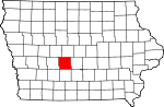 | |
| Townships | ||
| Unincorporated communities | ||
| Footnotes | ‡This populated place also has portions in an adjacent county or counties | |