Wheatland, New Jersey: Difference between revisions
Content deleted Content added
Magnolia677 (talk | contribs) m Copyedit (minor) |
add "use mdy dates" template and other tags |
||
| (13 intermediate revisions by 10 users not shown) | |||
| Line 1: | Line 1: | ||
{{Short description|Populated place in Ocean County, New Jersey, US}} |
|||
{{Use American English|date=July 2023}} |
|||
{{Use mdy dates|date=July 2023}} |
|||
{{Infobox settlement |
{{Infobox settlement |
||
| |
|name = Wheatland, New Jersey |
||
|settlement_type = [[Local government in New Jersey#Unincorporated communities|Unincorporated community]] |
|settlement_type = [[Local government in New Jersey#Unincorporated communities|Unincorporated community]] |
||
|nickname = |
|nickname = |
||
| Line 6: | Line 9: | ||
<!-- Images --> |
<!-- Images --> |
||
|image_skyline = |
|image_skyline = Wheatland, NJ.jpg |
||
|imagesize = |
|imagesize = |
||
|image_caption = |
|image_caption = Settlement as seen from Pasadena Road |
||
|image_flag = |
|image_flag = |
||
|image_seal = |
|image_seal = |
||
<!-- Maps --> |
<!-- Maps --> |
||
|pushpin_map = USA New Jersey |
|pushpin_map = USA New Jersey Ocean County#USA New Jersey#USA |
||
|pushpin_label_position = left<!-- the position of the pushpin label: left, right, top, bottom, none --> |
|pushpin_label_position = left<!-- the position of the pushpin label: left, right, top, bottom, none --> |
||
|pushpin_map_caption = Location within |
|pushpin_map_caption = Location within Ocean County (Inset: Ocean County in New Jersey) |
||
<!-- Location --> |
<!-- Location --> |
||
|subdivision_type = [[List of |
|subdivision_type = [[List of sovereign states|Country]] |
||
|subdivision_name = United States |
|subdivision_name = {{flag|United States}} |
||
|subdivision_type1 = [[U.S. state|State]] |
|subdivision_type1 = [[U.S. state|State]] |
||
|subdivision_name1 = |
|subdivision_name1 = {{flag|New Jersey}} |
||
|subdivision_type2 = [[List of counties in New Jersey|County]] |
|subdivision_type2 = [[List of counties in New Jersey|County]] |
||
|subdivision_name2 = [[Ocean County, New Jersey|Ocean]] |
|subdivision_name2 = [[Ocean County, New Jersey|Ocean]] |
||
|subdivision_type3 = [[List of townships in New Jersey|Township]] |
|||
|subdivision_name3 = [[Manchester Township, New Jersey|Manchester]] |
|||
<!-- Area --> |
<!-- Area --> |
||
| Line 45: | Line 50: | ||
<!-- General information --> |
<!-- General information --> |
||
|timezone = [[Eastern Time Zone|Eastern (EST)]] |
|timezone = [[Eastern Time Zone|Eastern (EST)]] |
||
|utc_offset = |
|utc_offset = −05:00 |
||
|timezone_DST = EDT |
|timezone_DST = EDT |
||
|utc_offset_DST = |
|utc_offset_DST = −04:00 |
||
|elevation_footnotes = <ref name=GNIS/> |
|elevation_footnotes = <ref name=GNIS/> |
||
|elevation_m = |
|elevation_m = |
||
|elevation_ft = 148 |
|elevation_ft = 148 |
||
| |
|coordinates = {{coord|39|53|42|N|74|26|02|W|region:US_type:city|display=inline,title}} |
||
|coordinates_type = region:US_type:city |
|||
|latd = 39 |
|||
|latm = 53 |
|||
|lats = 42 |
|||
|latNS = N |
|||
|longd = 74 |
|||
|longm = 26 |
|||
|longs = 02 |
|||
|longEW = W |
|||
<!-- Area/postal codes & others --> |
<!-- Area/postal codes & others --> |
||
| Line 72: | Line 68: | ||
}} |
}} |
||
'''Wheatland''' (also called '''Pasadena''') is an [[Local government in New Jersey#Unincorporated communities|unincorporated community]] in [[Ocean County, New Jersey]], |
'''Wheatland''' (also called '''Pasadena'''<ref name=1957_topo>{{cite map |url=http://ngmdb.usgs.gov/img4/ht_icons/Browse/NJ/NJ_Whiting_254984_1957_24000.jpg |title=Whiting, NJ Topo Map 1:24000 |publisher=[[United States Geological Survey]] |year=1957 |edition=rev. 1971 |access-date=August 18, 2015}}</ref>) is an [[Local government in New Jersey#Unincorporated communities|unincorporated community]] within [[Manchester Township, New Jersey|Manchester Township]] in [[Ocean County, New Jersey|Ocean County]], in the [[U.S. state]] of [[New Jersey]].<ref name=GNIS/><ref name="Google">{{Google maps|url=https://maps.google.com/maps?q=Wheatland,+Manchester+Township,+NJ&hl=en&sll=37.6,-95.665&sspn=60.22273,135.263672&t=h&hnear=Wheatland&z=15|title=Wheatland, Manchester Township, New Jersey|access-date=January 25, 2015}}</ref> |
||
Wheatland is located approximately {{convert|4|mi|km| |
Wheatland is located approximately {{convert|4|mi|km|spell=in}} southwest of [[Whiting, New Jersey|Whiting]], along a now-abandoned line of the [[New Jersey Southern Railroad]].<ref name="Edwards">{{cite book | last = Edwards | first = Richard | title = Industries of New Jersey: Essex County Including City of Newark | publisher = Historical Publishing Company | year = 1882 | url = https://books.google.com/books?id=cwVLAAAAYAAJ&pg=PP1 | pages = 135}}</ref> |
||
The Pasadena Wildlife Management Area is located east of the settlement.<ref name=GNIS1>{{gnis|883033|Pasadena Wildlife Management Area}}</ref> |
The Pasadena Wildlife Management Area is located east of the settlement.<ref name=GNIS1>{{gnis|883033|Pasadena Wildlife Management Area}}</ref> |
||
==History== |
==History== |
||
Sand—mined from nearby pits—was used to manufacture clay drain pipes at a factory erected at Wheatland during the 1870s.<ref>{{cite book | title = Transactions, Volume 6 | publisher = American Institute of Mining Engineers | year = 1879 | url = https://books.google. |
Sand—mined from nearby pits—was used to manufacture clay drain pipes at a factory erected at Wheatland during the 1870s.<ref>{{cite book | title = Transactions, Volume 6 | publisher = American Institute of Mining Engineers | year = 1879 | url = https://books.google.com/books?id=gVk2AQAAMAAJ&pg=PP1 | pages = 187}}</ref> |
||
In 1882, Wheatland had a post office, and a population of 125. |
In 1882, Wheatland had a post office, and a population of 125.<ref name="Edwards"/> |
||
==References== |
==References== |
||
| Line 88: | Line 84: | ||
{{Ocean County, New Jersey}} |
{{Ocean County, New Jersey}} |
||
[[Category:Manchester Township, New Jersey]] |
|||
[[Category:Unincorporated communities in Ocean County, New Jersey]] |
[[Category:Unincorporated communities in Ocean County, New Jersey]] |
||
[[Category:Unincorporated communities in New Jersey]] |
|||
{{ |
{{OceanCountyNJ-geo-stub}} |
||
Latest revision as of 12:42, 23 July 2023
Wheatland, New Jersey | |
|---|---|
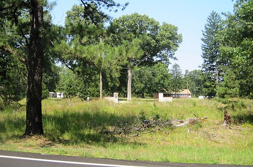 Settlement as seen from Pasadena Road | |
 Wheatland, New Jersey Location within Ocean County (Inset: Ocean County in New Jersey) 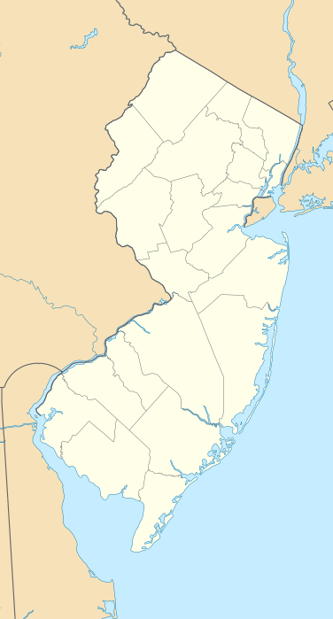 Wheatland, New Jersey Wheatland, New Jersey (New Jersey)  Wheatland, New Jersey Wheatland, New Jersey (the United States) | |
| Coordinates: 39°53′42″N 74°26′02″W / 39.89500°N 74.43389°W | |
| Country | |
| State | |
| County | Ocean |
| Township | Manchester |
| Elevation | 45 m (148 ft) |
| Time zone | UTC−05:00 (Eastern (EST)) |
| • Summer (DST) | UTC−04:00 (EDT) |
| GNIS feature ID | 881766[1] |
Wheatland (also called Pasadena[2]) is an unincorporated community within Manchester Township in Ocean County, in the U.S. state of New Jersey.[1][3]
Wheatland is located approximately four miles (6.4 km) southwest of Whiting, along a now-abandoned line of the New Jersey Southern Railroad.[4]
The Pasadena Wildlife Management Area is located east of the settlement.[5]
History[edit]
Sand—mined from nearby pits—was used to manufacture clay drain pipes at a factory erected at Wheatland during the 1870s.[6]
In 1882, Wheatland had a post office, and a population of 125.[4]
References[edit]
- ^ a b c U.S. Geological Survey Geographic Names Information System: Wheatland
- ^ Whiting, NJ Topo Map 1:24000 (Map) (rev. 1971 ed.). United States Geological Survey. 1957. Retrieved August 18, 2015.
- ^ Google (January 25, 2015). "Wheatland, Manchester Township, New Jersey" (Map). Google Maps. Google. Retrieved January 25, 2015.
- ^ a b Edwards, Richard (1882). Industries of New Jersey: Essex County Including City of Newark. Historical Publishing Company. p. 135.
- ^ U.S. Geological Survey Geographic Names Information System: Pasadena Wildlife Management Area
- ^ Transactions, Volume 6. American Institute of Mining Engineers. 1879. p. 187.

This Ocean County, New Jersey state location article is a stub. You can help Wikipedia by expanding it. |