Wilsthorpe, Lincolnshire: Difference between revisions
No edit summary |
population for the former parishes project |
||
| (12 intermediate revisions by 11 users not shown) | |||
| Line 1: | Line 1: | ||
{{Short description|Village in South Kesteven, Lincolnshire, England}} |
|||
{{Use British English|date=November 2013}} |
{{Use British English|date=November 2013}} |
||
{{Use dmy dates|date= |
{{Use dmy dates|date=December 2023}} |
||
{{Infobox UK place |
{{Infobox UK place |
||
| static_image_name= Church of St Faith, Wilsthorpe - geograph.org.uk - 1577574.jpg |
| static_image_name= Church of St Faith, Wilsthorpe - geograph.org.uk - 1577574.jpg |
||
| Line 8: | Line 9: | ||
| official_name= Wilsthorpe |
| official_name= Wilsthorpe |
||
| map_alt= |
| map_alt= |
||
| coordinates = {{coord|52.711325|-0.386268|display=inline,title}} |
|||
| latitude= 52.711325 |
|||
| longitude= -0.386268 |
|||
| civil_parish= [[Braceborough and Wilsthorpe]] |
| civil_parish= [[Braceborough and Wilsthorpe]] |
||
| shire_district= [[South Kesteven]] |
| shire_district= [[South Kesteven]] |
||
| Line 23: | Line 23: | ||
| london_direction= SSE |
| london_direction= SSE |
||
}} |
}} |
||
| ⚫ | |||
| ⚫ | '''Wilsthorpe''' is a village in the [[civil parish]] of [[Braceborough and Wilsthorpe]], in the [[South Kesteven]] district, in the county of [[Lincolnshire]], England. It is situated approximately {{convert|6|mi|km|0}} north-east from [[Stamford, Lincolnshire|Stamford]] and approximately {{convert|4|mi|km|0}} south from [[Bourne, Lincolnshire|Bourne]]. |
||
| ⚫ | |||
| ⚫ | Wilsthorpe was formerly a [[chapelry]] in [[Greatford]] parish,<ref>{{cite web|title=Wilsthorpe|url=http://www.visionofbritain.org.uk/place/place_page.jsp?p_id=14085|work=Vision of Britain|publisher=University of Portsmouth|accessdate=12 August 2011}}</ref> in 1866 Wilsthorpe became a separate civil parish, on 1 April 1931 the parish was abolished and merged with [[Braceborough]] to form "Braceborough and Wilsthorpe.<ref>{{cite web|title=Wilsthorpe civil parish|url=http://www.visionofbritain.org.uk/relationships.jsp?u_id=10463762&c_id=10001043|work=Vision of Britain|publisher=University of Portsmouth|accessdate=12 August 2011}}</ref> In 1921 the parish had a population of 60.<ref>{{cite web|url=https://visionofbritain.org.uk/unit/10463762/cube/TOT_POP|title=Population statistics Wilsthorpe CP/Ch through time|publisher=A Vision of Britain through Time|accessdate=13 January 2024}}</ref> |
||
| ⚫ | Wilsthorpe is mentioned in ''[[Domesday Book]]'' of 1086 when it was listed as having 20 households, {{convert|40|acre|km2|1}} of meadow, {{convert|12|acre|km2|2}} of woodland, and two mills.<ref>{{cite web|title=Wilsthorpe|url=http://www.domesdaymap.co.uk/place/TF0913/wilsthorpe/|work=Domesday Map|publisher=Anna Powell-Smith/University of Hull|accessdate=12 August 2011}}</ref> |
||
A possible [[Roman villa]] has been located as [[cropmark]]s to the south-east of the village,<ref>{{cite web|title=Wilsthorpe Roman Villa|url=http://www.pastscape.org.uk/hob.aspx?hob_id=348304&sort=4&search=all&criteria=wilsthorpe%20lincolnshire&rational=q&recordsperpage=10|work=Pastscape|publisher=[[English Heritage]]|accessdate=12 August 2011}}</ref> and [[King Street (Roman road)|King Street]] is a [[Roman roads in Britain|Roman road]].<ref>{{cite web|title=King Street Roman Road, Wilsthorpe|url=http://www.lincstothepast.com/Roman-coins-and-possible-Roman-station--Braceborough-and-Wilsthorpe/225594.record?pt=S|work=Lincs to the Past|publisher=Lincolnshire Archives|accessdate=12 August 2011}}</ref> |
|||
A possible [[Roman villa]] has been located as [[cropmark]]s to the south-east of the village,<ref>{{PastScape|mname=Wilsthorpe Roman Villa|mnumber=348304|accessdate=12 August 2011}}</ref> and [[King Street (Roman road)|King Street]] is a [[Roman roads in Britain|Roman road]].<ref>{{cite web|title=King Street Roman Road, Wilsthorpe|url=http://www.lincstothepast.com/Roman-coins-and-possible-Roman-station--Braceborough-and-Wilsthorpe/225594.record?pt=S|work=Lincs to the Past|publisher=Lincolnshire Archives|accessdate=12 August 2011}}</ref> |
|||
The church is a Grade II* [[listed building]] dedicated to [[Saint Faith]]. Built in 1715, it was restored and altered by [[James Fowler (architect)|James Fowler]] of Louth in 1869. In the sanctuary is a late-13th-century effigy of a knight in chain mail;<ref>{{NHLE|desc=St Faiths, Wilsthorpe|num=1062675|accessdate=12 August 2011}}</ref> perhaps a Wake family member. [[Hereward the Wake]] was an [[Anglo-Saxons|Anglo-Saxon]] who led resistance to the [[Norman Conquest]], and was born in or near Bourne.<ref>{{cite web|title=Braceborough and Wilsthorpe|url=http://parishes.lincolnshire.gov.uk/BraceboroughandWilsthorpe/|work=Lincolnshire Parishes|publisher=Lincolnshire County Council|accessdate=12 August 2011}}</ref> |
|||
| ⚫ | To the west of the village is the former railway station of [[Braceborough Spa Halt railway station|Braceborough Spa Halt]] which was on the Essendine and Bourne Railway line. It opened in 1860 and closed in 1951. The old station house is now a private house.<ref>{{ |
||
| ⚫ | To the west of the village is the former railway station of [[Braceborough Spa Halt railway station|Braceborough Spa Halt]] which was on the Essendine and Bourne Railway line. It opened in 1860 and closed in 1951. The old station house is now a private house.<ref>{{PastScape|mname=Braceborough Spa Halt|mnumber=506986|accessdate=12 August 2011}}</ref> In addition, [[Wilsthorpe Crossing Halt railway station]] was located to the north of the village. |
||
Nearby is the pumping station house from the old [[Peterborough]] Waterworks with its {{convert|52|ft|m|1}} deep [[artesian well]] drilled during the late 19th century when it provided a million gallons of water each day to supply the cathedral city {{convert|14|mi|km}} away.{{citation needed|date=August 2011}} |
Nearby is the pumping station house from the old [[Peterborough]] Waterworks with its {{convert|52|ft|m|1}} deep [[artesian well]] drilled during the late 19th century when it provided a million gallons of water each day to supply the cathedral city {{convert|14|mi|km}} away.{{citation needed|date=August 2011}} |
||
==Literature== |
==Literature== |
||
Wilsthorpe appears as a real world location in [[Mr |
Wilsthorpe appears as a real world location in [[Mr Humphreys and His Inheritance]] a short ghost story by [[M.R. James]] first published in [[More Ghost Stories]] in 1911 |
||
==References== |
==References== |
||
| Line 46: | Line 47: | ||
*{{Commons category-inline|Wilsthorpe, Lincolnshire|position=left}} |
*{{Commons category-inline|Wilsthorpe, Lincolnshire|position=left}} |
||
{{ |
{{Portal bar|England|United Kingdom}} |
||
{{Lincolnshire|state=collapsed}} |
{{Lincolnshire|state=collapsed}} |
||
{{Authority control}} |
|||
[[Category:Villages in Lincolnshire]] |
[[Category:Villages in Lincolnshire]] |
||
[[Category:South Kesteven]] |
[[Category:South Kesteven District]] |
||
[[Category:Former civil parishes in Lincolnshire]] |
[[Category:Former civil parishes in Lincolnshire]] |
||
Latest revision as of 18:12, 13 January 2024
| Wilsthorpe | |
|---|---|
 St Faith's Church, Wilsthorpe | |
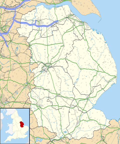 Wilsthorpe Location within Lincolnshire | |
| OS grid reference | TF091138 |
| • London | 90 mi (140 km) SSE |
| Civil parish | |
| District | |
| Shire county | |
| Region | |
| Country | England |
| Sovereign state | United Kingdom |
| Post town | Stamford |
| Postcode district | PE9 |
| Police | Lincolnshire |
| Fire | Lincolnshire |
| Ambulance | East Midlands |
| UK Parliament | |
Wilsthorpe is a village in the civil parish of Braceborough and Wilsthorpe, in the South Kesteven district, in the county of Lincolnshire, England. It is situated approximately 6 miles (10 km) north-east from Stamford and approximately 4 miles (6 km) south from Bourne.
Wilsthorpe was formerly a chapelry in Greatford parish,[1] in 1866 Wilsthorpe became a separate civil parish, on 1 April 1931 the parish was abolished and merged with Braceborough to form "Braceborough and Wilsthorpe.[2] In 1921 the parish had a population of 60.[3]
Wilsthorpe is mentioned in Domesday Book of 1086 when it was listed as having 20 households, 40 acres (0.2 km2) of meadow, 12 acres (0.05 km2) of woodland, and two mills.[4]
A possible Roman villa has been located as cropmarks to the south-east of the village,[5] and King Street is a Roman road.[6]
The church is a Grade II* listed building dedicated to Saint Faith. Built in 1715, it was restored and altered by James Fowler of Louth in 1869. In the sanctuary is a late-13th-century effigy of a knight in chain mail;[7] perhaps a Wake family member. Hereward the Wake was an Anglo-Saxon who led resistance to the Norman Conquest, and was born in or near Bourne.[8]
To the west of the village is the former railway station of Braceborough Spa Halt which was on the Essendine and Bourne Railway line. It opened in 1860 and closed in 1951. The old station house is now a private house.[9] In addition, Wilsthorpe Crossing Halt railway station was located to the north of the village.
Nearby is the pumping station house from the old Peterborough Waterworks with its 52 feet (15.8 m) deep artesian well drilled during the late 19th century when it provided a million gallons of water each day to supply the cathedral city 14 miles (23 km) away.[citation needed]
Literature
[edit]Wilsthorpe appears as a real world location in Mr Humphreys and His Inheritance a short ghost story by M.R. James first published in More Ghost Stories in 1911
References
[edit]- ^ "Wilsthorpe". Vision of Britain. University of Portsmouth. Retrieved 12 August 2011.
- ^ "Wilsthorpe civil parish". Vision of Britain. University of Portsmouth. Retrieved 12 August 2011.
- ^ "Population statistics Wilsthorpe CP/Ch through time". A Vision of Britain through Time. Retrieved 13 January 2024.
- ^ "Wilsthorpe". Domesday Map. Anna Powell-Smith/University of Hull. Retrieved 12 August 2011.
- ^ Historic England. "Wilsthorpe Roman Villa (348304)". Research records (formerly PastScape). Retrieved 12 August 2011.
- ^ "King Street Roman Road, Wilsthorpe". Lincs to the Past. Lincolnshire Archives. Retrieved 12 August 2011.
- ^ Historic England. "St Faiths, Wilsthorpe (1062675)". National Heritage List for England. Retrieved 12 August 2011.
- ^ "Braceborough and Wilsthorpe". Lincolnshire Parishes. Lincolnshire County Council. Retrieved 12 August 2011.
- ^ Historic England. "Braceborough Spa Halt (506986)". Research records (formerly PastScape). Retrieved 12 August 2011.
External links
[edit]Media related to Wilsthorpe, Lincolnshire at Wikimedia Commons