Ankenes Municipality
Ankenes Municipality
Ankenes herred | |
|---|---|
 View of the old Ankenes Herredshus (municipal government building) | |
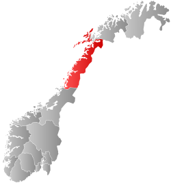 Nordland within Norway | |
 Ankenes within Nordland | |
| Coordinates: 68°25′16″N 17°22′11″E / 68.42111°N 17.36972°E | |
| Country | Norway |
| County | Nordland |
| District | Ofoten |
| Established | 1 Jan 1884 |
| • Preceded by | Ofoten Municipality |
| Disestablished | 1 Jan 1974 |
| • Succeeded by | Narvik Municipality |
| Administrative centre | Ankenesstrand |
| Government | |
| • Mayor (1972–1973) | Edgar Sneve (Ap) |
| Area (upon dissolution) | |
| • Total | 2,028 km2 (783 sq mi) |
| • Rank | #31 in Norway |
| Highest elevation | 1,893.7 m (6,212.9 ft) |
| Population (1973) | |
| • Total | 7,025 |
| • Rank | #139 in Norway |
| • Density | 3.5/km2 (9/sq mi) |
| • Change (10 years) | |
| Demonym | Ankenesværing[2] |
| Official language | |
| • Norwegian form | Neutral[3] |
| Time zone | UTC+01:00 (CET) |
| • Summer (DST) | UTC+02:00 (CEST) |
| ISO 3166 code | NO-1855[5] |
Ankenes is a former municipality in Nordland county, Norway. The 2,028-square-kilometre (783 sq mi) municipality existed from 1884 until 1974. It encompassed most of the present-day Narvik Municipality, surrounding of the town of Narvik which was once its own municipality. The administrative centre of Ankenes was the village of Ankenesstrand, situated along the west side of the Beisfjorden, where the Ankenes Church is located.[6][7]


Prior to its dissolution on 1 January 1974, the 2,028-square-kilometre (783 sq mi) municipality was the 31st largest by area out of the 444 municipalities in Norway. Ankenes Municipality was the 139th most populous municipality in Norway with a population of about 7,025. The municipality's population density was 3.5 inhabitants per square kilometre (9.1/sq mi) and its population had increased by 15.7% over the previous 10-year period.[8][9]
Today, the name Ankenes is often used to refer to the suburban Ankenesstrand area, just west of the centre of the town of Narvik. The European route E6 highway is the main thoroughfare through Ankenesstrand and it follows the shoreline of the Ofotfjorden and Beisfjorden and it then crosses the fjord over the 375-metre (1,230 ft) long Beisfjord Bridge where it then reaches the central part of the town of Narvik.
General information
[edit]The old Ofoten Municipality was established on 1 January 1838 (see formannskapsdistrikt law). Ofoten Municipality included all of the land surrounding the inner part of the Ofotfjorden, including the Ankenes area. On 1 January 1884, Ofoten Municipality was dissolved and split into two municipalities: Ankenes Municipality (population: 1,734) and Evindnæs Municipality (population: 2,397). In 1901, the Narvik (population: 3,705) received town status as a kjøpstad. Soon after, on 1 January 1902, the new town of Narvik was separated from Ankenes Municipality to form a separate municipality of its own. The split left Ankenes Municipality with a population of 3,023. On 1 January 1974, Ankenes Municipality was merged with the town of Narvik to form a new, larger Narvik Municipality. Prior to the merger, Ankenes had 7,022 inhabitants and Narvik had 12,758.[10]
Name
[edit]The municipality (originally the parish) is named after the old Ankenes farm since the first Ankenes Church was built there. The first element is derived from the diminutive form of the old male name Anki which is short for Arnkell. The last element is nes which means "headland".[11]
Churches
[edit]The Church of Norway had one parish (sokn) within Ankenes Municipality. At the time of the municipal dissolution, it was part of the Ofoten prestegjeld and the Nordre Salten (deanery) in the Diocese of Sør-Hålogaland.[9]
| Parish (sokn) | Church name | Location of the church | Year built |
|---|---|---|---|
| Ankenes | Ankenes Church | Ankenesstrand | 1867 |
| Skjomen Church | Elvegården | 1893 |
Geography
[edit]The highest point in the municipality was the 1,893.7-metre (6,213 ft) tall mountain Storsteinsfjellet.[1] The municipality was bordered by Sweden to the east and south; Ballangen Municipality and Evenes Municipality to the west; and Skånland Municipality, Gratangen Municipality, and Salangen Municipality to the north.
Government
[edit]While it existed, Ankenes Municipality was responsible for primary education (through 10th grade), outpatient health services, senior citizen services, unemployment, social services, zoning, economic development, and municipal roads. During its existence, this municipality was governed by a municipal council of elected representatives, which in turn elected a mayor.[12]
Mayors
[edit]The mayor (Norwegian: ordfører) of Ankenes was the political leader of the municipality and the chairperson of the municipal council. Here is a list of people who held this position:[13]
- 1884–1916: Bertheus Normann
- 1917–1922: Peter Leiros (V)
- 1923–1928: Hans Peder Seinæs
- 1929–1934: Peter Leiros (V)
- 1935–1940: Magnus Edvardsen (Ap)
- 1941–1945: Harder Kristiansen (NS)
- 1945–1945: Magnus Edvardsen (Ap)
- 1946–1967: Ole Andreassen (Ap)
- 1967-1971: Henning Eidissen (Ap)
- 1972–1973: Edgar Sneve (Ap)
Municipal council
[edit]The municipal council (Kommunestyre) of Ankenes was made up of 25 representatives that were elected to four year terms. The tables below show the historical composition of the council by political party.
| Party name (in Norwegian) | Number of representatives | |
|---|---|---|
| Labour Party (Arbeiderpartiet) | 13 | |
| Conservative Party (Høyre) | 3 | |
| Christian Democratic Party (Kristelig Folkeparti) | 1 | |
| Centre Party (Senterpartiet) | 6 | |
| Socialist People's Party (Sosialistisk Folkeparti) | 1 | |
| Liberal Party (Venstre) | 1 | |
| Total number of members: | 25 | |
| Note: On 1 January 1974, Ankenes Municipality became part of Narvik Municipality. | ||
| Party name (in Norwegian) | Number of representatives | |
|---|---|---|
| Labour Party (Arbeiderpartiet) | 14 | |
| Conservative Party (Høyre) | 4 | |
| Centre Party (Senterpartiet) | 3 | |
| Socialist People's Party (Sosialistisk Folkeparti) | 2 | |
| Liberal Party (Venstre) | 2 | |
| Total number of members: | 25 | |
| Party name (in Norwegian) | Number of representatives | |
|---|---|---|
| Labour Party (Arbeiderpartiet) | 15 | |
| Conservative Party (Høyre) | 4 | |
| Christian Democratic Party (Kristelig Folkeparti) | 1 | |
| Centre Party (Senterpartiet) | 3 | |
| Socialist People's Party (Sosialistisk Folkeparti) | 1 | |
| Liberal Party (Venstre) | 1 | |
| Total number of members: | 25 | |
| Party name (in Norwegian) | Number of representatives | |
|---|---|---|
| Labour Party (Arbeiderpartiet) | 14 | |
| Conservative Party (Høyre) | 5 | |
| Communist Party (Kommunistiske Parti) | 1 | |
| Christian Democratic Party (Kristelig Folkeparti) | 3 | |
| Centre Party (Senterpartiet) | 2 | |
| Total number of members: | 25 | |
| Party name (in Norwegian) | Number of representatives | |
|---|---|---|
| Labour Party (Arbeiderpartiet) | 15 | |
| Conservative Party (Høyre) | 3 | |
| Communist Party (Kommunistiske Parti) | 1 | |
| Christian Democratic Party (Kristelig Folkeparti) | 1 | |
| Farmers' Party (Bondepartiet) | 3 | |
| Liberal Party (Venstre) | 2 | |
| Total number of members: | 25 | |
| Party name (in Norwegian) | Number of representatives | |
|---|---|---|
| Labour Party (Arbeiderpartiet) | 10 | |
| Conservative Party (Høyre) | 3 | |
| Communist Party (Kommunistiske Parti) | 1 | |
| Christian Democratic Party (Kristelig Folkeparti) | 2 | |
| Farmers' Party (Bondepartiet) | 5 | |
| Liberal Party (Venstre) | 3 | |
| Total number of members: | 24 | |
| Party name (in Norwegian) | Number of representatives | |
|---|---|---|
| Labour Party (Arbeiderpartiet) | 10 | |
| Communist Party (Kommunistiske Parti) | 3 | |
| Christian Democratic Party (Kristelig Folkeparti) | 2 | |
| Farmers' Party (Bondepartiet) | 6 | |
| Liberal Party (Venstre) | 3 | |
| Total number of members: | 24 | |
| Party name (in Norwegian) | Number of representatives | |
|---|---|---|
| Labour Party (Arbeiderpartiet) | 10 | |
| Communist Party (Kommunistiske Parti) | 4 | |
| Christian Democratic Party (Kristelig Folkeparti) | 3 | |
| Farmers' Party (Bondepartiet) | 4 | |
| Liberal Party (Venstre) | 3 | |
| Total number of members: | 24 | |
| Party name (in Norwegian) | Number of representatives | |
|---|---|---|
| Labour Party (Arbeiderpartiet) | 13 | |
| Farmers' Party (Bondepartiet) | 6 | |
| Liberal Party (Venstre) | 5 | |
| Total number of members: | 24 | |
| Note: Due to the German occupation of Norway during World War II, no elections were held for new municipal councils until after the war ended in 1945. | ||
Notable people
[edit]- Gunnar Emil Garfors (1900–1979), a Norwegian poet
- Ola Teigen (1937–1970), a politician for the Norwegian Labour Party
- Toralv Kollin Markussen (1895–1973), a politician for the Norwegian Communist Party
See also
[edit]References
[edit]- ^ a b "Høgaste fjelltopp i kvar kommune" (in Norwegian). Kartverket. 16 January 2024.
- ^ "Navn på steder og personer: Innbyggjarnamn" (in Norwegian). Språkrådet.
- ^ "Norsk Lovtidende. 2den Afdeling. 1932. Samling af Love, Resolutioner m.m". Norsk Lovtidend (in Norwegian). Oslo, Norway: Grøndahl og Søns Boktrykkeri: 453–471. 1932.
- ^ "Forskrift om målvedtak i kommunar og fylkeskommunar" (in Norwegian). Lovdata.no.
- ^ Bolstad, Erik; Thorsnæs, Geir, eds. (26 January 2023). "Kommunenummer". Store norske leksikon (in Norwegian). Kunnskapsforlaget.
- ^ Helland, Amund (1908). "Ankenes herred". Norges land og folk: Nordlands amt (in Norwegian). Vol. XVIII. Kristiania, Norway: H. Aschehoug & Company. p. 434. Retrieved 5 September 2018.
- ^ Thorsnæs, Geir, ed. (6 July 2016). "Ankenes". Store norske leksikon (in Norwegian). Kunnskapsforlaget. Retrieved 5 September 2018.
- ^ Statistisk sentralbyrå. "Table: 06913: Population 1 January and population changes during the calendar year (M)" (in Norwegian).
- ^ a b Statistisk sentralbyrå (1 January 1951). Norges Sivile, Geistlige, Rettslige og Militære Inndeling 1. Januar 1951 (PDF). Norges Offisielle Statistikk (in Norwegian). Oslo, Norge: H. Aschehoug & Co.
- ^ Jukvam, Dag (1999). "Historisk oversikt over endringer i kommune- og fylkesinndelingen" (PDF) (in Norwegian). Statistisk sentralbyrå. ISBN 9788253746845.
- ^ Rygh, Oluf (1905). Norske gaardnavne: Nordlands amt (in Norwegian) (16 ed.). Kristiania, Norge: W. C. Fabritius & sønners bogtrikkeri. p. 286.
- ^ Hansen, Tore; Vabo, Signy Irene, eds. (20 September 2022). "kommunestyre". Store norske leksikon (in Norwegian). Kunnskapsforlaget. Retrieved 1 January 2023.
- ^ Svendsen, Oddvar (2002). Narviks historie (in Norwegian). ISBN 8299612829.
- ^ "Kommunevalgene 1972" (PDF) (in Norwegian). Oslo: Statistisk sentralbyrå. 1973. Retrieved 18 March 2020.
- ^ "Kommunevalgene 1967" (PDF) (in Norwegian). Oslo: Statistisk sentralbyrå. 1967. Retrieved 18 March 2020.
- ^ "Kommunevalgene 1963" (PDF) (in Norwegian). Oslo: Statistisk sentralbyrå. 1964. Retrieved 18 March 2020.
- ^ "Kommunevalgene og Ordførervalgene 1959" (PDF) (in Norwegian). Oslo: Statistisk sentralbyrå. 1960. Retrieved 18 March 2020.
- ^ "Kommunevalgene og Ordførervalgene 1955" (PDF) (in Norwegian). Oslo: Statistisk sentralbyrå. 1957. Retrieved 18 March 2020.
- ^ "Kommunevalgene og Ordførervalgene 1951" (PDF) (in Norwegian). Oslo: Statistisk sentralbyrå. 1952. Retrieved 18 March 2020.
- ^ "Kommunevalgene og Ordførervalgene 1947" (PDF) (in Norwegian). Oslo: Statistisk sentralbyrå. 1948. Retrieved 18 March 2020.
- ^ "Kommunevalgene og Ordførervalgene 1945" (PDF) (in Norwegian). Oslo: Statistisk sentralbyrå. 1947. Retrieved 18 March 2020.
- ^ "Kommunevalgene og Ordførervalgene 1937" (PDF) (in Norwegian). Oslo: Statistisk sentralbyrå. 1938. Retrieved 18 March 2020.
| |||||||||||
 | Towns and cities |
| |||||||||
| Municipalities |
| ||||||||||
| |||||||||||