Al-Yamun
al-Yamun | |
|---|---|
| Arabic transcription(s) | |
| • Arabic | اليامون |
 | |
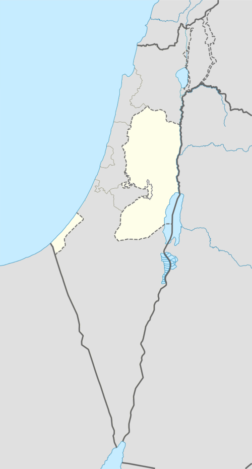 al-Yamun Location of al-Yamun within Palestine | |
| Coordinates: 32°29′11.35″N 35°14′06.98″E / 32.4864861°N 35.2352722°E | |
| Palestine grid | 171/210 |
| State | |
| Governorate | Jenin |
| Government | |
| • Type | Municipality |
| Area | |
| • Total | 20,361 dunams (20.4 km2 or 7.9 sq mi) |
| Population (2017)[1] | |
| • Total | 20,774 |
| • Density | 1,000/km2 (2,600/sq mi) |
| Name meaning | From a personal name[2] |
Al-Yamun (Arabic: اليامون) is a Palestinian town located nine kilometers west of Jenin in the Jenin Governorate of Palestine, in the northern West Bank. Al-Yamun's land area consists of approximately 20,000 dunams, of which 1,300 dunams is built-up area.[3]
According to the Palestinian Central Bureau of Statistics, the town had a population of 16,383 inhabitants in the 2007 census and 20,774 by 2017.[1][4] The population is formed mainly of a number of families such as Frehat, Khamaysa, Samudi, Hushiya, Abu al-Hija, Samara, 'Abahra, Zaid, Jaradat, Sharqieh and Nawahda that sourced many inspirational figures such as Jad and Ayham Frihat.[3]
History
The town is an ancient one, where two columns and two capitals have been reused at the door of the mosque.[5]
Potsherds from the early and late Roman, Byzantine, early Muslim and the Middle Ages have been found here.[6]
Ottoman era
In 1517 al-Yamun was incorporated into the Ottoman Empire with the rest of Palestine. During the 16th and 17th centuries, it belonged to the Turabay Emirate (1517-1683), which encompassed also the Jezreel Valley, Haifa, Jenin, Beit She'an Valley, northern Jabal Nablus, Bilad al-Ruha/Ramot Menashe, and the northern part of the Sharon plain.[7][8]
In the census of 1596, the village appeared as “Yamoun”, located in the nahiya of Sha'ara in the liwa of Lajjun. It had a population of 28 households, all Muslim. They paid a fixed tax rate of 25% on agricultural products, including wheat, barley, summer crops, olive trees, goats and beehives, in addition to occasional revenues; a total of 15,000 akçe.[9] Potsherds from the Ottoman era have also been found here.[6]
In 1799, al-Yamun was named the village Ellamoun on the map Pierre Jacotin made during the French campaign in Egypt and Syria.[10]
In 1838 Edward Robinson noted it on his travels,[11] and in 1870 Victor Guérin found that Yamun had 500 inhabitants, and was divided into two quarters, each commanded by its own sheikh.[12]
In 1870/1871 (1288 AH), an Ottoman census listed the village in the nahiya of Shafa al-Gharby.[13]
In 1882 the PEF's Survey of Western Palestine described it as “A large village, with olives round it, standing on high ground, with a well on the east. This appears to be the 'Janna of the Onomasticon,’ 3 miles south of Legio; does not exactly agree, being 7 English miles."[14]
British Mandate era
In the 1922 census of Palestine, conducted by the British Mandate authorities, Yamun had a population of 1,485; all Muslims except one Christian[15] who was Orthodox.[16] The population increased in the 1931 census to 1,836; all Muslim, in a total of 371 houses.[17]
In the 1945 statistics the population was 2,520; all Muslims,[18] with 20,361 dunams of land, according to an official land and population survey.[19] 6,036 dunams were used for plantations and irrigable land, 11,121 dunams for cereals,[20] while a total of 58 dunams were built-up, urban land.[21]
Jordanian era
In the wake of the 1948 Arab–Israeli War, and after the 1949 Armistice Agreements, al-Yamun came under Jordanian rule. Some of al-Yamun inhabitants descended from Abu-Hija, a commander who came to Palestine with Saladin. After 1948, al-Yamun received fellow Abu-Hija descendants from the depopulated village of Ein Hod, presently in Israel.[22]
In 1961, the population of al-Yamun was 4,173.[23]
Post-1967
Since the Six-Day War in 1967, al-Yamun has been under Israeli occupation.
On October 29, 2008, Muhammad 'Abahra, a farmer in the town was killed by the IDF. 'Abahra had a shotgun in his possession leading the IDF to believe he would fire at them. 'Abahra's son, however, alleged, that his father was guarding his sheep from suspected thieves.[24]
References
- ^ a b Preliminary Results of the Population, Housing and Establishments Census, 2017 (PDF). Palestinian Central Bureau of Statistics (PCBS) (Report). State of Palestine. February 2018. pp. 64–82. Retrieved 2023-10-24.
- ^ Palmer, 1881, p. 156
- ^ a b Israeli army's terror and Sabotage actions in Al Yamun town, Jenin District Archived 2016-08-14 at the Wayback Machine Applied Research Institute of Jerusalem (ARIJ). 2004-07-05.
- ^ 2007 Locality Population Statistics. Palestinian Central Bureau of Statistics (PCBS).
- ^ Dauphin, 1998, pp. 748-9
- ^ a b Zertal, 2016, pp. 188-190
- ^ al-Bakhīt, Muḥammad ʻAdnān; al-Ḥamūd, Nūfān Rajā (1989). "Daftar mufaṣṣal nāḥiyat Marj Banī ʻĀmir wa-tawābiʻihā wa-lawāḥiqihā allatī kānat fī taṣarruf al-Amīr Ṭarah Bāy sanat 945 ah". www.worldcat.org. Amman: Jordanian University. pp. 1–35. Retrieved 2023-05-15.
- ^ Marom, R.; Tepper, Y.; Adams, M. "Lajjun: Forgotten Provincial Capital in Ottoman Palestine". Levant. doi:10.1080/00758914.2023.2202484.
- ^ Hütteroth and Abdulfattah, 1977, p. 160
- ^ Karmon, 1960, p. 169 Archived 2017-12-01 at the Wayback Machine
- ^ Robinson and Smith, 1841, vol 2, pp. 161, 167
- ^ Guérin, 1875, p. 225
- ^ Grossman, David (2004). Arab Demography and Early Jewish Settlement in Palestine. Jerusalem: Magnes Press. p. 256.
- ^ Conder and Kitchener, 1882, SWP II, p. 46
- ^ Barron, 1923, Table IX, Sub-district of Jenin, p. 30
- ^ Barron, 1923, Table XV, p. 47
- ^ Mills, 1932, p. 71
- ^ Government of Palestine, Department of Statistics, 1945, p. 17
- ^ Government of Palestine, Department of Statistics. Village Statistics, April, 1945. Quoted in Hadawi, 1970, p. 55
- ^ Government of Palestine, Department of Statistics. Village Statistics, April, 1945. Quoted in Hadawi, 1970, p. 100
- ^ Government of Palestine, Department of Statistics. Village Statistics, April, 1945. Quoted in Hadawi, 1970, p. 150
- ^ Ben Ze'ev, 2011, p. 92
- ^ Government of Jordan, Department of Statistics, 1964, p. 13
- ^ West Bank farmer killed by troops BBC News. BBC MMVIII. 2008-10-29.
Bibliography
- Barron, J.B., ed. (1923). Palestine: Report and General Abstracts of the Census of 1922. Government of Palestine.
- Ben Ze'ev, Efrat (2011). Remembering Palestine in 1948: Beyond National Narratives. Cambridge University Press. ISBN 978-0-521-19447-1.
- Conder, C.R.; Kitchener, H.H. (1882). The Survey of Western Palestine: Memoirs of the Topography, Orography, Hydrography, and Archaeology. Vol. 2. London: Committee of the Palestine Exploration Fund.
- Dauphin, C. (1998). La Palestine byzantine, Peuplement et Populations. BAR International Series 726 (in French). Vol. III : Catalogue. Oxford: Archeopress. ISBN 0-860549-05-4.
- Government of Jordan, Department of Statistics (1964). First Census of Population and Housing. Volume I: Final Tables; General Characteristics of the Population (PDF).
- Government of Palestine, Department of Statistics (1945). Village Statistics, April, 1945.
- Guérin, V. (1875). Description Géographique Historique et Archéologique de la Palestine (in French). Vol. 2: Samarie, pt. 2. Paris: L'Imprimerie Nationale. (p. 225)
- Hadawi, S. (1970). Village Statistics of 1945: A Classification of Land and Area ownership in Palestine. Palestine Liberation Organization Research Center. Archived from the original on 2018-12-08. Retrieved 2014-09-09.
- Hütteroth, Wolf-Dieter; Abdulfattah, Kamal (1977). Historical Geography of Palestine, Transjordan and Southern Syria in the Late 16th Century. Erlanger Geographische Arbeiten, Sonderband 5. Erlangen, Germany: Vorstand der Fränkischen Geographischen Gesellschaft. ISBN 3-920405-41-2.
- Karmon, Y. (1960). "An Analysis of Jacotin's Map of Palestine" (PDF). Israel Exploration Journal. 10 (3, 4): 155–173, 244–253. Archived from the original (PDF) on 2017-12-01. Retrieved 2015-04-13.
- Mills, E., ed. (1932). Census of Palestine 1931. Population of Villages, Towns and Administrative Areas. Jerusalem: Government of Palestine.
- Palmer, E.H. (1881). The Survey of Western Palestine: Arabic and English Name Lists Collected During the Survey by Lieutenants Conder and Kitchener, R. E. Transliterated and Explained by E.H. Palmer. Committee of the Palestine Exploration Fund.
- Robinson, E.; Smith, E. (1841). Biblical Researches in Palestine, Mount Sinai and Arabia Petraea: A Journal of Travels in the year 1838. Vol. 3. Boston: Crocker & Brewster.
- Zertal, A. (2016). The Manasseh Hill Country Survey. Vol. 3. Boston: BRILL. ISBN 978-9004312302.
External links
- Welcome to al Yamun
- Yamun, Welcome to Palestine
- Survey of Western Palestine, Map 8: IAA, Wikimedia commons
- Jacotin map #46
- many photos from al yamoun
| Cities |  | |
|---|---|---|
| Municipalities |
| |
| Villages |
| |
| Refugee camps | ||
| International | |
|---|---|
| National | |