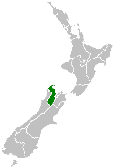
Tasman District
| Tasman District | ||
| Country: | New Zealand | |
 | ||
|---|---|---|
| Unitary Authority | ||
| Name: | Tasman District Council | |
| Mayor: | John Hurley | |
| Population: | 47,200 (June 2006 estimate) [1] | |
| Extent: | ||
| Land Area: | 9,771km² | |
| Website: | http://www.tasman.govt.nz | |
| Towns | ||
| Towns: | Richmond, Motueka, Collingwood, Takaka, Brightwater, Murchison, Mapua | |
Tasman District is a region of New Zealand. It borders with the West Coast Region, Marlborough Region and the Nelson Region. It is both a region and a unitary authority, and the regional council sits at Richmond.
Coverage
Tasman District is a large area at the top western side of the South Island of New Zealand. It covers 9,786 square kilometres and is bounded to the west by the Matiri Ranges, Tasman Mountains and the Tasman Sea. To the north Tasman and Golden Bays form its seaward edge, and the eastern boundary extends to the edge of Nelson city, and includes part of the Spencer Mountains and the Saint Arnaud and Richmond Ranges. The Victoria Ranges form Tasman's southern boundary and the district's highest point is Mt Owen, at 1,875 metres. The landscape is diverse. From large mountainous areas to valleys and plains, sliced by such major rivers as the Buller River, Motueka, Aorere, Takaka and Wairoa River. There's lush bush and bird life, golden beaches, the unique 40 kilometre sands of Farewell Spit, and boundless fishing in the bays and rivers. These assets make the district irresistible to tourists and precious to those who live there.
Tasman is home to three national parks - Abel Tasman National Park (New Zealand's smallest at 225.41 km²), Nelson Lakes National Park (1,017.53 km²) and Kahurangi National Park (4,520 km²).
Name
Tasman Bay, the largest indentation in the north coast of the South Island of New Zealand, was named after Abel Tasman, the first reported European discoverer of New Zealand. It passed the name on to the adjoining district formed in 1989 largely from the merger of Waimea and Golden Bay counties.
Government and settlements
Tasman District Council (unitary authority) headquarters are at Richmond, close to the adjoining Nelson City. Other towns are Brightwater, Collingwood, Motueka, Murchison, Riwaka, Saint Arnaud, Takaka, Tapawera, Wakefield, Mapua, and Kaiteriteri.
History

According to tradition, the Māori waka Uruao, brought ancestors of the Waitaha people to Tasman in the 12th Century. Archaeological evidence suggests the first Māori settlers explored the region thoroughly, settling mainly along the coast where there was ample food.
The succession of tribes into the area suggests considerable warfare interrupted their lives. Around 1828, Ngati Toa under Te Rauparaha and the allied northern tribes of Ngati Rarua and Ngati Tama, started their invasion of the South Island. They took over much of the area from Farewell Spit to the Wairau River.
The first immigrant ships from England arrived in 1842 and the European settlement of the region began under the leadership of Captain Arthur Wakefield.
In the 1850s, agriculture and pastoral farming started and villages were established on the Waimea Plains and Motueka. In 1856, the discovery of gold near Collingwood sparked New Zealand's first gold rush. Significant reserves of iron ore were located at Onekaka and an iron works operated here during the 1920s and 1930s.
Fruitgrowing started at the end of the 19th Century. By 1945, it was making a significant contribution to the local economy and that importance continues today.
People
Tasman District's estimated resident population at 30 June 2006 was 47,200. This represents about 1.1% of New Zealand's population.
Most of Tasman's urban population lives in the Richmond Ward (10,851). It has the district's fastest growth rate, particularly in North Richmond where the population has grown by 23% since 1996.
The second largest area of growth is in the Waimea/Moutere Ward. Mapua has posted the highest growth - 27.4% between 1996 and 2001.
Although Tasman has recorded strong growth, statistics show that the region itself has a low population density. As at March 2001, there were an estimated 4.3 people per square kilometre. This is mainly due to the lack of large urban areas and because 58% of the area is in national park.
Tasman has the country's highest percentage of people of European ethnicity - 96.8%.
The number of Māori, European, Pacific Island and Asians have increased markedly since 1991, with Māori increasing by 60.5%. The main iwi represented in the wider Tasman region are Ngati Rarua, Ngati Tama (Golden Bay and Tasman Bay), Te Atiawa, Ngati Koata, Ngati Kuia (eastern Tasman Bay) and the Poutini Ngai Tahu (southern areas).
Famous former residents include nuclear physicist Ernest Rutherford.
External links
| North Island | ||
|---|---|---|
| South Island | ||
* Governed by a unitary authority rather than a regional council | ||