Original file (480 × 640 pixels, file size: 138 KB, MIME type: image/jpeg )
Summary
Licensing
This image was taken from the
Geograph project collection. See
this photograph's page on the Geograph website for the photographer's contact details. The copyright on this image is owned by
ChurchCrawler and is licensed for reuse under the
Creative Commons Attribution-ShareAlike 2.0 license.
Attribution: ChurchCrawler
You are free:
to share – to copy, distribute and transmit the workto remix – to adapt the work
Under the following conditions:
attribution – You must give appropriate credit, provide a link to the license, and indicate if changes were made. You may do so in any reasonable manner, but not in any way that suggests the licensor endorses you or your use.share alike – If you remix, transform, or build upon the material, you must distribute your contributions under the same or compatible license as the original. https://creativecommons.org/licenses/by-sa/2.0 CC BY-SA 2.0 Creative Commons Attribution-Share Alike 2.0 true true English Add a one-line explanation of what this file represents
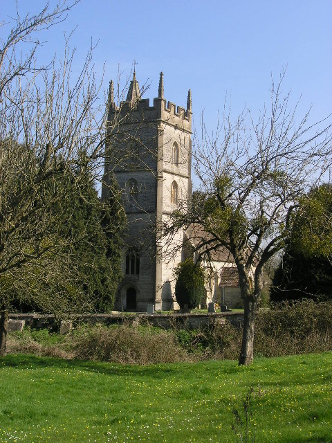
Church of St Thomas \u00e0 Becket<\/a>"}},"text\/plain":{"en":{"P180":"Church of St Thomas \u00e0 Becket"}}}}" class="wbmi-entityview-statementsGroup wbmi-entityview-statementsGroup-P180 oo-ui-layout oo-ui-panelLayout oo-ui-panelLayout-framed">
URL<\/a>"}},"text\/plain":{"en":{"":"URL"}}},"{\"value\":\"https:\\\/\\\/www.geograph.org.uk\\\/profile\\\/2694\",\"type\":\"string\"}":{"text\/html":{"en":{"P2699":"
https:\/\/www.geograph.org.uk\/profile\/2694<\/a>"}},"text\/plain":{"en":{"P2699":"https:\/\/www.geograph.org.uk\/profile\/2694"}}},"{\"value\":{\"entity-type\":\"property\",\"numeric-id\":2093,\"id\":\"P2093\"},\"type\":\"wikibase-entityid\"}":{"text\/html":{"en":{"":" author name string<\/a>"}},"text\/plain":{"en":{"":"author name string"}}},"{\"value\":\"ChurchCrawler\",\"type\":\"string\"}":{"text\/html":{"en":{"P2093":"ChurchCrawler"}},"text\/plain":{"en":{"P2093":"ChurchCrawler"}}},"{\"value\":{\"entity-type\":\"property\",\"numeric-id\":3831,\"id\":\"P3831\"},\"type\":\"wikibase-entityid\"}":{"text\/html":{"en":{"":" object of statement has role<\/a>"}},"text\/plain":{"en":{"":"object of statement has role"}}},"{\"value\":{\"entity-type\":\"item\",\"numeric-id\":33231,\"id\":\"Q33231\"},\"type\":\"wikibase-entityid\"}":{"text\/html":{"en":{"P3831":" photographer<\/a>"}},"text\/plain":{"en":{"P3831":"photographer"}}}}" class="wbmi-entityview-statementsGroup wbmi-entityview-statementsGroup-P170 oo-ui-layout oo-ui-panelLayout oo-ui-panelLayout-framed"> copyrighted<\/a>"}},"text\/plain":{"en":{"P6216":"copyrighted"}}}}" class="wbmi-entityview-statementsGroup wbmi-entityview-statementsGroup-P6216 oo-ui-layout oo-ui-panelLayout oo-ui-panelLayout-framed">
Creative Commons Attribution-ShareAlike 2.0 Generic<\/a>"}},"text\/plain":{"en":{"P275":"Creative Commons Attribution-ShareAlike 2.0 Generic"}}}}" class="wbmi-entityview-statementsGroup wbmi-entityview-statementsGroup-P275 oo-ui-layout oo-ui-panelLayout oo-ui-panelLayout-framed">
file available on the internet<\/a>"}},"text\/plain":{"en":{"P7482":"file available on the internet"}}},"{\"value\":{\"entity-type\":\"property\",\"numeric-id\":137,\"id\":\"P137\"},\"type\":\"wikibase-entityid\"}":{"text\/html":{"en":{"":"
operator<\/a>"}},"text\/plain":{"en":{"":"operator"}}},"{\"value\":{\"entity-type\":\"item\",\"numeric-id\":1503119,\"id\":\"Q1503119\"},\"type\":\"wikibase-entityid\"}":{"text\/html":{"en":{"P137":" Geograph Britain and Ireland<\/a>"}},"text\/plain":{"en":{"P137":"Geograph Britain and Ireland"}}},"{\"value\":{\"entity-type\":\"property\",\"numeric-id\":7384,\"id\":\"P7384\"},\"type\":\"wikibase-entityid\"}":{"text\/html":{"en":{"":" geograph.org.uk image ID<\/a>"}},"text\/plain":{"en":{"":"geograph.org.uk image ID"}}},"{\"value\":\"66325\",\"type\":\"string\"}":{"text\/html":{"en":{"P7384":" 66325<\/a>"}},"text\/plain":{"en":{"P7384":"66325"}}},"{\"value\":{\"entity-type\":\"property\",\"numeric-id\":973,\"id\":\"P973\"},\"type\":\"wikibase-entityid\"}":{"text\/html":{"en":{"":" described at URL<\/a>"}},"text\/plain":{"en":{"":"described at URL"}}},"{\"value\":\"https:\\\/\\\/www.geograph.org.uk\\\/photo\\\/66325\",\"type\":\"string\"}":{"text\/html":{"en":{"P973":" https:\/\/www.geograph.org.uk\/photo\/66325<\/a>"}},"text\/plain":{"en":{"P973":"https:\/\/www.geograph.org.uk\/photo\/66325"}}}}" class="wbmi-entityview-statementsGroup wbmi-entityview-statementsGroup-P7482 oo-ui-layout oo-ui-panelLayout oo-ui-panelLayout-framed"> Mendip<\/a>"}},"text\/plain":{"en":{"P1071":"Mendip"}}}}" class="wbmi-entityview-statementsGroup wbmi-entityview-statementsGroup-P1071 oo-ui-layout oo-ui-panelLayout oo-ui-panelLayout-framed">
File history
Click on a date/time to view the file as it appeared at that time.
Date/Time Thumbnail Dimensions User Comment current 11:41, 27 September 2009 480 × 640 (138 KB) Rodw {{Information |Description=PYLLE, Somerset |Source=From [http://www.geograph.org.uk/photo/66325 geograph.org.uk] |Date=2005-04-02 |Author=[http://www.geograph.org.uk/profile/2694 ChurchCrawler] |Permission=Creative Commons Attribution Share-alike license
File usage
The following pages on the English Wikipedia use this file (pages on other projects are not listed):
Global file usage
The following other wikis use this file:
Usage on ceb.wikipedia.org
Usage on fr.wikipedia.org
Usage on lld.wikipedia.org
Usage on nl.wikipedia.org
Usage on pl.wikipedia.org
Usage on tr.wikipedia.org
Usage on www.wikidata.org
Usage on zh-min-nan.wikipedia.org
This file contains additional information, probably added from the digital camera or scanner used to create or digitize it.
If the file has been modified from its original state, some details may not fully reflect the modified file.