元のファイル (SVG ファイル、1,148 × 881 ピクセル、ファイルサイズ: 319キロバイト)

|
- このファイルは、ウィキメディア・コモンズから呼び出されています。
- このファイルは、他のプロジェクトで使用されている可能性があります。
- このファイルの解説やノートへの記入、履歴などの詳細の確認は、ウィキメディア・コモンズのファイルページ(ノート/履歴/ログ)を使用してください。
|
概要

|
この地図は、ドイツ語版の (地図研究室)で制作、もしくは改善されたものです。更なる改善の為、 地図を提案することもできます。
|
\u8457\u8005\u540d (\u6587\u5b57\u5217)<\/a>"}},"text\/plain":{"ja":{"":"\u8457\u8005\u540d (\u6587\u5b57\u5217)"}}},"{\"value\":\"NordNordWest\",\"type\":\"string\"}":{"text\/html":{"ja":{"P2093":"NordNordWest","P4174":"
NordNordWest<\/a>"}},"text\/plain":{"ja":{"P2093":"NordNordWest","P4174":"NordNordWest"}}},"{\"value\":{\"entity-type\":\"property\",\"numeric-id\":4174,\"id\":\"P4174\"},\"type\":\"wikibase-entityid\"}":{"text\/html":{"ja":{"":"\u30a6\u30a3\u30ad\u30e1\u30c7\u30a3\u30a2\u306e\u5229\u7528\u8005\u540d<\/a>"}},"text\/plain":{"ja":{"":"\u30a6\u30a3\u30ad\u30e1\u30c7\u30a3\u30a2\u306e\u5229\u7528\u8005\u540d"}}},"{\"value\":{\"entity-type\":\"property\",\"numeric-id\":2699,\"id\":\"P2699\"},\"type\":\"wikibase-entityid\"}":{"text\/html":{"ja":{"":"URL<\/a>"}},"text\/plain":{"ja":{"":"URL"}}},"{\"value\":\"http:\\\/\\\/commons.wikimedia.org\\\/wiki\\\/User:NordNordWest\",\"type\":\"string\"}":{"text\/html":{"ja":{"P2699":"http:\/\/commons.wikimedia.org\/wiki\/User:NordNordWest<\/a>"}},"text\/plain":{"ja":{"P2699":"http:\/\/commons.wikimedia.org\/wiki\/User:NordNordWest"}}}}" class="wbmi-entityview-statementsGroup wbmi-entityview-statementsGroup-P170 oo-ui-layout oo-ui-panelLayout oo-ui-panelLayout-framed">\u8457\u4f5c\u6a29\u3067\u4fdd\u8b77<\/a>"}},"text\/plain":{"ja":{"P6216":"\u8457\u4f5c\u6a29\u3067\u4fdd\u8b77"}}}}" class="wbmi-entityview-statementsGroup wbmi-entityview-statementsGroup-P6216 oo-ui-layout oo-ui-panelLayout oo-ui-panelLayout-framed">
Creative Commons Attribution-ShareAlike 3.0 Germany<\/a>\u00a0
\u82f1\u8a9e<\/sup>"}},"text\/plain":{"ja":{"P275":"Creative Commons Attribution-ShareAlike 3.0 Germany"}}}}" class="wbmi-entityview-statementsGroup wbmi-entityview-statementsGroup-P275 oo-ui-layout oo-ui-panelLayout oo-ui-panelLayout-framed">\u30a2\u30c3\u30d7\u30ed\u30fc\u30c9\u8005\u306b\u3088\u308b\u72ec\u81ea\u306e\u5275\u4f5c\u7269<\/a>"}},"text\/plain":{"ja":{"P7482":"\u30a2\u30c3\u30d7\u30ed\u30fc\u30c9\u8005\u306b\u3088\u308b\u72ec\u81ea\u306e\u5275\u4f5c\u7269"}}}}" class="wbmi-entityview-statementsGroup wbmi-entityview-statementsGroup-P7482 oo-ui-layout oo-ui-panelLayout oo-ui-panelLayout-framed">
ファイルの履歴
過去の版のファイルを表示するには、その版の日時をクリックしてください。
| 日付と時刻 | サムネイル | 寸法 | 利用者 | コメント |
|---|
| 現在の版 | 2010年3月30日 (火) 21:55 | 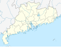 | 1,148 × 881 (319キロバイト) | NordNordWest | =={{int:filedesc}}== {{Information |Description= {{de|Positionskarte von Guangdong, Volksrepublik China}} Quadratische Plattkarte, N-S-Streckung 109 %. Geographische Begrenzung der Karte: * N: 25.7° N * S: 2 |
ファイルの使用状況
以下の 29 ページがこのファイルを使用しています:
グローバルなファイル使用状況
以下に挙げる他のウィキがこの画像を使っています:
- af.wikipedia.org での使用状況
- ar.wikipedia.org での使用状況
- azb.wikipedia.org での使用状況
- ba.wikipedia.org での使用状況
- bg.wikipedia.org での使用状況
- bn.wikipedia.org での使用状況
- ceb.wikipedia.org での使用状況
- ckb.wikipedia.org での使用状況
- cs.wikipedia.org での使用状況
- en.wikipedia.org での使用状況
- eo.wikipedia.org での使用状況
このファイルのグローバル使用状況を表示する。
このファイルには、追加情報があります (おそらく、作成やデジタル化する際に使用したデジタルカメラやスキャナーが追加したものです)。
このファイルが元の状態から変更されている場合、修正されたファイルを完全に反映していない項目がある場合があります。