Gomaringen
Gomaringen | |
|---|---|
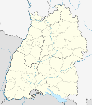
Location of Gomaringen within Tübingen district  | |
| Coordinates: 48°27′07″N 9°06′00″E / 48.4520°N 9.1000°E | |
| Country | Germany |
| State | Baden-Württemberg |
| Admin. region | Tübingen |
| District | Tübingen |
| Subdivisions | 3 Ortsteile |
| Government | |
| • Mayor (2020–28) | Steffen Heß[1] |
| Area | |
| • Total | 17.3 km2 (6.7 sq mi) |
| Elevation | 474 m (1,555 ft) |
| Population (2022-12-31)[2] | |
| • Total | 9,252 |
| • Density | 530/km2 (1,400/sq mi) |
| Time zone | UTC+01:00 (CET) |
| • Summer (DST) | UTC+02:00 (CEST) |
| Postal codes | 72810 |
| Dialling codes | 07072 |
| Vehicle registration | TÜ |
| Website | www.gomaringen.de |
Gomaringen is a municipality located about 10 km south of Tübingen in the German state of Baden-Württemberg.
Geography
[edit]Geographical Position
[edit]Gomaringen is located in the valley of the stream Wiesaz, a tributary of the Steinlach, which in turn flows into the Neckar.
Neighboring municipalities
[edit]The following cities and Municipalities border Gomaringen in clockwise order starting from the north. They belong to District of Tübingen or to District of Reutlingen.
- Kusterdingen
- Reutlingen (Reutlingen District)
- Mössingen
- Nehren
- Dußlingen
- Tübingen
Formation of the municipality
[edit]The settlements Hinterweiler and Stockach belong to the municipality of Gomaringen.
History
[edit]- The ending of the name "ingen" is proof for the first settlement done by the Alamanni
- The name "Gomaringen" is first mentioned in a document in 1191, the chronicle of Berthold von Zwiefalten.
- Werner von Gomaringen (approx. 1356-1393) and Peter von Gomaringen (1393-1412) belonging to the house of the Herren von Gomaringen become abbots of Bebenhausen, the domestical monastery of the Pfalzgrafen von Tübingen.
- 1499: Gomaringen and its contemporary settlements Hinterweiler und Stockach are bought by Reutlingen. For a 150-year-long era reeves take care of the interests of the imperial city.
- 1648: Because of the high contributions in the Thirty Years War Reutlingen had to pay as an imperial city, it needed to sell Gomaringen and Hinterweiler to Württemberg.
- 1807: Gomaringen becomes member of the Oberamt, later the district Reutlingen.
- 1973: As a result of the district reformation in 1973, the municipality changed districts, from Reutlingen to Tübingen.
Politics
[edit]Gomaringen is the seat of the municipal administration cooperation "Steinlach-Wiesaz". Other members are Dußlingen and Nehren.
Town Council
[edit]The last town election on 7 June 2009 had the following results at the last reapportionment:
- FWV - 7 seats
- SPD - 4 seats
- CDU - 4 seats
- Grüne Liste - 3 seats
International town partnership
[edit]- Arcis-sur-Aube in France, since 1976
Culture
[edit]
Museums
[edit]- Gustav-Schwab-Museum inside the castle palace
Castles
[edit]- Castle Gomaringen, started 1837 finished 1841, was the home of Gustav Schwab.
Economy and infrastructure
[edit]Traffic
[edit]The state road L 230 links the town to the federal road B 27 and thereby to Tübingen and Stuttgart. The state road L 394 links Gomaringen east-bound to Reutlingen. The state road L 384 provides the link from Gomaringen to the Schwaebische Alb.
Public transport is provided by Verkehrsverbund Neckar-Alb-Donau (NALDO). The town is in comb no. 113.
References
[edit]- ^ Aktuelle Wahlergebnisse, Staatsanzeiger, accessed 15 September 2021.
- ^ "Bevölkerung nach Nationalität und Geschlecht am 31. Dezember 2022" [Population by nationality and sex as of December 31, 2022] (CSV) (in German). Statistisches Landesamt Baden-Württemberg. June 2023.


