আহমেদাবাদ
আহমেদাবাদ
Ahmedabad અમદાવાદ | |
|---|---|
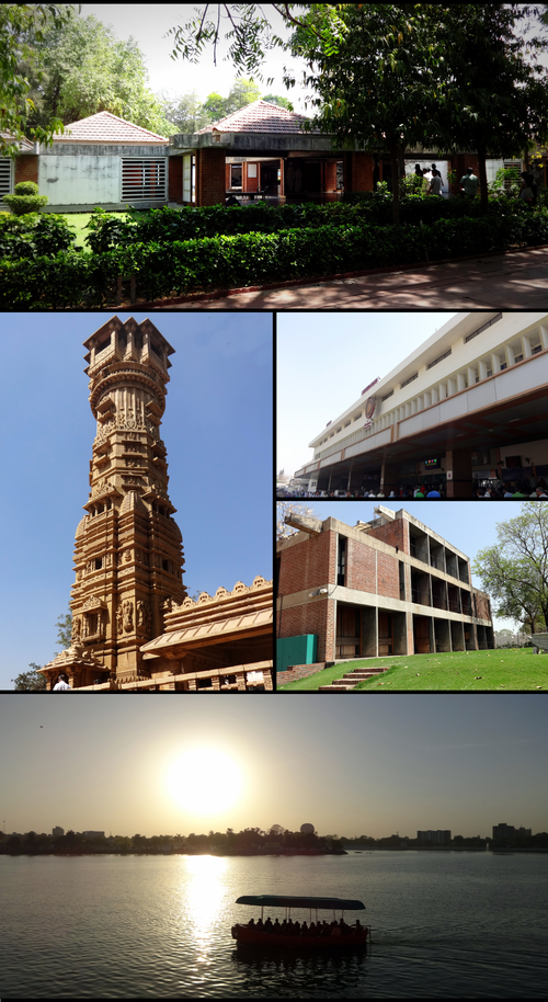 ঘড়ী কাঁটাৰ দিশত ক্ৰমে: সাবৰমতী আশ্ৰমত থকা গান্ধী স্মাৰক সংগ্ৰাহলয়, আহমেদাবাদ ৰে'ল ষ্টেশ্যন, চিইপিটি বিশ্ববিদ্যালয়, কংকৰীয়া হ্ৰদ আৰু হঠীছিং মন্দিৰত থকা কীৰ্তি স্তম্ভ | |
| দেশ | |
| ৰাজ্য | গুজৰাট |
| জিলা | আহমেদাবাদ |
| স্থাপন | * ১১ শতিকাত অশ্বাৱল হিচাপে
|
| চৰকাৰ | |
| • ধৰণ | মেয়ৰ–কাউঞ্চিল |
| • সংঘ | এএমচি |
| • মেয়ৰ | বিজল পেটেল (বিজেপি)[1] |
| • Deputy Mayor | Dinesh Makwana[2] |
| • Municipal commissioner | বিজয় নেহেৰা |
| কালি | |
| • মহানগৰ | 464.16 km2 (179.21 sq mi) |
| • স্থান | গুজৰাটৰ প্ৰথম |
| উচ্চতা | 53 m (174 ft) |
| জনসংখ্যা | |
| • মহানগৰ | 56,33,927 |
| • স্থান | 5th |
| • ঘনত্ব | 12,000/km2 (31,000/sq mi) |
| • নগৰ | 63,57,693 |
| উৎস: ভাৰতৰ লোকপিয়ল[6] | |
আহমেদাবাদ ভাৰতৰ গুজৰাট ৰাজ্যৰ বৃহত্তম তথা পূৰ্বৰ ৰাজধানী চহৰ। ই আহমেদাবাদ জিলাৰ সদৰ আৰু গুজৰাট উচ্চ ন্যায়ালয় ইয়াতেই অৱস্থিত। ২০১১ চনৰ লোকপিয়ল অনুসৰি ইয়াৰ জনসংখ্যা ৫,৬৩৩,৯২৭জন। এই হিচাপে ই ভাৰতৰ পঞ্চম বৃহত্তম চহৰ আৰু আনুমানিক ৬,৩৫৭,৬৯৩জন লোকৰ সৈতে ই ভাৰতৰ সপ্তম বৃহত্তৰ মেট্ৰ'প'লিটান এলেকা।[8][9] আহমেদাবাদ সাবৰমতী নদীৰ পাৰত, গুজৰাটৰ ৰাজধানী গান্ধীনগৰৰ পৰা ৩০ কিলোমিটাৰ (১৯ মাইল) দূৰৈত অৱস্থিত।
তথ্য সংগ্ৰহ
[সম্পাদনা কৰক]- ↑ "Bijal Patel appointed city Mayor". Ahmedabad Mirror. 15 June 2018. https://ahmedabadmirror.indiatimes.com/ahmedabad/others/bijal-patel-appointed-city-mayor/articleshow/64593445.cms.
- ↑ "Bijal Patel is mayor, Makwana her deputy". 15 June 2018. https://timesofindia.com/city/ahmedabad/bijal-patel-is-mayor-makwana-her-deputy/articleshow/64593593.cms.
- ↑ "About The Corporation: Ahmedabad Today". Ahmdabad Municipal Corporation. Archived from the original on 25 April 2018. https://web.archive.org/web/20180425114642/https://ahmedabadcity.gov.in/portal/jsp/Static_pages/about_amc.jsp। আহৰণ কৰা হৈছে: 24 April 2018.
- ↑ 4.0 4.1 4.2 "Ahmedabad City Census 2011 data". Archived from the original on 18 May 2014. https://web.archive.org/web/20140518023223/http://www.census2011.co.in/census/city/314-ahmedabad.html। আহৰণ কৰা হৈছে: 28 May 2014.
- ↑ "Gujarāt (India): State, Major Agglomerations & Cities – Population Statistics in Maps and Charts". Archived from the original on 30 April 2016. https://web.archive.org/web/20160430115558/http://www.citypopulation.de/India-Gujarat.html.
- ↑ "Ahmedabad (Ahmedabad) District : Census 2011 data". census2011. Archived from the original on 12 June 2014. https://web.archive.org/web/20140612111531/http://www.census2011.co.in/census/district/188-ahmadabad.html। আহৰণ কৰা হৈছে: 28 May 2014.
- ↑ "Distribution of Population, Decadal Growth Rate, Sex-Ratio and Population Density". 2011 census of India. Government of India. Archived from the original on 13 November 2011. https://web.archive.org/web/20111113182831/http://www.censusindia.gov.in/2011-prov-results/data_files/gujarat/table-1.xls। আহৰণ কৰা হৈছে: 21 March 2012.
- ↑ "India: States and Major Agglomerations – Population Statistics, Maps, Charts, Weather and Web Information". citypopulation.de. 29 September 2016. Archived from the original on 17 December 2014. https://web.archive.org/web/20141217011539/http://citypopulation.de/India-Agglo.html.
- ↑ "Major Agglomerations of the World – Population Statistics and Maps". citypopulation.de. 1 January 2017. Archived from the original on 2 April 2016. https://web.archive.org/web/20160402222958/http://citypopulation.de/world/Agglomerations.html.