Core Tech
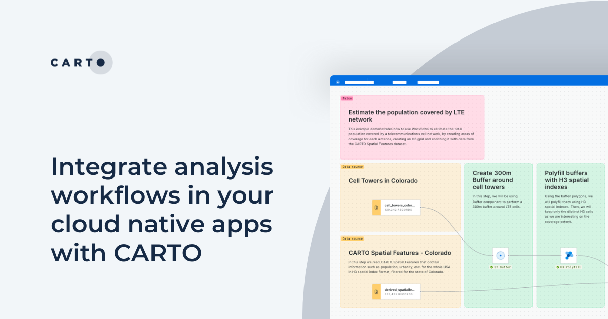

Integrate analysis workflows in your cloud native apps with CARTO
Seamlessly spatial analysis into cloud-native apps; trigger workflows via API, parameterize processes & seamlessly integrate them into spatial apps.
Dynamic Tiling: The key to highly performant cloud-native maps
Elevate cloud-native mapping of big data with CARTO's Dynamic Tiling. Seamlessly integrate interactive maps in your apps without compromising speed.

Upgrades improve CARTO platform performance by > 20%
Following several upgrades to the CARTO platform we are pleased to announce significant performance & security improvements.

Integrate CARTO & QGIS Using the New Direct SQL Connection
Integrating CARTO & QGIS through the Direct SQL Connection: access CARTO's database from QGIS using a regular PostGIS connection.

Introducing Direct SQL Connection for QGIS, Databricks & more
Connect to CARTO from other GIS or BI tools & database clients: bring your CARTO data to other tools you already use.
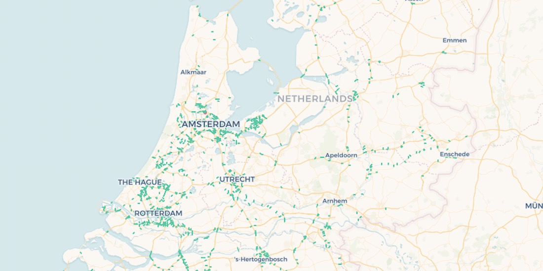
10,000 Dutch Bridges: A Foray into Using BigQuery Connector
Explore how to use our Google BigQuery connector to import large public datasets for geospatial analysis.

Inside CARTO Engineering: Configuration Management Makeover
In order to achieve our plan of being the leading location intelligence platform, we continually invest in our infrastructure to provide the best service to our client. Today we are telling a success story about how we revamped our configuration management system

Upgrading our Core Platform to PostgreSQL 11
In order to meet our users' increasing performance needs, during the following weeks we will be upgrading our software stack to be based on PostgreSQL 11 and PostGIS 2.5.

Airship 2.0 is here
Explore features, Histogram widget enhancements, Time Series widget, and seamless CARTO VL integration. Elevate your Location Intelligence with Airship 2.0.


Academy
How to take your GIS cloud-native with QGIS & CARTO
Modernize your GIS with QGIS & CARTO for scalable cloud-based analytics. Maximize efficiency, security, and collaboration.
10 Examples of Spatial Data & Visualizations for Telecom Analytics
Explore 10 maps using CARTO's cloud-native platform and spatial data for telecom analytics to enhance network optimization, coverage, and customer satisfaction.
Enhancing geospatial analytics with CARTO & Databricks
Unlock advanced spatial analysis in Databricks with CARTO’s Analytics Toolbox. Visualize & analyze large geospatial data inside your data warehouse.