Category:Ōtorohanga
Jump to navigation
Jump to search
town in Waikato Region, New Zealand  | |||||
| Upload media | |||||
| Instance of | |||||
|---|---|---|---|---|---|
| Location |
| ||||
| Population |
| ||||
| official website | |||||
 | |||||
Subcategories
This category has the following 3 subcategories, out of 3 total.
Media in category "Ōtorohanga"
The following 17 files are in this category, out of 17 total.
-
1934 and modern maps of Ōtorohanga, showing the diversions of the Waipā.jpg 1,407 × 516; 335 KB
-
1955 Te Kawa - Kiokio - Otorohanga North Island Main Trunk map.jpg 784 × 1,064; 549 KB
-
Anglican Church, Otorohanga, c 1910s (4573057822).jpg 6,396 × 4,732; 9.18 MB
-
Corregated Iron Kiwi in Otorohanga.jpg 640 × 480; 77 KB
-
General view of Otorohanga township (21422484658).jpg 6,420 × 4,713; 3.63 MB
-
General view of Otorohanga township (21474242076).jpg 6,390 × 4,676; 3.68 MB
-
Glowworm (183249417).jpeg 2,048 × 1,367; 498 KB
-
Kiwi in Otorohanga.JPG 3,296 × 2,472; 1.03 MB
-
New Zealand North Island Highway scenes (50801253572).jpg 3,696 × 2,448; 3.11 MB
-
Otorohanga District Library.jpg 1,600 × 1,200; 1 MB
-
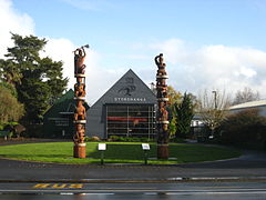
Otorohanga Kiwi House front.jpg 4,000 × 3,000; 7.58 MB
-
Otorohanga War Memorials.jpg 5,120 × 3,413; 5.18 MB
-
Otorohanga, Waikato ATLIB 312070.png 5,032 × 3,766; 13.56 MB
-
Road leading into Otorohanga (20126067614).jpg 6,423 × 4,697; 2.57 MB
-
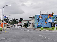
View of Otorohanga township (21119241608).jpg 6,410 × 4,678; 2.71 MB
-
View of Otorohanga.jpg 3,742 × 1,198; 3.75 MB
-
Ōtorohanga, Maniapoto Street.jpg 5,184 × 3,888; 9.97 MB