Category:Bays of Pembrokeshire
Jump to navigation
Jump to search
Wikimedia category | |||||
| Upload media | |||||
| Instance of | |||||
|---|---|---|---|---|---|
| |||||
Subcategories
This category has the following 28 subcategories, out of 28 total.
A
- Aberbach Bay (7 F)
- Abereiddy Bay (25 F)
B
- Barafundle Bay (76 F)
C
- Caer Bwdi Bay (4 F)
- Caer Bwdy Bay (16 F)
- Caerfai Bay (122 F)
- Ceibwr Bay (24 F)
F
- Fishguard Bay (26 F)
G
- Gwadn (beach) (30 F)
L
- Lydstep Haven (4 F)
M
- Maen Bachau (4 F)
- Manorbier Bay (14 F)
- Mill Haven (2 F)
N
- Newport Bay, Pembrokeshire (35 F)
- North Haven, Skomer Island (18 F)
P
- Porth Lleuog, Ramsey Island (10 F)
- Porth Lleuog, Whitesands Bay (40 F)
- Porth Maenmelyn, Pembrokeshire (12 F)
- Porthlysgi Bay (19 F)
S
- Saundersfoot Bay (14 F)
- Skrinkle Haven, Pembrokeshire (27 F)
- South Haven, Skomer Island (10 F)
- St Brides Bay (33 F)
W
Media in category "Bays of Pembrokeshire"
The following 81 files are in this category, out of 81 total.
-
A tiny patch of sunlight - geograph.org.uk - 1513943.jpg 640 × 480; 67 KB
-
Aber Bach (also known as Aber Hesgwm) - geograph.org.uk - 54759.jpg 640 × 480; 56 KB
-
Aber Bach - geograph.org.uk - 565013.jpg 427 × 640; 93 KB
-
Aber Draw, the Bay at dusk - geograph.org.uk - 1405185.jpg 600 × 450; 119 KB
-
Aber Felin - geograph.org.uk - 54430.jpg 640 × 480; 138 KB
-
Aber Grugog - geograph.org.uk - 4309372.jpg 1,920 × 1,428; 651 KB
-
Aber Hywel - geograph.org.uk - 4309444.jpg 1,920 × 1,304; 645 KB
-
Aber Mawr - geograph.org.uk - 4609430.jpg 6,000 × 4,000; 5.4 MB
-
Aber Mawr - geograph.org.uk - 54038.jpg 640 × 480; 41 KB
-
Aber Rhigian - geograph.org.uk - 54761.jpg 640 × 480; 61 KB
-
Aberfforest bay from above - geograph.org.uk - 1171961.jpg 640 × 480; 110 KB
-
Abermawr bay - geograph.org.uk - 1106250.jpg 640 × 480; 62 KB
-
Abermawr Bay - geograph.org.uk - 4960876.jpg 5,124 × 3,218; 5.62 MB
-
Across Gelliswick Bay - geograph.org.uk - 226195.jpg 640 × 480; 82 KB
-
Anglas Bay - geograph.org.uk - 705987.jpg 640 × 473; 73 KB
-
Angle Bay - geograph.org.uk - 82236.jpg 480 × 640; 61 KB
-
-
-
-
-
BaeCeredigion.svg 2,030 × 3,120; 71 KB
-
Barafundle Bay beach (May 2009).jpg 2,592 × 1,944; 1.85 MB
-
-
Blick auf den Ausgang von Porthlysgi Bay und vorgelagerte Felsen.jpg 3,264 × 2,448; 3.38 MB
-
Broad Haven. - geograph.org.uk - 113068.jpg 640 × 382; 160 KB
-
Bullwell Bay - geograph.org.uk - 1263010.jpg 640 × 480; 75 KB
-
Bullwell Bay from the West - geograph.org.uk - 1263055.jpg 640 × 480; 132 KB
-
Caer Bwdy Bay - geograph.org.uk - 1180952.jpg 640 × 288; 28 KB
-
CardiganBay cy.svg 2,030 × 3,120; 65 KB
-
CardiganBay mk.svg 2,030 × 3,120; 252 KB
-
CardiganBay.svg 2,030 × 3,120; 66 KB
-
CardiganBay2.svg 2,030 × 3,120; 69 KB
-
Carreg Onnen Bay - geograph.org.uk - 1497506.jpg 640 × 480; 120 KB
-
Cemaes Head and Cardigan Bay - geograph.org.uk - 119852.jpg 640 × 489; 40 KB
-
Chapel Bay - geograph.org.uk - 502414.jpg 640 × 482; 135 KB
-
Coast path looking west - geograph.org.uk - 565011.jpg 640 × 427; 100 KB
-
-
Cwm-yr-Eglwys from the Dinas path - geograph.org.uk - 565969.jpg 640 × 427; 87 KB
-
Dale - geograph.org.uk - 126959.jpg 640 × 439; 97 KB
-
Dale Roads Bay - geograph.org.uk - 161344.jpg 640 × 335; 217 KB
-
Dead Man's Bay - geograph.org.uk - 287760.jpg 640 × 480; 60 KB
-
Flimston Bay. - geograph.org.uk - 53669.jpg 640 × 412; 79 KB
-
Foreshore, Pwll Gwylog - geograph.org.uk - 298217.jpg 640 × 480; 75 KB
-
Fort Hubberstone (MGK28013).jpg 3,456 × 5,184; 12.34 MB
-
Fresh water meets salt - geograph.org.uk - 543605.jpg 640 × 480; 124 KB
-
Gelliswick Bay oil pipeline and jetty - geograph.org.uk - 369636.jpg 640 × 404; 58 KB
-
Gesail Fawr - geograph.org.uk - 1425609.jpg 640 × 480; 121 KB
-
Gesteinsmix am Porthlysgi Beach.jpg 3,264 × 2,448; 3.5 MB
-
-
Lindisway Bay - geograph.org.uk - 88180.jpg 480 × 640; 233 KB
-
Low Tide at Freshwater East - geograph.org.uk - 569098.jpg 640 × 480; 79 KB
-
Lydstep Haven - geograph.org.uk - 571664.jpg 640 × 480; 51 KB
-
Musselwick Sands - geograph.org.uk - 301103.jpg 640 × 423; 64 KB
-
Newgale - geograph.org.uk - 22008.jpg 640 × 417; 56 KB
-
Nolton Haven - geograph.org.uk - 398061.jpg 640 × 480; 129 KB
-
Panorama of Cardigan Bay - geograph.org.uk - 847795.jpg 640 × 199; 39 KB
-
Pembrokeshire Coast Path at Swanlake Bay - geograph.org.uk - 4322971.jpg 1,600 × 1,062; 437 KB
-
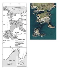
Penpleidiau Geological Map.jpg 689 × 812; 112 KB
-
Porth Lysgi - geograph.org.uk - 301105.jpg 640 × 300; 57 KB
-
Porthstinian - geograph.org.uk - 478476.jpg 640 × 480; 89 KB
-
Pretty little Watwick Bay - geograph.org.uk - 1841618.jpg 640 × 480; 92 KB
-
Pwllcrochan from the north - geograph.org.uk - 842716.jpg 640 × 480; 103 KB
-
Pwllgwaelod bay with boats - geograph.org.uk - 565006.jpg 640 × 427; 95 KB
-
Pwllstrodur - geograph.org.uk - 53829.jpg 640 × 480; 115 KB
-
Red Berry Bay, Caldey Island (Ynys Bŷr) - geograph.org.uk - 958084.jpg 640 × 480; 104 KB
-
Sandy bay by Stackpole Warren. - geograph.org.uk - 113119.jpg 640 × 414; 111 KB
-
Seals by the Haven - geograph.org.uk - 173282.jpg 640 × 480; 100 KB
-
Sheep Island - geograph.org.uk - 142769.jpg 640 × 120; 78 KB
-
-
Solva Bay - panoramio.jpg 3,264 × 2,448; 2.75 MB
-
Solva estuary from Penrhyn - geograph.org.uk - 581155.jpg 640 × 180; 135 KB
-
St Bride's bay just after sunset - geograph.org.uk - 417573.jpg 480 × 640; 209 KB
-
St Brides - geograph.org.uk - 318798.jpg 640 × 482; 103 KB
-
St Brides Bay from Broadhaven Beach - geograph.org.uk - 87964.jpg 640 × 480; 104 KB
-
St. Brides Bay - geograph.org.uk - 86338.jpg 640 × 480; 139 KB
-
Sunrise, Carmarthen Bay 8-44 - geograph.org.uk - 1351421.jpg 640 × 426; 31 KB
-
Sunrise, Carmarthen Bay 8-48 - geograph.org.uk - 1351412.jpg 640 × 178; 15 KB
-
Swanlake Bay - geograph.org.uk - 56215.jpg 640 × 480; 146 KB
-
Trewent Point - geograph.org.uk - 55955.jpg 640 × 480; 144 KB
-
View of the bay at Wiseman's Bridge - geograph.org.uk - 1692042.jpg 640 × 480; 124 KB
-
Pen-y-holt Bay. - geograph.org.uk - 30832.jpg 640 × 408; 75 KB