Category:Carnivora distribution maps
Jump to navigation
Jump to search
Subcategories
This category has the following 12 subcategories, out of 12 total.
A
C
E
- Eupleridae distribution maps (19 F)
F
H
- Herpestidae distribution maps (1 P, 49 F)
M
- Mephitidae distribution maps (25 F)
P
U
V
Media in category "Carnivora distribution maps"
The following 24 files are in this category, out of 24 total.
-
Carnivora Distribution.png 3,851 × 1,855; 2.37 MB
-
Carnivoria Distribution.png 3,671 × 1,867; 2.37 MB
-
Acinonyx jubatus history distribution in the early 20 century.png 1,600 × 812; 172 KB
-
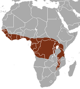
African Palm Civet area.png 297 × 333; 11 KB
-
Agnotherium range.png 319 × 260; 53 KB
-
Amphicyon range.png 1,249 × 628; 13 KB
-
Bush Dog area.png 212 × 319; 8 KB
-
Cryptoprocta ferox range map.svg 744 × 1,052; 635 KB
-
Cryptoprocta spelea subfossil range map.svg 452 × 533; 424 KB
-
Cryptoprocta subfossil range map.svg 452 × 533; 428 KB
-
Distribution of the grey seal.png 1,357 × 628; 35 KB
-
Fossa fossana range.png 500 × 484; 164 KB
-
Galerella ranges.png 331 × 336; 13 KB
-
Leefgebied gevlekte hyena.JPG 347 × 167; 7 KB
-
Leefgebied kleine panda.JPG 347 × 167; 6 KB
-
Monachus monachus history distribution 800 B.C.png 1,600 × 812; 168 KB
-
Monachus tropicalis history distribution before 1952 A.D.png 1,600 × 812; 167 KB
-
Mydaus areas.png 644 × 452; 15 KB
-
Nandinia binotata range map.png 456 × 473; 20 KB
-
Parahyaena brunnea range.png 910 × 876; 57 KB
-
Répartition Atropicalis'.png 800 × 800; 52 KB
-
Salanoia range.png 1,994 × 2,357; 401 KB
-
Tibetan Fox area.png 605 × 278; 15 KB


